Volcán Antuco - Trapa Trapa
|
|
|
| |||||||||||||||||||||||||||||||||||||||||||||||||||||||
Descripcion General
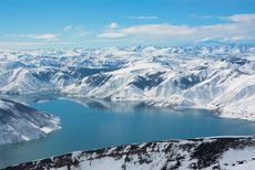
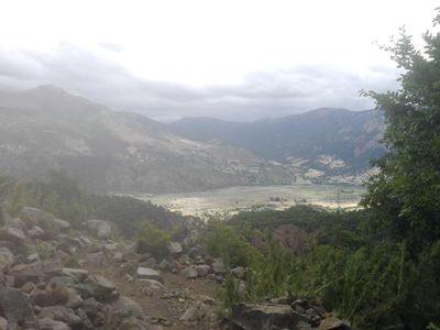
[[File:los barros (8).jpg|thumb|400px|Veranadas al final del valle.
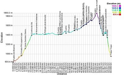
Ruta de montaña que sube por el camino internacional al paso Pichachen en Antuco, y luego recorre por veranadas y valles de montaña hasta descender a la localidad de Trapa Trapa, en Alto Biobío.
Este ruta puede realizarse tanto a pie como en bicicleta, o incluso a caballo coordinando en la comunidad de Trapa Trapa. Desde Trapa trapa este sendero se conoce como Tripapawe Antü (Salida del Sol), perteneciente a la Red de Senderos comunitarios Trekaleyin.
Además esta ruta es parte del [Greater Patagonial Trail], permitiendo continuar hacia el norte o sur por las altas cumbres de los Andes.
- Duration: 3 to 5 days
- Distance: 57 km
- Ascent: 1380 meters ↑
- Descent: 1770 meters ↓
Época adecuada
Octubre a abril. El resto del año la ruta está cubierta por nieve.
Plantilla:Acercamiento laglaja
Descripción de la ruta
Difficulty: The isolation and the high passes make this a rather difficult but rewarding trail. Good orientational skill are required because hardly any signposts are placed and some parts of the trail are cross country.
The fourth section of the Greater Patagonian Trail sets out on the base of volcano Antuco; a nearly perfect cone build with pitch black volcanic rocks and boulders. You can optionally climb this summit before continuing on the regular route. It’s a demanding long ascent over rather loose piles of sharp volcanic rocks that make the returning descent even more tiresome. But if the weather favours you, you get rewarded with an outlook that reaches north to the volcano Chillan and south to the volcano Copahue; a total distance that takes about 10 days to hike.
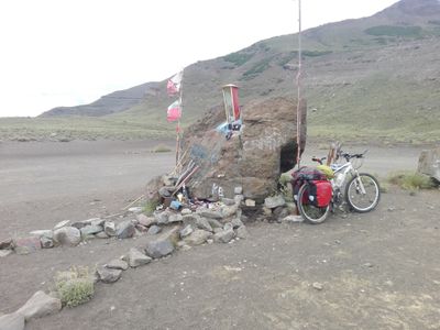
The regular trail takes the road to Argentine through vast fields of black volcanic ash in between the Laguna de Las Lajas and the volcano Antuco. On May 18, 2005 this road became the tragic scene of the worst peacetime military disaster in recent Chilean history. An overeager commander ordered about 400 poorly equipped conscripts to march this road despite a starting snow storm. 45 soldiers got disoriented and paralyze by the fierce snow storm and froze to death on the side of the road. Take it as an advise to always carry protective cloth and rather seek shelter if the weather turns against you. This trail is published for prudent hikers and not for wannabe heros.
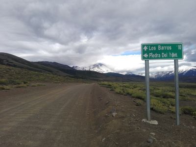
After passing the ill-fated military post and the border control you need to leave the road before crossing into Argentina at the "Piedra del Indio" and turn south to enter the territory of the Pehuenche people. The "Piedra del Indio" or "Rock of the Indios" received its name because two "Indio" families where surprised by a similar fierce snow storm and were wiped out all together. A wide open valley leads you towards the first Araucaria trees that also mark the initial of the tribal land. Indigenous herdsman have set up their “Puestos” to look after their animals on the summer patches of grass. Centuries of disrespect, deceit and displacement by colonists have made this people withdrawn and sceptical compared to the settlers and “Puesteros” that you meet before. But if you approach them with respect and in a humble attitude you may get invited into their huts and listen to them speaking their native language Mapuche.
After crossing a saddle and descending into the Valley Queuco you finally reach the Pehuenche settlement Trapa Trapa. If you ask around and you are lucky you may stay for a night with one of the families.
Tiempo Esperado
Next Sections
| Next Section | Comment |
|---|---|
| Northern | Section 3: Volcán Chillan |
| Southern | Section 5: Laguna El Barco |
Recomendaciones
- Bajar toda la basura ya que nadie lo hará por ti.
- Para minimizar el riesgo de incendios forestales evita hacer fogatas.
Link Externos
Galeria de Fotos
Revisa la lista completa de 621 rutas de trekking y las 345 rutas de montaña en Chile
|


