Diferencia entre revisiones de «ENG:Cerro Provincia»
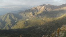
(Página creada con «category:KMZconTrack category:Parche Clasicos de Santiago {{Indexada}} {{Imperdonables|3}} File:Sierra de Ramon.jpg|frame|center|Sierra de Ramón desde el [[Cerro...») |
(Sin diferencias)
|
Revisión del 19:39 30 may 2018

|
|
|
| |||||||||||||||||||||||||||||||||||||||||||||||||||||||||||||
| From the series of del Cerro Provincia |
|---|
|
From Puente Ñilhue |

Appropriate time
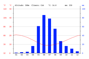
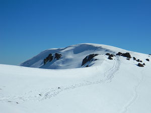
The most advisable time for this route is during the spring since the road is clear of snow (although there are still scattered patches), the temperatures are pleasant and it is possible to observe Santiago with little smog. Winter is complicated by the snow that accumulates along the route and the unstable weather. Summer can be hard due to high temperatures and lack of water. Autumn has the problem, like winter, of having fewer hours of light and like in summer there is no water on the route except in the channel at the beginning.
Anyway, this route can be done at any time of the year if the appropriate measures are taken in order to enjoy a pleasant walk.
Difficulty
The ascent does not present any particular difficulty, except for a rock step near the summit, but that should not be an obstacle for anyone who has been able to get there. In general, the slope of the road is not important, except for specific places. The real difficulty of this hill is the extension of the day to the summit and back, which can reach 10 hours of walking with a significant gap. The physical difficulty for a sedentary is very high, while for someone with good physical condition is medium / high.
Access to Puente Ñilhue
By car
Take Av Las Condes and continue on it to the former YPF petrol station, current Terpel gas station (natural meeting point for skiers, cyclists and mountaineers going into the valley). In this bifuración, you must take the right, and continue on a paved road, ascending through closed curves. Near kilometer 4.5 there is a steep descent to cross the river Mapocho: immediately "before" of this descent there is a dirt road to the right that after 900 meters leads to the parking lot that starts the trek (it is recognized by a wooden bridge).
Public Transportation
- Reach in minibus to Plaza San Enrique, at the end of Avenida Las Condes. From here you can take a bus to the bridge Ñilhue approximate cost of $ 3000 (US$ 4.9 as of May 2018).
- Take bus C01 and get off at the fork to the road to Farellones (Terpel gas station) and then walk or hitchhike for 5 km until the detour to Puente Ñilhue (the walk is unpleasant and dangerous because of the narrowness of the road)
See also the Transantiago map
Description of the route
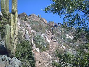
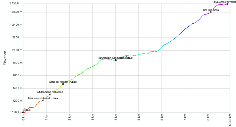
From the parking lot on the south bank of the Mapocho (km 0 - 1020m) you must take the clear path that goes along the northern slope of the hill. After a short walk, you reach an area with rocks equipped with chain handrails, which facilitates the passage. The footprint begins to ascend until it meets a wide path (km 0.5), built for the installation of high voltage towers, and that forms the mountain bike route La Ermita-San Carlos de Apoquindo . This is the most confusing stretch of the route: take the path of the towers for only 100 meters. A fence is passed, and immediately afterwards take the path that goes up.
At km 1.0, you get to a kind of viewpoint without infrastructure that gives us a break in the climb, and that allows you to contemplate the landscape that is revealed to the north. The road continues to rise and takes the south and south west direction. After 300 meters you will reach the Vallecitos / Cerro Provincia fork (km 1.3 - 1300m). You must take the branch on the right to continue the ascent. Otherwise, you will arrive at the pleasant sector of Vallecitos, a classic place for camping and the practice of walking techniques.
At km 1.9 (1470m) you reach the irrigation canal. It is the last place to obtain water. From here the road passes by the edge of the hill, on occasions the road is divided into branches that later come together. The important thing is to stay on the edge and not descend into the valley.
At km 3.7 (1863m) you reach the famous Alto del Naranjo. It is the term of the edge. It has reached the top of a small hill topped with a large quillay that gives the sector its name. It is a good place to take a break sheltered by the generous shade of the noble tree.
From this point, there are 460 more meters of walking almost flat in direction until connecting with the path that comes from the West, that is born in San Carlos de Apoquindo (km 4,15, - 1844m).
Continue straight to the South. The next two kilometers are relatively fast and pleasant, since the path is rather flat, with some ups and downs, and a nice view towards Santiago.
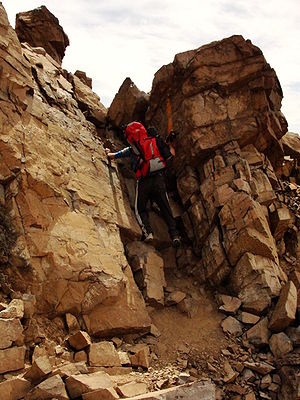
At km 8 (2125m) this north-south edge ends, which we have been following, and turns east to ascend the slope that leads directly to the top of Cerro Provincia. From this point to the top, the path is only up, and always very clear. While some secondary branches appear here and there, sooner or later they all converge on the main route. At km 8.5 (2595m) a small rocky pass is reached. It is the only section with some degree of difficulty. You have to de-scale about three meters from a rock face. It is a very simple climb, which should not limit anyone, except those people with some physical impairment.
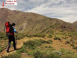
At km 8.8 you reach the false summit. The true top is 300 meters ahead by a flat path and without difficulty, which is reached at km 10.9, at an altitude of 2750m. From this point, you get a great panorama of the Central Andes, especially the lead massif) and the ski resorts. One hundred meters east, there is a Protege Project dome, which welcomes and can be used to spend the night.
Expected time
At a leisurely pace, consider five hours of ascent and three of descent.
Recommendations
- Checklist: Aunque sepas perfectamente lo que debes llevar, es preferible chequearlo al empacar. Esta ruta ha sido clasificada como Type 2 equipment checklist: medium altitude route, no camping or snow, some cold. In spring and summer, of course. In winter, consider Checklist of equipment type 3: route without camping, with snow
- The hill is visited by enough people, although many arrive until some point previous to the summit. It is unlikely to reach the summit with children under 12 years old, adults over 50 and / or people with a very bad physical condition, especially if they have no experience. This is far from meaning that they can not try, they should simply go with the idea of reaching "as far as they can", which in any case will be a good experience and perhaps the first step to achieve the summit in the future.
- It is possible to drink and load water in a channel located a little above the great carry of the Province and the bifurcation to Vallecito. In summer, it is the only source of water and allows you to avoid loading from the beginning what you need for about 8 or 9 hours of (arid) march. The consumption of water goes hand in hand with the physical state of the person (the more demanded one goes, the more water is lost), so that someone with a bad physical condition, or a large part of the national population, will need a lot of water, At least 2 liters and maybe more a hot day.
- Admission with pets is not allowed.
- A real possibility is that it gets dark before you get to the bottom so you ALWAYS have to go out with a flashlight. Ideally you have to program yourself to avoid it (sunset time here).
- If you have an additional day, it is advisable to continue from the summit towards the south to the summit of Cerro San Ramón, in the call Travesía de la Sierra de Ramón, with an excellent view to Santiago to the right and the high Andes to the left.
Permits / Rates
- You must pay $ 3000 (US$ 4.9 as of May 2018) to access the Cerro Provincia from Puente Ñilhue. If you are leaving with children, you must add $ 500 for each of them. Free access throughout the year is worth $ 26,000.
Weather Forecast
Related links
Image gallery
This gallery of images of Cerro Provincia shows photos of all the routes published on the page
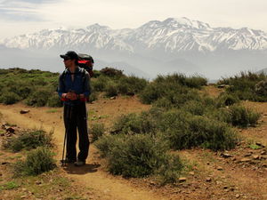
Cerro Plomo and Cerro Altar from the summit of Cerro Provincia. Normal route through Puente Ñilhue
Great view to Cerro el Plomo after the irrigation channel
View of Santiago on the edge of the Alto del Naranjo
Refuge very close to the top of Cerro Provincia, installed by the Project Protege
Quebrada de San Ramón and southwest face of Cerro Provincia from route to Cerro La Cruz. The Apoquindo Leap, although very small, is visible at the foot of the ravine on the right. Looking north, 10/2012
Leaving the gutter to connect with the summit ridge. July 2013. Route: Southwest Face
Ascent by gutter. July 2013. Route: Southwest Face
Southeast Face of Cerro Provincia, from Cerro Terremoto. June 2016


