![]()
GPT20 (Volcan Antillanca)
Contenido
[ocultar]How to a add new entry
You need to be logged in to save your edits (and on mobile view, you need to be logged in to start editing).
Add a new log entry always on top in the appropriate season sub-chapter and use format:
* '''Start Date to Finish Date (use Format YYYY-MMM-DD) / Duration in Days / Hiking or Packrafting / Travel Direction (SOBO for Southbound or NOBO Northbound) / Chosen Route and/or Option Name (RR for Regular Route) / Names or Alias'''
If you are packrafting, put the above info into HTML tags like this (if you follow a hiking route for part of the way, highlight only "packrafting", as above):
* <span style="background-color:aqua;">'''YYYY-MMM-DD / X days / Packrafting / SOBO / RP / Your name'''</span>.
Include remarks about your route useful for other hikers and packrafters, alerts, suggestions and personal perception of attractiveness and difficulties. Try to be specific. Do not be shy to fix obvious mistakes.
Overview
Section Log, Alerts and Suggestions
Season 2025/26
Season 2024/25
- 2025-03-09 to 2025-02-11 / 3 days / Hiking / NOBO / RR, OH01 / Peggy
Due to recent rains and the melting snow from the past few days, the Río Gaviotas was not easy. I am 1.60m tall, and at first, the water was up to my knees, then quickly up to my thighs, my waist, and for about 2 meters, it was above my chest. With the current, there was a difficult section until I managed to grab a large rock and pull myself up.
From the reports I had read, this river, though wide, is usually easy to cross. However, this time, the rain from the past few days and the melting snow from Volcán Casablanca and the surrounding areas quickly increased the water flow and strengthened the current in the Río Gaviotas. I still managed to cross, but it required a lot of strength. It was a challenging yet enriching experience that demanded a great deal of energy.
I spent the night at the nearby campsite (12,500 CLP per night). The day before, I checked the water level and the current. The next morning, I waited until 9 AM to start because the water was very cold. The water level and current remained about the same, with slightly less depth.
From the river at km 7.5 to the sign reading "NOBO: overgrown trail," the path is visible and relatively easy to follow. At the beginning, there are sometimes other trails branching off in different directions, so checking the GPS is necessary. In the dense forest section, a phone GPS is often insufficient, as it usually doesn’t get a signal, unlike a Garmin GPS.
Then comes the BB section. The trail is still there, but it often disappears (frequently) under the vegetation. I got lost three times in the first part (before the water source at km 33.2) but quickly found my way back using the GPS. After the water source, the trail was even more overgrown. At times, I was practically swimming through the vegetation, which sometimes reached my waist, chest, or even above my head for short stretches. However, by observing the trail and the surroundings and moving carefully (my pack was heavy, loaded with food to continue onto Section 19, plus extra water for the middle of the section, so I could only go slowly! 😁 Especially since in NOBO, it's an uphill climb!), I managed to find my way. There are also occasional blue markers (small pieces of blue plastic tied to branches or often on the ground) and machete marks (thanks to those who passed before me—I hope to do the same next time) that help confirm you're on the right track.
Honestly, and this is worth emphasizing: this section is manageable if you take your time and carefully observe your surroundings. It’s a great exercise in environmental awareness and appreciating the nature around you.
I loved this section! It’s a beautiful route for forest lovers and adventurers (even beginner adventurers like me).
On this first part, the river is easily accessible 500m before the water source at km 33.2 (I forgot to mark a GPS point but checked the distance to the next water source). Then, I didn’t go down to the river at km 33.2 but farther along (40.490244S, 72.104659W).
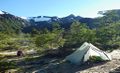
Upon reaching the plateau, I quickly set up camp for the night (40.477551S, 72.109980W). The view is stunning upon arrival, with Volcán Casablanca having lost all its recent snow. I took the opportunity to climb a bit higher via OH03A to admire the view of the volcano and my small camp below. In the distance, Volcán Tronador was partially hidden by clouds, while Volcán Puntiagudo stood behind it with its sharp, elegant shape. The entire mountain range and the dense forest below, which I had just climbed through, were magnificent. It was incredible to experience the different landscapes, from dense forest to volcanic plateau.
I was able to make a fire and enjoy the light at the end of the day.
During the night, the wind picked up, so I decided to move my tent to a more sheltered spot for safety. I checked the weather on my Garmin and saw that the wind would strengthen, and rain would continue until late morning. I stayed in my tent until the rain stopped before heading toward Pampa Frutillar. I had no desire to hike in the rain, wind, and fog—sometimes, following nature’s rhythm is the best choice.
I found a small water source here (40.474901S, 72.094731W), though it was likely temporary due to recent snowmelt. The CC trail was fine until the junction between RR and Variant D, which ascends Volcán Antillanca. Due to fog and wind, I chose the RR route. There was also water at this junction in the form of two small lakes, probably remnants of recent snowfall.
The descent started easily, but I struggled on the 4km traverse along the slope until I rejoined the junction with Variant D. It was quite steep and slippery. Gradually, I veered off the GPS track until I started slipping and falling repeatedly. Eventually, I noticed a faint trail just a few meters below (on the GPS track), which was much easier to follow!
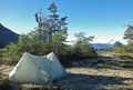
I continued to Pampa Frutillar, where I spent a very cold night—frozen! It was a beautiful spot.
Before the Pampa Frutillar junction, there were several good camping spots here (40.455471S, 72.049117W), but without water. Another spot was farther down on the RR, also without water (40.453367S, 72.047447W).
The last section was a bit chaotic at first, requiring some navigation through dense shrubs. There were also some downed trees to cross, but after that, the trail widened and became well-defined.
At Camp km8, there was a small river. The bridge at km3.9 is no longer passable, so the only option is to take the road—probably the worst section of GPT20.
- 2025-JAN-16 to 2025-JAN-17 / 2 days / Hiking / SOBO / RR / Ivan, Jakub, Daniel
We combined stages GPT20 + 21, taking food for 4.5 days. Although GPT20 was short, it was a very diverse and challenging stage that combined beautiful views with demanding bush-bashing on overgrown trails. We followed RR and detached at 41.9 km onto GPT21 (OH-01).
Challenges: The main challenge for us was the bush-bashing on the overgrown trail. This primarily applies to the section from RR 30.3 to 36.6, where the narrow path is overgrown, causing us to lose it a few times. There are also short sections through overgrown MR after the route from X {20} [17.1/1252], but nothing too complicated.
Bivouacing: The first nice place to sleep with water is Camp {20} [8.0/576]. We continued further and spent our first night at a beautiful place (-40.76012, -72.12685) about 3 km before the pass. After the pass in the section with the overgrown trail, it is very difficult to camp; nice sleeping spots are then found at Ford {20} [40.3/128] (Rio Gaviotas).
Water: It is essential to plan water well for this stage, as there is no reliable water source between Camp {20} [8.0/576] and Water {20} [33.2/852]. However, at the unmarked pass around km 25.8, we found snow that provided enough water to filter.
Resupply: For this stage, we planned food for 2 days, which we bought at the Iguazu supermarket in Entre Lagos. It was just enough. Additionally, at the coordinates -40.88075, -72.17967 near Lago Rupanco, there is a small kiosk on the beach that is not in track files. However, you can buy supplies for a few days there.
- 2025-JAN-16 > 17 / 1,5 jours / Randonnée / SOBO / RR > 20-D > RR / Pierre-Marie
Etape : GPT20+GPT21+GPT22 | Meteo : nuageux | Eau : rare | Neige : oui | Intérêt : 3/5 | Difficulté : 5/5 | Danger : bush-bashing, manque d'eau
Bus Osorno>Anticura de 17h10 puis camping au km 8. Dernier point d'eau avant le km 33,7 si la neige ne fond pas. Au km 13, le chemin s'arrête pour du sentier en mauvais état jusqu'au km 18. On est pas beaucoup ralenti. Je n'ai pas vu grand chose au sommet car il était dans les nuages. La descente est facile puis on marche dans l'herbe en hors piste ce qui ralenti pas mal avant de rentrer dans la forêt. C'est beaucoup plus compliqué dans la forêt, ça commence par du houx qui vous pique les jambes les 2 premiers km. Ensuite c'est toujours aussi compliqué (2km/h). Au km 36 je n'ai pas compris s'il fallait emprunter la riviere qui est dangereuse car très glissante. J'ai cherché mon chemin 30 minutes avant de passer par la rivière. La suite du sentier est en mauvais état jusqu'au lac, en finissant avec des ronces et des taons. J'ai abimé mon équipement sur cette section, je la déconseille même si le volcan est super. La suite c'est de la gravel road... J'ai réussi à faire 4km d'auto-stop jusqu'à El Poncho.
- 2025-01-07 to 2025-01-01 / 2,5 days / Packrafting/ SOBO/ RP, RR, variants D, F / Tomáš & Natalie
Finally we did something totally standard.
Day Day 0:The hitch, 5 km
We resupplied in Entre Lagos and started hitching after 17:00. We got one bus and one car that got us to turn-off for option 6 and then a brown bus came that drove us all the way to the start of the MR&BB. The bus leaves Osorno every day at five in the afternoon, arriving at the border around 19:30. It leaves from the border, back to Osorno, the next morning at 7:30. We walked five km to Camp [8.0]. Met a German and a Chilian camping there. They had just learnt about the GPT community and were planning on trying 21-22. We told them how to get the track files and gave some other advice. We wonder how they fared with the old osm gpt files.
Day 1: over the ridge, 17 km
We started at seven, beating the sun and tabanos on the long climb. There is no bushbashing for a long time on the MR. When it started (about 2 km? - it doesn't slow you down much), we cleared some with our machete. If everyone just got one and spent one hour per day (when appropriate) on trail maintenance, we would have a nice trail I (Tomáš) think. Tomáš did the ridge via D and F. Natalie climbed up to the start but did not like the snow wall and decided to go back down and follow the RR due to time and incoming weather. The snow wall on the ridge actually had an opening where the GPX tracks lead you and it was totally fine to get on the ridge: some walking (15 m) on 30-degree snowy slope, but it was soft and slip would end soon anyway, The pinnacle after the summit cannot be safely scaled as Alexie has mentioned (loose rock, even when you have got the skills, I would not trust those holds). I chose to go left, between the rock and ice. It involved using my hands, SAC 5 I would say. In the middle, where there was only a small gap, I cut steps into the snow and walked on it, seeing it was very thick from below. This is not ideal - probably better go to the right right away, although that looks steep too. Found a very scenic sheltered campsite with water from melting snow (will probably last a few more weeks) at -40.79137, -72.14787. There is a 20 m deep volcanic cave there. Casablanca looks easy to climb from the pass through a ridge, but it was cloudy with rain, so we did not try.
Day 2: through bush to hot springs, 17 km.
After crossing the plateau, we entered the forest. After the previous day's rain, we got soaked. The trail is there, sometimes more overgrown, sometimes less. We used our machete to clear some. No easy access to water at the water waypoint, but good access about 500 m further here: -40.82253, -72.17044. Last water was about 200 m before the X waypoint (going SOBO) from the main creek (not marked). About one km from waypoint "Important: Nobo: Overgrown Trails", we both, walking maybe 100 m after each other, independently got lost. In this part of the forest, there are many (animal? lost hiker?) trails. I, not looking at the GPS, followed an obvious trail while using the machete, suddenly realized I was in the middle between the TL&BB and the alternative BB trail. This at least used to be a man-made trail, as some old cut marks attested. However, it petered out. I walked in a circle, the forest being surprisingly passable at times. In the end I found myself on the alternative BB trail. It seemed like ages ago, there might have been a trail, but now it is (not so horrible) bushbashing. After an hour of being lost, I finally got to the X waypoint. I thought Natalie would be kilometers ahead but she was only waiting ~5min. She stuck to the RR but still got lost/turned around a few times. Supposedly she had a few full body encounters with stinging nettle over the "log graveyards", accidentally went in a circle and ended up almost a 1km uphill, threw up from stomach issues and had not a great time, but she still agrees the BB is not that bad, just following the trail can be tricky. The trail from the X to lake is an actual trail. At the lake, all of a sudden, tabaño hell started. About 15 seconds after we left the forrest, aiming for the beach, about 50+ red tabaños surrounded each of us, buzzing viciously. They seem to strongly prefer open sunny low locations. We got to shore, pitched the inner part of our tent and used it to change into drysuits - they provide good protection from the horseflies. It was about seven when we got to our packraft, still surrounded by a dozen of tabaños. We set off against sizeable waves, hoping to reach the termas waypoint 7 km far. In over an hour, we hardly covered two km when Natalie spotted steam rising from a lakeshore here: -40.85792, -72.21726. There was a pool made from stones in the lake and a very hot (60 degrees? - painful to touch) little stream pouring to it. Waves being high, the pool was quite cold. We improved the pool walls but when we were done, the waves already calmed and the pool got too hot, so we learned we should have never messed with it in the first place. We made a new breach into the pool wall, improving the balance of temperatures somewhat, but it was still at times too hot or too cold water. Nevertheless it was a beautiful location. The small beach provided a slopy place for a tent that was surprisingly ok.
Day 3: Hot springs to El Poncho, 5 km.
In the morning, we started paddling. Turns out steam and hot springs (without pools) are present along the shore for about 1 km from our camp. The formal hotspring is here: -40.85944, -72.22694. The waypoint in the track files is off by about 2 km. It is a beach with dug holes in it and it sees regular traffic - a motorboat brought people both in the evening and morning. People had shovels and buckets - not exactly sure how it all works. There is a sign saying it is prohibited to camp there. It would be a perfect camp - there is a freshwater stream about 100 m west of the beach. There were several other freshwater streams flowing into the lake around this part. In El Poncho beach where you are supposed to boat out, there is nothing: no shop, no ressuply. There is a cell tower on the opposite bank, but only some 3g signal: I only managed to receive e-mails, but could not even send replies.
- 2024-Dec-23 // 2.5 days // RR NOBO // Mara & Tobias
difficulties: heat, water, bush-bashing
Trail after Div20 badly overgrown and often blocked by fallen trees (NOBO). Trackfiles (2022) on our way up were mostly 10-30 meters wrong. We followed the old signs by machetes and the blue markings. It took time to make our way around the areas of fresh fallen trees. Found a good camp at -40.81607 -72.17725 with water nearby. Day 2 we crossed the pass, did not go to the top of volcan antillaca and camped at - 40.76642 -72.09776 (water if snow). We only found water -40.76693 -72.13776 that day! On the way down we trail and old minor road were partly overgrown as well. Bridge -40.67101, -72.14553 is destroyed! So we went straight to the main road and got a lift to Ente Lagos, where we take some rest and do resupply for the next section (GPT 19).
Season 2023/24
- From 2024-02-28 to 2024-02-29 // 1,5 day // Hiking // NOBO // RR + variant D // Quentin Clavel
From Las Gaviotas (because I took the option 1 on GPT 20) I passed the Rio Gaviotas. I slept just after on a flat area. Didn't wanted to go further on that day bc it's the last waterpoint until the end of the section, moreover it was a very rainy day and I was tired about it !
The crossing of Rio was not a problem as it was clear water and without current, knee level (but the next morning, as I was there to fill my water before leaving, the level of the rio was higher bc of the big rains but still doable).
Next morning I was ready to fight the bush, even if the weather was still terrible with big rain that announced a tuff day !
All the way through the heavy rainforest, until the volcanic plateau (10km of fight approx, from PK40,21 to PK 30,53) is overgrown. But there's a trail. It's just that it's somehow hard to follow. There's some blue marks that can helps you, but the trail is abandoned since few years.
Allow a slow pace and try to stick as much as possible to this trail. Everytime it was horrible bushbashing for me was when I lost the track and I had to fight to find it again. Again worse with the rain, all the vegetation was so wet, I had the feeling to be under a cold shower for 10km !
After that it's crosscountry on the volcanic plateau, without vegetation, Landscape changed radically and was amazing. That was my first volcan on the GPT and I was so amazed !
I took the variant D to reach the summit of volcan Antillanca, it's volcanic ground so not easy as it's soft ground with lot of micro rocks. To reach the summit you'll face just before the last push to a big rocky area that you have to conturn from the right or left. I choose left, it was a slippery but imo better than the snowy area on the right.
You left the volcanic plateau, then it's an easy overgrown trail on some part, but nothing compare to the beginning of the section.
I had enough water so I've been straight and didn't stopped to pampa frutilla. Water is an important point and at the time I was on the track, I haven't seen any from Las gaviotas to Anticura (end of the section, you can take water from Rio golgol or other stream/rivers around). Pampa frutilla is the only oasis.
The trail finish on the road as variant A wasn't possible because of the destroy bridge.
This section stop at the exact point of the entrance of the camping/cabanas that have a restaurant "Lodging $$$ {19} [83.4/364]". I stopped there and ate quite well, happy to recharge my stomach before the next big section. Nice people, wifi if needed, and cozy restaurant.
I resupplied just after, at "Tia Olivia" at Lican, point "Food, Lodging {19} [81.4/345]" but it's really in case of emergency. She's a very nice lady and has in stock Bread, cheese, big bottle of coca cola, some juices and frost empanadas that she warmup.
I was in emergency so I resupply there, but just to keep in mind it's not a minimarket or so, just a tiny tiny resupply possibility. Olivia is a charm we discussed a lot, and she even took from her personal reserve pasta and biscuits that make the next section easier in term of food !
- 2023-Jan-25 to 2024-Jan-26/ 1.5 days / RR + Option 1+3 / Matthias
The route: Anticura - Pampa Frutilla - Antillanca (-Osorno)
The path is officially closed (in NP) I checked in at CONAF Anticura (no entrance fees) and had to fill in a form. The ranger reported a broken bridge and therefore not to take Variant A. From approx. km 28 there is a route marked by cairns up to the MR leading to Antillanca. It’s probably the path marked on OSM.
The MR to Antillanca (option 3) is a toll road. I could get a ride all the way down from the pass to the main road Osorno-Bariloche („Termas de Puyehue“). A bus goes to Osorno around 16:30)
Bushbashing on (first part of) GPT20 was only minor. - I did not go down to LasGaviotas though!!!!. And it’s only for maximally 3 km, I did with shorts and T-Shirt, there is almost no bamboo, worst is (something like?) Ilex aquifolium.
Pampa Frutilla The detour to Pampa Frutilla is absolutely worth it (and for the water also necessary): Bathing and views!
Snow There is still considerable stretches of snow before and after the pass below vulcano Casablanca, but no problem.
Water: Requires planning your water resources! No water after Camp km 8.0 until Pampa Frutilla … or until some snow melt before the pass below Volcano Casablanca (around km 24/25)
- 2024-Jan-29 to 2024-Jan-30 / 2 days / Hiking / SOBO / RR / Lilian
If for comparison, the overgrown trail(RR, the trail at west side) goes down to Lago Rupanco, the difficulty just same as the overgrown part of GPT18.
GPT20's main difficulty is finding the trail in blowdown area. GPT18's is overgrown condition and the blocking by bamboo. So GPT20 is a little more technical, because finding the way to go.
And i recommend if you go in this overgrown part, sobo is better, because going down, you stand on a high position, is much easier and more possibilities to find a better and "correct" way. When i was walking inside, sometimes i turn back and look, i find that it is hard to know what's the trail going and what is the whole area's condition and happening.
Then I think CONAF already give up the road to strawberry lake, some small trees on the road(not beside the road), is growth up to 3-6m already.
{20-A} is not walkable now, because the bridge at bridge, camp[3.9/465] is completely broken. Better take RR road walking on PR then right turn to join dirt road.
RR km3.05 : friendly locked gate, climb over it easily.
The road at here is an old road, but it is still using by CONAF, i saw car tracks on the road, also some grass pressed by cars wheels not too long time ago. Mostly it is grassy in the middle of the road, also beside the road, two track are empty and easy to walk on.
Bridge, camp[3.9/465] , no trail to here, need to step through some long grass. Bridge is broken and impossible to cross the river, it is flowing very strong and at least up to chest. But you can crawl under the broken bridge to reach the river for collecting water, it is crystal clear and cold. It is the last water spot until km .
Camp[8.0/576] : no more refuge, just left a fire ring and picnic table here. Surrounded by lot of long grass, you can camp here, if you take some time to clear out the grass, looks like can fit 1-2 tents with views of Volcán Puyehue at here. But i think your tent will be wet completely in the morning. Also CONAF vehicles returns and go back at here(reverse turning trace on grass).
Km10.4 : huge blowdown, go around it at left side, road conditions changing point, road become much overgrown and some more small blowdowns. Roads changing to single track trail. No more cars running after here. Still easy to walk and easy to follow.
Km13.6 : another huge blowdown, road conditions changing point, go around it at right side, then GAME STARTS, much much overgrown with spike leafs plants and they covers the trail blocks your walking, also lot of huge blowdowns need to climb over and jump down. You know the way to go, but much slower. Ok to walk, ok to follow. If compares with the overgrown part of GPT18, it is easier here but much tired because many blowdowns up and down, up and down, up and down.
Km14.2 : join an old road, condition is the same, just from trail becomes old road.
Km14.6-14.7 : some flat spots for camping, a wooden tripod made by some people at km14.7, maybe for cooking? Road conditions become better.
Km15.6 : camping spot can fit 2-4 tents.
Km16.2 : road conditions become much better, easy to walk, easy to follow. It is flat and wide, also good for camping too.
X[17.1/1252] : junction of RR and strawberry lake, i didn't go to find strawberry but the road to lake is in a very good condition, i can fancy i hitch to there in 5 min(of course not). No more road on RR, just trail, and the trailhead is beside a wooden board that pitch on tree at here.
{20-01} 150m : camping spot(-40.75515, -72.07800), i climb up a little for views then find this spot, can fit 2-4 tents with a fire pit.
Km17.1-17.55 : trail going down to meadow. Very overgrown trail, it is difficult for NOBO to climb up, because all the plants growing towards down side at here.
Km17.55 : a super beautiful meadow, good camping spot but no water.
Km17.65-18.0 : not overgrown but blowdowns trail. Above treeline at 1260m.
CC to the junction of RR and {20-D}, then CC on RR go around Volcán Antillanca. If you looks at valley side (NW), a trail there.
Trail starts at(-40.76299, -72.10617), not on GPX track. And it mostly stay at the same attitude going to the small pass(-40.75915, -72.12489) at km22.
It is a step trace "trail", narrow just about 1-1.5 steps wide, loose sandy, steep, but walkable, recommend going here only on good weather also after eating and your business, there is no spot to take a break until km22.
No more trail 150m before the pass, so CC climb up to the pass.
After the pass, i didn't follow GPX track, go down to the valley on my way, (-40.75959, -72.12913) -> (-40.76027, -72.13294), then cut back to CC and climbing up. There is a huge flat area that you can camp at the valley with nice views of Volcán Puyehue, but no water.
If you follow CC, mostly you'll face a super huge gap at (-40.76178, -72.13861), that you need to go down and go around. So when i was at (-40.76151, -72.13766), i decided straight climbing up 100m at the east side of gap, and there is a connection at (-40.76462, -72.13876) 1450m, you can easily crossing to other side.
Because i'm lack of water, so mostly i going much west than the GPX track, luckily i find some water spots by snow melts.
(-40.77309, -72.14007) : flowing good by a huge snow patch melts, clear and easy to collect.
(-40.77531, -72.14089) : pond, by a huge snow patch melts, you can dip bottles to collect some amazing water!
Then i just CC to the pass(-40.78259, -72.14395) at km25.85. Snows begins at 1600m, no difficulty to climb up, mostly just gentle snow slope.
(-40.78306, -72.14374) : two beautiful ponds by snow melts at the pass with clear water. I think they'll not stay too long. Also i hear water flowing here, but it is close to dark, so i didn't have enough time to find out where it is and their condition.
There is not much snow left at south side of the pass. Also too steep, so better going down by the dry loose sandy slope at first, then join snow slope again for skiing down.
Lastly i cleared a small flat spot and camped at(-40.78742, -72.14541), can fit 1 tent, some rocks around here can used for holding the tents on sandy ground. No wind protection but amazing views(and flowing water as now) at here too!
Snow ends at (-40.78785, -72.14522) RR km26.5, 1500m. Also a small stream there, flowing good with clear, fresh and cold water! Some tiny waterfall, easy to collect.
From here to the km30.3, the junction of RR and {20-03A}, mostly CC on lava fields covered by grass, sometimes have cairns, but they are too small, also lot of other lava rocks nearby, so every time i notice them already in a very close distance.
Blue pole(-40.79524, -72.18397) and a trail leads to valley.
Flat spot at (-40.79622, -72.18337), can fit 2 tents before the overgrown section.
At km30.4, overgrown section start, trail is easy to walk, easy to follow. You'll find some blue ribbon(mostly already collapsed on the ground), and red ribbon(just a few) in this section.
Km30.8 : hell of bamboo, hell is not for hikers, is for bamboo. Most of of the bamboo is dead, defeated by huge trees in the war of forest. After here, a little overgrown and some blowdowns, still easy to follow, easy to walk. If you find the trail is blocked by lot of brushes, you can go around them by stepping on the bamboo, at here, bamboo helps you.
Km31.4 : if you don't find the trail after crawling under a huge blowdown, you can walking on the huge blowdown at (-40.80555, -72.17855) to west, then rejoin a clear trail at (-40.80564, -72.17840).
Km31.8 : after the sharp turning, trail become more overgrown, but trail still there. Ok to walk, easy to follow.
Km32.5 : camping spot(-40.81356, -72.17860), beside the trail, can fit 2-3 small tents with a small log seat. Some nice hikers put a silver shiny stake there for marker. After here, trail becomes much overgrown with spike leaves plant, because here is not in the forest, no big trees covering, bushes have more sunshine for growing bigger (then block the trail). Ok to walk, ok to follow.
Water[33.2/852] : can hear water flowing at valley side, looks like need BB about 10min to the stream. I find another better spot at not far away.
Km33.25 : trail is much closer to the stream at here, so i cleared a side trail(-40.81849, -72.17287) to there. Just 1 min, flowing good with clear water, have some puddles that can dip bottles. Some more type of spike plants start growing after here.
Km33.9-34.9 : although there are still some overgrown and blowdowns, but this part becomes very smooth, keep going and going, speed up, enjoy this moment.
Km34.9 : GAME STARTS, blowdowns MAZE. Huge amounts of blowdowns blocked your way, even there have some detour or go around, new blowdowns blocks it again. So you need to find the correct trail to go, mostly is the clearest one(do you see i said "mostly"?)
Because I don't have the habit of using GPS while walking, so after i keep going and going, i found I'm on the west of GPX track, following a looks clear trail walking parallel to GPX.
If you also don't follow GPX track walking, maybe the following will help you. (I don't know GPX or my "trail" which is better, and i assume GPX is the correct one)
At (-40.83961, -72.16451), the area of GPX looks like blocked by huge amount of blowdowns, and no ways to get in or get through that area. If follow the clear "trail" going, looks like it will block by another groups of blowdowns, maybe can crawl under a tunnel?
Yes! The answer is tunnel, but not crawling under it, the trail entrance (-40.83977, -72.16443) is just beside the tunnel, at right side, in a dark area hard to notice. You can walk on it.
Then you'll on GPX track again for a while.
At (-40.84042, -72.16400), looks like no way to go, look at the valley side(right) , trail is on the sandy slope.
Then i didn't find a good way to go after sandy slope, looks like GPX drops into the stream. But i don't think walking in a stream is a good idea, so i decided climbing up to east and try to find some good place, can keep going to south.
Luckily i found a clear trail at (-40.84047, -72.16384), of course still overgrown and blowdowns, but it leads me all the way to south.
Km36.5 : a pond just beside the trail, because the trail at here is very smooth, i nearly step in the pond carelessly. Looks like you can collect water at north shore, but water looks so so.
X[36.6/419] : junction of RR and {20-02}, lot of blue ribbon at trailhead of {20-02}, does it means anything? Thorn vine starts at here to south. But i cleared all the vine that blocked the trail until km39.55. Some overgrown and some blowdowns, but easy to walk, easy to follow.
Km39.35 : trail junction, sobo go straight, nobo go left.
Km39.55 : trail comes to a tiny grassland, if you follow the clear trail going, it is NOT RR, and going west, I don't know where is it's final destination. For RR, when you come to grassland, turn left immediately, entrance(-40.86662, -72.17480) of RR is hide behind some bushes, and the trail after here becomes overgrown and narrow again, also huge amount of thorn vine...i took some time try to clear, but there are too many, so i just cleared most of them, if you walk here, be careful.
Km39.85 : trail junction, sobo go right, nobo go straight.
Ford[40.3/128] : crossing of Rio Gaviotas, a wide crossing. North shore is deeper than south side, up to knee and flowing slow, also there are some stable big rocks underwater you can step on. Easy crossing. Water looks clear and lot of fish inside, better collect water at here, the water condition in lake is not too good.
After the crossing, i didn't follow GPX track and walking on the beach.
Camping spot (-40.87321, -72.18179) on a sandy ground, with nice views of lake and fire pit.
I asked some people at Las Gaviotas, about the ferry to El Poncho, some said 12noon, some said 1pm, some said 2pm, but there is nothing until 3pm i completely give up. I spend 4 hours and wait nothing in a super nice weather day, OMG.
Luckily i find a very tiny shop selling some food, biscuits, eggs, bread, pasta, canned food, drinks, ice cream at (-40.88061, -72.17970). I don't want to go to El Poncho resupply anymore. The shop open at 3.30pm, super friendly, i love them!
Lastly a small ferry arrived here at 4.30pm after i cooked and enjoyed my food from the shop... the ferry's name is Gavoita.
- 2024-Jan-15-20 / 5 days / Hiking / SOBO / Argentina, completely new option, Villa Traful to Villa Angostura / Natalie & Tomáš
[Note 2024 November: This is not in the GPT yet at all, but it is in our suggestions in the 2024 Track files. This is a part of an alternative Argentinian route connecting GPT16 all the way to GPT21. In our opinion, for hikers it is probably better as it involes a lot less roadwalking and is very scenic (and the roadwalking there is is mostly easily hitchable). It might be slightly mode difficult than the RR. This is especially useful when coming from the Villarica traverse. What follows is roughly what corrresponds to GPT20, previous log is in GPT19, next in GPT21. Look also at Hannes von S report who followed us: https://www.facebook.com/groups/222224388283455/posts/1763867210785824/.
Our pictures: https://www.facebook.com/groups/222224388283455/posts/1735838016922077/.]
You can connect Lago Trufal directly to Villa la Angostura with no hitchhiking and no road walking and with the added bonus of beautiful views and very little people. Look at our track in the suggestions for 2024 to see what you can do - and these trails are also mostly in OSM appart from a CC connection.
Day one: Villa Truffal to Río Minero We started late in the afternoon, went up the OSM trail and went down to the valley. The trail is there and is marked and easy to follow. Met noone after 30 minutes from the town. Do not try to do any shortcuts in the valley of Río Minero, it is not worth it, and follo the eastern curve. There are plenty of places to pitch a tent in the valley.
Day two: Río Minero to Lago Nahuel Huapi We followed the trail to Refugio Tapera at the pass. We did not see it as there was some sort of boy scout thing happening. Until then, we met noone. Going up, one needs to ford the river multiple times, it does not make sense to try to keep your feet dry probably. At the pass, Natalie followed the normal trail down to the lake Nahuel Huapi. She did not like it, it was a lot of up and down and it was not the clearest.
Tomáš went up west from the refugio, following a relatively (after unclear start) decent cow trail (it is on OSM now). Once above the treeline, he followed the ridge (quite pretty, not really needed to use hands, SAC scale T4), and then cut it across the valey through here: 40.7674378S, 71.4940931W., up over a pass and he caught the trail here: 40.7615383S, 71.5096497W. This was a nice ridgewalk that was fun but doable. He then followed the trail southbound, it was quite clear and exceptionally well marked with something reflexive, so he could easily follow it even in darkness to meet Natalie around here: 40.7615383S, 71.5096497W, where we camped.
Day three: We hitched to Villa Angostura, where we rested. There is good bakery in the middle of the town and decent pizzeria 100m on the right on the main road after the bus station. They did very good empanadas. Late in teh evening, we then took a bus out of the city and slept at suboptimal place near the trailhead here: 40.7885775S, 71.5863394W.
Day four: Getting up very early, we split, Tomáš investigated the longer ridge climb to Cerro O Connor approaching from the south all the way) while Natalie took the more classical route that goes from the west and only turns north in the middle of the ridge. We both met one or two couples of hikers. We then followed the ridge all the way to here, where we camped: 40.7243011S, 71.5295303W. The ridge is fairly easy to follow initially (there is a trail). Then whenthe trail foes left, one goes right and one needs to use one's hand maybe once or twice, but it is more like T3 on the SAC scale, doable by most people. Natalie went up Cerro Exequiel Bustill, because Tomáš was late and she liked it.
Day five: Natalie went exploring in the morning (see the Facebook post linked above) while Tomáš rested, being uncharacteristically lazy. In the afternoon, we followded the trail over the pass under Cerro Newberry, went down the valley then turned left to another valley and slept somewhere here: 40.7248703S, 71.5598608W. The trails are well marked and easy to follow.
Day six: We went up the valley and at the pass here: 40.6989764S, 71.5754606W turned west over the ridge, doing CC. It was easy, not scrambling. WE then went on, crossing Huella Andina and seeing some hikers on it (our third time in the park), we went up to Cerro Buol from the south, continuing the easy if steep CC. There we followed the trail to Cerro Belvedere and then down the Valley to Villa Angostura. On our way down, we met maybe a dozen people. Trail again very clear. The whole area is very beutiful and the ridgewalkign is just splenddid. In Villa angostura, we slept at Camping Unquehue, 500m further on the left from the bus station. It was ok, full of people. Villa Angostura is Argentinian Davos/Aspen, they say, so it is expensive. The next day we took a noon bus to Bariloche, which takes two hours and goes five or six times a day and is cheap (something like 3000 pesos). One could alternatively walk to Bosque de Arrayanes and from there take a ferry. Entry is paid (around 6 thousand I think). The ferry is a tourist boat the comes from Bariloche. You can contact them, but when we asked about the price, they insisted on paying the whole price there and back, amounting to about 55 thousand pesos (50 € or so), which we thought was too expensive. It is this company: https://www.turisur.com.ar/.
Season 2022/23
- 2023-Jan-29 / 3 days / hiking / RR / NOBO / Frank
The river at Las Gaviotas was easily fordable in late January, knee deep at the ford. Below the ford it runs deep into the lake. RR NOBO from Las Gaviotas remains very overgrown, machete highly recommended. I also used gardening gloves which help to grasp & break thorny plants. Many fallen trees, it gets better as you go up but is still slow going. Took me 9 hours to get to the treeline from Las Gaviotas ferry. The alternative route is likely to be a lot worse. There was still a lot of snow on Pass 1910 metres. I tried a few options but couldn't find a way over. The rock gendarme above the pass is not climbable - I tried, it starts as a scramble but goes up to a pinnacle. Ripped my pack on the sharp volcanic rock. I retreated & went around below the pass on OH-CC-A@20-A-001. It's a bit longer but fairly easy, there is a faint trail. Conaf are working on reopening the trail to Pampa Frutilla. It's open for 12KM SOBO from Conaf Anticura, easy walking & super fast. Then for 4KM it's overgrown but passable with moderate bush bashing & you are soon above treeline on RR. I didn't go to Strawberry Fields but suspect the route will be severe until Conaf cut it back. The slowness of the route means water becomes a serious issue. I was lucky to find one water source at 1600 metres from snowmelt (dirty with sand & needs to be filtered) but it's not reliable. There is water at bridge/camp 2.5KM after Conaf Anticura & then no permanent source until you are a few hours below treeline going down to Las Gaviotas. So carry a lot or consider splitting the trail in two with entry/exit at Antillanca ski station.
Season 2021/22
- 2021-Dec-02 / hiking / NOBO / Alex Abramov
We walked from Crater Raihuen (Ski Center Antillanca) to Anticura in one day. There was not much snow, but we faced the problem of bypassing the rocky gendarme on the ridge along the frozen snow slope. In running shoes, it looked unsafe given the steepness and length (over 300m) of the slope. So we decided to go around the ridge along the north side (similar to the GPT20 variant D). It is a simple, fast (about 2 hours) and logical route, accessible in any weather and in any condition. We found the trail between Pampa Frutilla and Antikura in ok condition: some easy bushwhacking and a dozen sections with fallen trees. It may feel harder with a heavy load. No water between Ski Center Antillanca and almost finish! We did not go to Pampa Frutilla Lakes
Season 2020/21
Season 2019/20
- 2020-Feb-22 / 2 days / RR SOBO and optional route to Antillanca / Martina & Ivo
Yes, we gave us that overgrown shit and we cannot believe Martin did that both ways! At least we could skip the first 3 km of the overgrown trail by starting on the Ruta International towards Argentina for 2.9 km and then turning right onto a former minor road which meets the regular route after 800 meters. We spent the night (and a day off due to exhaustion) at Pampa Frutillar, which is a 7.4 km detour to strawberry paradise and two pretty lagunas (optional route 19-05-#001). The ascent to the summit and the view from there were the most spectacular ones so far! Still a bit snow left, but no problem. As Matus said "hell starts" on the last 4 km before Las Gaviotas and we thought we already had our personal hell on the first 14 km, we decided to end this section in Antillanca, where we found accommodation. From here you need to walk or to hitchhike to Aguas Calientes for busses to Osorno.
- 2020-FEB-13 / hiking / Optional Start @ Antillanca / Tyler Wood
I opted to skip the first 13 km bush bashing noted by martin and hitched up to Antillanca with good luck. From there I slept in the crater at the base of Casa Blanca and summited the next morning. The same day went all the way down to the end of the section via the RR. Huge day, but definitely do-able with the optional start. As far as the bush bashing, it’s all good until near the end of RR-TL-V@20-27.1+6.3. Yeah, then it really tricky. Expect at least 2-3 hours to get through the thousands of downed trees. The madness continues pretty much all the way to the bottom. We camped on the beach and it was super beautiful. I decided to skip section 21 due to the $100 ferry across todo santos. A ferry leaves Las Gaviotas around noon to El Poncho for just 250 pesos. Ask locals for exact time for the ferry. From el poncho a bus comes (times with the ferry) that runs directly to Osorno. I got off at an intersection where I could hitchhike to Cochamo. (Huge hitch).
- 2020-JAN-01 - 2020-JAN-02 / 2 days / Hiking / SOBO / Option 2 from the ski station to the Volcanoe, RR from the volcanoe to waypoint Div133,Option 1 down to Lago Rupanco / Linda
Beacuse the pass of the Volcan is now impossible (view Martin feedback), I decided to hike only the southern part of this section = starting from Aguas Calientes (Buses all day long from Mercado of Osorno directly to Agua Calientes, which is a good spot to rest with a camping) to the ski station and then to Lago Rupanco :
1st part = Option 2 from the ski station to the Volcanoe
2nd part = Regular route from the volcanoe to waypoint Div133
3rd part = Option 1 down to Lago Rupanco
The 2 first parts are simply amazing = the view both on Volcanoe Casablanca and the valley where lies Lago Rupanco
BUT I won't recommend the 3rd part which is indicated on the GPS as overgrown. And it was crazily overgrown!!! I did it without a machete and it took me about 7 hours to come across 2km of very very wild forest, full of flourishing bamboos, that is very strong. As there is no track, I had to stick very closely to my compass (South / South West) to be able to join the end of the regular hiking track (that leads to the Lago Rupanco) which was also full of huge dead trees!!!!
I don't know how overgrown is the Regular Hiking route through this same forest. But be prepared to something very very tough.
- 2019-DEC-19 - 2019-DEC-20 / 2 days / hiking / SOBO / Martín Lizondo /
The trail from Conaf is extremely overgrown, even after the first bridge. There’s no minor road anymore. Guards offer you a “machete” to clean the path. Expect super ultra slow hiking (2 km p/h) the first 12 km. From then, as the trail reaches higher altitude, it becomes very easy to walk.
- 2019-NOV-09 / hiking / Sophie & Hendrik
The river crossing directly north of Las Gaviotas is difficult right now. It is highly recommended to organise a boat which takes you over the lake. (It is just a short distance and won't cost much.)
- Comment Jan Dudeck: Arranging this boat transfer northbound is probably easier than southbound (there are several settlers south of the river but not north of the river). So hiking section GPT20 southbound might not be feasible right now.
At this date, the pass to Rupanco is all covered by snow, impossible to cross with regular gear, due to the snow fall the last few days. The optional route to avoid snow is also impassae. Pro: views are very nice. I had to return to Anticura and hitchike back to Entre Lagos.
Season 2018/19
Season 2017/18
- Route description by Kara Davis after Season 2017/18
A small road leads past the CONAF building and winds through several Cabañas until reaching a trail. This trail, although fairly obvious and easily followed, becomes more overgrown as it travels deeper into a bamboo forest. The density of obstructions (foliage, fallen logs, etc.) makes hiking slow. Around 1.100 m, the forest begins to open up and there are several small campsites. At treeline, the trail widens into a old gravel roadbed. Be careful not to miss the turnoff onto a small trail to the right that dips back into the trees, as the regular route does not follow this roadbed for long. At the bottom of the descent, the trail crosses a meadow and climbs back up to treeline. The trail on Volcán Casablanca is not obvious, but there are several stone cairns (and the occasional bamboo pole) sparsely spaced along the path. Alternate Route: After descending from the Volcano, we decided to hike along the mapped trail located to the east of the GPS route. We quickly discovered the trail was wiped out by a landslide, and involved a steep descent to a faint track. The track winds through some open forest and joins a large black river bed. At the end of the open river bed, reenter the trees and follow a fairly obvious but overgrown path. Camping is very difficult to find until rejoining the regular route. I would seriously recommend sticking to the regular route as shown by the GPS track; this alternate was slow going and painful.
Resupply and Accommodation
Resupply and Accommodation in nearby Towns
- Shopping: Food
4 big supermarkets in Osorno all near the bus terminals Puerto Octay has a limited selection for resupply, but there are several restaurants and a good quesería.
- Shopping: Fuel
In Portal Osorno shopping centre Doite shop has camping gas screwgate canisters.
- Accommodation: Camping
El Encuentro campsite with cabanas just behind the beach at Las Gaviotas, camping is 10,000 pesos. Run by Marcelo who is friendly & helpful. He has a boat so might be able to take you across the river NOBO for a small fee. About 3KM beyond Puerto Buey on the road out is Entre Rios camping, cabanas & small shop, basic camping for 5000 pesos, tap water but no shower or toilet
- Puerto Octay has a limited selection for resupply, but there are several restaurants and a good quesería.
Resupply and Accommodation along the Route
Transport to and from Route
Access to Route and Return
- 2020/ Tyler Wood
A ferry leaves Las Gaviotas around noon to El Poncho for just 250 pesos.
- On Monday, Wednesday & Friday a bus goes to Puerto Poncho from Osorno main terminal at 12:30 & connects to the ferry, getting you to Las Gaviotas at 16:30.
- Ferry Las Gaviotas-Puerto Poncho :
Monday 7:00 & 16:30 / Wednesday 2:30 PM / Friday 7:00 & 16:30 / Sunday 15:00 Ferry connects with a bus. Buses may go to Entre Lagos, sometimes Puerto Octay or more often to Osorno. Buses every half hour Entre Lagos-Osorno. There should be an unscheduled ferry Las Gaviotas-Puerto Buey Monday, Wednesday, Friday & Sunday at 8PM but this ferry does not connect with a bus.
- Ferry Puerto Poncho-Las Gaviotas:
Monday 8:00 & 15:30 / Wednesday 15:30 / Friday 8:00 & 15:30 / Sunday 16:00 No bus on days the ferry doesn`t run. Hitching is difficult, there is a gravel road all the way to Las Gaviotas but not much traffic except on weekends.
- Comment by Jan Dudeck:
There is a local who lives in the house on the lake shore northwest from the mouth of the river whom may offer passage on his personal row boat for payment. You may see his boat tied to a tree near the lake. Town: Puerto Octay to Osorno/Puerto Varas/Puerto Montt There is a boat ferry that picks passengers up at Las Gaviotas, which is the beginning of GPT21, and travels to Puerto Buey. It is about a 50 minute ride and 200 CLP. The boat only runs two or three times a day. It is also possible to walk the distance, about 10 km down the road on the south side of the lake. From there you can catch a bus, which also only runs a couple of times per day, to Puerto Octay with connections to Osorno (which is the better resupply option). It is easy to catch a bus to Osorno, Puerto Varas, or Puerto Montt which all have large supermarkets. To my knowledge the boat runs not daily. Please check with locals and provide current information to the ferry Las Gaviotas.
Permits, Entry Fees and Right-of-Way Issues
Links to other Resources
Retired Section Article GPT20 - Volcán Antillanca
Images
thumb|
thumb|
thumb|
thumb|
thumb|


