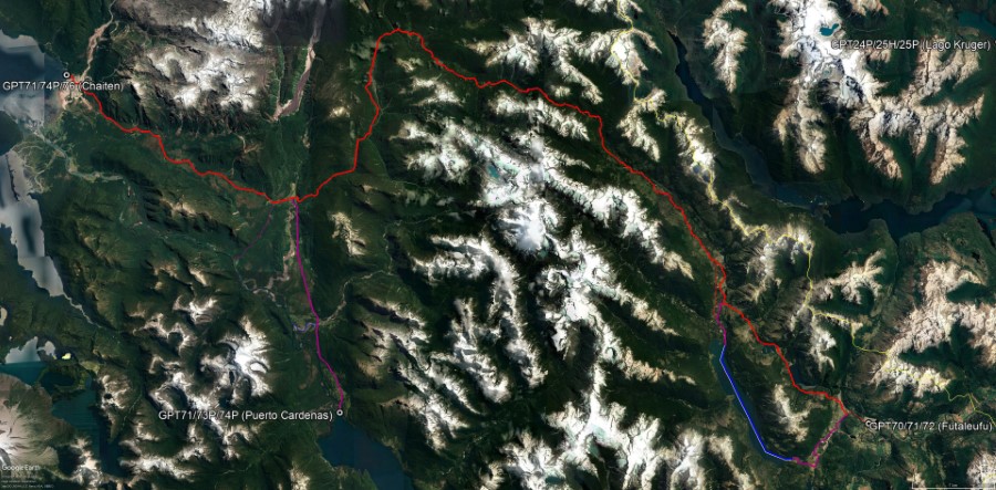
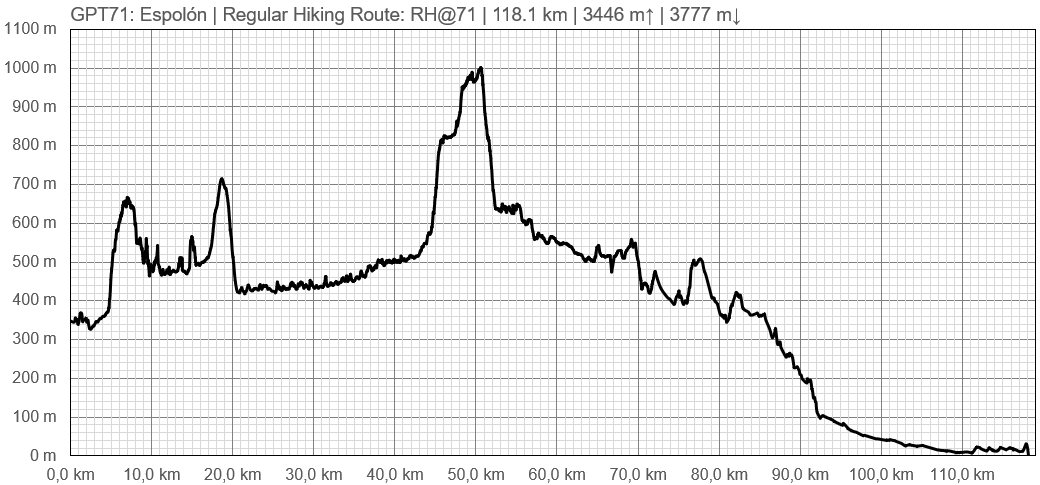
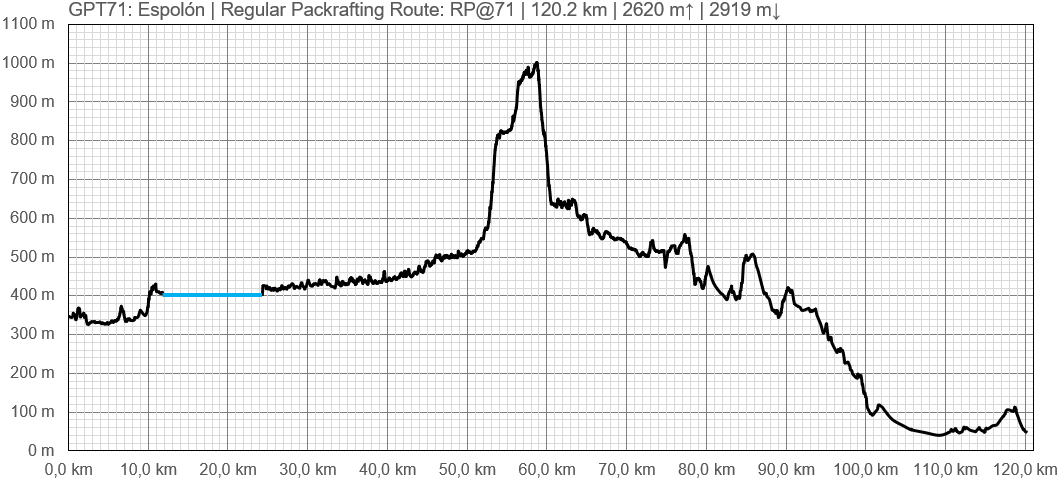
GPT71 - Espolón
Página de redirección
Redirige a:
| All GPT sections (click to show) |
|---|
|
GPT Section Articles
|
Recent Alerts and Suggestions
- Martin Lizondo / 1-Jan-19 to 5-Jan-19 / Regular Hiking Southbound
Long and beautifull route, if well demanding.
The Río Turbio crossing isn’t a problem anymore as it has a bridge now at 42°52'51"S 72°22'13"W. There are two very difficult river crossings in this section. One is Río Michimahuida at 42°53'15"S 72°20'19"W. It’s possible to cross with water up to the hips. There live some settlers who can help you cross with horses. The next river is Río de los Mallines, which is 42°55'19"S 72°16'57"W. Much more strong and difficult, you may require help with horses too. The last settler of that valley is called “Chayo” Pezo and he lives with his son Jaime at 42°55'27"S 72°16'32"W. Very gentle, they offer bed, mate and bread.
Near to the mountain pass the trail is confusing and becomes lost in some mallines, so fresh steps and wood cuts are the best signaling. Signs of old cattle use are visible everwhere if well the route was practically abandoned since the last volcano’s eruption. The valley of Espolon isn’t hard, is mostly well marked and there are many well built bridges. Remeber to say hello and spend some time chating with settlers. The don’t require money for their help.
The Lagos de las Rosas trail is perfectly marked and daily used.
Season Section Log
Summary Table
| GPT71: Espolón | Hiking | Packrafting | |||||
| Group | M: Sector Yelcho | Total | 118.1 km | 34 h | 120.2 km | 33 h | |
| Region | Chile: Los Lagos (X) | Trails (TL) | 49.0 km | 41.5% | 36.8 km | 30.6% | |
| Start | Villa Futaleufú | Minor Roads (MR) | 43.4 km | 36.7% | 51.4 km | 42.7% | |
| Finish | Puerto Cárdenas, Chaitén | Primary Roads (PR) | 25.7 km | 21.8% | 19.5 km | 16.2% | |
| Status | Published & Verified | Cross-Country (CC) | - | - | - | - | |
| Traversable | Jan - Mar (Maybe: Dec, Apr) | Bush-Bashing (BB) | - | - | - | - | |
| Packraft | Useful | Ferry (FY) | - | - | - | - | |
| Connects to | GPT70, GPT72, GPT74P, GPT73P, GPT76 | Investigation (I) | - | - | - | - | |
| Options | 42 km (1 Options & Variants) | Exploration (EXP) | - | - | - | - | |
| Hiking | Packrafting | Total on Water | 12.5 km | 10.4% | |||
| Attraction | 4 (of 5) | 4 (of 5) | River (RI) | - | - | ||
| Difficulty | 4 (of 5) | 4 (of 5) | Lake (LK) | 12.5 km | 10.4% | ||
| Direction | Both ←→ | Both ←→ | Fjord (FJ) | - | - | ||
| Comment | - | ||||||
| Character | Valdivian Rain Forest, Farmland, Settlers, Lake Packrafting, Road Walking | ||||||
| Challenges | Demanding River Fords, Bush Bashing, Demanding Navigation, Possibly Impassable | ||||||


