![]()
GPT22 (Cochamo)
Contenido
[ocultar]How to a add new entry
You need to be logged in to save your edits (and on mobile view, you need to be logged in to start editing).
Add a new log entry always on top in the appropriate season sub-chapter and use format:
* '''Start Date to Finish Date (use Format YYYY-MMM-DD) / Duration in Days / Hiking or Packrafting / Travel Direction (SOBO for Southbound or NOBO Northbound) / Chosen Route and/or Option Name (RR for Regular Route) / Names or Alias'''
If you are packrafting, put the above info into HTML tags like this (if you follow a hiking route for part of the way, highlight only "packrafting", as above):
* <span style="background-color:aqua;">'''YYYY-MMM-DD / X days / Packrafting / SOBO / RP / Your name'''</span>.
Include remarks about your route useful for other hikers and packrafters, alerts, suggestions and personal perception of attractiveness and difficulties. Try to be specific. Do not be shy to fix obvious mistakes.
Overview
- General advice : The Regular Route is best hiked between December and April. The primary obstacles are high river levels early in the season and after rain. During the peak period of January and February it may be difficult to obtain a camping reservation at La Junta which could prevent a southbound traverse (but people were usually let through when they say they go all the way to El Arco).
Section Log, Alerts and Suggestions
Season 2025/26
Season 2024/25
- 2025-03-05 to 2025-03-15 / 11 days (2 days rest) / Hiking+horse+boats / RR 22N+Valle Verde+22S / Dorota
This stage was exceptional due to the people I have met on my road.
Day 1: I took Uber from Ralun to the entrance to Valle Cochamo (20.000 clp, +56 9 9866 2101 Miguel). I was there at 8:58, so I still had 2 minutes to enter. I said that I would like to go to Arco. I have registered and got a lot of information about the route. On the road to La Junta I met Ariero, Javier. He was returning to his house in Valle Verde. He took part of my luggage. The trail was muddy. There were some tourists but not too many. Two boys were looking for a girl who had lost last night on the trail near Junta. Rio La Junta (98.9) till knee for women of 1.64 cm and Rio Traidor (97.4) also. I spent the night at Milico (Ariero said to me about this place) before the Arco (-41.42665,-72.05549). Water from Rio Cochamo.
Day 2: It started to rain in the night. The trail was very moody. It was a really hard day. As I know, Javier and I were the only persons who made this day stage from el Arco to Laguna Vidal. We started at 7. Rio El Arco had a water level to my knee. But at 12 a.m I had a big problem crossing the river [80.9]. There was no bridge. I tried two times, but I resigned. In the middle, the current was too strong and the water was to my waist. I waited one hour, rested a little, and crossed the river. But it was really demanding. The night ended at the end of Laguna Dial, in Casa de Dona Luisa. The night, dinner, and breakfast cost 31,000 clp. I met a group of Argentinos who had waited for better weather.
Day3: I had an invitación to the house of Javier at Valle Verde at Morros. It is 5 km from the trail. It was the next day with rain, so I was happy that I had a roof. Javier is a local guide. He can organize horse trips and pesca, and also has hospedaje. @cabalgatasypescavalleverde, +56 9 4945 9601.
Day4: rest en Valle Verde.
Day5: I came back to trail on horse with Javier. It was amazing because it was my first time on horseback. I survived 17 km on horseback, also crossing a river. After that, I walked to Steffen. I spent the night at 53.5km. Here is a "fugon" house with a place for a fire. Here, I met arrieros de Lago Vidal. They invited me for asado and wine. In the night, it was raining.
Day6: I crossed Rio Steffen (till knee) without a problem. In the morning it was raining, after that it was sunny. In mini shop 43.0 you can buy a lot of things. I asked for a boat to cross Rio Puelo. Women said to me that I needed to go to cabanas de señora Oco and from there call for a boat. In Manso I took a really good bear. At cabana de senora Oco (Fabian,+56 9 6102 0535 ), a man called for a boat. I went to playa and after one hour came somebody. He took me to the other side for 20.000 clp at point -41.74885,-72.065492. About 1.7 km from the house of Ricardo Garardo (28.9). I put up a tent at -41.76425,-72.05840, close to the house of Ricardo.
Day7: In the morning, I returned to Ricardo’s house because his three perros followed me. He invited me for breakfast. Finally, I spent the night at his house. In the evening, we collected cows and sheep on his motocross, giving apples to the pigs, and made bread. And also, he showed me how to use the cable car for crossing the river. It was a really interesting day.
Day8: Ricardo +56 9 6473 8749 took me on his boat to cross Rio Traidor for 30,000 clp. But I have not paid for hospedaje y food. In my opinion, if you take a boat from Playa de Dona Oco, you should like to cross Rio Puelo y Rio Traidor. I continued RR from 24 km. It is a good place for camping at -41.85365, -71.98192. And from this point, you have some bushwalking and till puesto 7.7 km trail is not clear. Wife of Christian invited me for the night. I helped her with carrying different things. We spent a very nice evening together. Her husband was in Puerto Montt.
Day9: She also said to me that in Puerto Urutia from 9 to 12 and from 15-17 is Dario with a boat for crossing the river 1000 clp. Hostel Puelo Libre is only with a reservation. I took the road to avoid discussion at puesto 7.2. On the trail I met Roberto (he lives at lago rocas at -42.01945, -71.86015). You can ask him to put up a tent. He crossed with me a landslide. After Laguna Mosquitos the trail is complicated because of fallen trees. Finally I spent the night in the middle of BB but there was no water. (-4×.05604,-71.83066)
Day10: Day without problems. Crossing borders easy. Control point AR is at 34 km not 30. I spent night at camping agreste.
Day11: I took variant 22-03 to Lago Puelo at 1.7 km before Rio Azul. Men said to me that he had water level till his hips. At Lago Puelo I have found a fantastic place for stay. Hostel La Estación 15.000 ars for a night. There are a lot of shops. The most economical supermercado is Todo, the most expensive is Anónima. You can withdraw money, a maximum of 60.000 ars with a commission of 14.000 ars.
2025-02-01 to 2025-02-05 / 5 days / Hiking / SOBO (partly) / option 8 / Steve Behaeghel & Katrijn + kids Lotta (9ys), Bosse (6ys), Pelle (3ys)
When we hiked/packrafted the GPT21-GPT22 back in 2013 we had some very nice stays with settlers in the valle ventisquero, so we decided to come back with our kids this season.
We did a 4 day trek starting at rancho Velazquez-Alegria (-42.02312, -71.93288) after an extensive almuerzo with the campesinos which we had not seen since 2013. There is a bridge over the Rio Correntoso (-42.02938, -71.94279) where you can leave a car, so no need to do difficult ford near the mouth of the ice stream into the ventisquero river.
The first 5km it's all ripio walking where it changes in a trail just next to a ranch. There is nice camping on the river banks at (-42.01151, -72.02404). There are safe cable crossings for Río Alicia (-42.02393, -72.05756) and Rio Unniverso (-42.03852, -72.12473). There are several settlers in the valley which offer camping (see picture on FB page, rincon bonita is glamping with fly-in guests, so skip that one). Our objective of the hike was Bernaditta Alegria which offers camping at 6000CLP/person with hot showers included.
Bernaditta also offers half board (delicious food) sleeping in a bed for 45000CLP/pers/night. She has starlink internet nowadays, which is free to use when she puts on the solar battery 2-3 times a day for like half an hour. She still remembers well when we stayed at her ranch back in 2013, because on the night when we camped there, a puma came out of the mountain which killed a sheep somewhere 50m from our tent. It's a lovely place to go with kids. There are a lot of wasps because of the fruit trees, so in autumn they might become very aggresive.
2025-01-25 to 2025-01-27 / 3 days / Packrafting / SOBO (partly) / RP / Thijmen Scholten
- Primer Coral has a very nice campspot. Chance there will be kayakers around doing the upper section of Rio Puelo with class 5 rapids you can watch them paddle it, it's insane.
- I heard there is a cabin you can stay up on Río Ventisquero would be a nice option and you can leave part of your gear/food at the camping. And do an overnight trip. Rio Ventusquero supposed to be very nice.
- I was lucky to go with another group of Kayakers into the Rio Puelo and into the rapids at the Canyon. I had no whitewater experience but the camping owner convinced me it was doable and safe even if I fall. It was nice to paddle the Canyon and the waves felt huge. I had a decked packraft that still filled with water, which was nice and made it more stable.
- So if you are here and get the chance on going with a group of Kayakers into the Canyon and rapids , it will be a nice experience
- First I would continue after the rapids and the pickup would take my backpack. But I decided to go back with the pickup to Primer Coral and continue next day towards Argentinia.
- First part of the trail from primer coral to Lago de Las Rocas is closed the settler there told me. You can join the trail from road V723. But I went from Lago Azul.
- The trail (blue line) towards Lago Azul already started earlier. * From the road at you left side there is already a sign with trail towards Lago Azul.
- Lago de Las Rocas went fast with wind in the back.
- I had to stay at the border crossing because they only had electricity at 7 p.m. to register me. Next morning from 8.00 I could pick up my passport. I did not fill in am online form beforehand and that was no problem.
- I went to the Argentinian border crossing that is indicated at the map. But because I was with a boat they did not let me. I had to get my passport stamped at the maritime office at the end of the lake at the beach of lago Puelo. So if you decide to skip lago Puelo/El Bolson than you better not show that you are by boat and pretend you are walking.
- 25Jan2024 - 28jan2024 / hiking NOBO / RR (El Manso to Cochamo) / 3 days / Clara
From Cochamo to get to El manso, there is the bus - ferry (lake tagua tagua) - bus. First bus pass at Cochamo every day around 10am. It comes from Puerto Montt and Puerto Varas before. First bus is 3k. Boat 1.3k. 2nd bus 500.
At El manso there are 2 little negocios. In front of the first one there is a cervecería with a nice terrasse, artisanal beer and wifi. Sadly it was closed on this super hot begining of afternoon ! There is an inconstant but working phone coverage there (entel).
Lago Vidal Gomez. Possible to ask at the camping to cross the lake by boat, Francisco do the traverse during summer. 35k that can be devided until 4 people. May make you pay less if he has to go to the other side anyway to get other people. The family here also sell good bread, vegetables, beers, sweets,...
Because of rainy night, I slept on the north side of the lake at the first house. Marguerita has a sort of barn where you can sleep/pitch a tent and also make fire (for 5k). Dry toilets and water.
Then trail was on better conditions than I expected. Camp sites along lago grande are really nice. Refugio El Arco is a really good shelter if bad weather (all in wood, nice roof, closing windows).
Between El arco and la junta very muddy trail but nothing impassable even after a rainy night. It just slow down a lot.
The valley is really nice.
La Junta - Cochamo : overrun +++.
There are multiple buses going back to Cochamo from the end of the trail
- 2025-JAN-20 to 2025-JAN-27 / 7 days / Hiking / SOBO / RR + OH (Var. 01 / Ivan, Jakub, Daniel)
Stage 22 is one of the longest sections of the GPT, but from our perspective (also thanks to our route choice), it wasn’t particularly difficult. Due to health issues and plenty of time (we had a scheduled meeting in Bariloche on a specific date), we took the stage quite leisurely.
The first part to La Junta is very busy, with a large number of day hikers. That wasn’t really our thing, so we rushed ahead into the wilderness, which starts right after the camps in La Junta.
In the Rio Puelo valley, due to health issues, we chose Variant 01 and rejoined the RR at Puerto Urrutia at the start of 22S.
The most surprising and interesting stop on the trail for us was meeting señira Alexandra at Lago Verde, where we spent an entire morning on the lake on boats and doing deep water solo climbing. (More details in the BIVOUACING section.)
ENTRY INTO VALLE COCHAMÓ
The first major challenge is entering Cochamó Valley, but it’s not as complicated as it might seem.
The entry checkpoint is at Road End {22N} [109.8/58], and access to the valley is free. However, due to high visitor numbers, there are relatively strict regulations. To be allowed entry, you need to follow these rules:
If you want to camp near La Junta, you must have a reservation through www.reservasvallecochamo.org and bring confirmation of your reservation to the checkpoint. Entry is permitted between 7:00 AM and 3:00 PM.
If you want to camp at Refugio El Arco, no reservation is needed, but entry is only allowed between 7:00 AM and 9:00 AM.
The time restrictions aren’t enforced too strictly, but you shouldn’t arrive much later. According to locals, it’s also theoretically possible to enter very early in the morning before any staff arrive, avoiding the need to follow these rules.
However, we personally recommend adhering to the official regulations. There are many visitors (often with little or no experience), and if the beauty of this valley is to be preserved, some regulation and monitoring are necessary. This is also why camping outside of the designated campsites in the valley is prohibited.
For GPT hikers, the best option is to enter the valley in the morning, explain your plans, and then hike to El Arco, where there is plenty of space for tents and camping is free. (Although volunteers manage the site and, like at the entry point, record visitor details.) If you follow this approach, there’s no reason you wouldn’t be allowed in, and you will still comply with all the rules.
CHALLENGES
Ford at Rio Traidor {22N} [95.9/340] was very easy. All other fords on this section were also crossable with dry feet, except for the final fords over Rio Azul at the very end.
Bridge {22N} [80.9/645] doesn’t exist, but the river can be crossed on fallen logs.
Bridge {22N} [51.8/146] (Rio Steffen) was washed away. There is a cable car alternative, or you can cross using fallen logs.
At Settler {22S} [7.2/215], a man yelled at us from a house, saying we shouldn’t walk there. He seemed angry, and we didn’t feel like arguing. Instead, we walked a short stretch along the road and then rejoined the trail by climbing over a valley (near coordinates -41.98297, -71.88292). This involved a short bush-bash and crossing a creek on fallen logs.
The trail around Las Rocas is quite overgrown in one section, with many fallen logs. This rough stretch is between km 17.8 {22S} (-42.05306, -71.83367) and km 19.9 {22S} (-42.06622, -71.81971). We believe it may be possible to bypass this section using other trails, as well-maintained paths connect before and after it, but we didn’t try it ourselves and just bush-bashed through.
Border control was quick and completely problem-free on both sides.
BIVOUACING
The first night, we camped at La Frontera Camp at the entrance to Cochamó Valley. It’s a small and very nice eco-camp, where making a reservation is a good idea. Staying here was a special experience for us, as it is run by Pavel, a fellow Czech.
At El Arco, there’s a shelter, though it doesn’t have much sleeping space. However, right next to it is a large grassy area with plenty of room for tents.
At -41.56978, -71.93585 (km ~64.3 {22N}), there’s a beautiful flat campsite with a refugio.
At Bridge {22N} [63.0/337] (Rio El Colorado), there’s a fire pit with benches and a small tent spot.
One night, we camped in the backyard of Valle Puelo Brewery. They let us stay for free, but the roosters woke us up early.
At -41.96567, -71.90571 (Lago Verde), there is a settlement run by a very kind woman named Alexandra and her brother. They offer cabins for rent, but they also allowed us to camp in our tents for 8,000 CLP per person. The price included free kayak rental for a paddle on the lake. We highly recommend staying here. It is also the only reasonable access point to the lake. Elsewhere, the shoreline is covered with dense vegetation or cliffs.
WATER
There is plenty of water available. The trail runs along rivers and crosses many smaller streams.
RESUPPLY
Cochamó has several minimarkets, a hardware store (where you can buy gas cartridge), a pharmacy, post office, and plenty of restaurants and food stalls.
At the Road End {22N} [109.8/58] (Valle Cochamó entry checkpoint), there is a food truck open in summer with fast food, and a small store nearby selling snacks and some basic groceries.
We bypassed Camp La Junta via Toboganes, so we have no info on current shopping options there.
At Lake, Settler, Camp $ {22N} [70.9/602], we bought very good and reasonably priced fresh cheese and beer. They likely have some other basic supplies as well.
Shop {22N} [43.0/49] is operational. It’s small but sufficient for basic resupply.
Settlement, Shop, Bus {22N} [40.7/36] (El Manso) is a complex of brewery with the best beer we've had in Chile so far. The store is slightly better stocked than the previous one and sells gas cartridges.
Llanada Grande has a fairly large and well-stocked supermarket.
At the start of 22S, there’s a restaurant with its own brewery (Hostal Puelo Libre).
TRANSPORT
A bus from Lago Puelo to El Bolsón runs every hour (around the full hour) and costs 1,800 ARS per person.
- 2025-01-24 to 2025-01-26/ 2days / Packrafting/ SOBO/ Option 02, RP, Option 09, Option 03/ Natalie & Tomáš
Coming from Cochamo, where we had to organize getting a new neck gasket, we once again set off towards Lago Azul. The bus for the Lago Tagua Tagua arrived in Cochamo at 10:20am and left at 10:30am (around here, -41.49304, -72.30553). It came five minutes after the bus that goes from Puerto Montt to the trailhead. We left Rio Puelo at 12:00 after ten minute break and when we got to the ferry (didn't look @ time), before we could get out of the bus and pay the driver, the ferry that was docked left and we had to wait about half an hour for the next one. Lots of people, so Entel did not work. On the other side, the two buses were waiting. The bus did its regular stop at Llande Grande (~10min - they have a very good non industrial salami there) and then we got off where the road to Lago Azul goes. We had to remind the driver to stop for us around 15:30. We managed to get a hitch quickly, but it was short lived. There is a man watching a gate (7mil for the car owner, nothing for us) and the car was only allowed to go ~1km further to a parking here -41.90928, -71.88832 (maybe because it wasn't 4-wheel drive, an/ or they only allow certain [local?] people to go all the way to the beach, not sure). The road to lake has very recently been "upgraded" and is quite ugly. 02B and 02C are probably roads too, based on satellite and little survey where 02B joins 02A. At the beach there were a stand selling empanadas, a toilet, about 20 people and 4 cars parked. We started paddling around 18:00. First going west for ~600m to check out an alternative trail Tomáš was interested in that is on OSM leading to here: -41.92170, -71.87635. The trail exists, but might be somewhat unused, as there seems to be a new road for cars built above it too. Anyway, it looks like a more attractive and shorter approach to Azul, somebody needs to investigate it (we only noticed the trail half way on 02A). The start of the lake outlet (20 m) is magical with its blue-green water, a nice detour. The waves got stronger near the middle of the lake but then eased quickly. Near the end of the lake we had almost calm water. We camped at a spot we noted last year when hiking: -41.98306, -71.84801. It has a small flowing creek but is near a cottage. Both years of being here we have not seen anyone in it, you can camp in the trees and be mostly hidden. People vacation in tents 200m along the lake shore. Lago Azul is very pretty.
The next day was straightforward. Lago Los Rocas was "reflection-like" calm, despite starting around 11:00. We were worried about the boat and the Chilean Carabineros (read Jan's description in the manual) so we put the boat and equipment into the duffel bag and placed it all outside the Carabineros building, entering without our luggage. Everything went well because the men were nice (same ones from last year). However, we were almost busted when they asked us specifically if we were going to Argentina on foot or by boat. At first we said boat, but then they asked who was taking us, and when we struggled to come up with an explanation, they seemed to take our silence as a language misunderstanding and asked us again, so to make things easier, we said we were walking. We then slipped down using Variant U. If you are uncomfortable about this, it might be worth just putting your boat in your bag and walking the 3km to the next beach along RH. Variant S does not exist. Lago Inferior was once again sadly not windy, we started around 16:00. We were hoping to have a bit more horsepower from the waves and wind. They got stronger near the end but only at the very end, and it wasn't that strong. Tomáš and I had a small misunderstanding about our end goal at the lake. Tomáš wanted to walk up the river to scout the rapids and possibly run them back I, being completely unaware of the obvious, agreed. I thought we most likely wouldn't run them and just walk on the other OSM trail. What I didn't know was that the river flowed against us, despite looking at satellite images and saying, "why does it look like the rapids are going in the wrong direction?". Like I said, unaware of the obvious. When I realized the river went against us I instantly hated the idea, but we were already past the normal take out point, so in the end we went for it. The first longish set of rapids (class II, around here: -42.10240, -71.73502) is north (river right), so you cannot just connect to the OSM trail next to the river. We crossed to southern shore of the river. If you want to follow us, aim for it directly. Then it was a slow 400m walk and 100m paddle up to here -42.10413, -71.73233, before we could safely ferry to northern shore (to which we kept from then on). It was slow because of the algae/didymo being very slippery and rocks in the river bed having gaps in between them. You will appreciate how easy entrapment could be if you were in deeper faster water. A pole in one hand will greatly improve your stability and also a leash for the boat helps a lot (in your hand, not clipped on!), so you can walk the boat as a dog. We paddled up to the second short rocky (class II+?) rapid (-42.10487, -71.72934), which was more involved as we had to lift the boat over some rocks and it was a bit sketchy trusting our dollar store locking carabiners on our leash. The last (class III) rapid (-42.10487, -71.72934) was much easier to walk up, once again on our left/north/river-right. We filled up on water after the last rapid and paddled towards the lake. Surprisingly there was not much wind and the waves only started to be not small just before the Argentinian border patrol, so it was a bit slower than expected. Were it not for the border and a bit sooner, we could have gone to lake end. All in all this option was probably a little slower than just packing your boat and walking straight to the border control and about as fast as deflating your boat, walking the 2km portage and reinflating your boat. It might be worthwhile the effort if you have a boat with cargo or just really don't feel like walking. If you are careful, it is not dangerous (slips permitting). When water levels are high, it might be a different story. It took us 75 minutes. Going down the river in case you go NOBO should be much easier: capsizing in the first (going from Lago Puelo) rapid did not look safe due to undercuts, so better walk it down on the right, but the rest can probably be run (after scouting!) or easily walked down.
The camping at the border was once again packed and this time all toilets locked or non-functional, pretty gross considering the amount of people. There is a stream on the west side. The evening was quiet but fierce wind picked up around 3am, the wind was better in the morning but still not great. The check-in with Argentina (open from 8 till 20) was very easy and we got our passports stamped. I had a bit of "boat fever" and wanted to walk out, plus I wanted to be conservative with the waves at this lake. Tomáš felt it would be totally manageable so he sailed on down to Lago pueblo and I hiked out to La Pasarela because I hadn't gone there last year and I was curious. It was an okay hike with a little bit of water along the way. It turned into a MR for a little bit but then went back into a non-native Douglas Fir forest and through a few settlers pastures. It was up and down basically the whole way and very warm. La Pasarela is extremely popular. There is a restaurant and a smoothie joint and many other food stands. Sadly I didn't get a hitch. There is a bus stop when you hit the main road around here; -42.05087, -71.59679. I wasn't sure if it was the main road to El Bolson so I just walked into town and caught the bus out front the hospital here; -42.05924, -71.59776 @ 14:15. It was 1.700mil and paid only in cash. The earlier bus stop would have been fine, the other main road goes to Esquel. Plum season is almost here, red ones are tart but edible, yellow ones need at least 2-4more weeks.
Tomáš: waves were sizable (75 cm maximum difference top to bottom?), from the camp I had to ferry to get out of the cove, but then I mostly paddled only to keep the boat in the right position and let the wind push me to the lake end. A huge parking lot by the beach, hitching does not work but the bus does.
- 2025-01-15 to 2025-01-22 / 7 days / Packrafting/ NOBO (flip flop)/ Option 8 (extended), RP / Natalie & Tomáš
For hikers: the RR west of Rio Puelo is actually attractive and the part we walked was no bushbashing, do not all shun it :-).
Summary
Despite never wanting to do the whole "yo-yo" (Natalie speaking) we did the yo-yo. Starting in Ventisquero and going until the bridge before the Rio Puelo town (didn't do the fjord). We then hitchhiked to Cochamo to deal with a ripped neck seal and planned to return to Laguna Azul to cross into El Bolsón. Last year we were inspired by Tobi and Fangwen's (T&F) trip into the Ventisquero valley and tried but didn't finish due to time and weather. On the flip side, that meant we were able to return this year with a packraft, which made the return trip much more interesting. It is a stunning valley and a beautiful river to be in a packraft (a must for packrafters, Tomáš thinks). There were virtually no tabanos which was a biggie after the mid-January infestation of 20 and 21! Tomáš did the upper Ventisquero river after the view-hike in Rincon Bonito and I chose to go higher on the mountain of the view-hike, earning myself a very incredible 360-view of the glaciated mountains around (both not in GPT yet). The Ventisquero river was easy, class II at most, we hit our knees on occasion. The Upper Puelo before the hike was very easy with a faster flow, just a bit of wood (nothing that couldn't be avoided), probably class l. We skipped the first rapids of the Gorge (6.2), they are surprisingly powerful and should not be paddled by anyone unskilled or without a team. The hike was actually nice, not that overgrown and pretty easy to follow. Tomáš went back into the river a little earlier and skipped the last 6km of hiking, while I met him after the hiking section, he had to walk one more rapid and ride two. The rest of the Puelo until the lake was once again easy. Upon approaching Lago Tagua the headwind was strong and paddling was slow. We planned to paddle to the parque Tagua (Option 11) but the waves and wind were very strong so we camped and crossed the lake the next morning, skipping the hike. Lake was easy and fast in the morning but the lower Puelo was slow for the first 5km before the rapids. We skipped the first rapid there and went down river right, putting in a bit earlier than Jan suggests, crossing a few small rapids and hitting our knees once. The rest of the lower Puelo was a bit slow but overall the whole thing was very beautiful.
Day zero: the bus
We again took the bus at 8:38 near Hostel Apel in Puerto Varas to Cochamo, we were told the bus that goes to the ferry (Laguna Tagua Tagua) was 10min behind the Cochamo-only bus. The ferry bus supposedly leaves here: 41.3160641S, 72.9853782W at 8:15 and then probably goes around town, taking a long time. The plan was to get off the first bus, look for Tomáš's inReach and then catch the second bus. Unfortunately, while we were looking for the imReach, the Laguna bus passed and we were unable to stop it, it was the only bus of the day. On the bright side, with more time to spare, Tomáš managed to wake up the land owner of Camp {21} [79.3/7], and it turned out they had found the inReach the day before and gave it back to us, yay! Soon after all of this (~10:15) we were able to catch another bus to Cochamo, so there must be a few that go in a day (later we learnt they go at 8,9,10,11,12 and 16:00 from Puerto Montt). In Cochamo, we waited until a bit after 12:00 for a bus to Rio Puelo, which made a stop at the trailhead for hiking the RR. We reached Rio Puelo at about 13:45, and that is where the original bus going to and from Laguna Tagua made its appearance on its way back to Puerto Varas/Montt. Since both of us were underslept due to Tomáš having spent the night vomitting (and having had little luck with hitchhiking on that road last year), we found a very nice two-room cabaña for 50.000 here: -41.66243, -72.29821, WhatsApp +56 9 4243 2328. (Entel internet in town functional.)
Day one: the bus and the walk, 4 km
The bus from Rio Puelo is said to be at 11:30 but arrived around 12:15. If one is stopping in Puelo for re-supply, there is a small vegan bakery with good sourdough loafs (-41.6599144, -72.2974946; not open Mondays). Also Supermercado El Maiten sold gas canister's for 7mil. By one o'clock and 1.5mil per person shorter, we were at the ferry. There you get out of the bus and catch a new one waiting at the other side (there are two on the other side, be sure to take the correct one). It takes over half an hour and costs 1.3mil (slow but functioning 3G Entel most of the lake ferry, but not at the end, telecom tower at the northern terminal). The ferries are three and at least two of them go 7 times a day each way (December- March), so you are likely to wait less than an hour. The buses on each side of the ferry are coordinated but when the bus misses a ferry narrowwly, it can add to delay, be prepared to wait some time if you are waiting to go SOBO (for example at the end of GPT22 RH). The bus to primer coral costs 1.5mil. It still stops for some time (15 min? - but the driver was making a big purchase) at Llanada Grande, where the shop is still good and the Entel internet mostly not functioning (receiving e-mails and text messages at most). We got to Primer Corral at 16:00.
Our plan was to stash extra food near Ford 37.5 (not fordable, maybe in February or better March). It seems it is regularly used for camping. We read T&F got their food stolen so we made sure to hide/bury our duffel bag of food very well. Unfortunately, after I hid it and carried on to the first ford, Tomáš met a pig. The pig tried to invade his backpack despite Tomáš only standing a meter away. He realized quickly our food stash had no hope against this invader. Since he did not know whereIt hid it, he started to pursue me, which only came to fruition at the river "Correntos", which has a fitting name. Therefore our first day was extremely short. Tomáš took both our backpacks across the ford (had to cross up river near the top of the islands where it divides into three: -42.01786, -71.93876 ) and made camp (lots of spots near the OSM path). The river was above his knees (173cm), but the length of the crossing, doing it three times and coldness made it somewhat challenging. I went back to make the duffel pig-proof, taking the OSM route that follows the river in my way (-42.00228, -71.93336). It was a lot nicer than the road, recommended.
Day two: Ford camp to outside Ricon Bonito, 16 km
Since we were both still struggling to get over our stomach bugs, we had a late morning and a very easy day. The simple 16km walk to Ricon Bonito felt a lot harder than it should have. As T&F described this section before, it is partially a MR, with a short detour, turning into a trail midway. From our river camp, the GPT track files follow an old trail used probably mostly by cows now, until a settler: -42.02520, -71.94877. At the settler, who was not at home, we had to zig zag through gates and over one fence until reaching the MR: -42.02707, -71.94872 (it makes a detour probably to cross Rio Correntoso over a bridge). The way to Rincon Bonito is signed with little red arrows. Our first water was located here: -42.01995, -71.98929, shortly after the MR ends and trail begins. The last few kilometres of the MR were recently "upgraded", so it is quite ugly, and they may be expand it more, but who knows. On the trail, there were two more simple fords. The first ford was a calm creek: -42.01840, -72.04246. There looked to be good camping just before it, would have been a nice place to aim for the first night. The second ford [15.8/164] has a cable car, where the GPT files indicate a bridge. Tomáš went to verify this after we forded and saw other tents camping there as well. Not sure if it was organized or not, probably yes. A little further ahead there is a settler with their own cell tower. Tomáš (who is from Europe) got full bars but my Canadian phone got nothing. There is still water just before the turn off to the viewpoint trail as T&F have noted. We went into Ricon Bonito to see what they would charge us for camping. We were surprised to meet a group of American packrafters who had flewn in that day to paddle down to the fjord. There were 5 of them sharing the 200mil cabin, so not terribly expensive, but the plane from Puerto Montt was 600mil. Kind of nice to know we had a group of river guides near. In the end we were not allowed to camp at this glamping site, it is for reservations only. The men that worked there recommend us to camp at the Bernardita Alegría's (referred to as "abuela" in earlier seasons) place 2km up the valley but they said it was 25mil a night per person, which sounded far too expensive for camping (maybe it included half board?) so we found a place in the forest not far from Ricon Bonito and once again had an early night. It seems that while the valley is privately owned (by several landowners? - settlers still live up there), there are no right of ways issues at all.
Day three: Stealth Ricon camp to Ventisquero river camp, 20-25 km
The trail to the view point is steep but easy (~930m in 4km). The men working at Ricon Bonito had cleared the brush the day before, so Tomáš finally almost didn't need his machete. There was a little bit of water on the way up ( -42.03631, -72.09700), but probably best to fill at the bottom. You do not have to go all the way up for a view, there is also a view point after 450m of elevation gain. At the top we decided to split and go on two different adventures. Tomáš wanted to explore the upper Ventisquero river and I wanted to explore the upper Ventisquero mountain (aka go to the highpoint above the view point like T&F considered). Luckily we both had successes and you can read Tomáš's description below. As for extending the trail to a highpoint at 1600m I HIGHLY recommend it if weather is nice. By using satellite imagery and a little intuition, the bushbashing was not bad at all. The bush is that dwarf alpine Lenga that is usually very stiff to walk through, but luckily it was not so dwarf. It was taller than me which made it possible to slither through the understory without much fight. There is roughly 500m of BB, the rest is CC. At the beginning I zig zagged between hidden open spots and then eventually made my way to a ridge-like feature that had many breaks from the bush, and some interesting views. You have to play with this ridge a bit because it is not continuous. Ridge around here -42.05122, -72.09511. Eventually you break free from the bush and enter a dry basin just below the highpoint. It is an easy walk from there and if there is snow you might come across a few small meltwater streams as I did. The views were amazing, it felt A LOT like home but obviously more special. If we did not have a plan to start paddling that day I would have explored the ridge. It easily goes to 1700m and then from there it looks you could connect to the main mountain, it will be a fun trip for one lucky person. As for meeting Tomáš, we planned to meet where the track files hit the river. However I was unable to get to that spot as there were blackberries and cliffs, so I ended up taking the main trail to the river in Ricon Bonito: no one said anything. But when you take this trail down you will hit the bottom and eventually walk along two small boardwalks, just after these boardwalks, the main trail goes left, but dont go left, a better way in is to the right after the boardwalks. It is a sneaky path but it is there and leads you to a nice small beach. Luckily I was ahead of Tomáš and warned him of this new point; -42.02492, -72.09604. We had a nice evening paddle of only a few kilometers, filled up on water at the cable car ford and then made camp in a sheltered bay. Unfortunately the day ended with a torn neck gasket: I ripped my neck gasket all the way to the bottom when taking off my drysuit. I was terribly sad and in disbelief. I had been trying hard to treat it well, not pulling it, covering my face with a balaclava, covering it with a balaclava from sun, treating it once a month with 303 and so on. Luckily Tomáš had one bar of internet ať the camp site so I managed to find a store in Pucón that could ship a spare neck gasket to Cochamo (do not do that, ship things to Puerto Varras instead).
Tomáš's trip up the Ventisquero valley: This goes beyond what is in the GPT files - I was not sure why they end up only in the middle of the valley. when one can clearly see buildings and meadows higher up the valley on satellite.Turns out there is a trail to them indeed. There is one more settler, Fredy Alvarado living here with his family: -42.03933, -72.13376. He is signposted, maybe he would provide lodging and stuff too. Up to him, there is an OSM trail. You can divert from it to a cable car over a river here -42.03852, -72.12473 (signposted by Ricon Bonito). From Fredy, the trail continues, it seems to be used by animals and is still fairly clear. When you enter one clearing, trail can be a bit difficult to find, join it here: -42.04754, -72.16677. Then here -42.04773, -72.17127, the trail fell into the river with trees (obstructing it, this part needs to be walked in packraft through a shallow side channel). It is just 50m and can be easily walked around. The meadows are abandoned puestoes that still seem to be grazed. I put in here: -42.04244, -72.18400. One could probably walk further up in the braided river bed if willing to ford, the valley is really pretty with lots of waterfalls and glacier views and the river would be packraftable for a few kilometres more. River itself is stunning (more scenic and wild than Rio Puelo I think) and easily navigable until Bernardita's place here -42.03202, -72.11899, where II or II+ rapids start (sorry, I am only apporixmate in rating). With a bit of scouting and skill (I am not very skilled though), the rapids are navigable though, as I ran them. The second and third are the biggest, and those are the ones I scouted, the following ones are a bit smaller but could have been scouted too. One can also portage and supposedly there is a path maintained by Ricon Bonito along the river bank (see OSM) so bailing out should be easy. Where there is the OSM path to the side valley, there were some cables so I assume a cable car, but did not see it and cables could be for water too, I did not get a good look. Rapids end around our meeting point with Natalie. I definitely recommend this extension especially for packrafters.
Day four: Ventisquero camp to Puelo Gorge exit, 26 km
We spent the morning organizing the online neck gasket purchase with one bar of internet and then set off quite late. The Ventisquero river is indeed gorgeous and although it is rated II+, the rapids are small and easily portaged if need be (Tomáš thinks II+ is for the rapid section he did alone - or possibly for spring months with more water). We scouted a few rapids but overall there were no surprises, and obstacles were easily passed. There was very little wood, and the wood that was there was big and obvious with lots of room to go around. I saw only one rapid with possibly dangerous strainers (around here -42.02042, -72.06173 if we postidentified it well). There are two possibly II rapids here: -42.01429, -71.99931 and here: -42.01853, -71.99523. The first one is straightforward, the second one has a good line on the left of the main current. We picked the left side of the river there, hitting our knees a bit - better walk it if you do not take the main current. I personally agree with Jan's description that the river is shallow, we hit our knees a few times (canoe seat). (Tomáš thinks it is "Moderate with occasional ground contact" at most - and this more in the upper part than the part we did with Natalie, that is as long as you pick the correct main line to run rapids, anyway it has a lot more water than Rio Huenuhuenu). There was one more water source for drinking further down the river on river right (-42.01882, -71.98949) and then Rio Correntoso if you trust that (we did going up without issues). I wish I filled up more because it was the last water until Bridge {22N} [7.4/137]. We got to our food stash near Ford 37.5 in ~3hrs. After lunch we headed towards the gorge entrance/hiking section (Rapids Start 6.2). This part of Rio Puelo seemed easier but flowing faster and with more water, no more shallows. There was more wood than the Ventisquero but once again easily avoided. However, there were a couple of underwater logs we almost hit. Tomáš thinks the river is at most I+, when Jan mentions "up to class III" in the manual, that either applies to November or is wrong in his opinion, you can avoid all of the small rapids if you want and keep it strictly at class I. We were totally surprised when we hit the gorge because we were fighting a headwind and thought we were moving slow. Turns out we were still moving fast (~13km in 1.5hrs) and therefore missed the first exit by a hundred metres (the gorge is more than half a kilometre after the exit). We had to walk back up the river and ferry across it to get to the start of the hiking section. It was 17:30 so we just camped there and boiled river water. There is a telecom tower above Puerto Urrutia but we did not test it. Lots of didymo algae.
Day five: Gorge to end of hiking section, 12 km
The bypass trail turned out to be a nice if slow (up and down) trail. It is only very little overgrown with some beautiful views of the gorge and powerful rapids within. There was drinking water throughout. We started late and stopped somewhat early. The first ~2km to Settler 7.7 (Christian) was very easy and clear but Bridge 7.4 is not there anymore, there is a new log bridge just up the creek bed (go left after the gate). Two men on very stunning horses were there but we didn't talk for long. The overgrown bit technically starts after this settler but it was ~80% easy to see and follow. The meadow sections are the only places I would often loose it and it was only badly overgrown at the first beach after Settler's 7.7 gate (locked). There, the GPX wants you to walk on the river shore, which is probably a lot easier than the overgrown trail, as long as you find the entrance back to the trail again: -41.87870, -71.96787. Later, it would have been very overgrown after the last hill climb before Settler 15.3 but it had been recently cleared. I was very lucky as it seemed to have been cleared that morning or day before. There were fresh cuts, prints and horse poo. I often found the GPX was off by ~20m, which can be annoying in the forest at times. At the third beach (~6km before end), Tomáš and I split. He wanted to paddle the last bit as he believed it could be a good alternative river in, the rapids looked easily portaged. I was less inclined, so I walked and he took most of the weight and we met back at the normal put in. See Tomáš's notes below. Camping at the end of the hike, beach under Settler "Castanos", is very nice. There are lots of camping spots on the beach or grass meadow above and some tables as well. Near his boat, there is a tarp set up, if you want shelter from the rain. You can fill up on water at the top near Castanos or ferry across the river to a creek.
Tomáš: Rio Puelo in the section that is portaged looks like at least solid class III (that was also the assessment of the Americans we met earlier - they said the start of the gorge is 500m of big waves without holes, surveying from an airplane on their way to Rincon Bonito) and technically probably can be run by people who know what they are doing (but do your own research), as the Americans presumably did (but they were river guides). Possibly, you could even put in (somewhat precariously from a rock) at the end of the first beach Natalie mentions above, walking the rapids (the gorge is mostly not closed from then on where there are rapids) if you have got the skills (they are still mostly class III). From what we saw, I am unsure only whether rapid at -41.86224, -71.97834 can be walked, as we could not see the rapid properly. Also possible there are more rapids than we saw. Make your own assessment first.
Anyway, I put here: -41.85388, -71.98151. This is also a very pretty and comfortable campspot with access to water. There were three more rapids. First one well visible on satellite at -41.85019, -71.97913. It is II or II+, but short and straightforward to run through the center. Could be walked on the left, especially if you have a rope. Then there is a rapid at -41.83779, -71.97925. The main current is probably still III, I did not like it, so I walked it on the right, which was easy (and short, like 10-15 m). The last rapid is here: -41.86224, -71.97834, I would say it is II (or possibly II+) and I ran it. Natalie was faster as I ate, took forever to set up the boat and scouted all the rapids, which I would recommend you do too. Even with the scouting, it took me about an hour to do this section. The last two rapids were not visible on satellite, so Jan's waypoint ending the rapids is correct. According to my GPS, Puelo drops from 80 m to 45 m over this section, which is about 15m more than the manual says. The gorge is beautiful (but you will see it even if you put where recommened by Jan, it is not over there yet). Puelo here has a lot of that nasty didymo algea thing, it is ugly and do wash your boats after leaving.
Day six: End of hike to Laguna Tagua Tagua, 28 km
Rio Puelo was again pretty calm (and pretty) but then somewhat slow nearing the lake. Fresh (last that we saw) water not coming from humans here: -41.80219, -71.99786. We found a nice lunch spot here with picnic tables and nice views: -41.70008, -72.09018. No water but I recommend camping here if you know the lake is going to be too windy to cross and you don't want to take the ferry. However it looks like it sees day trip visitors from time to time. Our plan after lunch was to paddle to the start of the Parque Tagua Tagua hike. However, close to the ferry port the base valve in our middle seat inflation tube ripped (obviously a weak point in our boat as the same spot ripped on the main compartment while on the Rio Ñuble). Luckily it was just the seat but as soon as we could arrive at the port a ferry arrived so we had to wait to go to shore. I stupidly put Aquaseal FD on it rather than taping it and doing the permanent fix later, so we had to be very careful for the rest of the day. The Aquaseal was a battle. I had been keeping the valve clean but the first few centimeters of aquaseal in the tube had turned to concrete and we had to make a new hole to get some out, I wish I had two tubes (FD + UV). In the end it didn't matter too much because the waves and wind were so strong at the lake that we decided not to cross the lake to get to the hike. For camping we went into the trees and found a wind sheltered patch of grass: -41.70132, -72.11486. We boiled water from the lake, probably not great considering the ferry port was right there. It is probbaly 4-5 hours of padddling from end of gorge to the lake.
Day seven: Laguna Tagua Tagua to Bridge 79.3, 23 km
We got started fairly early and the lake was easy to cross in about 100 minutes, even with some light tailwind. We stopped for internet at the north side. The first 5km of the Puelo before Rapids 68.9 were more like an extension of the lake, very slow (but pretty). It was easy to stay right at the small gorge before Rapids 68.9. We stopped to scout them and although they were not as strong as the rapids in the first gorge, they had many features we did not like (a giant wave and a possible hole and possible undercuts). If there was more water it would have been possible to stay to the far right of them, but at this time it looked impossible to do so without hitting rocks on our knees (it is possible to walk the boat through here too). So we walked the boat to the far right as GPX indicates, there is not enough water to float the whole way. At the end of the walk (-41.61433, -72.21046), there is a a rapid you enter downstream if you want to re-enter the river. After that we stayed right the whole way, passing some more minor rapids directly after. We hit our knees badly on the last shallow rapid because at the end we went to the left of a center rock, we should have gone right (that was here: -41.60956, -72.21677). We found a nice water supply here: -41.61519, -72.24686. The rest of the Puelo that day was easy and it got a bit slow, we had to paddle against the waves for the last few kms before Bridge 79.3 (it pays to follow the current, not chasing the shortest route). There was a fun small feature (possibly a hole) here: -41.63345, -72.25323 that we rode to the side channel of the river. At the bridge we got out and caught a hitch easily to Cochamo, and prepared ourselves to deal with the broken gear and online orders (the Post office in Cochamo is delivered to only on Mondays, so order your stuff to Puerto Varras instead - we had to go to retrieve the stuff in transit in Puerto Montt). In Cochamo there are many hospedajes, the going rate seems to be 17mil per person. We chose Hostal Arcoíris (-41.49402, -72.30973), we got a small private room for 34mil. There is a large grass area in the back with outside showers to make cleaning the packraft easy, only downfall was it is very popular for Chilean campers. Good fruit shop here: -41.49456, -72.29692.
- 2025-JAN-18 > 22 / 4,5 jours / Randonnée / SOBO / 22N > 22-01 > 22S / Pierre-Marie
Etape : GPT20+GPT21+GPT22 | Meteo : soleil | Eau : facile | Neige : non | Intérêt : 3/5 | Difficulté : 2/5 | Danger : aucun
Après quelques achats à Cochamo, je continue ma journée pleine de surprises. Sans que je fasse d'auto-stop, une dame s'arrête et je fais 4km avec elle sur la gravel road qui mène au barrage de la CONAF. Il est alors 15h30 et il n'est plus possible de passer depuis 15h, dernière montée possible seulement avec une preuve de réservation au camping La Junta. Pour passer sans réservation il faut se présenter entre 7h et 9h. Je dors au camping 200m avant le barrage. Le dimanche matin, je me fais dépasser par des dizaines de coureurs. Après La Junta, il n'y a plus personne et le sentier est plus difficile et boueux. Jusqu'au km 45, ce sont des montagnes russe. On a toujours l'impression de monter. Je prend la 22-01 puisque le RR est fait pour le packraft, et surtout parce qu'après l'échec du GPT20 pour demander un bateau, je préfère éviter de recommencer, 3 fois qui plus est. J'ai fait de l'auto-stop 20km sur les 30. J'ai fait quelques courses à Llanada Grande, le supermarché est vraiment bien. Je n'ai pas vu de bateau au km 0 du 22S, preuve que j'ai fais le bon choix. Ensuite sur le RR ça alterne entre route de terre carrossable et chemin ou il faut pousser quelques branches, et enjamber des arbres en travers de la route. Mais le chemin est relativement bon. Attention aux ronces qui sont plutôt répandues ici. Aucun taon. Les 4km avant de croiser la 22-X sont en très mauvais état. Attention à bien passer par les postes frontière Chilien et Argentin, le premier pour sortir administrativement du Chili et le second pour entrer administrativement en Argentine. JAN-23: Repos Lago Puelo
- 23rd of december / 1 day/ hiking/ sobo/ var 12 + boat (rio puelo) + rr (lago inferior) + var 3 / allie
I started in segundo corral where I stayed in a hospedaje. The dueña helped me with the logistics of the boat transfer +56 9 2050 2809. The border control went smooth on both sides. The trail is well maintained and stunning views. When i got to the village lago puelo i tried to cross the rio azul but the current was too strong and it was very deep. I couldnt pass (im 165cm). I went back to the argentinian border control to ask for a boat. They called for one through the radio but no responses. so i had to take the detour to get to la paserela (var 3) which was an extra 13 km more or less to get to lago puelo alto. I passed some people that managed to pass the rio azul 5 km away from the pasarela. But they were quite tall.
- (2024/Dez/19-2024/Dec/23) 5 Days/ Packrafting/ NOBO/ Route K/ Lukas, Basil, Maxi and Tabea)
Entry point at Lago Pueblo and took the bridge over Rio Azul, which looked not easy fordable. The path to the border was easy to find and well kept. The packrafting route starting at primer corral is easy and nice. The hiking path starting at 15.2 is partly in overgrown and takes a long time. The second rafting section starting at 28 km is also beautiful and easy however the current is quite slow getting closer to the lago tagotago. The lake should be crossed before noon, strong winds pick up at around 12. Rafting after Lago TagoTago is easy, the rapids need to be skipped. pay attention of water vortex.
- (2024/Dez/12-2024/Dec/17) 6 Days/ Hiking/ SOBO/ Route N/ Lukas, Basil and Tabea
Entry point at Cochamo. Dont forget to register in advance for the park, they will send you away otherwise. In the park the path is well kept and easy to walk on, although a bit muddy. Up to the camping la junta many tourist are on the way. From el Manso, after the loop, we took a bus to secundo corral. The bus leaves daily at 2pm on the main road.
- From 2024-12-07 to 2024-12-11 // 4 days //Hiking // NOBO // RR + Puerto Urrutia to La Junta // Mo
Transfer from Cochamo to Puerto Urrutia and the other side of Rio Puelo with Bus/Ferry/Bus/Bote was easy, then nice walking next to the river, in really short parts completely overgrown, otherwise easy walking until the river crossings where no settler was there but I was lucky to find others to get me over, from El Manso to La Junta you have a minimarket in El Manso and a little further (knocked on the door of the farm house) and a farmer sells eggs (I just asked for eggs) after Lake Viedma. In La Junta there is an expensive minimarket. Other settlers (like in Terrentosa) might also sell food.
- From 2024-12-04 to 2024-12-10 // 6.5 days //Hiking // NOBO // RR + Pasarela option, Option 2 (Lago de las Rocas east side) + Gravelroad between Llanada Grande and Rio Manso // MiaimZelt
In general: no dofficult river crossings, the biggest challenge was the mud between Rio Manso and La Junta. Navigation was mostly without difficulties.
Day 1: Easy trail to the argentinian border. Arrived at 5pm and needed to wait until next morning for the stamp. Camped at the beautiful and free camping next to the carabinieros.
Day 2: Got my stamp and continued. Lovely trail with nice vies until the chiliean carabinieros. Easy bordercrossing. Took the alternative at the east side around Laguna de las Rocas. At some point i saw a sign, indicating the trail is closed due to fallen trees. I continued, the trail got wider. Then i reached the farm of german settlers. A woman (Vivi) approached me and we talked. She told me, my GPX-Track is wrong, because it want's me to cross their private property. Last days people climbed over locked fences, what bothers them. Should walk outside of the fence. On the other side Vivi waited for me and asked me to walk the original trail with her daughter. Got invited to lunch, later her daughter walked with me on the original trail (indicated by a sign "Lago Azul 6km"), while she cleared it with a machete. I did record it with my Smartphone. Sent it to Jan, you also can find it in the facebook group. After the ford of a river the trail in the dense forest was partly covered under fallen trees. Several times i needed to check the GPS. Camped at a tiny lake near Lago Azul.
Day 3: Didn't follow the GPS around Lago Azul, because it lead's through the property of a settler. Instead i stayed outside of the fenced area. Found signs indicating i'm on the right track, directly before i reached the shore of the lake. The path up to the gravel road was partly overgrown, but doable.
Walked on the gravel road, later i got a hitch to the supermarket in Llanada Grande. Very good shop for a full resupply. After resupply i didn't find a hitch, walked 3 hours until a very nice chilean took me the last kilometers. Stayed at Camp {22N} [45.2/44].
Day 4: Due to the steep up and downs + the mud i was much slower than expected. Met 2 very nice settlers on horseback. Bridge {22N} [51.8/146] (Rio Steffen) has a cable car instead of a bridge. Settler warned me about it. Didn't know how to get inside, because it drives away when you don't hold the rope at the same time. Decided to ford the river instead, was knee-deep. 4 more easy fords along my way to the nice campside at Bridge {22N} [63.0/337] (Rio El Colorado).
Day 5: Trail was in better conditions the next hours. At Torrentoso there is a open shelter with lots of space for tents around. Along Lago Vidal the trail got muddy again. Bridge {22N} [80.9/645] doesn't exist, but very easy to ford. The forst half of the ascent to Lago Grande was easy, but the second half was very muddy and challenging. Wanted to camp at Lago Grande but, Camp {22N} [83.8/1001] is fully covered under a huge downfall of several big trees. Trail along Lago Grande is in poor condition (fallen trees + mud). Camp {22N} [84.9/1012] is a beautiful campspot.
Day 6: Began with the poor trail. Directly after camp, there is a hole where the trail should be. Campspot near the tiny lake. Later one more huge downfall. Trail improves a little bit until El Arco, but due to mud i was very slow. 4 easy fords until the refuge. Rio Arco was knee-deep, easy ford. Met the first hikers directly after the crossing. Mud was getting even more, improved at the descent. Ford Rio Traidor was not difficult, again knee-deep. Ford Rio La Junta could be avoided, because above Toboganes there is a bridge. Didn't know. Could stay at Camp Trawen (13mil), was plenty of space for more tents. They have a small kiosk. Toboganes waterfall is worth to be visited.
Day 7: Easy trail in the beaufiful rainforest from La Junta to the reception. Hiked on the gravel road and luckily i got a hitch to Puerto Varas.
Season 2023/24
- From 2024-02-19 to 2024-02-24 // 6 days // Hiking // NOBO // RR + Option 2, 1B, 1 + Variant I, J // Quentin Clavel
Lago Puelo - lago de las rocas (east) - Lago Azul - Lago Totoral - Llana Grande - El Manso - Lago Vidal Gormaz - La Junta - Toboganes - mirador Arcoiris - Anfiteatro - Cerro Trinidad - Cochamo
The section begin with the crossing of Rio Azul, wich was not difficult at this time of the year. Then easy track to the lovely Argentinia border, I slept on the camping there. 8 more kilometers to arrive to the carabineros office. Easy border, nice people.
Then due to the landslide on the RR (carabineros confirm me that the track is still not praticable there) I continued along Lago de Las Rocas, on the eastern side, following the option 2. Pretty easy to follow.
At some point there is a junction, with a sign indicate Lago Azul - 6Km on the right. I followed it, even if it get me out of the GPX file (and the nice and easy to follow track). Not sure it was a great idea, I ended up on a sort of small bush-bashing areas that I managed to pass threw and after few kilometers, finally found back the option track, clear and easy, and continue my way.
Then you arrive to a big farm, the one from Jonas, a German native arriving here when he was a child, grow up there and have now a family, living in nature, along the lake, cultivating fruits and vegetables, and selling woods. Very nice man, interesting discussions ! After his farm, you'll follow the valley but keep the left in the woods straight after his farm, if not you'll arrive in a big swampy area.
The track is less obvious and there's a lot of fallen trees. Few check on the GPS was necessary. Then you reach the Lago Azul. The GPX file is going inside the property of a settler. He's a nice guy but his dogs less, one bites me ! (Not hardly, but still!). Just be more careful than me going there, or go around the property.
One last hard push to reach a gravel road, that you will follow until El Manso (30km a bit boring), but easy to find camping and food, especially around Lago Totoral. Resupply at Llana Grande, big supermarket with everything you need.
At El Manso, there's a minimarket next to the cervecería wich is a place where you can camp. The track is quite easy to follow, and quite physical with all the ups and downs. I had rain for two days and this stretch was muddy, especially along the Lago Vidal Gormaz. Then it becomes VERY muddy until La Junta. I had the feelings I will never finish this stretch, and I felt few times in the mud.
I was definitely not presentable when I arrived in La Junta, and the contrast was huge with all people well dressed with clean sports clothes who smell good the fresh perfume of lavenderia ahaha.
I wanted to do Arco iris, but the track is closed because of a landslide. So I opt for the glaciar Paloma wich was surprisingly technical and steep. But the surrounding worth it, the glaciar Is amazing, the fact that you can enter into it is mad ! I slept up there, there's a little circle with rocks to put your tent.
Then I reached Cochamo and enjoyed great food, confortable hostel and relaxing atmosphere
- 2024-Feb-09 to 2024-Feb-16 / 7,5 days / Hiking / SOBO / RR / Gerald
First: I wouldn't do it if there was a lot of rain. Did it after a week of rain in 2019 and it was a mud hell until El Arco. Now it seems at least until junta the trail improved (not sure). For those who don't own a trekking pole, organize a stick early... you won't have mich fun with the muddy situation otherwise.
The bus leaving Puerto Varas at 8:30 (Bus stop at -41.31617, -72.985396) charged 7k. Surprisingly they drove me to the trailhead, last time i had to walk from the bridge, guess it depends on the bus. If you want to get a seat you should probably take the bus in Puerto Montt, had to stay the whole ride. Seems like they will also stop along the way if you wave (check the cochamo insta for an overview of the schedule and route of the bus). Arrived at the checkpoint at 11:45. After explaining my trip and that i will stay at El Arco they let me pass (without a reservation). They just ask you to register before you go. Stopped at la junta to make a coffee and enjoy the view. They sell veggies they grow on site. If i remember rights from Rio Trador on it gets really muddy. It rained 4 days ago and mud was not a big issue until that river.
Anyway, arrived quite late at 8pm at the shelter. There is a path to the right to a place to pitch couple of tents. After Rio Traidor (-41.407173, -72.092915) would also be a nice place to camp
In average only 2 tabano/day annoyed me, what a time we live in... Finally
Dona Luisa has a nice spot on the southern side of the lake Vidal gormaz. To give you idea, here a short pricelist: 5k camping, 3k for a beer (brahma or Sol), 7k for a bottle of wine, 12k for dinner (meat, salad and bread), 1.5k for cheese
Camping at the settlement Steffen looked nice. Unfortunately i chose a spot next to a way too curious bull...
The camping at the brewery in El Manso is not worth a penny (they charge 5k). It's basically a dry piece of land full of goose shit. Engine on petrol runs untill 10pm. Only wifi is positive. I couldn't find a good spot to camp nearby. I would camp way before. Bus supposed to arrive between 14:30 and 15:00. Luckily a car took me to Puerto Urrutia where i continued. Hostel Puelo Libre looked nice next to the beautiful river. Hiked until the north west side of lago las rocas.
Ricardo (?) offered me a ride for free to the other end of the landslide. But I chose to cross the whole lake by boat. He charged 30k (I was alone). The radio is not anymore at the "port", but you can walk to his house (just continue the MR, first house at around [-42.019089, -71.861245] to your left, if you want to avoid the dogs take the small trail to your left once you see it).
Leaving Chile without the PDI document was not an issue (I requested the paper 5 days in advance and only got an auto response...). They did not even ask. Good views on the lake from now on. Spend an extra day at the camp next to the AR border control. All in all, nice hike!
Missed the bus to El bolson by 5mins. Seems like it's more towards x:30h. I think they run every hour. Got a ride with a car for 1k to the city. If someone is fancying good sourdough bread i can recommend "El Obrador"
The Post office is also doing Westernunion here (check Googlemaps reviews for more Infos)
- 2024-Feb-03 to 2024-Feb-09 / Lilian
If you decide stay at Segundo Corral, and take the boat to Argentina.
NO NO NO
NO NO NO
DON'T DON'T DON'T stay at Mari Mari Peni Camping, (or another name) Amancays Camping.
I saved a girl hiker almost RAPED by the campground owner, and I'm pointed by a rifle gun force me to stop helping her at the night on 07/02. About the details, i type it and upload later.
It is already reported to Chile carabineros and Consulate in Chile.
- GPT22 2024-01-31 to 2024-02-05 / 5,5 days days / Hiking / SOBO / RR + Cochamó options/ Tomáš & Natalie
After a month and a half, we finally did something standard! From Puerto Varras (the bus stop on Avenida Vicente Perez Rosales just after Antonio Varras street) we took a bus at 8:38 going from Puerto Mont that went all the way to the end of MR to the "Road end" waypoint (aka the trailhead). At our hostel (Casa Apel), they told us it would arrive at 8:45. Not sure if this is the same bus that others said would pass Puerto Varras at 8:15 or if it just goes to the road end only in high season. It was 7000 per person - I think they might charge double for backpacks, it seemed expensive but happy they took us all the way.
We were at the entrance at 11 AM and were let through for free when we told them we were going to El Arco. Nat worries this excuse won't last long. The way to La Junta is really busy (met maybe 50 people and about ten horses), easy and without many views as it goes through a forest. When we reached La Junta, we decided that the valley is too special to just walk on by, so we decided to try our luck and ask for camping in order to do the side trips. We asked all the campsites and only La Junta let us stay, 8000 CLP per person. Nat says it is important not to spread the word as they were nice people and did us a favor even though they were not supposed to allow people without reservations to stay. So, do not expect to be let in. We had a numbered site so I think they genuinely had some places free. If nobody had places, after ford 98.9, there is a maze of paths and mini-meadows on the left where I saw somebody camp illegally. If you hide your packs well for the day and then camp from dusk till dawn, you would probably get away with it. Alternatively there are some flat spots in Trinidad valley two hours up - if you start so that you would arrive by dusk, you should meet nobody.
The side trips are steep but not challenging, many people take them. We went to Paloma [November 2024: in our suggestions and in OSM, like the next option too] in the evening, it can be done in three hours there and back if you do not stop (we did). We started going up at 1715 and saw last person going down at 1830 or so. It is quite splendid and fun, there are a couple of places you have to use a fixed rope. OSM says there is a route to Cerro La Junta. It is probably an exit route for climbers, I did not see any traces of it, but it looked like it was possible. If it is, one could probably continue all the way to Cerro Capicua.
Arco Iris is still closed. If it were open I think one could follow the ridge, which is not very steep or outcroppy, all the way north to above GPT21 - only there is probably no way down [November 2024: in the Facebook group, it was said that somebody died there and that is why it is close, so maybe there is nothing wrong with the path, but it is closed officially for sure].
The next morning I went to the Trinidad Valley and all the way up to Cerro Bella Vista and Nat went ahead to escape the approaching rain. The roundtrip takes about 7-8 hours. There is a marked travelled trail to the pass ("El Paso"), the last 300 vertical meters or so are marked by cairns. You will need your hands occasionally, but it is not exposed or particularly hard - SAC 4. The views are well worth it. It seemed most people only go to La Laguna (lake just under the pass). We started at 6 AM and I met the first people on my way down around noon at La Laguna. The way up through Camping Vista Hermosa (the current GPT track) is not supposed to be used by people not staying at the campsite. The proper way up seems to be the more western trail that is marked on OSM. Going back down trough camping Bella Vista was without issues though. They told Natalie you are not supposed to use their cable car (the one more upstream). Tomáš thinks you should use it as it is the only one that you can use without going through either of the campsites (the downstream one goes directly from La Junta campsite). No horseflies by now!
I left the camping at 15:30, and met only one group of hikers all the way up to the second Camp waypoint at Lago Grande. It is a nice camp, bigger than the first, but no good water sources. Wild legal camping, if I get it right. Refuge El Arco is unmanned, it is just a simple wooden hut. I would only use it in case of severe rain. The way up was almost all dry after two weeks of no rain. Mostly through forest, with some nice views of the valley, a few more fords than indicated, but they could all be jumped.
The next day it rained (5mm?) from 4 AM till 11 AM but it was not enough to make the trails substantially muddy. Nat had camped under a tree on a bench at Doña Luisa (5mil) and despite the rain was mostly dry without a tent. Tomáš had camped at Lago Grande and the tent got very wet (but not his sleeping bag). The bridge before Lago Vidal is not there but there was a nice log. There are some pre-colonization rock paintings after Lago Vidal, one probably needs to make a sidetrip to see them based on the information signs near Torrentoso (trail 22-10 was signposted; trails in the valley are well maintained so I assume the option is good to go). On the last meadow before the gone bridge at 51.8, there was a cherry tree that still had very tasty miniature cherries in the beginning of February. It is behind the house to the left of the trail, maybe 40 m from it. I discovered it by going south of the house (nobody seemed to be in it). Do not miss the turnoff of the trail from the meadow - I went straight, there was initially a trail but petered out into a landslide. Camp at 45.2 is nice but bring water (reach it by turning left from the trail cca 50-100 m beyond the imaginary shortest route from the trail to the camp, that way you avoid any vegetation, there is an opening in the fence (-41.70438, -71.99186). Finally met Natalie after two days of escaping rain, she found a dry spot under the tree canopies there. Shop in El Manso is better than expected (has good veges and fruit) but not as good as the one in Llanada Grande. El Manso also is besides a cerveceria with wifi (you have to buy the beer). The bus only came at 1530 despite being told it comes at 1pm. In almost three hours of waiting, we did not manage to hitch a car.
The bus indeed stops at Llanada Grande for 10 minutes or so - it is not really enough to orientate yourself and buy lots of supplies. The supermarket had lots of nectarines! Should you want to go to Puerto Urutia, the bus does not go there so you need to get off and walk the minor road there. We could not get reliable Entel internet reception anywhere in the valley (calls were fine) along the bus route.
We went to Primer Corral to do 22-08. The first few km are not a pleasant road to walk on. We decided to turn back as bad weather was coming in two days and it did not seem worth it. Not sure how far the road for cars goes. There seems to be regular but sparse traffic on it.
We walked back for about an hour on the main road before getting a hitch for the last 3 km to turnoff to 22-02, as others indicated the RR is badly passable due to a landslide. The MR we walked was aesthetically dreadful and supersteep. We had to climb a locked gate right at the start. We found a miniature camping spot (dry) about 200 m before the signposted trail turnoff. In the morning a lorry driver waved at us so probably no issues with climbing the gate. Luckily the trail is much nicer than the road. We met the settler at the lake Azul, he let us walk through his property. The few km to the first very small lake are actually an undriven MR, but very pleasant, it does not seem to be connected to the road network. After 2 km, one turns left onto a trail, there are new signposts indicating you ca go to the "Frontera" or the lake - go to the Frontera. Until the pass, it is very clear. After the pass, the visibility deteriorates somewhat but no bush bashing is involved. Soon after that, there is a gate saying there is no trail afer a harsh winter. We went further and it turned out there is a trail. There were some trees on it, but not too much and we lost it only for about 50 m. From setler at 11.4, the trail is much more clear. Met a seemingly lonely girl from the next homestead with whom we had a lovely chat. The trail to the border control was easy, we came there at 1530 and were let through. They told us that it would be ok to reach the Argentinian border control the next day. They too had a very ripe cherry tree but did not pick up on my appraisal of it and did not suggest I get some fruit.
We met several people on the way to Argentina border. We camped there (wild permitted numbered camping sites - there was about twenty other Argentinians, the functioning toilets are unsigned immediately next to the Police building, the building that looks like the old toilets is closed). The next day we had no issues with getting a stamp and going down. The last CC part is a trail. We forded the second ford a bit earlier than suggested, it was waist deep but very slow moving. Took a bus at 1340 to El Bolson - seems to run regularly (the dog bandits there are aggressive, watch out).
- 2024-Jan-19 to 2024-Jan-24 / 6 days / Hiking / NOBO / RR + day trip / Lotti & Alex
We did this section mostly as described by Fangwen and Tobi (El Manso to Cochamo base camp), so there is not much to add. We stayed at La Junta for 2 nights and did a very nice day trip to Cerro Bellavista (see description further down). The trails were very well maintained all the way. The only minor problems were mud and lots of horse flies. Like Fangwen and Tobi, we were happy we did the section NOBO, because the landscape gets more and more spectacular. This way it is also much easier to get to camp at La Junta without reservation, because they always reserve some space for hikers coming from the south. It was a beautiful hike and especially the area around La Junta is really spectacular and worth visiting. We even met a fellow GPT hiker there, which was great!
Transportation:
To start: Bus "Rio Puelo" from Puerto Varas to Lago Tagua-Tagua at 8:20am, then ferry to Puerto Maldonado, then bus to El Manso. We arrived at the trailhead around 1pm.
after hike: Bus from end of trailhead ("Cochamo base camp") to Cochamo/Puerto Montt at 1pm.
Day trip to Cerro Bellavista:
Start at La Junta on GPT Variant G, following the signs to "Trinidad". It starts by crossing the river with the little cable car. After the walls of Trinidad, stay on the trail and follow the signs to "Laguna". The official trail ends there, but there are stone cairns and ribbons marking a trail that goes up to the pass. The laguna is crowded, but we didn't meet anyone further up. The view at the pass is already great, but you can go up even further. Turn to the left and follow the stone cairns until the summit. It is not difficult, just walking and easy scrambling, and the view is absolutely spectacular. The whole tour has about 1300m of altitude difference. It took us around 5h to go up, and 3-4h down.
- 2024-01-07 to 2024-01-14: Fangwen and Tobi / 2.5 days Ventisquero Valley (Option 08 + more), 4 days El Manso to Cochamo RR / NOBO hiking.
We did two parts along this enjoyable section, connecting them by hitchhiking and resupplying in between in Llanada Grande.
The first part was hiking ~20km into the scenic Ventisquero valley (Option 08), alongside a wonderful river on an enjoyable and easy hiking trail through farms and rainforest that mostly follows an old minor road. It's often better to follow the well-marked trail rather than the GPT track files. A highlight of our trip was hiking up to a fantastic viewpoint at 1100m with a view of the whole valley, its remote side valleys and glaciated mountain peaks. The trail (900m elevation gain, 4.5km) through the thick rainforest is steep but excellent in quality and easy to follow (but the turnoff at S 42° 01.737', W 072° 05.643' is easy to miss). This and other trails in the valley are not part of the GPT files yet, but GPX files can be found on the website of Rincon Bonito (glamping accommodation for groups) that presumably created the trail. We camped by the viewpoint; what a wonderful experience! There are plenty of places to pitch up a tent, but little protection from wind. We found a wind protected camp in a dried-out puddle at (S 42° 02.705', W 072° 06.193'). Make sure to bring water, since the last reliable water source is in the valley, just before the turnoff onto the steep trail. From the viewpoint, we attempted to climb the local mountain, but beyond 1500m, it appears to require bush bashing. Our track: Media:GPT 22 Ventisquero Viewpoint.gpx. The GPX on their site. The viewpoint is within the Pumalin National Park, but the whole valley seems to be private property and camping is forbidden outside official campsites, which begin quite far into the valley. There are plenty of spots to pitch up a tent nonetheless (which is what we did). For packrafters, going down the river must surely be a highlight! Rincon Bonito offers packrafting (maybe only for their guests?), they describe it as class II+.
Our second part followed the regular route 22N from El Manso to the Cochamo trailhead. This was an enjoyable hike and we found the trail to be in good condition, although it gets pretty muddy around El Arco (and that's after one week of sunny weather). There is quite a bit of pointless up and down between km45 and km79. Additionally, our hiking distance was often 20-25% longer than expected, as there are many switchbacks too small to be represented on the track files. We liked hiking this section northbound, as the rainforest and the views get more and more impressive as you go along. La Junta has a lot of local hiking options (e.g. hiking into the Anfiteatro valley or on top of Cerro Trinidad), but we didn't spend any extra days because the weather was turning.
Logistics: to get to the start of section 22, take the daily bus that leaves at 7.45am from Puerto Montt (stops at 8.15 in Puerto Varas at intersection el Salvador/San Pedro S 41° 19.081', W 072° 59.038', and later in Cochamo). The bus company Río Puelo has a ticket office in Puerto Montt, their WhatsApp number is +56 9 7408 9199. From there, take the ferry across Lago Tagua Tagua and the connecting bus down the valley to your respective trailhead (El Manso for the Cochamo valley, Primer Corral for the Ventisquiero valley). Note that travel is slow... We arrived at the Primer Corral at 4pm. We left a bag of food for the second half of our trip. Unfortunately it was visible from the parking lot and got stolen, so we resupplied at the Llanada Grande supermarket. The bus makes a stop there for ~15min, if you want a quick resupply there (it's a bit bigger than in El Manso). We hitchhiked to El Manso, which worked after two hours of waiting/walking (not a lot of traffic).
If you are in the Llanada Grande area, go to Camping Reflejo Azul. The campsite itself is average, but it has the most beautiful river we have ever seen in our lives. Visit this truly special place before Instagram influencers find out about it and it becomes overrun by hordes of tourists. Day access is possible also for 5.000 CLP.
Photos: https://www.facebook.com/groups/222224388283455/permalink/1732098767296002/?app=fbl
- 2024-Jan-4 / 7.5 days / Packrafting / SOBO / RH + OP-LK-2 + RP / Lauren & Sebastian
Note: We were told a reservation is needed for a camp site at La Junta to be allowed into the valley from Cochamo side, so we did that. However, one of the wikiexplora entry mentioned that they were allowed in when mentioning that they wanted to camp at El Arco Refuge but we read it too late. Camp Trawen is the most expensive (15k per person), which is the reason why it’s been available on short notice. There are several other sold-out camps around for 8k-10k.
Day 1: We hitchhiked to Cochamo Base Camp at 9am and reached Camp Trawen by 2pm. It would have been better to go on the El Arco Refuge straight away and camp there. It’s a touristy stretch and in our view not really worth doing, if you like the general quiet nature of the GPT.
Day 2: Camped at the beach at Lago Vidal. Easy hike but lots of ups and downs.
Day 3: We packrafted Lago Vidal and had a good lunch at Luisa’s place (make sure to drop by!), before continuing on to Torrentoso (not the paid camp, but on the meadow a few hundred meters after the official camp).
Day 4: The bridge at wp Bridge {22N} [51.8/146] (Rio Steffen) does not exist anymore. It’s not a demanding ford but there are short steep ups and downs on both sides. We stayed near wp Settler {22N} [50.1/307].
Day 5: We rivered in at wp Rio Manso. The ride was super scenic and beautiful and there were no rapids, just a bit of boiling water but nothing difficult, which might be due to different water levels compared to previous accounts. It’s 45 minutes from there to the bridge at wp Bridge {22N} [40.8+0.2/36]. We rivered out behind the bridge on the right side. There is a nice flat beach which leads to the cabin of Harv and Veronica. They let us camp on their land and even offered a hot (wood fired) shower for 2.5k per person. There is a cervezeria and shop across the road for resupply.
Day 6: We took the bus at 1 pm to intersection at wp X {22-01} [25.0/187] and went on OP-MR-V (along Hunter’s estate) to Lago Azul. You will be charged 5k per person to access the lake. We crossed Lago Azul with strong waves and tailwind so we sailed to the other side in no time.
Day 7: Crossed Lago de Las Rocas, Lago Inferior, and Lago Puelo to the Argentinian border control which opens at 8am next morning so we camped there. Next day we finished at Lago Puelo which is a popular tourist beach.
Tip: It is a hot & dusty walk to town from the beach and hitchhiking is not as easy in this part of Argentina as in Chile. Keep some small change of USD or Argentinian pesos for the bus ride to resupply in town. If you plan to continue packrafting Lago Puelo on GPT23 after resupplying, the earliest bus back to the beach reaches around 7.30am but it will be too late as the wind picks up by 8am. Lago Puelo is known for its strong gusts so it’s best to check wind forecast and paddle early morning 5.30am to cross. Therefore it may be easier to camp at one of the campsites nearer to the beach instead of staying in town. Just go there for resupplying.
- 2023 Dec OH-TL-V / Anh
Note: the trail OH-TL-V alias Cerro Arco Iris [from La Junta] was damaged by big rocks in the last season and is completely closed. A new route or repair is not in planning.
- 2023-12-17 to 2023-12-21 / 5 days / Hiking + Packrafting / SOBO /RR & Option 01B / Roman
Route: Hiking from Cochamó to El Manso. Bus to Lago de Las Rocas. Packrafted the lake and Lago Inferior. Hiked to Lago Puelo.
Due to the border crossing, there is a thread about it on Facebook: https://www.facebook.com/groups/222224388283455/permalink/1709504102888802/. I applied online - no answer. Went to the carabineros in Cochamó they couldn't issue it, so I went without it (it worked without a problem)
Started in Cochamó (there is a bus to the entry I just got him by hitchhiking so I don't know the schedule) and had a reservation for Camp Trawen (Fruit, Groceries, Electricity). This is getting checked at the entrance if you have one. The trail to the camp was a bit muddy (2 days of rain before the start) but all doable. The next day went to the northern end of Lago Vidal Gormaz and slept there at Lake {22-05} [7.9/604]. Bridge destroyed at: -41.43696, -71.96632 and Bridge {22N} [63.0/337] (Rio El Colorado). Both are crossable dry feed due to trees. Generally, there is no fording necessary after Lago Vidal Gormaz. Before yes. Packrafted Rio Manso. There were no rapids on the map, it's mentioned in the Manuel that it can be challenging. There are some rapids but all are doable and manageable (I am a beginner with kayak experience and an open deck packraft). You can get easy access to the river at -41.692561, -71.972725 this is 300m after the mark in the file. There is a dry river bed to avoid BB to get to the River. The river is fast flowing. Follow the GPS only at one point where the river splits pay extra attention: turn left as shownin the GPS: -41.698615, -71.985482 . Went out at the south side of the bride: Bridge {22N} [40.8+0.2/36] (Rio Manso) on the right side. There is a trail to the street with one gate where you can walk through on the right side. The shop Settlement, Shop, Bus {22N} [40.7/36] (El Manso) has good supplies and free WiFi. The trail to this point is very good. Based on previous comments and a chat to a local I want to skip at least to Puerto Urrutia [comment in: 2023-FEB-01 to 2023-FEB-07]. There is an official bus going all the way from Rampa Punta
Maldonado -> Segundo Corral. Find the schedule here: https://imgur.com/a/7MVEscb . The shop owner said the bus is normally there at 02:00 PM. The bus was there in my case at 02:30 PM. This bus stops at the large supermarket [Supermercado Llanada Grande] a great place for a last resupply). The bus also stops at Puerto Urrutia but I went all the way to Lago de Las Rocas and used OH-MR-V {22-01B} [8.2+1.9] to get to the lake. Started packrafting at 05:00 PM. The start was fine. The wind got worse during the evening and was to my capabilities on the maximum with serious waves. Strong wind from the north. It was pleasantly paddling after going through the gap at -42.069608, -71.813735. Camped at Lake, Camp {22S} [21.8/314]. Got there at 07:45 PM. Crossed the border without any problems. Packrafted Lago Inferior and got in the water here: Lake {22S} [20.9/201] at 10:00 AM. The wind got stronger but manageable. Exited the lake at 11:15 AM at -42.102244, -71.742575. The trail back to the RR is good to hike. From there, the trail is in good condition. Due to the higher water in Rio Azul fording and therefore the RR is not possible. You get also the recommendation from the Argentinien carabineros to take Option 03. I didn't want to take this and followed the RR to this point: -42.091481, -71.633667. From there I followed the trail to this point: -42.09399, -71.634188. There is an old dock [image here: https://imgur.com/a/5LMsKA1]to put in you packraft. The trail can be downloaded at the end of the comment. There I packrafted with very strong onshore wind and if it hadn't been for only 300m I wouldn't have done it to (03:15 PM):-42.096114, -71.628682 ,and walked from there to the end of GPT22.
Overall: great section! It's a nice trail to hike and packrafting rRioEl Manso is a lot of fun and a great change in perspective after hiking for a few days. After that, the trail continues bto bein a good condition. The conditions for Lago de Las Rocas should be closely checked. I would definitely recommend it!
Trail download: https://1drv.ms/u/s!AqzLweJ3NZW5q7YZzDoW3qlKypqwBg
Contact: https://linktr.ee/RundW
- 2023-Dec-03 to 2023-Dec-12 / 9 days / PACKRAFTING / NOBO & SOBO / Jordan Jennings
Route:
took bus to Primer Corral>Arroyo Ventisquero>Rio Puelo (walked 13km of rapids through canyon)>Lago Tagua Tagua>Rio Puelo>Estero Reloncavi to Cochamó (nobo) took bus back towards Primer Corral from Cochamó, asked to be dropped off near Lago Azul.. Lago Azul>lago las rocas>Lago Inferior>Lago Puelo>Lago Puelo town (sobo).
Highlights:
Arroyo ventisquero: is well worth a visit, packrafting or hiking. I got told that there is a hostel run by an abuela 4km further up the valley from Rincon Bonito (posh cabins) where the route on track files stops (c20km up valley from Primer Corral). Between the hostel and Rincon there are rapids, so be prepared to walk back to Rincon to put boat in water. The river from Rincon to Rio Puelo is stunning and very easy in packraft.
Lago Azul: If you flip flop (as recommended if packrafting), and return back to Primer Corral for sobo travel as Jan mentions in the manual, ask the bus driver to drop you at Lago Azul, rather than taking the bus closer to the Lago las rocas trailhead/Primer Corral. The 3km walk from the bus stop to the lake is easy and I got super lucky and passed a local horse race (Carreras) on a Saturday. Maybe ask ahead when they are on?!
Other comments:
The hiking section bypassing Rio Puelo (first set of) rapids through canyon, the 13km or so took me all day. Parts of the trail were barely a trail, very slow kms. Although I was also a bit sick so my experience might be tainted. The alternative is taking roads on the right hand side of the river.
I hiked the section between the Argentinian border patrol and lago puelo town (13km) which passed through some stunning farmland (lago puelo can get angry with wind as with any big lake). The dotted line section or shortcut which requires two river fords was impassable for me. Rio Azul was not even close to being fordable mid December. And even if you did pass, you would have to take the road to Puelo anyway.
In terms of transport to Primer Corral, the bus leaves Cochamó at 10:30am and Puelo at 11:30am (same bus, which I think starts in Puerto Montt v early). From the ferry there’s another local bus that will essentially drop you wherever you want (en route) to primer corral. Super easy.
Season 2022/23
- 2023-Feb-18 to 2023-Feb-23 / 6 days / Hiking / SOBO / RR + 22-01 / Martin & Helena
A lot has been already written, so just a few comments from our side:
No problem with entering the valley in SOBO direction, until the noon aprox., saying you will spend the night at the refugio El Arco - they have some time estimate for this hike and can’t let you in if its late. By the entrance you can buy some useful things that might be hard to buy in Cochamo, like gas or peanut butter. There was also a beer truck with quite good wifi connection (only during summer). Crowds of people in both directions, quite muddy trail. Detour to the Toboganes is definitely worth it. We spend the night after all in a marked camp aprox. 4 kms before the refugio and it was a good decision - there were quite a lot of people when we passed by the next day.
From the refugio its nice and easy walking. We spent the night on the southern side of Lago Vidal Gomaz where is amazing campsite Doña Luisa, for I think 5000 CLP pp. We bought there beer, some cheese and bread in the morning, and you can also charge electronics inside. It is possible to have proper breakfast or dinner, it looked all very tasty. At km N 40.7 is shop with all the basic things + great brewery next to it, definitely stop there if you are a fan.
Based on other comments and our time schedule we decided to take the alternative 22-01 to Llanada Grande. This is a good resuppy spot as there is a new and big (at least in comparison to what you would expect in a place like this) supermarket that replaced the old one destroyed by fire. Good place to stay is a campsite at the end of the village, on the right side, run by really nice lady. Not expensive and if its free, you can stay for the same price in a so called refugio, that is actually just a very small room, but for us better than a tent. Hot water and electricity + possibility to buy pizza and maybe some other small things - there is actually no restaurant in the village. Some more road walking around Lago Totoral to Rio Puelo to connect back to RR. In general not very attractive part of the trail. Great restaurant in Hostal Puelo Libre with local beer and view on the river.
From the port its again easy walking on the RR again. Drunk settler and quite agressive dogs out of his control at S km 7.2 so be careful. We slept half way to Las Rocas lake. We thought about taking the RR around the lake, but the landslide caused by snow (aprox. 1.5 km from the port) looked quite difficult to pass. We discovered there is possibility to cross the lake on one of the locals boat, which we did in the end. We were lucky that after waiting for some time in the port a car with locals arrived. Happily for us they arranged a boat transfer with other residents to get to the other side of the lake, where they went for a lunch. We were able to go with them, and after picking up their friends, we all hop off the boat close to the police station. Great experience and we learned a lot about this area and people living here. We paid 10k CLP. In the comments here is a contact for the guy with a boat, but without signal it must be arranged in advance, and the price might differ when not sharing the transfer with others. No problem with the border check. It took us around 4 hrs to get to the argentinian side, where everyone was super friendly as well. They offered us to camp there, but we decided to make it to Lago Puelo, which took us 2 more hrs. The landscape changes significantly on the other side where everything is more dry. No problem with the river crossing. We got off the trail directly on the main road.
Contact: @martin_hanzelka @helenneka
- 2023-FEB-01 to 2023-FEB-07 / 7 days / hiking / SOBO / Cochamó - Lago Puelo / Anna & Christopher
We hitchhiked from Eco Camping El Valle to the entry of the park and arrived around 8 am. We told them that we would camp at the Refugio El Arco and explained our further route. Until la Junta there were lots of chilenean tourists, therefore the path was very good only with some muddy stretches. Like Véronica we walked to Toboganes, a waterfall/stream with beautiful rock formations. There were tons of people, but it's worth it. La junta seems to be an amazing place for rock climbing, we would have loved to have some climbing gear with us.
After la Junta there were almost no more hikers. We camped next to the Refugio, as there were already two other groups of hikers sleeping in the Refugio.
Until Lago grande there are still some muddy stretches and blowdowns, but generally it is a good path. From there on the path is perfectly maintained. We camped at approx. km 66 next to Río los Morros.
Nice path until El Manso. We resupplied at the minimercado and camped next to the river, which was a beautiful camping spot with lots of delicious blackberrys.
The next morning we arrived at Señora Ocos house around 8 am. She contacted multiple people and luckily found out that there was somebody crossing the river to our side at 11 am. The man, whose name we unfortunately forgot, was super friendly and dropped us off after the river mouth of Rio Traidor, close to where he lives. He charged 10.000 CLP p.p.
The path to the first settler was mediocre and afterwards got worse and worse until it was almost pure buschwhacking. It was the worst we had so far on the GPT. Thorns.. Lots of thorns tearing away at your clothes, backpack and skin. We camped at the river at approx. km 12, which was a beautiful spot. Until the settlement Las Nieves the path continued beeing bad with lots of bush bashing. The settler told us that no locals use that path and she also told us that there are no regular boat transfers to Puerto Urrutia on weekends (it was sunday..). We wouldn't do that stretch next to Rio Puelo again and instead hitchhike from El Manso to Puerto Urrutia.
At the boat transfer waypoint to Puerto Urrutia we had Entel service and contacted one lodging on the other side. They told us to go to the last house 1km back to ask for a transfer (it's the house of the man who does the boat transfer on weekdays). But we got lucky and a boat passed by and took us to the other side. The man on the boat also told us that the path from Río Traidor to Puerto Urrutia "is closed".
We continued to Lago verde, where we planned to camp, but it's surrounded by dense forest, apart from a private property. That spot is amazing, a little landing stage to go swimming, a great view and a very friendly owner. She even baked some delicious apple bread for us. For camping she charged us 8000 CLP p.p.. That was definetly worth it.
After Lago verde there is a minimarket. We didn't check it out, but there is no resupply wp yet.
After reading previous blogs and having had enough of thorns we decided to cross el Lago de Las Rocas by boat. Therefore there is a walkie talkie on the landing stage on the northern end of the lake with which you can contact Richard. We also got his number (+56958694897), if you want to contact him in advance. When we arrived at the lake, there were already lots of people waiting for the boat so we just waited with them and after some time got knocked the boat with them. The ride was really nice across the crystal clear blue water and we were charged 5000 p.p.
From the southern end of the lake it's just a couple of minutes to walk to the chilenian border control. We continued on and camped at km 30 at the river. Again a really beautiful spot.
The next day we passed the argentinian border control and continued to Lago Puelo.
The section was really beautiful, except the part with the thorns. There are lots of streams along the whole trail, so one does not need to carry much water.
- 2023-Jan-29 to 2023-Feb-02 / 5 days / hiking / NOBO / RR mostly / Frank
I got the bus-ferry-bus from Puerto Montt to Segundo Corral. To avoid the landslide at Laguna Las Rocas & delays with the river ferries I walked on the road from Segundo Corral to El Manso, about 50KM. Easy but not very interesting walking. It takes a full day to get from Puerto Montt on the bus to Segundo Corral so I believe it would be better to go SOBO with an early start to get through La Junta, otherwise you need 2 additional days for travel.
Stayed @ nice & cheap campsite at bridge over Rio Colorado & camped at El Arco. The trail approaching El Arco was muddy & a bit swampy (it had been raining). It's possible to go by boat across Lago Vidal Gomez but it's an easy 3 hour walk.
Got the bus again to Segundo Corral & ferry to Paso Bolson. The trail across the border is generally in good condition. There is some easy bushbashing on the Chilean side for about 1KM before the border & some fallen trees but they are straightforward to go over. Rio Azul was easily fordable in early February.
- 2023-Jan-10 to 2023-Jan-14 / 5 days / hiking / SOBO / RR, also GPT22-01 / Véronica
Route: Cochamó - La Junta - Lago Vidal Gormáz - El Manso - Puerto Urrutio via Option 1 - Lago Las Rocas - Lago Puelo (Argentina)
The borders of Paso El León and Paso El Bolsón are both opened again for tourists! Go for it! It is a beautiful section with wonderful people, such a contrast to where I started the GPT further north.
In Cochamó, I stayed at Eco Camping El Valle, right at the entrance to the Cochamó River Valley. Paid 7000 clp, very nice campground, there are tarps over the picnic tables at each site so you have a dry place to hang out even if it rains :) Since I spent the night so close to the trailhead, it was easy to get to the guarded valley entrance (Road End {22N} [109.8/58]) early. I did not have a camping reservation for La Junta. I arrived at the trailhead at 7:30 a.m., explained my route to the staff, saying I would stay at Refugio El Arco that night. They let me through no problem. The trail to La Junta is a bit muddy, but nothing bad, my feet stayed dry in my trailrunners despite the fact it was also raining off and on. Beautiful path through the Valvidian rainforest, I really enjoyed all the green and the moss. When I reached the La Junta area, I stashed my pack in some trees and made a short detour to Las Toboganes. They are only 0.7 km off the regular route, and highly worthwhile to see! What a spectacular area, I totally see the Yosemite resemblence, and would love to go back someday.
I found the trail after La Junta (all the way to Lago Vidal Gormáz) to be in good shape, contrary to what others have written. It was maybe slightly less maintained than the popular trail leading into the valley, but it was still very clear and easy to follow — not overgrown, no blowdowns, just a bit muddy in some places. Granted, it has been drier than normal so far this summer. None of the fords went above my knees, and sometimes I could cross the creeks without even getting my feet wet, all very easy.
The refugio at El Arco is dark and without any furniture inside. I found it much nicer to camp in the nearby meadow just south of the trail there. There are outhouses.
Nice path from Lago Vidal Gormáz all the way to El Manso. Very beautiful in this valley as well. Met a few arrieros along the way. Most of the rivers have bridges crossing them. There is a small camp at the bridge over Río Colorado.
In El Manso, I topped off my food supply at the shop on the main road. It has a good selection of food items. Then I went to Señora Oco's house to try and arrange a boat transfer over Río Puelo. She and her family are very friendly and welcoming. I arrived there mid-afternoon, but she could not get in radio contact with anyone on the other side. In the evening, we heard back from Hospedaje Nancy, who charged 60,000 clp for a crossing upriver all the way to Río Traidor (where she lives). This I found too expensive for me traveling alone. Señora Oco baked some bread and I was able to buy some. She also said I was welcome to camp in the fields behind her house while waiting for a response from settlers Paulina and Jovino regarding a crossing to their place (much more direct and therefore likely much cheaper). The next morning, we still hadn't received any response from Paulina and Jovino either via radio or Whatsapp (they may have been away). Because of this, I decided to take the gravel road to Puerto Urrutia (Option 1), and forgo crossing Río Puelo, unfortunately. Despite this setback, I'm really glad I got to meet and spend time with Señora Oco and her family, they are such kind people.
I was able to hitch most of the way to Puerto Urrutia, where I rejoined the regular route. The trail from there all the way to Lago Las Rocas is mostly easy and clear. There were a few confusing junctions in the vicinity of Lago Verde, so I kept a close eye on the GPS there. After crossing the road after that, the beginning of RR -TL-V {22S} [2.8/7.1+2.7] is tricky to find. There are lots of fallen trees and many forest paths. The GPS was very helpful there too until I finally found the right path. After about 700 m it merges with a nice clear path all the way to Lago Las Rocas.
As has been previously reported, there is a large rockslide about 2 km in once you reach Lago Las Rocas. It didn't look overly dangerous to me, the boulders were large and seemed solid enough. I started crossing it right at the bottom where the rocks fall into the lake, as it looked to be the easiest and safest way across. I was maybe 50 meters through it, when a boat came along, and the people in it told me to hop in! What lucky timing! As we passed the rest of the rockslide, I could see the last part of it was steep, loose scree rather than big boulders. That part would have definitely been nerve-wracking to cross, and I was very grateful for the boat ride. The settlers who owned the boat live about 3 km along the trail, at a little bay/inlet in the lake. They have a nice beach and campground too. That's where I rejoined the trail. Beyond their house, the "Camino Los Mosquitos," as it is locally called, gets progressively worse in terms of overgrowth and blowdowns. The trail has not been cleared since the past winter, and not been used either. The stretch between kilometers 4 and 6.5 is the worst. It felt more like pure bushwhacking than following a trail. The path was mostly burried beneath walls of downed trees and branches, it got very hard to follow at times. Lots of climbing over and under vegetation, some of it quite thorny too. Very slow and tiring. My pack got ripped up a bit and so did my clothing. Had I known the trail was this bad, I would have taken the option on the east side of Lago Las Rocas. It's hard to imagine it could be in worse shape than the regular route.
When I got to the Chilean Border Control it was around 6:30 p.m., so too late to cross that day. The border agent working there was very friendly, but he couldn't get in contact with his supervisor to get approval for stamping my passport with the next day's date. So I camped back at Lago Las Rocas, and the next morning came back at 8 a.m. when the border post reopened. The trail on the Chilean side of the border was a bit rough in places, it has been neglected since the winter too. But it was not as bad as the previous stretch along Lago Las Rocas. Once I got into Argentina, it got much better. The trails in Parque Nacional Lago Puelo are well-maintained, and I met some day hikers. No issues at the Argentine Border Control.
I was able to ford Río Azul easily, thanks to the dry weather. There are three branches of the river to cross (the GPS waypoints only show two of them). The middle branch is the widest and deepest. The water there went up to my upper thighs (I'm 165 cm), but the current was slow and it never felt dangerous.
Now I'm skipping down to GPT32 to continue my adventure further south :) The northern sections that I hiked from 6 to 22 were simply amazing, with great weather almost the entire time. Thank you, all!
- 2022-Oct-19 to 2022-Oct-24 / 6 days / hiking / SOBO / RR / ???
Here are the main points because our story is long :) Paso el bolson and El Leon are closed for tourists until further notice Some of trails are in bad condition because of the hard winter but they might be cleared in the following weeks. Landslide in Lago Las rocas - very dangerous part to cross. We suggest to take an optional route
The trail starts in valle cochamo. We did not have any reservations but as we were in low season we were not worried. However the lady from the tourist office in Cochamo told us to arrive at the entrance of the valley between 7 & 8 to avoid being rejected. At 7h50 there was nobody at the reception so we did not have any trouble, but we cannot say for the high season. You can arrange a car transfer to go the valley entrance. The numbers of the drivers are available at the tourist office.
The trail until La Junta is muddy but well maintained - no worries there. Up there we met some arrieros and the locals from the camping and they told us that the trail was closed a bit further because of snow (up to 2 meters) in laguna Blanca. This is the highest part of the trail (about 1100m). The river crossings were feasible, but as they forecasted rain for the next day, we preferred to turn back in order to avoid being blocked between high rivers and snow.
Back on the road between Cochamo and Puelo, we caught at about 10:30 the bus that leaves at 7:45 from Puerto Montt, to go to Rio Manso. There is a well furnished Shop where you can even find gas. We remained in the Southbound direction and went to Senora Oco's house. She was very welcoming, and her and her grandchild helped us in arranging a boat transfer for the following morning (nothing was possible the same day). We paid 50000 pesos to go from their house to Rio Traidor - close to Nancy hospedaje. Indeed, we skipped the first part of the trail as they told us that it was very closed with a lot of small trees and not used anymore. Maybe it would be cheaper to cross a bit south using the cable car or directly from Manso to Rio Traidor.
Until the Rio Tigre, settler # 22N [7.7/157], the trail is visible but sometimes with some obstacles (fallen trees). After this settling, you will have to cross the Rio Tigre which might be the hardest to cross on your way if you have a lot of rain. There is a bridge indicated on the tracks but it has been swept away this winter. The best place to cross is a bit higher following the river, follow the horse track. We did not have any problem crossing, and probably the settler could help you with his horse if the river is too high. That is an advantage of the Southbound direction.
After, the trail is really clear. We found the last transfer across Rio Puelo about 1 km before the point indicated on the track. It is his job to do the crossings and he also does sportive fishing if you are interested. Look for a house with a border collie with a piece of wood around the neck :)
From Puerto Urrutia, the trail is clear again until the road. There is a shop at 600m on the right. Again here, the trail is closed due to fallen trees at the beginning, but the locals (last house on the right) will help you find another path. Clear trail until Lago Las Rocas.
Once you reach the Lago Las rocas you will be blocked after 2km. Indeed there was a landslide this winter and you have to cross a very dangerous part of about 300 m of rocky mountain slide. It is not stabilized yet. We went through but we do not advise it. Also, there were a lot of fallen trees and the path was really tiring. The locals will probably clear the path in the following weeks. To get more information we suggest to contact the camping Playa Las Rocas on Instagram. You can also consider the other routes or arrange a boat crossing.
Finally we arrived at the border crossing. Unfortunately it was closed due to the Covid, except for the very locals (people from Cochamo). Apparently Paso el Leon is closed as well for tourists. Be aware of that if you have to cross the Chilean- Argentinian borders, as small passes seem to be closed for tourists. In the end we had to go back to Puerto Montt crossing the Lago inferior with a free boat (ask the carabineros), and then the bus-ferry-bus from Segundo Corral.
Season 2021/22
- 2021-Nov-23 & 2021-Nov-25 / 2 days / Packrafting / SOBO / Estuario de Reloncavi from Ralun to Rio Puelo (Western shore) / Jan Dudeck & Meylin Ubilla
We paddled in two easy days the roughly 40 km southbound.
Start at Ralun at Puente Petrohue: On the right side of the bridge (view in river flow direction) is a suitable put-in and good spot to camp. The gate was closed but not locked. There are signs of people occasionally camping there.
Ralun to Cochamo: Packrafters in need to resupply can do this in Cochamo about 16 water kilometers from the put-in. Both, the western and eastern coast are suitable for packrafting. The eastern side is next to the main road what facilitates switching to hiking. The western side is less intervened and more scenic.
Ralun to Rio Puelo: Again, the western and eastern coast are suitable for packrafting. The eastern side is next to the main road what facilitates switching to hiking but requires the crossing of a 4 km wide bay in open water. The western side is less intervened and more scenic but requires crossing the 3 km wide Estuario de Reloncavi near Rio Puelo. On the western side are also the Termas de Sotomo that are suitable for camping.
Wind: On nice sunny days “viento sur” often kicks in around 10 am making southbound paddling difficult or unfeasible. We had two partially overcasted days and could paddle on the first day till 4 pm when wind became annoying strong. On the second day around 3 pm the wind and waves became unpleasant but by this time we were walking the final kilometers into Rio Puelo.
GPT22: Southbound packrafters may take in Cochamo or Rio Puelo the bus to Lago TaguaTagua an get to the recommended packrafting starting point of section GPT22 halfway into this section to Flip-Flop as recommended.
- 2021-NOV-18 / 1 day / hiking / NOBO / Cochamó Valley (Lago Tagua Tagua - Lago Grande) / Tobías
The Section between La Junta Base and Lago Vidal Gormez was very challenging. It had been raining a lot, so the Trail was very muddy and I had to cross several rivers and creeks. Went straight from Cochamó to Lago Grande and camped there in some Snow. Met only a few settlers. After reaching Lago Vidal Gormez, the Trail was easy and I enjoyed the hike a lot. Amaizing área up there!
Season 2020/21
Season 2019/20
- 2020-FEB-18 to 2020-FEB-21 / 4 days / Hiking / SOBO / RR / Tyler
I didn’t have problems getting a campsite at la junta on the spot luckily. AMAZING area that I’ll be returning to again to do all the day hikes in. Aside from that, most the trail was very muddy, rainy, and unmaintained. This got a bit difficult after the 3rd day in a row. Good places to camp at the lakes over the pass SOBO. When I got down to Lago Vidal Gomez the trail improved.. I got some bread from a settler at the start of the lake. There right on the trail and super friendly and have rooms. The last ferry across Tagua Tagua leaves at 7 pm. I didn’t make it, so I slept underneath the office/bathrooms and took the ferry at 8:00 the next morning. I believe there’s another ferry at 12.
- . 2020-Jan-09 to 2020-Jan-11 / hiking / SOBO / RR / Shaun
Despite the austere warnings on the La Junta Camping website, I was able to make a reservation at short notice in high season, and the back and forth process only took a few hours. In Cochamó, I was warned that due to recent rain the river crossings at El Arco and another nearby river would likely be impassable. With four more days of heavy rain forecast, I decided to take the bus-ferry-bus combo to Puerto Urrutia and try to walk northbound from there with the optimistic hope that by the time I reached El Arco the river would be passable or, at least, the wait would be less. However, 10km north of the Rio Puelo crossing (service starts at 9am) my way was blocked by a high and fast river. I then retraced my steps and completed the rest of the section southbound - which was straightforward. The trail on the west side of Lago de la Roca until the frontera is a bit overgrown but still easy to see and nothing particularly slowed me down. On the Argentinian side the trail is well maintained. It is not permitted to camp on the 12km stretch between the border posts. I arrived too late to cross that day, but the Chileans stamped my passport with the next day’s date so I didn’t have to wait for the post to open at 9am. The Argentinian border guards informed me that because of the rain, the Rio Azul was too high to ford at the point on the regular hiking route just before Lago Puelo so I took the alternative route (Oh-Tl-V@22-04-#001) a few kms north and crossed over the La Pasarela bridge.
- 2020-Jan-22 to 2020-Jan-26 / 5 days / hiking / SOBO / parque de la vallee de Cochamo - La Pasarella / Arnaud
As we arrived from Puerto Montt we were with the bus and stopped directly at the entrance of the private parque de la vallee de Cochamo. As it is private, there are some rules to get in, or they block you at the control point. The entrance is free but you need to have a reservation in one of the official camp sites there. To get the reservation, you can do it on internet (but you need to wait for the confirmation and it can be several days long), or do it directly there (red house), they give you the reservation voucher if there are places available (number seem to be limited). Then you pay the night when you reach the camp sites (6000 clp/pers). Or the other solution is to say that you sleep in the refugio del Arco. It is 23km further after the control. Then it is free and no reservation is needed, but this is possible only before 10am (after they block you). After 10am the only way to pass is to sleep in the camp sites. They block you if you do not have a reservation voucher for one camp site. This spot (la Junta) is famous among the chilenos so the access to the camp sites is really overrunned. The path is easy to walk. Once you go further than the campsites, you're alone, so it is better. The path is clearly marked. There are bridges for most of the rivers you cross. But it is very muddy. At the lago Vidal you can resupply a bit with those living there (you can also sleep in their camp sites). In El Manso you can find a minimarket with lots of things. Then, we decided to follow the road instead of the track because we were in a hurry with a deadline in El Bolson, until we reached la cruce de la rocas. There are buses or hitchiking is easy. Crossing borders was easy. There are 12km between the chilean stamp and the Argentin one that we did in 3.5 hours. At the very end we have not not crossed El Rio Azul, we walked 7 more km to the north to reach La Pasarella.
Resupply and Accommodation
Resupply and Accommodation in nearby Towns
- In Cochamo go down towards the lake. There is a church on the left & before you reach it there is a hospedaje on the right, good & cheap.
Really nice Cafe (Materia Cochamo) with a good selection of coffee, cake (Kuchen) & sandwiches ca 50 meters before turning right to the cheap campsite.
- There is a good place to stay NOBO 500 metres before the junction where the road turns towards Laguna Las Rocas. Farmhouse on RHS of road has rooms & meals. Cheap, friendly & good
- In Segundo Corral there are two campsites. The first one is just before the school, it just says Kuchen but you can camp there. Cheap, nice family & they do meals. There is a campsite after the school but the owner was drunk & looking for an argument.
Lots of campsites at Lago Totoral (on the road, not on RR) It's possible to camp near the Argentinian border control.
Resupply and Accommodation along the Route
- 2023 / Martin & Helena
We spent the night on the southern side of Lago Vidal Gomaz where is amazing campsite Doña Luisa, for I think 5000 CLP pp. We bought there beer, some cheese and bread in the morning, and you can also charge electronics inside. It is possible to have proper breakfast or dinner, it looked all very tasty. At km N 40.7 is shop with all the basic things + great brewery next to it, definitely stop there if you are a fan.
- Zapatoria Puerto Varas.He is located in the back corner of a market like building across the street from the Santa Isabella on San Bernardo street. San Bernardo & Del Salvador. I payed extra (10mil total) to have them finished and ready to go that day
Transport to and from Route
- February 2023 / Gerald
Bus lago puelo - El bolson: According to the timetable the bus is leaving from the lake every full hour from 7am till midnight
- January 2023 Frank
To avoid the landslide at Laguna Las Rocas you can walk on the road or get the bus to Segundo Corral then from Lago Inferior about 1.5KM from Segundo Corral there is a ferry to Paso Bolson (Chilean border control).The government subsidised ferry runs Monday-Friday only from 8-12 & 2PM-6PM & is only 2000 pesos. You need to radio the ferryman to arrange pickup, easily done in Segundo Corral.
- 2023 / Anna & Christopher
We decided to cross el Lago de Las Rocas by boat. Therefore there is a walkie talkie on the landing stage on the northern end of the lake with which you can contact Richard (+56958694897),we were charged 5000 p.p.
Permits, Entry Fees and Right-of-Way Issues
- 2023 / Martin & Helena
From the port its again easy walking on the RR again. Drunk settler and quite agressive dogs out of his control at S km 7.2 so be careful. We slept half way to Las Rocas lake.
- Northbound and southbound hiking is feasible. However, due to the controlled private southbound access through the La Junta área, hiking in that direction is only possible with a camping reservation, or by arriving at the checkpoint before 10am. A northbound traverse may therefore be preferred. For hikers generally heading south, it is possible to take the single ticket, half-day bus-ferry-bus combination south from Cochamó to Puerto Urrutia, hike the 120km north to Cochamó, then return to Puerto Urrutia and resume the section southwards from there.
- Crossing the border is typically straightforward, however it is not permitted to camp on the 12km between the border posts. So if you arrive too late to cross, it is necessary to camp at the border post and cross the next day. In this situation, Chilean officials will stamp your passport with the next day’s date so you don’t need to wait for the office to open that morning.
- Southbound access to the popular La Junta area is controlled at a private checkpoint and only granted to those with a prior camping reservation, or those arriving before 10am and therefore early enough to make it on to the free and unmanaged El Arco campsite 23km away. Reservations for La Junta can be made online at cochamo.com, but there may not be availability and the process may take several days, so hiking this section southwards may not be possible.Therefore, an option for hikers generally heading south is to take the bus-ferry-bus combination from Cochamó across Lago Tagua Tagua and on to Puerto Urrutia, hike 120km north back to Cochamó, then take the bus-ferry-bus south again and hike the remainder of the section southwards from Puerto Urrutia.
Links to other Resources
Retired Section Article GPT22 - Cochamó
Images
[[Archivo: | ]]
| GPT22: Cochamó | Hiking | Packrafting | |||||
| Group | D: Lagos Chilenos | Total | 160.6 km | 51 h | 136.6 km | 35 h | |
| Region | Chile & Argentina: Los Lagos (X) & Chubut | Trails (TL) | 137.9 km | 85.9% | 20.3 km | 14.9% | |
| Start | Cochamó | Minor Roads (MR) | 10.8 km | 6.7% | 1.8 km | 1.3% | |
| Finish | Lago Puelo (Puerto) | Primary Roads (PR) | 9.7 km | 6.0% | 2.8 km | 2.0% | |
| Status | Published & Verified | Cross-Country (CC) | 2.2 km | 1.4% | 0.5 km | 0.4% | |
| Traversable | Dec - Apr (Maybe: Sep, Oct, Nov, May) | Bush-Bashing (BB) | - | - | - | - | |
| Packraft | Very Useful | Ferry (FY) | (1.8 km) | (1.1%) | - | - | |
| Connects to | GPT21, GPT23 | Investigation (I) | - | - | (1.9 km) | (1.4%) | |
| Options | 268 km (9 Options & Variants) | Exploration (EXP) | - | - | - | - | |
| Hiking | Packrafting | Total on Water | 111.1 km | 81.4% | |||
| Attraction | 4 (of 5) | 5 (of 5) | River (RI) | 62.5 km | 45.7% | ||
| Difficulty | 4 (of 5) | 4 (of 5) | Lake (LK) | 32.4 km | 23.7% | ||
| Direction | Both ↓↑ | Both ↓↑ | Fjord (FJ) | 16.3 km | 11.9% | ||
| Comment | Hiking: Flip-Flop recommended | ||||||
| Character | Packrafting: Flip-Flop recommended | ||||||
| Challenges | Valdivian Rain Forest, Sea Coast, Farmland, Settlers, River Packrafting, Lake Packrafting, Fjord Packrafting, Partly Overrun | ||||||


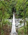
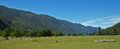
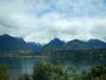
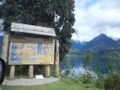
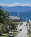
thumb|
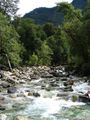
thumb|
thumb|
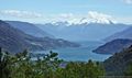
thumb|
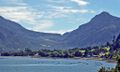
thumb|
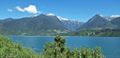
thumb|


