GPT18 - Lago Pirihueico
| All GPT sections (click to show) |
|---|
|
GPT Section Articles
|
Recent Alerts and Suggestions
Season Section Log
- 2019-Dec-5 / Shaun C / 1 Day Lago Pirihueico only / Southbound / Optional Packrafting Route
Packrafted Lago Pirihueico only - as add-on to Section 17P. Didn’t hike any part of Section 18. At Puerto Fuy, an official of the Armada/Navy said solo kayaking on the lake was prohibited, but after a 10 minute conversation I convinced him to let me do it. Key was saying that I, not Navy, bore responsibility. Lake is stunning, especially at dawn.
Summary Table
| GPT18: Lago Pirihueico | Hiking | Packrafting | |||||
| Group | D: Lagos Chilenos | Total | 72.5 km | 22 h | 88.0 km | 27 h | |
| Region | Chile: Los Ríos (XIV) | Trails (TL) | 4.5 km | 6.2% | 4.6 km | 5.3% | |
| Start | Puerto Fuy | Minor Roads (MR) | 67.1 km | 92.6% | 60.5 km | 68.7% | |
| Finish | Puerto Maihue | Primary Roads (PR) | 0.9 km | 1.2% | - | - | |
| Status | Published & Verified | Cross-Country (CC) | - | - | 0.4 km | 0.5% | |
| Traversable | Dec - Apr (Maybe: Oct, Nov, May) | Bush-Bashing (BB) | - | - | - | - | |
| Packraft | Very Useful | Ferry (FY) | (25.1 km) | (25.7%) | - | - | |
| Connects to | GPT17H, GPT17P, GPT19 | Investigation (I) | - | - | - | - | |
| Options | 143 km (2 Options & Variants) | Exploration (EXP) | - | - | - | - | |
| Hiking | Packrafting | Total on Water | 22.5 km | 25.6% | |||
| Attraction | 2 (of 5) | 4 (of 5) | River (RI) | - | - | ||
| Difficulty | 3 (of 5) | 4 (of 5) | Lake (LK) | 22.5 km | 25.6% | ||
| Direction | Both ↓↑ | Both ↓↑ | Fjord (FJ) | - | - | ||
| Comment | - | ||||||
| Character | Valdivian Rain Forest, Settlers, Lake Packrafting | ||||||
| Challenges | Demanding River Fords, Bush Bashing, Right-of-Way Disputes | ||||||
Satellite Image Map
Elevation Profile
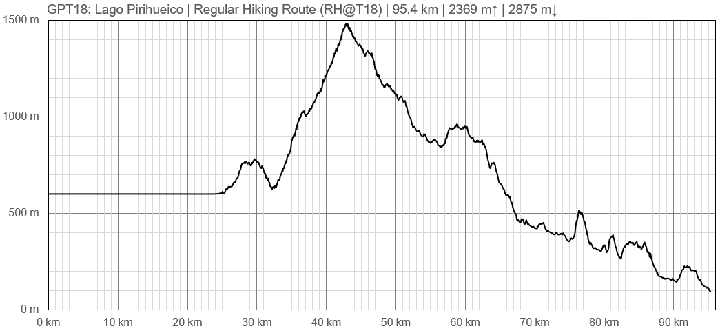
Elevation Profile of Regular Hiking Route
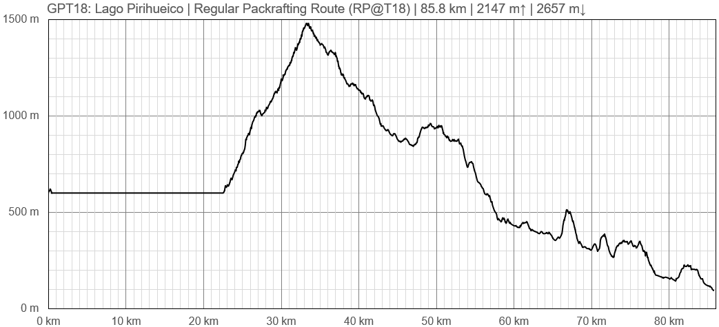
Elevation Profile of Regular Packrafting Route
Section Planning Status
Recommended Travel Period
Benefits of Hiking and Packrafting
Recommended Travel Direction
Section Length and Travel Duration
Suitable Section Combinations
Section Attractiveness
Section Difficulty
Resupply
Resupply Town
Shopping: Food
Shopping: Fuel
Shopping: Equipment
Services: Restaurants
Services: Laundry
Services: ATM and Money Exchange
Accommodation: Hostals and Hotels
Accommodation: Cabañas
Accommodation: Camping
Transport: Ground Transport
Transport: Ferries
Transport: Shipping Services
Resupply on the Trail
Location, Names, Available Items and Services
Access to Route and Return
Access to Start
Return from Finish
Escape Options
Permits, Entry Fees and Right-of-Way Issues
Regular Route
Regular Hiking Route
Regular Packrafting Route
- Route description by Kara Davis after Season 2017/18:
Notes to consider before beginning: We were halted by rangers in a jeep on the 4WD road on the west side of Río Pillanleufu. They informed us it was illegal to be in Huilo Huilo at this time because the reserve was closed for the rehabilitation of the Pudú, the world’s smallest deer. We had no knowledge of this since we entered the reserve in a very remote location and there was not adequate signage to inform us of this closure. After explaining this to the ranger, they escorted us out of the reserve. You may want to enquire about the status of Huilo Huilo before beginning this section.
Comment by Jan Dudeck: This was publicly accessible land with public roads until the Petermann clan took control of this vast property during the final year of the Pinochet dictatorship. Huilo Huilo is not advertised as a “private for profit reserve” with very expensive high-end lodging but wood logging continues in parts of this property. Several hikers reported that they were stopped by guards and send or escorted out. It remains unclear to me if the right-of-way legally ended or if the new owner simply want to keep people out that don’t spend lots of money.
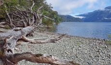
GPT18 begins with a 23 km paddle on Lago Pirihueico, a long, remote, serpentine lake. There are almost no residences along the shoreline of Lago Pirihueico, but there are some beaches suitable for camping. A ferry also runs from Puerto Fuy to Puerto Pirihueico at the southern end of the lake several times a day. You can find more information about the ferry and make reservations here: https://barcazahuahum.com/en/schedule-and-prices/.
The take-out is not obvious, and we relied on our GPS to guide us to the spot. A short walk up is a 4WD track that leads into the Reserva Biológica Huilo Huilo. The track is overgrown and littered with downed trees but becomes clearer and easier to navigate as it ascends. The views are gorgeous as the 4WD track climbs above treeline.
As the route nears the roaring Río Pillanleufu, it reduces to a single track trail. The trail meanders on the east shore of the river and eventually disappears. We backtracked a bit and made our way down to the east river bank which we followed until we picked up the trail in a large meadow. A bridge is located where the GPS track is shown crossing over the Río Pillanleufu to the west side and joining a 4WD road. The vegetation on this side of the river is thick and camping is hard to come across.
About 10 km from the bridge crossing, the 4WD track ends in an impenetrable bamboo forest. We backtracked and headed down to the west bank of the Río Pillanleufu where we found a horse track that eventually led back to the main route. The route follows easy grade farm roads until exiting onto T-559. T-559 is a windy gravel road which makes for an easy road walk all the way to Lago Maihue and the end of GPT18.
Town: Futrono
Futrono, about a 40 minute drive from where the route joins T-559, is the nearest large town. It has a variety of restaurants and lodging options and is a good place to resupply. There is no central bus station in Futrono, but there is a gas station at the east end of town where you can pick up a bus that will take you back to the trail.


