GPT28P - Bajo Río Palena
|
| ||||||||||||||||||||||||||||||||||||||||||||||||||||
Section Statistics
Basic statistics
| Traversable | Nov - May (Conditionally: Sep, Oct) | |
| Packraft | Required (77.5 km | 77.5 % on Water) | |
| Hiking | Packrafting | |
| Attraction | No Rating | 5 / 5 |
| Difficulty | No Rating | 3 / 5 |
| Distance | - | 83.0 km | 18 h |
| Direction | None | Only ↓ |
| Comment | Hiking: Packraft required | |
| Status | Published and Verified | |
| Zone | F: Zona Palena | |
| Region | Chile: Aysén (XI) | |
| Start | Río Palena, La Junta | |
| Finish | Puerto Chacabuco , (Puerto Cisnes) | |
| Previous Section | Next Section | Alternative Section |
| GPT27P or GPT30P | GPT31P or GPT29P or GPT30P | No |
Section Planning Status
Recommended Travel Period
Benefits of Hiking and Packrafting
Recommended Travel Direction
Section Length and Travel Duration
Section Attractiveness
Section Difficulty
Resupply
Resupply Towns at Start, Finish and off Route
Resupply en Route
Access to Route
Permits, Entry Fees, Right-of-Way Issues
Regular Route
Regular Hiking Route
Elevation Profile of Regular Hiking Route
|frame|center|Elevation Profile of Regular Hiking Route (2019)]]
Comments to Regular Hiking Route
Regular Packrafting Route
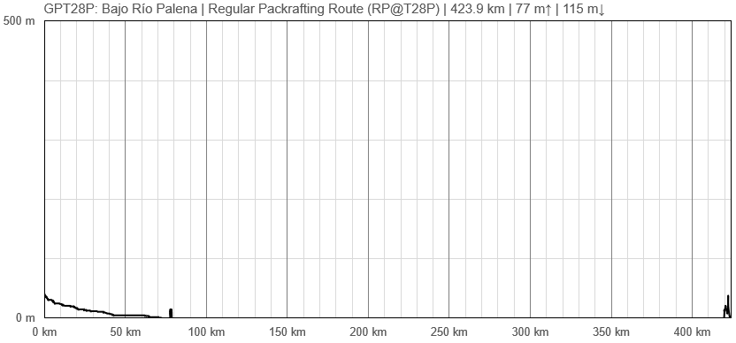
Elevation Profile of Regular Packrafting Route
Comments to Regular Packrafting Route
Summarising route description to be issued.
Route description by Kara Davis after Season 2017/18:
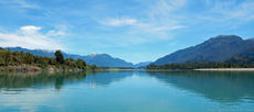
Río Palena continues to steadily grow as it makes its way towards the ocean. This section has noticeably fewer rapids, and mostly consists of calm, slow moving water. Camping is abundant and easy to find. There are many rocky beaches that lead to flat grassy or sandy land. Within 20 km or so from the ocean, tidal effects on the river current are noticeable. Check a tidal timetable before embarking to get an idea of good times to paddle. If the wind or tides makes paddling impracticable, it is possible to reach Ruta X-12, a dirt road which follows the river and leads to Puerto Raúl Marín Balmaceda.
Notes for Travel to Puerto Chacabuco (Beginning of GPT29P): There are two options for transportation to Puerto Chacabuco:
1. Ferry
Book your tickets on the ferry from Puerto R.M. Balmaceda to Puerto Chacabuco in advance here: http://www.navieraustral.cl/itinerarios-y-tarifas
The ferry is a popular travel option and only runs a couple days during the week. It is also possible to purchase tickets at the local grocery store, but be prepared to wait for several days if you decide to do this.
2. Three Buses and a Taxi
There is also an option to take a series of shuttles to Puerto Chacabuco. This is a cheaper but certainly less enjoyable and more time consuming option. The series of shuttles required to get from Puerto R.M. Balmaceda to Puerto Chacabuco are as follows:
a. There is a van that runs from Puerto R.M. Balmaceda to La Junta twice a day which leaves from the ferry port (trip time ~3 hours). The tourist information station in Puerto R.M. Balmaceda can give you times and details about tickets.
b. From La Junta, there's a bus to Coyhaique that usually only runs once a day (trip time ~5 hours). Tickets may be bought before hand at the local depot (ask the tourist information center for directions). One company that offers transportation by bus from La Junta to Coyhaique is Aguilas Patagónicas. See their website here: http://www.aguilaspatagonicas.cl.
c. From Coyhaique, catch one of the many buses traveling to Puerto Aysen.
d. The final step is to hire a taxi (about 500 CLP) to Puerto Chacabuco. There is a pickup/dropoff location along highway 240 just outside of the Unimart.
Town: Puerto Raúl Marín (R.M.) Balmaceda
Puerto R.M. Balmaceda has a few lodging options and lots of open ground for camping. There are a couple of expensive markets that could meet resupply needs, but Coyhaique or Puerto Aysen definitely have better options.


