GPT17H - Liquiñe
| All GPT sections (click to show) |
|---|
|
GPT Section Articles
|
Recent Alerts and Suggestions
Season Section Log
- Feb 2020 / Matthieu / Northbound / RR + Lago Chanchan
Another part of the Huilo Huilo parc, no entry fees in this sens. Nice for the forest walkers the like flowers and calm. Tracks well maintained in the form of 4x4 roads, easy to follow (Little red plastic birds sticked on the trees). I agree with Martina and Ivo on the attractivity of this section. There are a few lakes to see on the way, if you get off the RR, and it is worth the effort. The savage beach just a few kilometers after Puerto Fuy is a paradise to camp. Liquiñe is a nice place to rest, with camping and thermal water. Lots of shops.
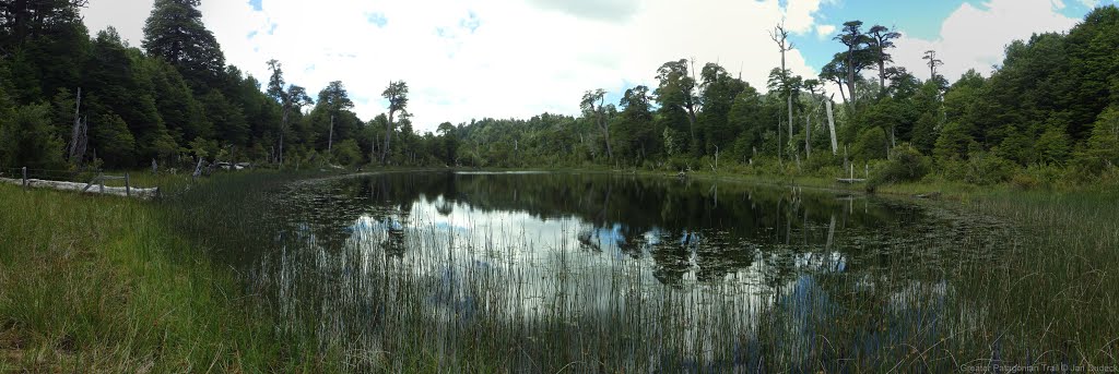
- Lago Chanchan : Talking to chilean hikers there, the main attraction seems to be the Lago Chanchan, which is actually a lake in a volcano crater, with a little beach, and a wonderful place to camp. I took the detour to go. From the waypoint "Refugio?" (which is actually the house of Juan, whose mission is just to take the names of the people going south, just for safety if they get lost. No fees, no stress. Juan is really nice and I could enjoy a nice coffee and discussion with him.), I came back going southbound to the Div 108. Then you take the little forest trail, that goes up gor 2-3 hours until the lake Chanchan. It is a little technical trail cutted in the bamboos, but in this sense easy to follow, following the little red birds. Just before the lake there is a Div where you arrive to a 4x4 trail. One road goes north to the lake, and the other one goes south to the "pozo del Oro", and I assume that this trail join the RR between "Bridge, camp2" and "DIV 110" I didnt explore it the next day thow, going back on my tracks by the little bamboo trail because I was initially going northbound. SO there is a path exploitable from the south part of the section, leaving the RR on a minor road, going to the lake Chanchan, and then going back to RR taking this little trail to the Div 108, making your experience really more attractive.
- 2020-Feb-09 / Martina & Ivo / Regular route southbound
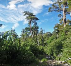
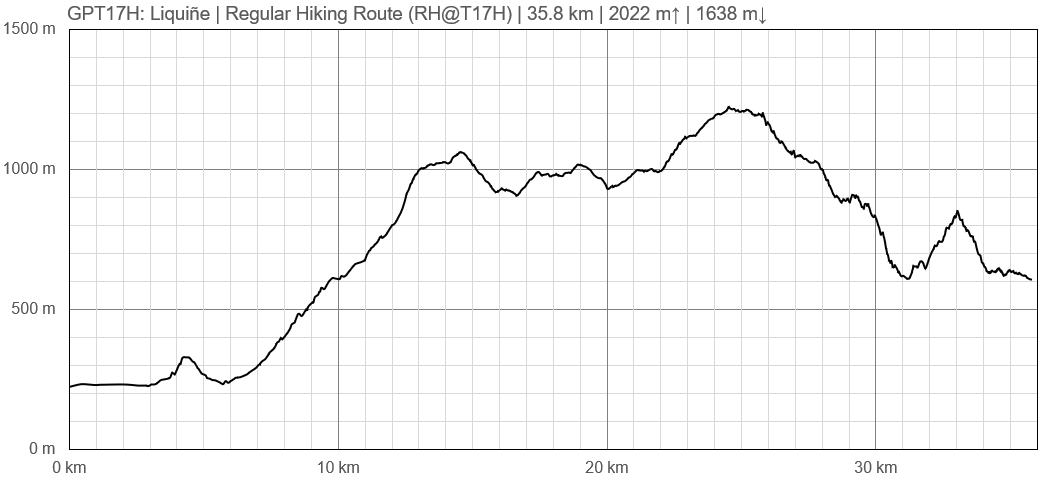
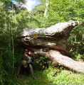
1.5 days. Here is our advertisement for this beautiful section: From Liquiñe alto to the beginning of the forest: great view to the volcanoes Villarica and Lanín. Nice trail to the enchanted Laguna Ankacoigüe. Then beginning of the Reserva Biológica Huilo-Huilo Sector Norte: stunningly huge trees and a sudden change of landscape, entering Valdivian rainforest for the first time. Only a short part of minor road between waypoint "lake, no camp" and the highest point of the section. The whole descent to Puerto Fuy is a attractive trail through pretty rainforest with views to the Volcán Choshuenco. 4 km before the village you find this pristine hidden lonely beach, perfect for a last rest before you arrive at busy touristy Puerto Fuy.
Our rating: 3
Don't skip ;-)
- 8 Feb 2020 Frank RR 2 days Southbound
I met Martina & Ivo on the route & agree with their above comments. This section was an unexpected highlight & the campsite on the lake was the best. When you reach the lake you cross a river then arrive at the campsite which you will probably have to yourself. Avoid the campsites near Puerto Fuy as there are lots of car campers there.
Summary Table
| GPT17H: Liquiñe | Hiking | Packrafting | |||||
| Group | D: Lagos Chilenos | Total | 35.8 km | 12 h | - | - | |
| Region | Chile: Los Ríos (XIV) | Trails (TL) | 3.7 km | 10.3% | - | - | |
| Start | Reyehueico | Minor Roads (MR) | 28.3 km | 79.0% | - | - | |
| Finish | Puerto Fuy | Primary Roads (PR) | 3.8 km | 10.7% | - | - | |
| Status | Published & Verified | Cross-Country (CC) | - | - | - | - | |
| Traversable | Nov - Apr (Maybe: Sep, Oct, May) | Bush-Bashing (BB) | - | - | - | - | |
| Packraft | Deployable | Ferry (FY) | - | - | - | - | |
| Connects to | GPT16, GPT17P, GPT18 | Investigation (I) | - | - | - | - | |
| Options | 12 km (Variants Only) | Exploration (EXP) | - | - | - | - | |
| Hiking | Packrafting | Total on Water | - | - | |||
| Attraction | 1 (of 5) | - | River (RI) | - | - | ||
| Difficulty | 1 (of 5) | - | Lake (LK) | - | - | ||
| Direction | Both ↓↑ | - | Fjord (FJ) | - | - | ||
| Comment | - | ||||||
| Character | Valdivian Rain Forest, Hot Springs, Pehuenche | ||||||
| Challenges | - | ||||||


