This article is just a draft. You can help by expanding and improving its content
|
|
|
| Summary (editar)
|
| Activity
|
Trekking
|
| Location
|
Argentina, Chile,
|
|
|
| Duration
|
días "Días" no está en la lista de valores posibles (3 horas o menos, 1/2 día, 3/4 día, 1 día, 1 día y medio, 2 días, 3 días, 4 días, 5 días, 3 - 5 días, 6 - 7 días, 8 - 10 días, 11 - 14 días, 15 - 20 días, 20 - 25 días, 26 - 35 días, 36 - 60 días, 61 - 89 días, más de 90 días) para esta propiedad.
|
|
|
| Signage
|
Inexistente
|
| Infraestructure
|
Inexistente
|
|
|
|
|
| Topology
|
Cruce
|
| Distance (k)
|
118.1
|
|
|
| Skills
|
No requiere
|
| Original creator
|
Jan Dudeck
|
| Download KMZ/GPX
|
SinKMZ
|
|
|
| Para ver estos botones debes registrarte. Toma 30 segundos: es un formulario minusculo, de solo 3 campos obligatorios.
|
|
| All GPT sections (click to show)
|
|
GPT Section Articles
|
Recent Alerts and Suggestions
Season Section Log
Summary Table
GPT71: Espolón
| GPT71: Espolón
|
Hiking
|
Packrafting
|
| Group
|
M: Sector Yelcho
|
Total
|
118.1 km
|
34 h
|
120.2 km
|
33 h
|
| Region
|
Chile: Los Lagos (X)
|
Trails (TL)
|
49.0 km
|
41.5%
|
36.8 km
|
30.6%
|
| Start
|
Villa Futaleufú
|
Minor Roads (MR)
|
43.4 km
|
36.7%
|
51.4 km
|
42.7%
|
| Finish
|
Puerto Cárdenas, Chaitén
|
Primary Roads (PR)
|
25.7 km
|
21.8%
|
19.5 km
|
16.2%
|
| Status
|
Published & Verified
|
Cross-Country (CC)
|
-
|
-
|
-
|
-
|
| Traversable
|
Jan - Mar (Maybe: Dec, Apr)
|
Bush-Bashing (BB)
|
-
|
-
|
-
|
-
|
| Packraft
|
Useful
|
Ferry (FY)
|
-
|
-
|
-
|
-
|
| Connects to
|
GPT70, GPT72, GPT74P, GPT73P, GPT76
|
Investigation (I)
|
-
|
-
|
-
|
-
|
| Options
|
42 km (1 Options & Variants)
|
Exploration (EXP)
|
-
|
-
|
-
|
-
|
|
|
Hiking
|
Packrafting
|
|
Total on Water
|
12.5 km
|
10.4%
|
| Attraction
|
4 (of 5)
|
4 (of 5)
|
River (RI)
|
-
|
-
|
| Difficulty
|
4 (of 5)
|
4 (of 5)
|
Lake (LK)
|
12.5 km
|
10.4%
|
| Direction
|
Both ←→
|
Both ←→
|
Fjord (FJ)
|
-
|
-
|
| Comment
|
-
|
| Character
|
Valdivian Rain Forest, Farmland, Settlers, Lake Packrafting, Road Walking
|
| Challenges
|
Demanding River Fords, Bush Bashing, Demanding Navigation, Possibly Impassable
|
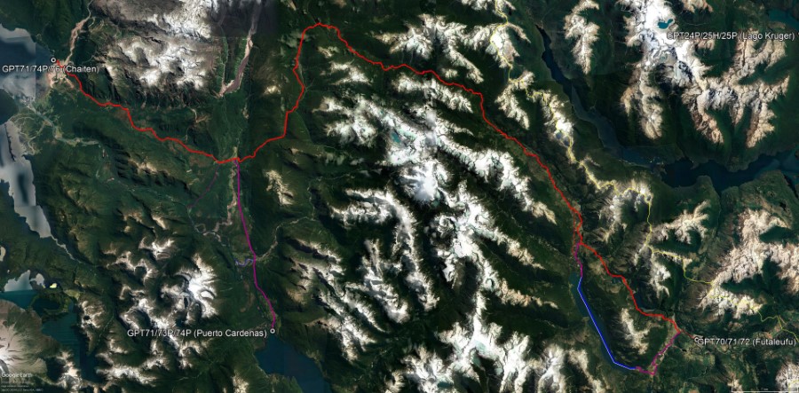
Satellite Image Map

Overview of GPT71: Espolón
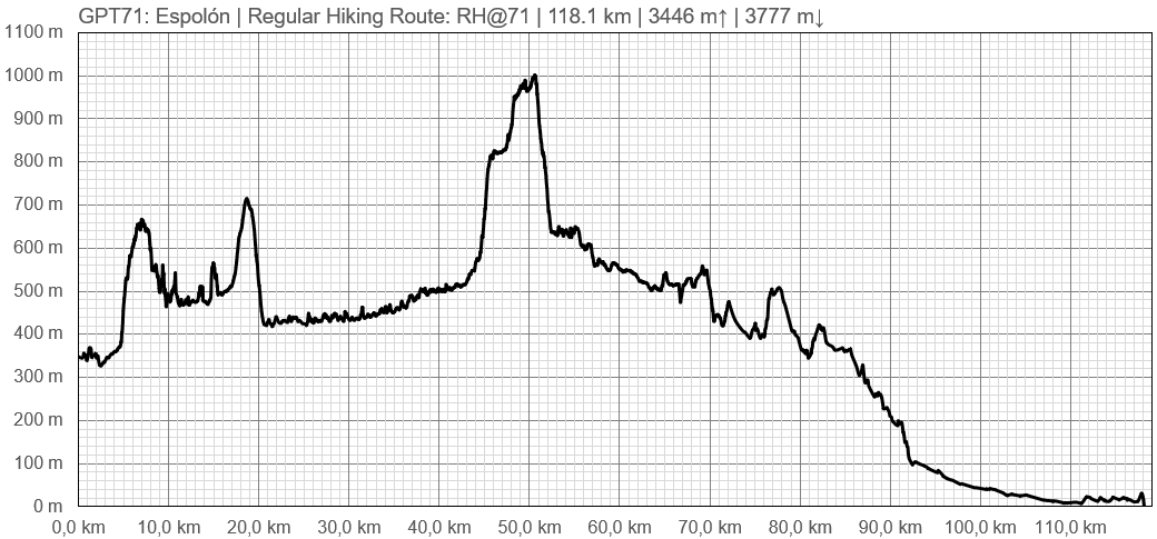
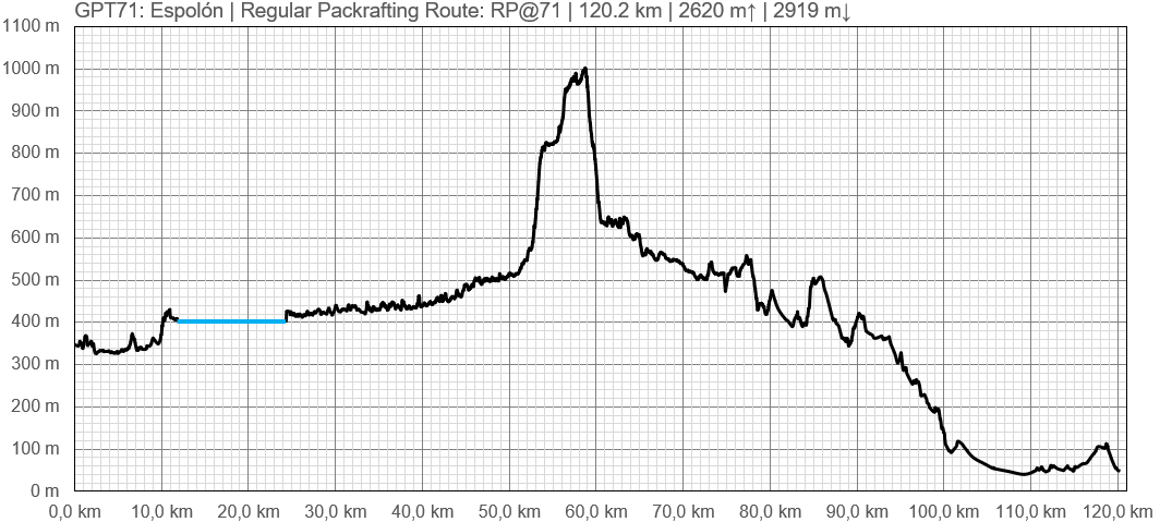
Elevation Profile

Profile of GPT71: Espolón

Profile of GPT71: Espolón
Section Planning Status
Recommended Travel Period
Benefits of Hiking and Packrafting
Recommended Travel Direction
Section Length and Travel Duration
Suitable Section Combinations
Section Attractiveness
Section Difficulty
Resupply
Resupply Town
Shopping
Food
Fuel
Equipment
Services
Restaurants
Laundry
ATM and Money Exchange
Accommodation
Hostals and Hotels
Cabañas
Camping
Transport
Ground Transport
Ferries
Shipping Services
Resupply on the Trail
Location Name
Location Description and Waypoint
Name(s) of Person(s)
Services
Access to Route and Return
Access to Start
Return from Finish
Escape Options
Permits, Entry Fees and Right-of-Way Issues
Regular Route
Regular Hiking Route
Regular Packrafting Route
Optional Routes
Investigations and Explorations
Links to other Resources
Alerts and Logs of Past Seasons


