GPT14 (Volcan Sollipulli)
Add a new log entry always on top in the appropriate season sub-chapter and use format:
* '''Start Date to Finish Date (use Format YYYY-MMM-DD) / Duration in Days / Hiking or Packrafting / Travel Direction (SOBO for Southbound or NOBO Northbound) / Chosen Route and/or Option Name (RR for Regular Route) / Names or Alias'''
Summary with remarks to route that are considered useful for other hikers and packrafters. Include alerts, suggestions and personal perception of attractiveness and difficulties. Try to be specific. Do not be shy to fix obvious mistakes.
Section Log, Alerts and Suggestions
Season 2025/26
Season 2024/25
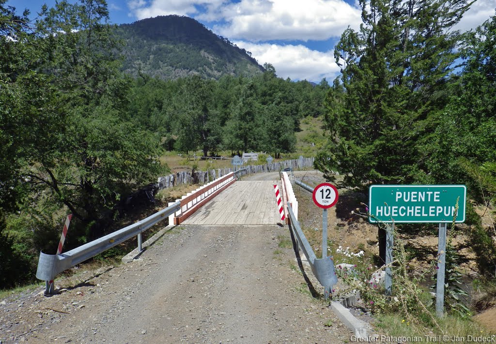
- 2024 nov 13 / 1 Day/ Hiking / SOBO/ hitchhiked to huechelepun + RR till reigolil/ Allie
I camped in camping Carilafquen in Huechelepun. I left early in the morning as it was 32km to get to Reigolil. I stopped by the lodge nevados for a coffee and stayed a bit, the place was so lovely. On the highest parts of the regular route there are some patches of snow to cross but nothing sketchy. Watch out for snow bridges though. The river fords are doable as well.
- 5.-8.11.2024 / 4 hiking days / Daina and Arno
We did a combination of GPT 14 and 15, although we didn't have the files at this time.
We took a bus from Pucón to Flor del Valle and arrived later than expected at 1:30 pm. First we hiked into section 14 on the minor road with very few traffic. At -39.01943, -71.458341 we needed to cross a creek, that is not visible in our map. There are huge treetrunks like a natural bridge. Later at -39.014836, -71.456205 there was another wide stream of water at the road, but very easy to ford. Later we dicided to turn around and hiked to the Laguna Huesquefilo instead, to find a nice campspot. The trail to the Laguna was very smooth, the Laguna itself was beautiful. Next day we continued to GPT 15.
Season 2023/24
- 2024 Mar 24th to Mar 31st / 6 hiking days and 2 rest days / SOBO / Hiking / RR, Var C, E, H, G, Opt 1 and 1A, Opt 2 and 2A / Michael and Kasia
We did sections 14 and 15 together.
TL:DR: a nice section; the summit of Sollipulli is not to be missed!
Day 1 March 24th
We left Icalma at 08:30. It was a foggy morning and the air was still, very nice hiking weather and beautiful light. It had rained the day before so the road walk was thankfully not dusty. It was a Sunday morning and very few cars passed.
We left the highway to keep on RR. It is a dirt road for quite some time. We found a lot of piñones just lying on the ground. There was an unmarked ford at (-38.84187, -71.36345). After that the overgrown section began. It was somewhat challenging for us, not bush bashing per se, but definitely bush pushing. A lot of it was waist high and really slowed us down. Our plan had been to get to the laguna on Var C, but it became obvious that even if we did make it, it would be dark before we got there. Looking at the GPS I noticed what looked like a small laguna at (-38.86766, -71.38010). There was no OSM track for it, but when we got closer, we found a dirt road going to it. There was no sign and no fences. It was a lovely spot. There were a few araucarias dropping piñones, and the laguna was clear and glassy smooth. It was, however, definitely someone's campground. There are flat spots for tents, picnic tables, a shipping container turned into a bathroom (padlocked shut when we were there), and there were signs of more development planned. Point being, if you plan to camp here in future seasons, be aware that, at least during “la temporada”, there may be other people there, and it probably costs money.
Day 2 March 25th
We made it a short day. Our packs were extra heavy due to all the piñones we were harvesting. We kept trying to stop, but there is just something about their color and shape that makes them irresistible to pick up. The path from the campground to the laguna on 14-C is a dirt road the whole way. We had to check the GPS a few times as there are a few other roads that break off of it, but the route is easy walking. The laguna is very pretty and the campsite there is nice. It's fairly flat with plenty of space for multiple tents, under some trees, so mixed shade and sun, and easy water access. There was also a fire ring there. We had our first fire of the season and cooked a few batches of piñones. Some people on horseback came by looking for their cows. They said they are beginning the process of collecting the animals and moving them down to the invernadas for the winter. They mentioned that the laguna on 14-C is called Laguna Santa Olga.
Day 3 March 26th
Stayed at Laguna Santa Olga for a rest day.
Day 4 March 27th
We walked by (Camp 14 [17.9/1538]) on the way back to the road. We could hear a stream trickling in the opposite side of the road from it.
The forest along the way was beautiful. It was a great time of year to be there as well, sunny but not hot and the light was always nice. We collected another 2 kg of piñones. There were so many everywhere, we definitely could have bought less food and been okay.
We took Var E to bypass the road construction even though there was no one there by the time we arrived. It was mostly because we were looking for camping and knew there wouldn't be any good spots there. But if someone arrived there after work hours, the gate going SOBO was just closed with wire, and on the other end it was possible to just walk around the fence.
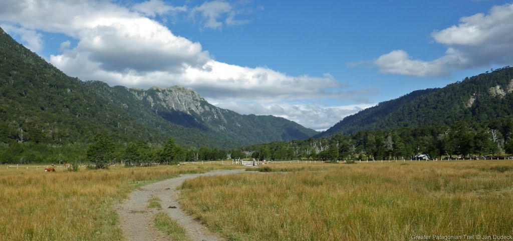
We then followed Var H on to Var G towards Var F. We camped at Camping Carilafquen (-38.91004, -71.49813) along Var F. We paid 10.000 for the tent space. There was no one else there. The campground was pleasant. It had plenty of space on the grass for tents, picnic tables, and bathrooms with showers, cold water only, no electricity. It was a good option for us because it was only 1.6 km from the CONAF office. If wanting to camp there, just up the road from the property there is a house. A couple who manages the campground lives there. They were very nice, they even gave us sopaipillas.
Day 5 March 28th
We arrived at the CONAF office around 09:00. There was no ranger on the office. We started moving things into a small backpack anticipating leaving our bags. By the time we were ready to hike, still no one had shown up. Fortunately a small tour group arrived and parked right next to the CONAF office. They said we could put out bags in their vehicle and they would leave them for us if they got back first.
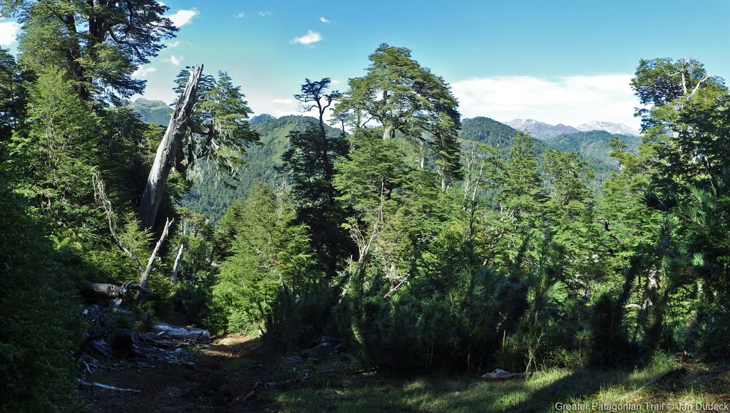
The walk up through the forest was beautiful and peaceful. There were a lot of huge, old trees that were very impressive. The trail was well maintained and easy to follow. Higher up it switched to a more lunar landscape with multiple volcanoes and cordilleras of mountains appearing the higher up we got. Towards the top it got a little steep which was slower going. It took us 5 hours to the summit with photo breaks and a snack break. We spent about an hour at the summit with no one else there. The weather was impeccable, full sun and hardly a breeze. The only sound was the river below. It took us about 3 hours to get back to the bottom. We ended up camping across the path from the CONAF office next to the picnic tables. There was a facet outside the office and bathrooms.
Day 6 March 29
When the CONAF guard arrived in the morning, he came over to talk with us. He said it was fine that we camped for the night, but just asked us to take the tent down, and then we could take as much time as we needed. It seems that camping there is unofficially acceptable as long as you're there after closing and wrapped up before people start to show up in the morning.
We started to walk along RR. We had been walking less than 30 minutes when a truck stopped and offered us a ride. They were going to Paso Llaima and to collect piñones. We rode in the back with their two dogs getting to watch the beautiful misty forest go by around us.
From Paso Llaima we continued on RR, then took Opt 2 to Laguna Huequefilo. The trail up is easy to follow and well maintained. The sign at the front says no camping and no fires, but there was no CONAF office and no guardadaparques. When we got to the lake there were several groups camping and having fires. There are a huge number of araucarias there and it is a very popular spot with locals to go to collect them.
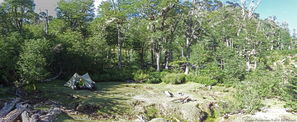
Going down Opt 2A to the SE end of the lake, there is a fairly large sand beach and a creek feeding into the lake that was a good place to get water from. A local family from Ragolil that was camping there suggested a good spot around (-39.05250, -71.43000) that was fairly wind protected but still close to the beach. But if it's not windy, that end of the lake has plenty of space for camping. The lake and the setting is beautiful and for us it was well worth the detour.
Day 7 March 30th
We stayed at Laguna Huequefilo for a rest day.
Day 8 March 31st
We left Laguna Huequefilo and headed back to finish 14 and start 15. We gathered more piñones along the way. At (-39.05455, -71.46918), around km 52.26 there was a sign for a minimarket. The woman who runs is, Viviana, is very nice. She and her family moved there a couple of years ago from Santiago. We suggested she carry gas for camping and she said she would try to get some to sell in the future. She had canned fish, pasta, rice, 200 g tomato sauce packets, bullion cubes, mermeladas, butter and margarine, and a variety of cookies and candy. Prices were reasonable. We bought some things and got back to the road. We almost immediately caught a hitch to the beginning of GPT15 Opt 1.
- 2024-Mar-18 to 2024-Mar-19 / 1 day / SOBO / RR 01 01a/ Matthias de Austria
No snowfields, no Tabanos, no Mosquitos. Plenty of water except for the Sollipulli peak area.
Came from Lonquimay by bus at 12:00 to Icalma, arrival around 14:00. There is a minibus directly going a bit west, but only to the intersection at the end of the lake, so maybe like 3km for 500 peso. Very little traffic, but luckily got 4 rides until the ranger at 31.8 in just 3 hours. I am a bit in a hurry as I want to hike Sollipulli but the weather turns bad next day evening. There is a minibus coming from Melipeuco to intersection end of Variant I. It turns to the bridge 30.6.
I did not visit the rangers, as I don't want to go back the same way. Looking for a hidden spot ro camp and early start to the peak the next day.
Don't camp at Hannes suggestion, every Hilux driver coming downhill will spot you easily. I am sure the actuall place he meant is -38.923355,-71.489118. Well hidden and flat, but the water on the other side of road dried up. There is water on your side too, but don't just follow your ears, you won't reach the water. Instead walk where it is relatively easy in south to south east, you may or may not see path like structure, but ca. in 200m you will reach a good path, just follow it uphill directly to the water at -38.924705,-71.489552. It is a 5 to 10min walk from camp. If you follow this path further it leads you to the OSM dirtroad, which is an offical marked hiking path of the park.
I am alone all the way, later I heard that the rangers closed the path due the upcoming bad weather. Very strong and cold winds at the peak, a few hours later it will be snowing, I would love to try the traverse, but it is too risky with that forecast. Nice CC back down to the pass 41.5.
First running water coming from the peak: -38.966463,-71.472000
Possible camp with water at 01: -38.971581,-71.465207
Only car on the road picks me up, a tourist couple from Santiago who stayed at the luxury lodge, and we drive to Pucón, while the rain starts.
Without summiting Sollipulli this would be a drive by section, but Sollipulli makes this section absolutely amazing and I strongly recommend the easy climb up just for those mind blowing views.
- From 2024-03-10 to 2023-03-11 // 2 day // Hiking // NOBO // RR + OPT1 (Summit) // Quentin Clavel
What a section !
After a very cold start, early in the morning at the bottom of the vallee of reigolil, you just go slowly but surely in the Villarica reserve.
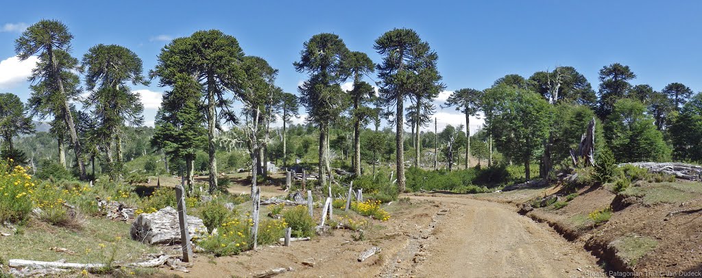
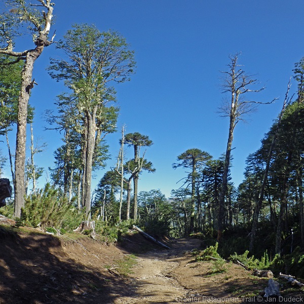
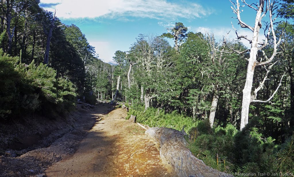
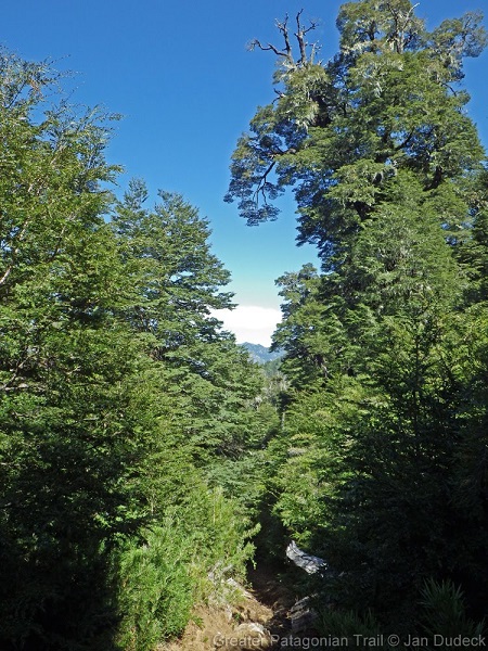
The gravel road is transforming into a smaller 4WD track, and the path is lovely, going up gradually, passing threw a nice forest, with many amazing aucaria trees.
Lucky enough to arrive in this region at the time where piniones are still possible to pick. Didn't had to make a lot of effort, just harvesting the ground was enough to give me way more than what I needed !
I took the junction to reach the summit. At the very beginning I struggle a bit, when you reach a puesto, there's few possibility of track, I took the wrong one that result on a little fight with the bush, then I managed to come back on track, which is pretty clear until the volcanic plateau.
No trouble at all with water, as you'll have some along the path, from th beginning to the end.
Arriving to the plateau, then stick to the track, it will guide you to the summit and the outstanding view on the massive nevados de sollipulli ! That was sick, even with a looooooot of wind. I still stayed there for more than an hour, protected from the wind thanks to some bog rocks, contemplating this amazing landscape, some condors dancing around and the views over lanin and Llaima volcanoes.
It was finally time to leave this kind of parrallele world. The way down was very easy as the track is marqued. Some crazy views again with Llaima volcán + the aucaria trees around, then I reached the conaf desk. I arrived there late and no-one was still there.
(Didn't mentionned that going NOBO you don't have to respect a precise timing to go up, there's no conaf desk on that way).
Then continuing on the way to icalma, passing threw a private pipeline working area. But as it was late on the day, I haven't got any troubles (still easy to avoid, by taking the variant E).
After passing the Hot Spring {13} [#1/945] (PK28), you'll have to jump a gate, then few gates/fences, and continuing in the forest on a very well marked 4WD track, until the overgrown part, which is not difficult to pass.
It's overgrown, but nothing to be scared about ! The track is still visible, it's just that the nature want to give you some hugs, very nice and kind, I could even say cute. It's nothing like a fight with the bush !
Then you continue till reaching the gravel road until Icalma. There it's possible to resupply Ith multiple minimercado, you have some possibilities to sleep too, bit it's still a tiny city, don't expect a lot.
- 2024-Feb-16 to 2024-Feb 18 / 3 days / Hiking / NOBO / RR /czimahi
from Reigolil - no good resupply, no pan- following RR, night camp 46,9; then no prob (cross rio Carilafquen just first bridge after camping, think it is 14E) till point S38°51.753` W71°23.062` where I follow wrong way- for sure this would lead to 14a and to the main road. I decided go back to RR and be hours in bush. At the end I missed the route once more but I found water which I needed (aprox S38°50.483` W71°21.907`) and then meet 14B and back to RR to the camp $ 13, and next day to Icalma pueblo.
- 2024 Jan 30 to 2024 Feb 01 / 3 days / Hiking / SOBO / RR + OH14-C + OH14-E + OH14-01 / Hannes
Hitchhiked to km 5,2. Then I went on RR, found last water at -38.841797 -71.363423, soon after the as overgrown marked trail starts. Trail actually not to bad overgrown, most of the time clearly visible, sometimes I had to stick to GPS, especially at the beginning, there are a few trails there… Till the Laguna {14C} I did not see water anymore, except close to Camp at km 17,9, around 50m down towards the puesto was running a little streamlet, maybe drying out? Laguna on OH 14-C is very nice! Good camping spot, but I headed on, still to early. Camped then at km 28,6. I loved this place! An open air cinema with all the green and birds flying and singing around. At -38.889097 -71.450367 you’ll find a locked? gate, barbed wire fence around. Check if it is really locked, I did not look accurately! I say this, because the next one I encountered outside this valley was just pseudolocked. Anyway, I passed the fence at around -38.889820 -71.449927, around 100ms to the left from gate beneath. Seemed to me the best option, but check out for yourself…Walked on. You’ll find another unlocked gate at -38.901269 -71.504529, private property with a sign that just authorised persons can pass, some company I suppose. I took a detour over OH14 E, but having seen the exit of this company road close to km 30, shortly before the bridge, I would have taken it. There a gate as well, but not locked and either entrance or exit nobody around. Went on to Conaf to take some water. Read about their rules and so I decided to take the unofficial trail up to the volcano shown on the OSMmap at 38.9238605S, 71.4873252W as some others already spotted. My plan was to do the Sollipulli-Traverse over the rim. The thing is: Where this trail (actually more an MR) starts, there is a nearly 100m long fence, hindering you to drop in directly, furthermore at the end of this fence there is an other cabaña, looks like an outpost of CONAF checking who is taking this trail. I do not know who sits in this shack, did not want to know either, did not want to explain my plans. So I went back were the fence starts. This is at -38.92315, -71.48867, there is a signboard with „Sollipulli Lodge, 500ms". There I dropped into the bushes. There would be actually a pretty nice camp spot for one to two tents at around -38.922156 -71.489928, around 30ms from the MR, but nobody sees you and water nearby at the other side of the road. From there I walked up (little CC) keeping in mind where the OSM trail goes, found a path and somewhere I got on this OSM trail. Went up to the summit. Looked over the rim, realized I had to descent for the next summit towards the south, impossible there to cross over the rim. Went down southeast of the summit to this two beautiful lakes, some bigger snowfields there, but could be done with afternoon sun. Camped at -38.971172 -71.489823, an amazing campsite! But realized there that without micro spikes or crampons I would have to detour some extended snowfields in the morning and loose a lot of time, not knowing what expects me after the next summit. So I skipped my plan for the traverse and went down over OH 14-01. Then all the way out to Reigolil. Difficult for me to hitch a car…
- 2024-Jan-13 to 2024-Jan-15 / 2 days / Hiking / SOBO / RR - {14-A} - RR - {14-E} - RR - {14-01} - RR / Lilian
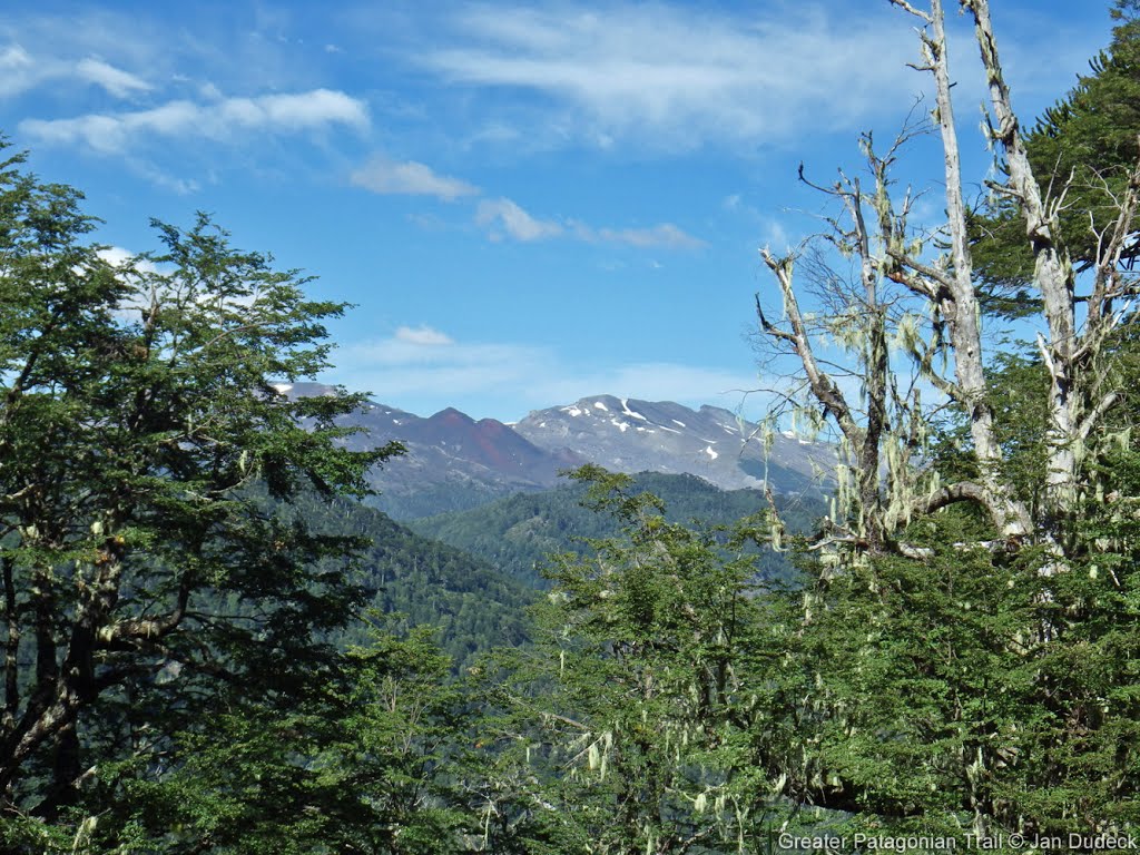
DON'T SKIP GPT14, the views on Nevados de Sollipulli is one of the most STUNNING views in my life!
HIGHLY RECOMMEND to you!
Here is the waypoint description:
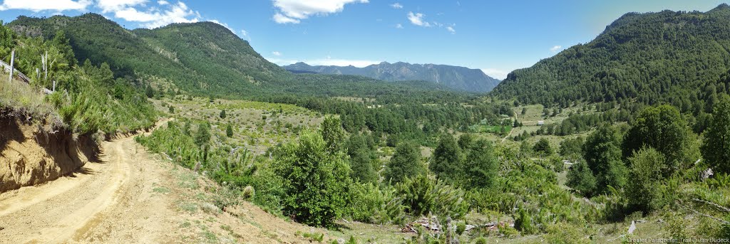
RR road walking.
Km1.0 : a small shop.
Km1.1 : tiny shop, look like only have drinks and ice cream. It is closed when i was there at weekend.
Km5.2 : junction of RR and {14-A}, i go for {14-A} because i want to arrive ranger station RR[31.8/1141] before 11am, {14-A} is a dirt road, the time can be controlled and stable.
{14-A} km6.3 : ranger station, crowned when i pass here.
Lot of possible camping spot beside the dirt road of {14-A}, i think it is easy to find a spot here.
{14-A} km10.9 : water flowing, but it need some BB, about 10m for get close to stream.
Km11.4 : locked gate, go around itbon right side.
Km12.5 : huge blowdown, no more cars going up by this road.
Km13.0 : side trail on valley side, 30m for collecting water, flowing low.
Km13.3 : {14-A} end, connect with RR km15.7.
I find one more water spot nearby, at RR km15.6, also a side trail at valley side, a little overgrown about 10m to stream, better water at downstream 10m, you can cross 2 logs there, then you will find a very tiny waterfall, easy to collect.
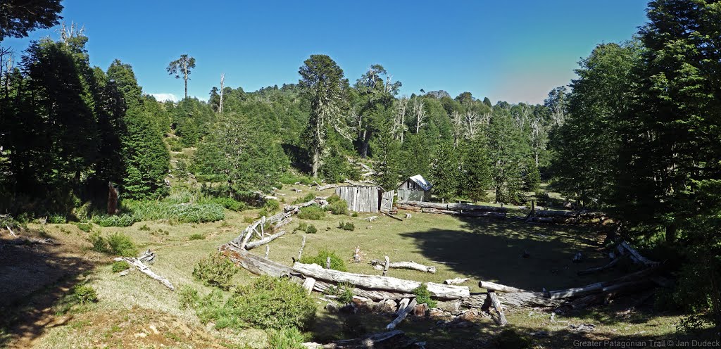
Camp RR[17.9/1538] : tiny grassland, some muddy nearby. Water flowing at downstream of the muddy, but in steep valley look like very difficult to collect.
Camp[22.4/2158] : very beautiful grassland camping spot until km22.95.
Km23.45 : locked gate with barbed wire fence. Better climb at left side, just the top one is barbed wire, all the wire of right side is barbed.
Km24.6 : another beautiful grassland camping spot. I heard water flowing good at valley side, but I'm not sure can collect water or not. I think this is the last camping spot before you met settlement and climbing Sollipulli.
Km25.85 : crossing Estero Huechelepun on bridge, water flowing good under the bridge, it is a steep valley, I don't think it is possible to collect water here.
Km29.5 : junction of RR, {14-I} and {14-E}. RR is blocked by barbed wire fence. So i go for {14-E} then met RR.
Honestly, i don't think {14-F}, {14-G} and {14-H} is still usable now. At {14-E} km0.4, {14-F} is blocked by a barbed wire fence(no gate) that taller than human, only this spot the fence is such high, i think it means the owner not welcome other people to go in at here. Also bridge[31.0+0.2/1020] and ford[31.0/1034] is all blocked by gate or barbed wire fence. Even you can climb all over them, {14-F} is going just beside settlement, it will annoys the people there.
Lastly, ranger station is not at park ranger[31.8/1141], it is at (-38.91796, -71.49481), even you can sneak by {14-F}, rangers are still in front of you. There are no way to go around them, and their windows are towards the road, they see you before you get close (the only method is earlier or later than them at there).
So, i go for a round trip for Sollipulli, and put my backpack in ranger station.
For Sollipulli {14-01}:
Km0 : ranger station, car parking lot, some picnic table, food truck(not open on Sunday when i was there) and toilet. Also you can collect water by Río Carilafquén if need.
Km1.25 : official viewpoint, but surrounded by some trees taller than the viewpoint 5-20m, i saw nothing here. Some benches here too.
Km2.1 : junction of {14-01} and {14-01A} (CC route). For GPT hiker, both are in good condition, easy to follow and walk, but of course {14-01} is a little better condition, because of official route.
Km3.8 : sharp turning, a helipad nearby.
Km4.73 : official viewpoint.
Km5.3-km6.1 : snow valley, covered by snow now. Not too steep, no difficult climb up and go down, also there are some day hikers, mostly you can follow their steps or go by yourself.
Summit [6.3/2145] to km7.05, covered by snow ridge now, very easy to walk on. Km7.1 is a better point for rest, mort quite, more peaceful. Most of the day hikers would not come to here. km7.05, enjoy your moments here.
For my observation from high, km7.1 to km7.9 are all covered by snow, but easy to walk on. I didn't see any footprints or trace on the snow, so I don't know descent is still work or not. I need to get back my backpack at ranger station, so i didn't go down at here.
I take a long nap and some relax with amazing views at km7.05, such a good time.
I took 3 hours for climb up and 1.5 hour to go down.
Continues on RR :
Km32.2 : viewpoint of waterfall.
Bridge[33.5/1188] : no bridge here, wet feet crossing. From here to ford[37.0/1228] you need to cross the same river 6 times, all wet feet crossing but just above ankle, easy.
Km37.95: flat grassland beside a pond. I saw some people camping here, look nice.
Camp[39.3/1294] : grassland camping spot with 2 fire ring beside the river.
Km40.6 : an old dirt road leads you to a grassland beside the river.
Km43.0 : junction of RR and {14-01}, {14-01} at here is a clear road to west, also one more road is going west after here 80m.
Lot of small stream if flowing good with clear water across the road after the pass.
Km44.5 : road junction, a sign "Reigolil Paso Mallin Chileno" here. Nice seat with good view of Sollipulli too.
Km49 : wet feet or an exciting log crossing.
Shop[57.8/856] : it is a ferretería, with drinks and ice cream, friendly.
At last, I didn't cross bridge[59.8/835] to Reigolil and keep going south because i have enough food for GPT15.
- 2023 28 - 31 dec / 3 days / NOBO/ Option 01B / Natalie & Tomáš
Last year we wondered if one can avoid roadwalking on GPT 14 and GPT15 by traversing Sollipulli (not the glacier) and it turns out it can be done and is quite a spectacular option (probably a lot more attractive then RR and when done right, not with too many people). The idea is, SOBO, to follow the rim of Sollipulli for about 4 km, then go to Laguna Cochor (14-01B), then to Laguna Isolda, Termas Rio Blanco and NP Huerquehue (15-01) and then Villarica Traverse (16-04). If you hitch (should be easy) or take a bus between the end of 15-01 and beginning of 16-04 through Pucon, you will get quite a nice trail without much roadwalking. See our notes to GPT15 and GPT16 for the rest of this option, here follows the Solipulli bit.
Note: to do a one way traverse of Sollipulli, either walk through the CONAF station before about 8 AM or after about 7 PM when the guards should no longer be there or walk past it for qbout 1 km on the road and take a right at 38.9238605S, 71.4873252W where there is an OSM trail based on Strava heatmap; however that trail needs to be confirmed, but it is almost for certain there.
Since we climbed Sollipulli last year from the north, this year we opted to do a day trip from Laguna Cochor to the north summit via south summit of Sollipulli, thus proving the traverse is doable and not too hard. The following paragraph (Tl;DR: do not expect to get a ride easily on this road) is about access, so if you are coming from the north, skip it.
We took a bus from Temuco to Cunco, they go every half an hour and cost a few thousand pesos. There are many terminals, the company you look for is Nar Bus, find its terminal in google maps to save yourself 1 km of going to the rural bus terminal and back. The ride takes cca 80 minutes. From Cunco, there is a daily bus to Laguna Caburga that leaves everyday at 17:00. On Monday, Wednesday and Friday, it should go all the way to Termas Rio Blanco (it probably goes back in the morning, do not remember time schedule but we just saw a bus in the morning in the direction of Cunco). In Cunco we missed that bus and had to hitch. It was very easy at the beginning to get to Lago Colico but after that it became extremely difficult all the way to the start of the hike. We had to sleep in the forest that night because no cars were stopping. In the morning, we got a hitch of 3 km and then we walked a few more to the western end of Laguna Caburga. We bought some bread and chips there, waited for four hours for a hitch and killed about twenty horseflies. None of the 15 cars that passed took us. We then walked to the other end of the lake, where we got a hitch to the junction with access to Thermas Rio Blanco. From there, we walked to the start/end of GPT14 option 1B. It took us about 26 hours from Cunco.
At the entrance to the trail (it is open but seems to lead through private land), there is a sign saying it is not allowed to camp at Laguna Cochor (which is clearly being violated, on our second night there, there was a Chilean tent). Secondly, it says there is no estabilished access to Sollipulli, which is not true, the path leads well above the tree line. The trail is an old road for ~1 km and the rest is very clear, easy and pretty through sometimes dark forrest. At the laguna, there is a beach where one can camp, as we did. There is no good source of water on the way to the laguna or at the laguna (but some streams could be heard in the undergrowth), definitely treat the water in the laguna.
The next day, we hid our tent and set off to reach the south summit of Sollipulli and then to the northern summit via the ridge (or below the ridge). It was an extremely long day trip (~16hrs out and back) but it should not be a problem if doing a proper traverse, many camping options. If one does not want to camp at Laguna Cochor, first good place is right above the treeline where the TR section ends and CC section begins. A nicer place would be cca 1 km further on, where you traverse to a nice valley. The first cca 2 km of CC are actually more TR&CC, the trail comes and goes and follows the contour line, which is to be recommended. In the valley, there was a stream that can still be jumped in one place or could be easily forded. With less snow, it would probably be jumpable almost everywhere. The way to the summit is uneventful and a bit of a slog. No scrambling is needed (there is just one small rock obstacle, but one can walk through). Above around 1900 m., there was a lot of snow. If going early in the season, check the map where glaciers are and do not walk on them - you do not need to, they are fairly small. From the summit, we looked for several ways to go down and then retraced a bit and actually crossed what on a map is marked as a glacier here: 38.9963315S, 71.5233126W. Judging from satellite photos and our own survey, we think the western part of the glacier has melted and we walked over a snowfield to a soft ridge with a small tarn at the end of it. Getting down from this ridge sharply down a f left towards a plateau like valley may or may not be difficult if there is "no" snow. We found a good way down on moderate snow slopes but considering the snow there is still almost 10-15m deep we do not know what the rock would be like, most likely it should be fine without snow. Here Natalie went back as it was already 1500, but Tomáš pressed on. He went across the valley and up the side of the next ridge at roughly 2000 m (there are two places that are not rocky, this one was the lower one, it was steep but fairly easy walking through loose stones and scree), then he went roughly half the way up the ridge, traversed above the two lakes on the way, the got to the rim and walked the ridge, then he got down to the other two lakes on the map and walked up to the summit.
It was six, so he ate and then spent 6 hours walking back, this time not going to the rim at all and staying under the two more southern lakes and then retracing his steps - this was a faster but less spectacular variant. There seemed to be many possible variants how to cross this six km between two endpoints of GPT, the best variant will depend on your mood, skill level, weather and snowncover. It is however possible to do the traverse without climbing or exposed scrambling (though to make sure, somebody should do this in February when there is no snow), Tomáš practically never used his hands. On the way back, he met a Chilean tent above the treeline.
Next day, we walked down to the road, walked about six km, got a hitch of 3 km to Reigolil, after 15 min there got a hitch of 5 km, waited for an hour and then got a hitch all the way to Pucón (about 75 min of driving).
- 2023 23 - 25 dec / 3 days / SOBO / RR + D + Sollipulli summit / Frans
Trail is mildly overgrown going up to the first campsite but not as bad as expected. Usually until your knees but the trail is still visible, it just slows you down. Keep an eye on your GPS if you think you lost it, it's spot on with the GPX files. Camp 14 [22.4] is such a nice spot! Be aware that if you want to do the Sollipulli summit you have to there before 1100 (according to the sign) or the rangers won't let you up. Still a 2hr walk, but not difficult.
GPT14-I point there is a gate and private property sign if you want to continue RR. They are doing road construction, and there is a guard house at the end. I didn't see anyone there, but it was weekend. Just keep in mind you might need to do the detour which takes a bit longer to get to the ranger station.
At the park rangers place you can drop your backpack. I was not allowed to do a one-way trip. Needed to come back. It's definitely worth it! Amazing crater and nice views! Took me 2hrs to get up, 1.5 to get down.
I walked to Camp 14 [39.3] to spend the night. Also a nice spot. The rest of the trail is not super exiciting but 80% slowly downhill which is nice to speed up this part. I spend the night a few km's into GPT 15 next to the river. There are a few decent spots after about 4km.
Season 2022/23
- 2023-Jan-31 to 2023-Feb-02/ 3 days / Hiking / SOBO / including the Sollipulli volcano / Johana & Matouš
One of the best sections so far for us thanks to the Sollipulli volcano. We started at the Icalma lake (the San Alfonso camp was great, 10 000 per two people, hot water (yes!) and access to the beach). There are some restaurants and minishops as well, enough to resupply I believe. The overgrown section had been cleared half a bamboo-metre ago, so sometimes it was tough and felt like the forest wants to suck you in. Nothing impassable, but the two kilometres took us two hours. Another thing - the river where the ascent starts in the forest is for long the only water source there if the weather is dry. There was a gate (S 38° 53.3570' W 071° 27.0191'); there's a hole in the fence on the left that we went under. We camped at a good spot on the right side of the road (S 38°53.4903' W 071° 27.8162'). The next day, we rushed to the CONAF station - we got there a little past 11 AM, but the ranger let us do the ascent anyway, we even had lunch before we went up (not from the stand, sadly, still operates only at the weekends). You can leave your backpacks with the ranger, which was great! We didn't pay anything to enter the park. It took us 5 hours there and back with a longer break at the top. The view from the top is indescribable plus the path leading up to it is also very nice with some snowpatches next to it that you can slide down as you please. After that we continued further down the road. We tried to outsmart the three fords but ended up fording the river three times anyway since the number of the fences and gates had increased I guess and we got stuck on a private property with nowhere to go. The best option might be to just follow the regular route. There's a beautiful camping spot that we highly recommend and had been told about by the ranger - a lot of free space, a laguna/pond, nice (not dense!) forest and several safe fireplaces. (S 38°56.3141' W 071°27.6738) From there on it was easy walking until Reigolil. The shop before the bridge has not many things to resupply but is good to refresh. The shop near the bus stop tuna, rice, pasta, biscuits, chips, beverages, some vegetables as well, enough to resupply. Its owners were so nice that they took us to their lot near the river where they let us pitch our tent. It seems that you can freely camp by the river but there was some Mapuche festival going on at that time. The bus schedule: 7:30 a.m. and 8:00 a.m. from the bus stop by the shop to Pucon.
- 2023-Feb-18 to 2023-Feb-20 / 3 days / Hiking / SOBO / RR starting in Tracura (road to Sollipulli) / Natalie & Tomáš
We used Icalma as a resupply which worked well enough; many "mini- supermercados" and cheap accomodation (we had a cabana for 20mil/10mil each) but as a warning internet is awful! There is a nice pehuenche restaurant at the southern end of town on the main road and a little further than this on the main road you can get the best cell signal. Supposedly a bus goes to Lonquimay Mon-Wed-Fri but I forget the times, I think it was at 6am and 3pm.
We headed towards parque Sollipulli but hitching out of Icalma was slow, ~2hours combined waiting. We got off at Tracura and walked most of the way to CONAF (minus 4km hitch). Hitching was difficult even though it was a Saturday and there were cars, just no takers. No clean water sources until conaf but you could ask one of the cabana rentals along the way if needed. No entrance fee at CONAF and although camping is not allowed the "senior" ranger told us we could camp behind the office (I may have persuaded him with piñones). The only thing is we had to wait until everyone was gone (~7-730pm) and then leave early the next day (~7-730am). He didn't want people to know so don't spread the word... There are water, toilets, cold showers and the next morning we were able to keep our things in the other building as we went up Sollipulli. Finally there was a food truck there with sopapillas and juice (it was a Saturday).
As for Sollipulli it has been the easiest summit so far, there is superb trail and it took ~2hrs up más o menos. There is one intersection where the trail tells you to go right but the climbers trail goes straight and is quicker ( staying left is more quick;-38.93399, -71.49659). The glacier is amazing, 4km in diameter and supposedly 200m deep. I would come back here with glacier gear to cross it and go down the south summit. However Tomáš has his eyes on a way to go around the crater without glacier gear, so it would be a mixture of walking the rim and traversing above treeline towards the south summit where there should be another trail. That would save one cca 20 km of road walking.
We wanted to go up the main route and down option 01 but CONAF still requests you come down the same way and since they helped us with camping I wanted to respect their wishes. If you wanted to avoid the rangers we both think you could easily go up before or after they arrive, we saw a few other parties doing this. Note that there is no water after CONAF, if you were doing the traverse there are some lakes down to the east from the North summit. We think the traverse looks easy until the treeline. From the other end we later passed the trail going up which is in fact a road - not sure how far it goes as a road.
The summit was quick so afterwards we started walking the road that skirts Sollipulli on its east. It was a peaceful road and I have no complaints until it became not fun anymore after the camping at ~46.9. There were two vehicles that passed (no room) but I have no idea how they drove past some of the downed trees, would be a dodgy ride. The forests here are finally becoming alive! We saw tarantulas and a giant moth carcass and mushrooms finally! There are many fords at the beginning after the lodge so keep sandals on if you have them. It would be worth looking at Google earth for an alternative trail because we met a guided horse group on gpt15 that told us they went from the south summit of Sollipulli to the lodge without going on the road. It is possible they meant "no road" as in "no asphalt road" but who knows. We headed to routa S-965 to hitch to GPT15 PN Huerquehue (no cars passed until S-965).
- 2023-Jan-23 to 2023-Jan-25 / 2 days / Hiking / SOBO / RR / Martin & Helena
This section took us 2 days. Unfortunately we didn’t go to the summit, because we needed to go quickly down to Curarrehue, but otherwise we wouldn’t skip it, just a few kms more and it looks incredible. About the trail, the beginning is a dirt road around the lakes and it continues until the start of overgrown section. That is a little more than 4kms, but from the start its a relatively normal trail, easy to follow. The overgrown part is mainly between km 2-3.5, but not so terrible overall following the gps. We camped at the end of this part that took us around 2 hrs, maybe less. After that you walk on a minor road all the time, in a really nice forrest. All the puestos were empty. Hot Spring waypoint is somewhere around houses so we didn’t even go there. To cross the river before CONAF station we used GPT14-E and the bridge. At the station was one guard, food truck closed, water available. The lodging after 1km is nice but it comes with higher prices, we stopped there to have some drink and beer + cola (cans) cost us 6k CLP. We spent the night in the forrest after the pass, but camp at km 46.9 looked great. The rest of the trail is still the same gravel road. Minishop at 57.8 has only basic food, but also some things for repairs etc. In Reigolil was only one shop on the main road open with very limited supplies, but we got from the lady pastel de choclo and some homemade bread, all delicious! Later we continued to GPT15.
Contact: @martin_hanzelka @helenneka
Season 2021/22
Season 2020/21
Season 2019/20
- 2020-Feb / Hiking / NOBO /
From Reigolil to Solipulli it is a very easy forest road inside the reserva nacional. Carabineros asked some questions and said we could camp where we wanted. Arriving at the CONAF site at Solipulli, there is a small campground, free if you pay the entrance for the volcanoe (4000pp). There is a food truck with sopaipillas and jugos. We hiked the Solipulli and it is a must see. It is incredible and there are not that many people doing it. The CONAF ranger is very friendly. We did not hike from there to Icalma to avoid bushbashing and we wanted to see the big fiesta planned in Melipeuco (every year in late feb). It was worth it as we got to see a celebration of baqueanos. Melipeuco is not this nice but there are several supermarkets and restaurants to resupply. Easy hitch to Icalma (or there are 2 buses / day). We then hitched to Liucura to start section 12.
- 2020-Jan-30 / 2.5 days / Hiking / SOBO / RR / Martina & Ivo
Nothing to add to the previous comments. We arrived at the pipeline construction site during working hours and just followed the indications of the workers, no detour, just some optional route. We spent the night at the CONAF campground and had one of the best breakfasts in Chile at the Sollipulli Lodge (13'000 p.P.). As the rain hasn't stopped by lunchtime we had lunch there too, it was excellent :-D We actually quite liked this section with all the trees. We directly added section 15 after this one. There are several busses per day from Reigolil to Curarrehue but we don't know the schedule.
- 15-Jan-2020 / 4 days (GPT 14 + GPT 15) / Hiking / SOBO / RR / Matus & Anna
We combined sections 14 and 15. It took us 3 days and nero. GPT14 - there are signs that someone tried to clear overgrown part of the trail on the begining and end but middle is still nicely overgrown. Though we didn't have problem to follow. Part of minor road on regular trail is under construction. They are putting a huge pipe under it. It was evening and workers were not there se we managed to sneak through but I don't think they will let you pass during working hours. It's just before descending to the river before National reserve Villarrica. In the Conaf campsite was food truck (it was weekend) with churasco, sopapillas, drinks... pure heaven. We paid 4000 per person at conaf. They are building a dorm at Lodge. It will be ready for next years hikers ;) Resuply in Reigolil - mini shop on trail seemed abandoned. We found best supplies in shop-4. There is one other shop directly after bridge. GPT15 - road and trail in good condition. On the climb to the lake bit before last settler there are some wild cherry trees on the left. We stuffed ourselves and left for others too. Enjoy. Multiple shops, accomodation options and restaurants in Curarrehue.
- 2020-Jan-18 / 1.5 days / Hiking / SOBO / RR + optional summit up Volcán Sollipulli / Tom & Maddie
Overgrown trail towards the start is relatively easy to follow. Mostly overgrown around the middle but the tracks towards either end are in decent condition. The rest of the section is easy walking. I would strongly recommend taking a small detour to summit Volcán Sollipulli in the CONAF National park (~30km into the section). When we arrived at the park we had to pay a CLP 4000 fee per person. When speaking to the ranger about where we intended to walk, he advised that the optional route down from the Volcán we planned to take is in very poor condition and would not let us take it. We had to do an out and back. It took us around 3.5-4h to summit and return. The trail is in excellent condition (trail markers are present) and the view is spectacular!! Possibly the best thing I’ve seen on the GPT. We camped in the park for no charge and bought some hot food from the food truck in the evening on the weekend. No issues with the rest of the section.
- 2020-Feb-02 / 2 days / Hiking / SOBO / RR including Sollipulli climb / Frank
2 long days including Sollipulli climb They are building the pipeline under the dirt road, when they are finished they will bury the pipe & road should reopen. No issues going through there but it was Sunday & no one was around. You walk on a narrow track above ditch, when you reach a point where two big boulders block the path you need to go down into the ditch to go around them. Climbing Sollipulli is highly recommended to see the huge summit crater filled with ice & snow. Easy & well marked ascent. You are not allowed to do the ascent after about 11AM. The food truck 'Sabores de Sollipulli' at the Conaf campsite only operates on weekends, it was closed on Sunday. I believe there is another Conaf site a little off route at Laguna Huaquifilo where you can camp. Nowhere good to camp after that. It was raining so I continued to Reigolil. Just after you cross the bridge there is a shop, they have rooms & provide very basic food. Not recommended but will do if you are stuck.
A few minor corrections: There is no bridge @ Bridge 46, just ford the river easily. Gate @ far side of ford is marked no entry but walking through appears to be OK. There is a gravel track that stays on the right side of the river & goes past Ford 133 & Ford 134 so you don't need to cross either of them. It leads to Ford 135 which you do cross.
Resupply and Accommodation
Resupply and Accommodation in nearby Towns
Resupply and Accommodation along the Route
Transport to and from Route
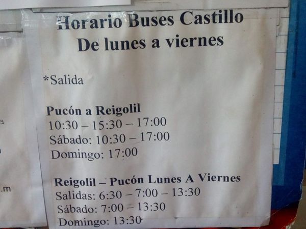
Bus goes from Reigolil to Curacautin & Pucon. When I was there it left Reigolil at 7 & 7:50 AM (different to timetable) Confirm times at the shop by the bridge in Reigolil. Frank
South Summit: Temuco-->Cunco-->Lago Caburga-->Hitch/Walk. Or ask/phone the business at Termas Rio Blanco & Termas San Sebastián about their own chartered buses, from a brief conversation with an employee there sounded to be a bus every few days.What's app +56946809918, +56992318329
Temuco's Terminal de Buses Rurales (Balmaceda 1475) can be complicated since most buses have their own shop elsewhere. For Cunco go to office "IGI LLAIMA/ Nar Bus"; Balmaceda 997. The bus leaves every 30min.
From Cunco check with locals about bus to Lago Caburga. Supposedly a bus leaves everyday at 4 or 5pm from Balmaceda corner La Concepción. It will pass by the nice supermarket;Supermercado Hesis on "Colico Sur" aka the S-75. Confirm schedule in the municipality of Cunco before traveling at +56 45 2200147.
Hitchhiking is easy up until Lago Collico, after that there are cars but not many stop.
Permits, Entry Fees and Right-of-Way Issues
Links to other Resources
Retired Section Article GPT14 - Volcán Sollipulli

