Diferencia entre revisiones de «GPT30H - Coyhaique»
De Wikiexplora
m (Texto reemplazado: «{{GPT KMZ}} }}» por «{{GPT KMZ}} }} {{Table all GPTs}}») |
|||
| Línea 17: | Línea 17: | ||
|AltitudMedia= | |AltitudMedia= | ||
|Primer Autor=[[user:Jandudeck|Jan Dudeck]] | |Primer Autor=[[user:Jandudeck|Jan Dudeck]] | ||
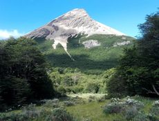
| − | |Imágen Principal= | + | |Imágen Principal= Laguna el rosado (11).jpg |
| − | |ComentariosImagen= | + | |ComentariosImagen=Cerro el Rosado from the lagoon |
|KMLZ=GPT30H - Coyhaique.kmz | |KMLZ=GPT30H - Coyhaique.kmz | ||
|TipoDeMap=HYBRID | |TipoDeMap=HYBRID | ||
Revisión del 14:59 28 mar 2019
This article is just a draft. You can help by expanding and improving its content
|
| ||||||||||||||||||||||||||||||||||||||||||||||||||||
Section Statistics
Basic statistics
| Traversable | Sep - May | |
| Packraft | Only Burden | |
| Hiking | Packrafting | |
| Attraction | 1 / 5 | No Rating |
| Difficulty | 1 / 5 | No Rating |
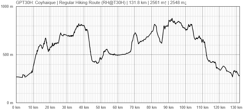
| Distance | 131.8 km | 33 h | - |
| Direction | Both ↓↑ | Both ↓↑ |
| Comment | - | |
| Status | Published and Verified | |
| Zone | G: Zona Aysen Sector Norte | |
| Region | Chile: Aysén (XI) | |
| Start | Carretera Austral, Cruze Rio Picacho | |
| Finish | Coyhaique | |
| Previous Section | Next Section | Alternative Section |
| GPT29H | GPT31H | No |


