Diferencia entre revisiones de «GPT14 - Volcán Sollipulli»
(Página redirigida a GPT14 (Volcan Sollipulli)) |
|||
| (No se muestran 24 ediciones intermedias de 10 usuarios) | |||
| Línea 1: | Línea 1: | ||
| + | #REDIRECT [[GPT14 (Volcan Sollipulli)]] | ||
| + | |||
{{Draft}} | {{Draft}} | ||
{{RutaForme | {{RutaForme | ||
| Línea 17: | Línea 19: | ||
|AltitudMedia= | |AltitudMedia= | ||
|Primer Autor=[[user:Jandudeck|Jan Dudeck]] | |Primer Autor=[[user:Jandudeck|Jan Dudeck]] | ||
| − | |Imágen Principal= | + | |Imágen Principal= |
|ComentariosImagen=Caption | |ComentariosImagen=Caption | ||
|KMLZ=GPT14 - Volcán Sollipulli.kmz | |KMLZ=GPT14 - Volcán Sollipulli.kmz | ||
| Línea 24: | Línea 26: | ||
{{GPT KMZ}} | {{GPT KMZ}} | ||
}} | }} | ||
| − | + | {{Table all GPTs}} | |
| − | + | ||
| − | + | ||
| − | + | ||
| − | + | ||
| − | + | ||
| − | + | ||
| − | + | ||
| − | + | ||
| − | + | ||
| − | + | ||
| + | ==Recent Alerts and Suggestions== | ||
| + | * 2 Feb Frank RR Southbound | ||
| + | A few minor corrections: There is no bridge @ Bridge 46, just ford the river easily. Gate @ far side of ford is marked no entry but walking through appears to be OK. | ||
| + | There is a gravel track that stays on the right side of the river & goes past Ford 133 & Ford 134 so you don't need to cross either of them. It leads to Ford 135 which you do cross. | ||
| − | ==Section | + | 31. Jan - 2. Feb. 2023/ Johana & Matouš/SOBO/3 days, including the Sollipulli volcano |
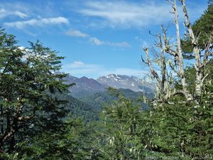
| − | == | + | One of the best sections so far for us thanks to the Sollipulli volcano. We started at the Icalma lake (the San Alfonso camp was great, 10 000 per two people, hot water (yes!) and access to the beach). There are some restaurants and minishops as well, enough to resupply I believe. The overgrown section had been cleared half a bamboo-metre ago, so sometimes it was tough and felt like the forest wants to suck you in. Nothing impassable, but the two kilometres took us two hours. Another thing - the river where the ascent starts in the forest is for long the only water source there if the weather is dry. There was a gate (S 38° 53.3570' W 071° 27.0191'); there's a hole in the fence on the left that we went under. We camped at a good spot on the right side of the road (S 38°53.4903' W 071° 27.8162'). The next day, we rushed to the CONAF station - we got there a little past 11 AM, but the ranger let us do the ascent anyway, we even had lunch before we went up (not from the stand, sadly, still operates only at the weekends). You can leave your backpacks with the ranger, which was great! We didn't pay anything to enter the park. It took us 5 hours there and back with a longer break at the top. The view from the top is indescribable plus the path leading up to it is also very nice with some snowpatches next to it that you can slide down as you please. |
| + | After that we continued further down the road. We tried to outsmart the three fords but ended up fording the river three times anyway since the number of the fences and gates had increased I guess and we got stuck on a private property with nowhere to go. The best option might be to just follow the regular route. | ||
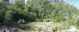
| + | There's a beautiful camping spot that we highly recommend and had been told about by the ranger - a lot of free space, a laguna/pond, nice (not dense!) forest and several safe fireplaces. (S 38°56.3141' W 071°27.6738) | ||
| + | From there on it was easy walking until Reigolil. The shop before the bridge has not many things to resupply but is good to refresh. The shop near the bus stop tuna, rice, pasta, biscuits, chips, beverages, some vegetables as well, enough to resupply. Its owners were so nice that they took us to their lot near the river where they let us pitch our tent. It seems that you can freely camp by the river but there was some Mapuche festival going on at that time. | ||
| + | The bus schedule: 7:30 a.m. and 8:00 a.m. from the bus stop by the shop to Pucon. | ||
| + | |||
| + | ==Season Section Log== | ||
| + | *18/02/23-20/02/23 / Natalie & Tomáš/ SOBO RR starting in Tracura (road to Sollipulli)./ 3days | ||
| + | We used Icalma as a resupply which worked well enough; many "mini- supermercados" and cheap accomodation (we had a cabana for 20mil/10mil each) but as a warning internet is awful! There is a nice pehuenche restaurant at the southern end of town on the main road and a little further than this on the main road you can get the best cell signal. Supposedly a bus goes to Lonquimay Mon-Wed-Fri but I forget the times, I think it was at 6am and 3pm. | ||
| + | |||
| + | We headed towards parque Sollipulli but hitching out of Icalma was slow, ~2hours combined waiting. We got off at Tracura and walked most of the way to CONAF (minus 4km hitch). Hitching was difficult even though it was a Saturday and there were cars, just no takers. No clean water sources until conaf but you could ask one of the cabana rentals along the way if needed. | ||
| + | No entrance fee at CONAF and although camping is not allowed the "senior" ranger told us we could camp behind the office (I may have persuaded him with piñones). The only thing is we had to wait until everyone was gone (~7-730pm) and then leave early the next day (~7-730am). He didn't want people to know so don't spread the word... There are water, toilets, cold showers and the next morning we were able to keep our things in the other building as we went up Sollipulli. Finally there was a food truck there with sopapillas and juice (it was a Saturday). | ||
| + | |||
| + | As for Sollipulli it has been the easiest summit so far, there is superb trail and it took ~2hrs up más o menos. There is one intersection where the trail tells you to go right but the climbers trail goes straight and is quicker ( staying left is more quick;-38.93399, -71.49659). | ||
| + | The glacier is amazing, 4km in diameter and supposedly 200m deep. I would come back here with glacier gear to cross it and go down the south summit. However Tomáš has his eyes on a way to go around the crater without glacier gear, so it would be a mixture of walking the rim and traversing above treeline towards the south summit where there should be another trail. That would save one cca 20 km of road walking. | ||
| + | |||
| + | We wanted to go up the main route and down option 01 but CONAF still requests you come down the same way and since they helped us with camping I wanted to respect their wishes. If you wanted to avoid the rangers we both think you could easily go up before or after they arrive, we saw a few other parties doing this. Note that there is no water after CONAF, if you were doing the traverse there are some lakes down to the east from the North summit. We think the traverse looks easy until the treeline. From the other end we later passed the trail going up which is in fact a road - not sure how far it goes as a road. | ||
| + | |||
| + | The summit was quick so afterwards we started walking the road that skirts Sollipulli on its east. It was a peaceful road and I have no complaints until it became not fun anymore after the camping at ~46.9. There were two vehicles that passed (no room) but I have no idea how they drove past some of the downed trees, would be a dodgy ride. | ||
| + | The forests here are finally becoming alive! We saw tarantulas and a giant moth carcass and mushrooms finally! There are many fords at the beginning after the lodge so keep sandals on if you have them. It would be worth looking at Google earth for an alternative trail because we met a guided horse group on gpt15 that told us they went from the south summit of Sollipulli to the lodge without going on the road. It is possible they meant "no road" as in "no asphalt road" but who knows. | ||
| + | We headed to routa S-965 to hitch to GPT15 PN Huerquehue (no cars passed until S-965). | ||
| + | |||
| + | 31. Jan - 2. Feb. 2023/ Johana & Matouš/SOBO/3 days, including the Sollipulli volcano | ||
| + | One of the best sections so far for us thanks to the Sollipulli volcano. We started at the Icalma lake (the San Alfonso camp was great, 10 000 per two people, hot water (yes!) and access to the beach). There are some restaurants and minishops as well, enough to resupply I believe. The overgrown section had been cleared half a bamboo-metre ago, so sometimes it was tough and felt like the forest wants to suck you in. Nothing impassable, but the two kilometres took us two hours. Another thing - the river where the ascent starts in the forest is for long the only water source there if the weather is dry. There was a gate (S 38° 53.3570' W 071° 27.0191'); there's a hole in the fence on the left that we went under. We camped at a good spot on the right side of the road (S 38°53.4903' W 071° 27.8162'). The next day, we rushed to the CONAF station - we got there a little past 11 AM, but the ranger let us do the ascent anyway, we even had lunch before we went up (not from the stand, sadly, still operates only at the weekends). You can leave your backpacks with the ranger, which was great! We didn't pay anything to enter the park. It took us 5 hours there and back with a longer break at the top. The view from the top is indescribable plus the path leading up to it is also very nice with some snowpatches next to it that you can slide down as you please. | ||
| + | After that we continued further down the road. We tried to outsmart the three fords but ended up fording the river three times anyway since the number of the fences and gates had increased I guess and we got stuck on a private property with nowhere to go. The best option might be to just follow the regular route. | ||
| + | There's a beautiful camping spot that we highly recommend and had been told about by the ranger - a lot of free space, a laguna/pond, nice (not dense!) forest and several safe fireplaces. (S 38°56.3141' W 071°27.6738) | ||
| + | From there on it was easy walking until Reigolil. The shop before the bridge has not many things to resupply but is good to refresh. The shop near the bus stop tuna, rice, pasta, biscuits, chips, beverages, some vegetables as well, enough to resupply. Its owners were so nice that they took us to their lot near the river where they let us pitch our tent. It seems that you can freely camp by the river but there was some Mapuche festival going on at that time. | ||
| + | The bus schedule: 7:30 a.m. and 8:00 a.m. from the bus stop by the shop to Pucon. | ||
| + | |||
| + | * 2023-Jan-25 / SOBO / RR / 2 days / Martin & Helena | ||
| + | |||
| + | This section took us 2 days. Unfortunately we didn’t go to the summit, because we needed to go quickly down to Curarrehue, but otherwise we wouldn’t skip it, just a few kms more and it looks incredible. About the trail, the beginning is a dirt road around the lakes and it continues until the start of overgrown section. That is a little more than 4kms, but from the start its a relatively normal trail, easy to follow. The overgrown part is mainly between km 2-3.5, but not so terrible overall following the gps. We camped at the end of this part that took us around 2 hrs, maybe less. After that you walk on a minor road all the time, in a really nice forrest. All the puestos were empty. Hot Spring waypoint is somewhere around houses so we didn’t even go there. To cross the river before CONAF station we used GPT14-E and the bridge. At the station was one guard, food truck closed, water available. The lodging after 1km is nice but it comes with higher prices, we stopped there to have some drink and beer + cola (cans) cost us 6k CLP. We spent the night in the forrest after the pass, but camp at km 46.9 looked great. The rest of the trail is still the same gravel road. Minishop at 57.8 has only basic food, but also some things for repairs etc. In Reigolil was only one shop on the main road open with very limited supplies, but we got from the lady pastel de choclo and some homemade bread, all delicious! Later we continued to GPT15. | ||
| + | |||
| + | Contact: @martin_hanzelka @helenneka | ||
| + | |||
| + | *Nobo/ Feb 2020 | ||
| + | From Reigolil to Solipulli it is a very easy forest road inside the reserva nacional. Carabineros asked some questions and said we could camp where we wanted. Arriving at the CONAF site at Solipulli, there is a small campground, free if you pay the entrance for the volcanoe (4000pp). There is a food truck with sopaipillas and jugos. We hiked the Solipulli and it is a must see. It is incredible and there are not that many people doing it. The CONAF ranger is very friendly. We did not hike from there to Icalma to avoid bushbashing and we wanted to see the big fiesta planned in Melipeuco (every year in late feb). It was worth it as we got to see a celebration of baqueanos. Melipeuco is not this nice but there are several supermarkets and restaurants to resupply. Easy hitch to Icalma (or there are 2 buses / day). We then hitched to Liucura to start section 12. | ||
| + | *2020-Jan-30 / Martina & Ivo / Regular route southbound | ||
| + | |||
| + | 2.5 days. Nothing to add to the previous comments. We arrived at the pipeline construction site during working hours and just followed the indications of the workers, no detour, just some optional route. We spent the night at the CONAF campground and had one of the best breakfasts in Chile at the Sollipulli Lodge (13'000 p.P.). As the rain hasn't stopped by lunchtime we had lunch there too, it was excellent :-D We actually quite liked this section with all the trees. We directly added section 15 after this one. There are several busses per day from Reigolil to Curarrehue but we don't know the schedule. | ||
| + | |||
| + | * 15-Jan-2020 / Matus & Anna / Regular route SOBO | ||
| + | We combined sections 14 and 15. It took us 3 days and nero. | ||
| + | GPT14 - there are signs that someone tried to clear overgrown part of the trail on the begining and end but middle is still nicely overgrown. Though we didn't have problem to follow. | ||
| + | Part of minor road on regular trail is under construction. They are putting a huge pipe under it. It was evening and workers were not there se we managed to sneak through but I don't think they will let you pass during working hours. It's just before descending to the river before National reserve Villarrica. | ||
| + | In the Conaf campsite was food truck (it was weekend) with churasco, sopapillas, drinks... pure heaven. We paid 4000 per person at conaf. | ||
| + | They are building a dorm at Lodge. It will be ready for next years hikers ;) | ||
| + | Resuply in Reigolil - mini shop on trail seemed abandoned. We found best supplies in shop-4. There is one other shop directly after bridge. | ||
| + | GPT15 - road and trail in good condition. On the climb to the lake bit before last settler there are some wild cherry trees on the left. We stuffed ourselves and left for others too. Enjoy. Multiple shops, accomodation options and restaurants in Curarrehue. | ||
| + | |||
| + | |||
| + | 18-Jan-2020 Tom & Maddie | ||
| + | Regular route SOBO plus optional summit up Volcán Sollipulli, 1.5 days. | ||
| + | Overgrown trail towards the start is relatively easy to follow. Mostly overgrown around the middle but the tracks towards either end are in decent condition. The rest of the section is easy walking. I would strongly recommend taking a small detour to summit Volcán Sollipulli in the CONAF National park (~30km into the section). When we arrived at the park we had to pay a CLP 4000 fee per person. When speaking to the ranger about where we intended to walk, he advised that the optional route down from the Volcán we planned to take is in very poor condition and would not let us take it. We had to do an out and back. It took us around 3.5-4h to summit and return. The trail is in excellent condition (trail markers are present) and the view is spectacular!! Possibly the best thing I’ve seen on the GPT. We camped in the park for no charge and bought some hot food from the food truck in the evening on the weekend. No issues with the rest of the section. | ||
| + | |||
| + | * 2 Feb Frank RR Southbound | ||
| + | |||
| + | 2 long days including Sollipulli climb | ||
| + | They are building the pipeline under the dirt road, when they are finished they will bury the pipe & road should reopen. No issues going through there but it was Sunday & no one was around. You walk on a narrow track above ditch, when you reach a point where two big boulders block the path you need to go down into the ditch to go around them. | ||
| + | Climbing Sollipulli is highly recommended to see the huge summit crater filled with ice & snow. Easy & well marked ascent. | ||
| + | You are not allowed to do the ascent after about 11AM. The food truck 'Sabores de Sollipulli' at the Conaf campsite only operates on weekends, it was closed on Sunday. I believe there is another Conaf site a little off route at Laguna Huaquifilo where you can camp. Nowhere good to camp after that. It was raining so I continued to Reigolil. Just after you cross the bridge there is a shop, they have rooms & provide very basic food. Not recommended but will do if you are stuck. | ||
| + | |||
| + | ==Summary Table== | ||
{| border="1" style="border-collapse:collapse" | {| border="1" style="border-collapse:collapse" | ||
|+'''GPT14: Volcán Sollipulli''' | |+'''GPT14: Volcán Sollipulli''' | ||
| − | |style="background-color:#bfbfbf;"| | + | | colspan="4" style="background-color:#bfbfbf;"| GPT14: Volcán Sollipulli |
| − | |colspan="2"| | + | | colspan="2" style="background-color:#bfbfbf;"| Hiking |
| + | | colspan="2" style="background-color:#bfbfbf;"| Packrafting | ||
|- | |- | ||
| − | |style="background-color:#bfbfbf;"| | + | |style="background-color:#bfbfbf;"|Group |
| − | |colspan="2"| | + | | colspan="2" | C: Zona Pehuenche |
| + | |style="background-color:#bfbfbf;"| Total | ||
| + | |style="background-color:#ffbfbf;"|'''60.0 km''' | ||
| + | |style="background-color:#ffbfbf;"|'''17 h''' | ||
| + | |style="background-color:#c2edfc;"| '''61.4 km''' | ||
| + | |style="background-color:#c2edfc;"|'''18 h''' | ||
|- | |- | ||
| − | |style="background-color:#bfbfbf;"| | + | | style="background-color:#bfbfbf;"|Region |
| − | |style="background-color:#bfbfbf;"| | + | | colspan="2" | Chile: Araucanía (IX) |
| − | |style="background-color:# | + | |style="background-color:#bfbfbf;"| Trails (TL) |
| + | |style="background-color:#ffbfbf;"|5.8 km | ||
| + | |style="background-color:#ffbfbf;"|9.6% | ||
| + | |style="background-color:#c2edfc;"| 5.8 km | ||
| + | |style="background-color:#c2edfc;"|9.4% | ||
|- | |- | ||
| − | |style="background-color:#bfbfbf;"| | + | |style="background-color:#bfbfbf;"| Start |
| − | |style="background-color:#ffbfbf;"| | + | | colspan="2" | Icalma |
| − | |style="background-color:#c2edfc;"| | + | |style="background-color:#bfbfbf;"| Minor Roads (MR) |
| + | |style="background-color:#ffbfbf;"|49.0 km | ||
| + | |style="background-color:#ffbfbf;"|81.7% | ||
| + | |style="background-color:#c2edfc;"| 49.4 km | ||
| + | |style="background-color:#c2edfc;"| 80.6% | ||
|- | |- | ||
| − | |style="background-color:#bfbfbf;"| | + | |style="background-color:#bfbfbf;"| Finish |
| − | |style="background-color:#ffbfbf;"| | + | | colspan="2" | Reigolil |
| − | |style="background-color:#c2edfc;"| | + | |style="background-color:#bfbfbf;"| Primary Roads (PR) |
| + | |style="background-color:#ffbfbf;"|5.2 km | ||
| + | |style="background-color:#ffbfbf;"|8.6% | ||
| + | |style="background-color:#c2edfc;"| - | ||
| + | |style="background-color:#c2edfc;"| - | ||
|- | |- | ||
| − | |style="background-color:#bfbfbf;"| | + | |style="background-color:#bfbfbf;"| Status |
| − | |style="background-color:#ffbfbf;"| | + | | colspan="2" | Published & Verified |
| − | |style="background-color:#c2edfc;"| | + | |style="background-color:#bfbfbf;"| Cross-Country (CC) |
| + | |style="background-color:#ffbfbf;"|- | ||
| + | |style="background-color:#ffbfbf;"|- | ||
| + | |style="background-color:#c2edfc;"| 0.1 km | ||
| + | |style="background-color:#c2edfc;"| 0.1% | ||
|- | |- | ||
| − | |style="background-color:#bfbfbf;"| | + | |style="background-color:#bfbfbf;"| Traversable |
| − | |style="background-color:#ffbfbf;"| | + | | colspan="2" | Dec - Apr (Maybe: Oct, Nov, May) |
| − | |style="background-color:#c2edfc;"| | + | |style="background-color:#bfbfbf;"| Bush-Bashing (BB) |
| + | |style="background-color:#ffbfbf;"|- | ||
| + | |style="background-color:#ffbfbf;"|- | ||
| + | |style="background-color:#c2edfc;"| - | ||
| + | |style="background-color:#c2edfc;"|- | ||
|- | |- | ||
| − | |style="background-color:#bfbfbf;"| | + | |style="background-color:#bfbfbf;"| Packraft |
| − | |colspan="2"|- | + | | colspan="2" | Useful |
| + | |style="background-color:#bfbfbf;"| Ferry (FY) | ||
| + | |style="background-color:#ffbfbf;"|- | ||
| + | |style="background-color:#ffbfbf;"|- | ||
| + | |style="background-color:#c2edfc;"| - | ||
| + | |style="background-color:#c2edfc;"|- | ||
|- | |- | ||
| − | |style="background-color:#bfbfbf;"| | + | |style="background-color:#bfbfbf;"| Connects to |
| − | |colspan="2"| | + | | colspan="2" | GPT13, GPT15 |
| + | |style="background-color:#bfbfbf;"| Investigation (I) | ||
| + | |style="background-color:#ffbfbf;"|- | ||
| + | |style="background-color:#ffbfbf;"|- | ||
| + | |style="background-color:#c2edfc;"| - | ||
| + | |style="background-color:#c2edfc;"| - | ||
|- | |- | ||
| − | |style="background-color:#bfbfbf;"| | + | |style="background-color:#bfbfbf;"| Options |
| − | |colspan="2"| | + | | colspan="2" | 49 km (2 Options & Variants) |
| + | |style="background-color:#bfbfbf;"| Exploration (EXP) | ||
| + | |style="background-color:#ffbfbf;"|- | ||
| + | |style="background-color:#ffbfbf;"|- | ||
| + | |style="background-color:#c2edfc;"| - | ||
| + | |style="background-color:#c2edfc;"|- | ||
|- | |- | ||
| − | |style="background-color:#bfbfbf;"| | + | | |
| − | |colspan="2"| | + | |style="background-color:#bfbfbf;"| Hiking |
| + | |style="background-color:#bfbfbf;"| Packrafting | ||
| + | | rowspan="4" style="background-color:#bfbfbf;"| | ||
| + | | colspan="2" style="background-color:#bfbfbf;"| Total on Water | ||
| + | |style="background-color:#c2edfc;"| '''6.1 km''' | ||
| + | |style="background-color:#c2edfc;"| '''9.9%''' | ||
|- | |- | ||
| − | |style="background-color:#bfbfbf;"| | + | |style="background-color:#bfbfbf;"| Attraction |
| − | |colspan="2"| | + | |style="background-color:#ffbfbf;"|2 (of 5) |
| + | |style="background-color:#c2edfc;"| 3 (of 5) | ||
| + | | colspan="2" style="background-color:#bfbfbf;"| River (RI) | ||
| + | |style="background-color:#c2edfc;"| - | ||
| + | |style="background-color:#c2edfc;"| - | ||
|- | |- | ||
| − | |style="background-color:#bfbfbf;"| | + | |style="background-color:#bfbfbf;"| Difficulty |
| − | |colspan="2"| | + | |style="background-color:#ffbfbf;"|2 (of 5) |
| + | |style="background-color:#c2edfc;"| 2 (of 5) | ||
| + | | colspan="2" style="background-color:#bfbfbf;"| Lake (LK) | ||
| + | |style="background-color:#c2edfc;"| 6.1 km | ||
| + | |style="background-color:#c2edfc;"| 9.9% | ||
|- | |- | ||
| − | |style="background-color:#bfbfbf;"| | + | | style="background-color:#bfbfbf;"|Direction |
| − | |style="background-color:# | + | |style="background-color:#ffbfbf;"|Both ↓↑ |
| − | |style="background-color:#bfbfbf;"| | + | |style="background-color:#c2edfc;"|Both ↓↑ |
| + | | colspan="2" style="background-color:#bfbfbf;"| Fjord (FJ) | ||
| + | |style="background-color:#c2edfc;"| - | ||
| + | |style="background-color:#c2edfc;"|- | ||
|- | |- | ||
| − | | | + | |style="background-color:#bfbfbf;"| Comment |
| − | | | + | | colspan="7" | - |
| − | | | + | |- |
| + | |style="background-color:#bfbfbf;"| Character | ||
| + | | colspan="7" | Araucaria Forest, Volcanic Terrain, Summit Ascents, Farmland, Pehuenche | ||
| + | |- | ||
| + | |style="background-color:#bfbfbf;"| Challenges | ||
| + | | colspan="7" | Demanding River Fords | ||
|} | |} | ||
| + | ==Satellite Image Map== | ||
| + | ==Elevation Profile== | ||
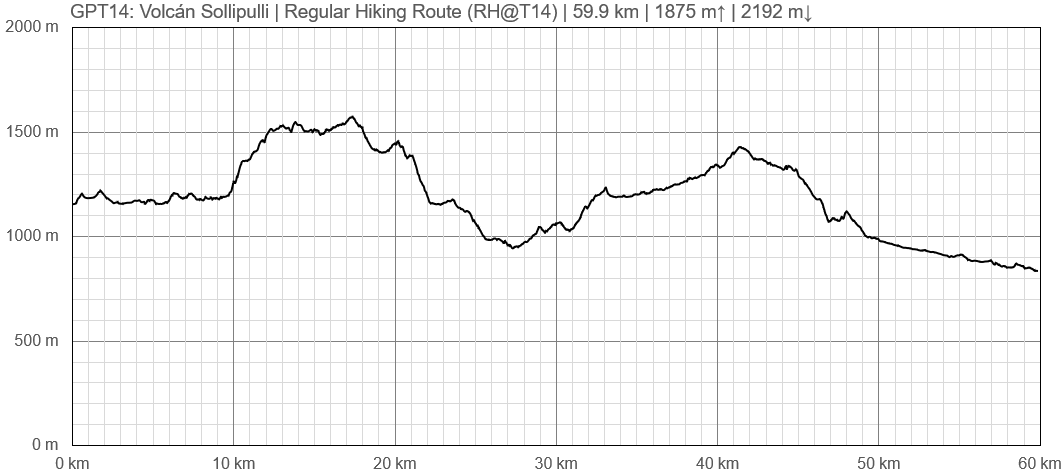
| + | ====Elevation Profile of Regular Hiking Route==== | ||
| + | [[File:profile GPT14.PNG|frame|center|Elevation Profile of Regular Hiking Route (2019)]] | ||
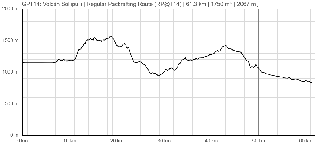
| + | ====Elevation Profile of Regular Packrafting Route==== | ||
| + | [[File:profile GPT14-p.PNG|frame|center|Elevation Profile of Regular Hiking Route (2019)]] | ||
==Section Planning Status== | ==Section Planning Status== | ||
==Recommended Travel Period== | ==Recommended Travel Period== | ||
| Línea 99: | Línea 225: | ||
==Recommended Travel Direction== | ==Recommended Travel Direction== | ||
==Section Length and Travel Duration== | ==Section Length and Travel Duration== | ||
| + | ==Suitable Section Combinations== | ||
==Section Attractiveness== | ==Section Attractiveness== | ||
==Section Difficulty== | ==Section Difficulty== | ||
==Resupply== | ==Resupply== | ||
| − | ===Resupply | + | ===Resupply Town=== |
| − | ===Resupply | + | ====Shopping: Food==== |
| − | ==Access to Route== | + | ====Shopping: Fuel==== |
| − | ==Permits, Entry Fees | + | ====Shopping: Equipment==== |
| + | ====Services: Restaurants==== | ||
| + | ====Services: Laundry==== | ||
| + | ====Services: ATM and Money Exchange==== | ||
| + | ====Accommodation: Hostals and Hotels==== | ||
| + | ====Accommodation: Cabañas==== | ||
| + | ====Accommodation: Camping==== | ||
| + | ====Transport: Ground Transport==== | ||
| + | ====Transport: Ferries==== | ||
| + | ====Transport: Shipping Services==== | ||
| + | |||
| + | ===Resupply on the Trail=== | ||
| + | ====Location, Names, Available Items and Services==== | ||
| + | |||
| + | ==Access to Route and Return== | ||
| + | ===Access to Start=== | ||
| + | ===Return from Finish=== | ||
| + | Timetable January 2020: [[:File:Reigolil.jpg]] | ||
| + | |||
| + | Bus goes from Reigolil to Curacautin & Pucon. When I was there it left Reigolil at 7 & 7:50 AM (different to timetable) Confirm times at the shop by the bridge in Reigolil. Frank | ||
| + | |||
| + | ===Escape Options=== | ||
| + | ==Permits, Entry Fees and Right-of-Way Issues== | ||
==Regular Route== | ==Regular Route== | ||
===Regular Hiking Route=== | ===Regular Hiking Route=== | ||
| − | |||
| − | |||
| − | |||
===Regular Packrafting Route=== | ===Regular Packrafting Route=== | ||
| − | |||
| − | |||
| − | |||
==Optional Routes== | ==Optional Routes== | ||
| − | == | + | ==Investigations and Explorations== |
| − | == | + | ==Links to other Resources== |
| − | == | + | ==Alerts and Logs of Past Seasons== |
| − | + | ||
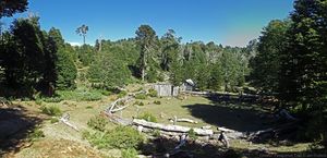
| + | [[File:GPT_8_Laguna_Icalma_and_Volcán_Sollipulli_109047041.jpg|thumb|]] | ||
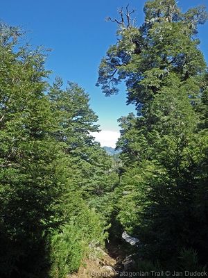
| + | [[File:GPT_8_Laguna_Icalma_and_Volcán_Sollipulli_109045479.jpg|thumb|]] | ||
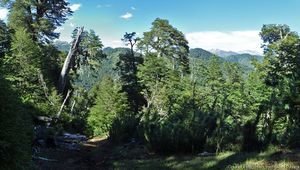
| + | [[File:GPT_8_Laguna_Icalma_and_Volcán_Sollipulli_109045586.jpg|thumb|]] | ||
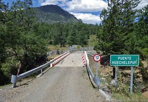
| + | [[File:GPT_8_Laguna_Icalma_and_Volcán_Sollipulli_109045611.jpg|thumb|]] | ||
| + | [[File:GPT_8_Laguna_Icalma_and_Volcán_Sollipulli_109045628.jpg|thumb|]] | ||
| + | [[File:GPT_8_Laguna_Icalma_and_Volcán_Sollipulli_109045648.jpg|thumb|]] | ||
| + | [[File:GPT_8_Laguna_Icalma_and_Volcán_Sollipulli_109046479.jpg|thumb|]] | ||
| + | [[File:GPT_8_Laguna_Icalma_and_Volcán_Sollipulli_109046482.jpg|thumb|]] | ||
| + | [[File:GPT_8_Laguna_Icalma_and_Volcán_Sollipulli_109046483.jpg|thumb|]] | ||
| + | [[File:GPT_8_Laguna_Icalma_and_Volcán_Sollipulli_109047161.jpg|thumb|]] | ||
| + | [[File:GPT_8_Laguna_Icalma_and_Volcán_Sollipulli_109047207.jpg|thumb|]] | ||
| + | |||
[[category:Greater Patagonian Trail]] | [[category:Greater Patagonian Trail]] | ||
Revisión actual del 17:25 15 may 2023
Redirige a:
| All GPT sections (click to show) |
|---|
|
GPT Section Articles
|
Recent Alerts and Suggestions
- 2 Feb Frank RR Southbound
A few minor corrections: There is no bridge @ Bridge 46, just ford the river easily. Gate @ far side of ford is marked no entry but walking through appears to be OK. There is a gravel track that stays on the right side of the river & goes past Ford 133 & Ford 134 so you don't need to cross either of them. It leads to Ford 135 which you do cross.
31. Jan - 2. Feb. 2023/ Johana & Matouš/SOBO/3 days, including the Sollipulli volcano One of the best sections so far for us thanks to the Sollipulli volcano. We started at the Icalma lake (the San Alfonso camp was great, 10 000 per two people, hot water (yes!) and access to the beach). There are some restaurants and minishops as well, enough to resupply I believe. The overgrown section had been cleared half a bamboo-metre ago, so sometimes it was tough and felt like the forest wants to suck you in. Nothing impassable, but the two kilometres took us two hours. Another thing - the river where the ascent starts in the forest is for long the only water source there if the weather is dry. There was a gate (S 38° 53.3570' W 071° 27.0191'); there's a hole in the fence on the left that we went under. We camped at a good spot on the right side of the road (S 38°53.4903' W 071° 27.8162'). The next day, we rushed to the CONAF station - we got there a little past 11 AM, but the ranger let us do the ascent anyway, we even had lunch before we went up (not from the stand, sadly, still operates only at the weekends). You can leave your backpacks with the ranger, which was great! We didn't pay anything to enter the park. It took us 5 hours there and back with a longer break at the top. The view from the top is indescribable plus the path leading up to it is also very nice with some snowpatches next to it that you can slide down as you please. After that we continued further down the road. We tried to outsmart the three fords but ended up fording the river three times anyway since the number of the fences and gates had increased I guess and we got stuck on a private property with nowhere to go. The best option might be to just follow the regular route. There's a beautiful camping spot that we highly recommend and had been told about by the ranger - a lot of free space, a laguna/pond, nice (not dense!) forest and several safe fireplaces. (S 38°56.3141' W 071°27.6738) From there on it was easy walking until Reigolil. The shop before the bridge has not many things to resupply but is good to refresh. The shop near the bus stop tuna, rice, pasta, biscuits, chips, beverages, some vegetables as well, enough to resupply. Its owners were so nice that they took us to their lot near the river where they let us pitch our tent. It seems that you can freely camp by the river but there was some Mapuche festival going on at that time. The bus schedule: 7:30 a.m. and 8:00 a.m. from the bus stop by the shop to Pucon.
Season Section Log
- 18/02/23-20/02/23 / Natalie & Tomáš/ SOBO RR starting in Tracura (road to Sollipulli)./ 3days
We used Icalma as a resupply which worked well enough; many "mini- supermercados" and cheap accomodation (we had a cabana for 20mil/10mil each) but as a warning internet is awful! There is a nice pehuenche restaurant at the southern end of town on the main road and a little further than this on the main road you can get the best cell signal. Supposedly a bus goes to Lonquimay Mon-Wed-Fri but I forget the times, I think it was at 6am and 3pm.
We headed towards parque Sollipulli but hitching out of Icalma was slow, ~2hours combined waiting. We got off at Tracura and walked most of the way to CONAF (minus 4km hitch). Hitching was difficult even though it was a Saturday and there were cars, just no takers. No clean water sources until conaf but you could ask one of the cabana rentals along the way if needed. No entrance fee at CONAF and although camping is not allowed the "senior" ranger told us we could camp behind the office (I may have persuaded him with piñones). The only thing is we had to wait until everyone was gone (~7-730pm) and then leave early the next day (~7-730am). He didn't want people to know so don't spread the word... There are water, toilets, cold showers and the next morning we were able to keep our things in the other building as we went up Sollipulli. Finally there was a food truck there with sopapillas and juice (it was a Saturday).
As for Sollipulli it has been the easiest summit so far, there is superb trail and it took ~2hrs up más o menos. There is one intersection where the trail tells you to go right but the climbers trail goes straight and is quicker ( staying left is more quick;-38.93399, -71.49659). The glacier is amazing, 4km in diameter and supposedly 200m deep. I would come back here with glacier gear to cross it and go down the south summit. However Tomáš has his eyes on a way to go around the crater without glacier gear, so it would be a mixture of walking the rim and traversing above treeline towards the south summit where there should be another trail. That would save one cca 20 km of road walking.
We wanted to go up the main route and down option 01 but CONAF still requests you come down the same way and since they helped us with camping I wanted to respect their wishes. If you wanted to avoid the rangers we both think you could easily go up before or after they arrive, we saw a few other parties doing this. Note that there is no water after CONAF, if you were doing the traverse there are some lakes down to the east from the North summit. We think the traverse looks easy until the treeline. From the other end we later passed the trail going up which is in fact a road - not sure how far it goes as a road.
The summit was quick so afterwards we started walking the road that skirts Sollipulli on its east. It was a peaceful road and I have no complaints until it became not fun anymore after the camping at ~46.9. There were two vehicles that passed (no room) but I have no idea how they drove past some of the downed trees, would be a dodgy ride. The forests here are finally becoming alive! We saw tarantulas and a giant moth carcass and mushrooms finally! There are many fords at the beginning after the lodge so keep sandals on if you have them. It would be worth looking at Google earth for an alternative trail because we met a guided horse group on gpt15 that told us they went from the south summit of Sollipulli to the lodge without going on the road. It is possible they meant "no road" as in "no asphalt road" but who knows. We headed to routa S-965 to hitch to GPT15 PN Huerquehue (no cars passed until S-965).
31. Jan - 2. Feb. 2023/ Johana & Matouš/SOBO/3 days, including the Sollipulli volcano One of the best sections so far for us thanks to the Sollipulli volcano. We started at the Icalma lake (the San Alfonso camp was great, 10 000 per two people, hot water (yes!) and access to the beach). There are some restaurants and minishops as well, enough to resupply I believe. The overgrown section had been cleared half a bamboo-metre ago, so sometimes it was tough and felt like the forest wants to suck you in. Nothing impassable, but the two kilometres took us two hours. Another thing - the river where the ascent starts in the forest is for long the only water source there if the weather is dry. There was a gate (S 38° 53.3570' W 071° 27.0191'); there's a hole in the fence on the left that we went under. We camped at a good spot on the right side of the road (S 38°53.4903' W 071° 27.8162'). The next day, we rushed to the CONAF station - we got there a little past 11 AM, but the ranger let us do the ascent anyway, we even had lunch before we went up (not from the stand, sadly, still operates only at the weekends). You can leave your backpacks with the ranger, which was great! We didn't pay anything to enter the park. It took us 5 hours there and back with a longer break at the top. The view from the top is indescribable plus the path leading up to it is also very nice with some snowpatches next to it that you can slide down as you please. After that we continued further down the road. We tried to outsmart the three fords but ended up fording the river three times anyway since the number of the fences and gates had increased I guess and we got stuck on a private property with nowhere to go. The best option might be to just follow the regular route. There's a beautiful camping spot that we highly recommend and had been told about by the ranger - a lot of free space, a laguna/pond, nice (not dense!) forest and several safe fireplaces. (S 38°56.3141' W 071°27.6738) From there on it was easy walking until Reigolil. The shop before the bridge has not many things to resupply but is good to refresh. The shop near the bus stop tuna, rice, pasta, biscuits, chips, beverages, some vegetables as well, enough to resupply. Its owners were so nice that they took us to their lot near the river where they let us pitch our tent. It seems that you can freely camp by the river but there was some Mapuche festival going on at that time. The bus schedule: 7:30 a.m. and 8:00 a.m. from the bus stop by the shop to Pucon.
- 2023-Jan-25 / SOBO / RR / 2 days / Martin & Helena
This section took us 2 days. Unfortunately we didn’t go to the summit, because we needed to go quickly down to Curarrehue, but otherwise we wouldn’t skip it, just a few kms more and it looks incredible. About the trail, the beginning is a dirt road around the lakes and it continues until the start of overgrown section. That is a little more than 4kms, but from the start its a relatively normal trail, easy to follow. The overgrown part is mainly between km 2-3.5, but not so terrible overall following the gps. We camped at the end of this part that took us around 2 hrs, maybe less. After that you walk on a minor road all the time, in a really nice forrest. All the puestos were empty. Hot Spring waypoint is somewhere around houses so we didn’t even go there. To cross the river before CONAF station we used GPT14-E and the bridge. At the station was one guard, food truck closed, water available. The lodging after 1km is nice but it comes with higher prices, we stopped there to have some drink and beer + cola (cans) cost us 6k CLP. We spent the night in the forrest after the pass, but camp at km 46.9 looked great. The rest of the trail is still the same gravel road. Minishop at 57.8 has only basic food, but also some things for repairs etc. In Reigolil was only one shop on the main road open with very limited supplies, but we got from the lady pastel de choclo and some homemade bread, all delicious! Later we continued to GPT15.
Contact: @martin_hanzelka @helenneka
- Nobo/ Feb 2020
From Reigolil to Solipulli it is a very easy forest road inside the reserva nacional. Carabineros asked some questions and said we could camp where we wanted. Arriving at the CONAF site at Solipulli, there is a small campground, free if you pay the entrance for the volcanoe (4000pp). There is a food truck with sopaipillas and jugos. We hiked the Solipulli and it is a must see. It is incredible and there are not that many people doing it. The CONAF ranger is very friendly. We did not hike from there to Icalma to avoid bushbashing and we wanted to see the big fiesta planned in Melipeuco (every year in late feb). It was worth it as we got to see a celebration of baqueanos. Melipeuco is not this nice but there are several supermarkets and restaurants to resupply. Easy hitch to Icalma (or there are 2 buses / day). We then hitched to Liucura to start section 12.
- 2020-Jan-30 / Martina & Ivo / Regular route southbound
2.5 days. Nothing to add to the previous comments. We arrived at the pipeline construction site during working hours and just followed the indications of the workers, no detour, just some optional route. We spent the night at the CONAF campground and had one of the best breakfasts in Chile at the Sollipulli Lodge (13'000 p.P.). As the rain hasn't stopped by lunchtime we had lunch there too, it was excellent :-D We actually quite liked this section with all the trees. We directly added section 15 after this one. There are several busses per day from Reigolil to Curarrehue but we don't know the schedule.
- 15-Jan-2020 / Matus & Anna / Regular route SOBO
We combined sections 14 and 15. It took us 3 days and nero. GPT14 - there are signs that someone tried to clear overgrown part of the trail on the begining and end but middle is still nicely overgrown. Though we didn't have problem to follow. Part of minor road on regular trail is under construction. They are putting a huge pipe under it. It was evening and workers were not there se we managed to sneak through but I don't think they will let you pass during working hours. It's just before descending to the river before National reserve Villarrica. In the Conaf campsite was food truck (it was weekend) with churasco, sopapillas, drinks... pure heaven. We paid 4000 per person at conaf. They are building a dorm at Lodge. It will be ready for next years hikers ;) Resuply in Reigolil - mini shop on trail seemed abandoned. We found best supplies in shop-4. There is one other shop directly after bridge. GPT15 - road and trail in good condition. On the climb to the lake bit before last settler there are some wild cherry trees on the left. We stuffed ourselves and left for others too. Enjoy. Multiple shops, accomodation options and restaurants in Curarrehue.
18-Jan-2020 Tom & Maddie
Regular route SOBO plus optional summit up Volcán Sollipulli, 1.5 days.
Overgrown trail towards the start is relatively easy to follow. Mostly overgrown around the middle but the tracks towards either end are in decent condition. The rest of the section is easy walking. I would strongly recommend taking a small detour to summit Volcán Sollipulli in the CONAF National park (~30km into the section). When we arrived at the park we had to pay a CLP 4000 fee per person. When speaking to the ranger about where we intended to walk, he advised that the optional route down from the Volcán we planned to take is in very poor condition and would not let us take it. We had to do an out and back. It took us around 3.5-4h to summit and return. The trail is in excellent condition (trail markers are present) and the view is spectacular!! Possibly the best thing I’ve seen on the GPT. We camped in the park for no charge and bought some hot food from the food truck in the evening on the weekend. No issues with the rest of the section.
- 2 Feb Frank RR Southbound
2 long days including Sollipulli climb They are building the pipeline under the dirt road, when they are finished they will bury the pipe & road should reopen. No issues going through there but it was Sunday & no one was around. You walk on a narrow track above ditch, when you reach a point where two big boulders block the path you need to go down into the ditch to go around them. Climbing Sollipulli is highly recommended to see the huge summit crater filled with ice & snow. Easy & well marked ascent. You are not allowed to do the ascent after about 11AM. The food truck 'Sabores de Sollipulli' at the Conaf campsite only operates on weekends, it was closed on Sunday. I believe there is another Conaf site a little off route at Laguna Huaquifilo where you can camp. Nowhere good to camp after that. It was raining so I continued to Reigolil. Just after you cross the bridge there is a shop, they have rooms & provide very basic food. Not recommended but will do if you are stuck.
Summary Table
| GPT14: Volcán Sollipulli | Hiking | Packrafting | |||||
| Group | C: Zona Pehuenche | Total | 60.0 km | 17 h | 61.4 km | 18 h | |
| Region | Chile: Araucanía (IX) | Trails (TL) | 5.8 km | 9.6% | 5.8 km | 9.4% | |
| Start | Icalma | Minor Roads (MR) | 49.0 km | 81.7% | 49.4 km | 80.6% | |
| Finish | Reigolil | Primary Roads (PR) | 5.2 km | 8.6% | - | - | |
| Status | Published & Verified | Cross-Country (CC) | - | - | 0.1 km | 0.1% | |
| Traversable | Dec - Apr (Maybe: Oct, Nov, May) | Bush-Bashing (BB) | - | - | - | - | |
| Packraft | Useful | Ferry (FY) | - | - | - | - | |
| Connects to | GPT13, GPT15 | Investigation (I) | - | - | - | - | |
| Options | 49 km (2 Options & Variants) | Exploration (EXP) | - | - | - | - | |
| Hiking | Packrafting | Total on Water | 6.1 km | 9.9% | |||
| Attraction | 2 (of 5) | 3 (of 5) | River (RI) | - | - | ||
| Difficulty | 2 (of 5) | 2 (of 5) | Lake (LK) | 6.1 km | 9.9% | ||
| Direction | Both ↓↑ | Both ↓↑ | Fjord (FJ) | - | - | ||
| Comment | - | ||||||
| Character | Araucaria Forest, Volcanic Terrain, Summit Ascents, Farmland, Pehuenche | ||||||
| Challenges | Demanding River Fords | ||||||
Satellite Image Map
Elevation Profile
Elevation Profile of Regular Hiking Route
Elevation Profile of Regular Packrafting Route
Section Planning Status
Recommended Travel Period
Benefits of Hiking and Packrafting
Recommended Travel Direction
Section Length and Travel Duration
Suitable Section Combinations
Section Attractiveness
Section Difficulty
Resupply
Resupply Town
Shopping: Food
Shopping: Fuel
Shopping: Equipment
Services: Restaurants
Services: Laundry
Services: ATM and Money Exchange
Accommodation: Hostals and Hotels
Accommodation: Cabañas
Accommodation: Camping
Transport: Ground Transport
Transport: Ferries
Transport: Shipping Services
Resupply on the Trail
Location, Names, Available Items and Services
Access to Route and Return
Access to Start
Return from Finish
Timetable January 2020: File:Reigolil.jpg
Bus goes from Reigolil to Curacautin & Pucon. When I was there it left Reigolil at 7 & 7:50 AM (different to timetable) Confirm times at the shop by the bridge in Reigolil. Frank


