Diferencia entre revisiones de «GPT76 - PN Pumalin Sur»
(→Elevation Profile) |
(Página redirigida a GPT76 (PN Pumalin Sur)) |
||
| (No se muestra una edición intermedia del mismo usuario) | |||
| Línea 1: | Línea 1: | ||
| + | #Redirect [[GPT76 (PN Pumalin Sur)]] | ||
{{Draft}} | {{Draft}} | ||
{{RutaForme | {{RutaForme | ||
Revisión actual del 20:40 2 dic 2024
Redirige a:
| All GPT sections (click to show) |
|---|
|
GPT Section Articles
|
Recent Alerts and Suggestions
- 30-Dec-19 to 1-Jan-19 / Martín Lizondo / Regular Hiking Southbound
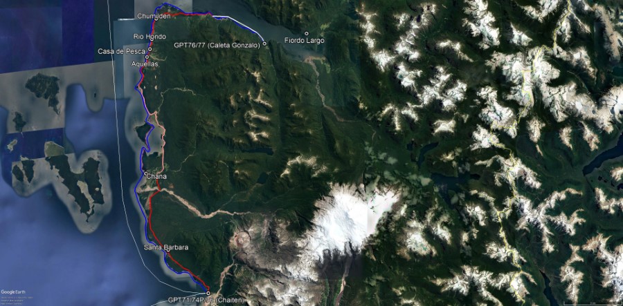
The boat to Loyola and Chumilden leaves Caleta Gonzalo on monday, tuesday, wednesday and friday at 11 am. Contact: Roberto Btos +56 9 85564749. Cost = CLP 2400 per person. Also locals travel by small boats between Caleta Gonzalo to Loyola and Chumilden and can pick you up for some money. The route starts in Loyola following mostly isolated minor road, some cross country sections and cattle trails. The trails are very moody and in bad conditions. Walking along the beach is an easier alternative. Two river crossing are difficult: “Río Quita Calzón” and “Río Negro”. The second one depends on the sea level and is practicaly impassable by foot at the gps’s track point. Instead, a boat crossing is recommended from Chana, which is near to the beach and easy to access. From Chana the road continues to Chaiten.
Season Section Log
Summary Table
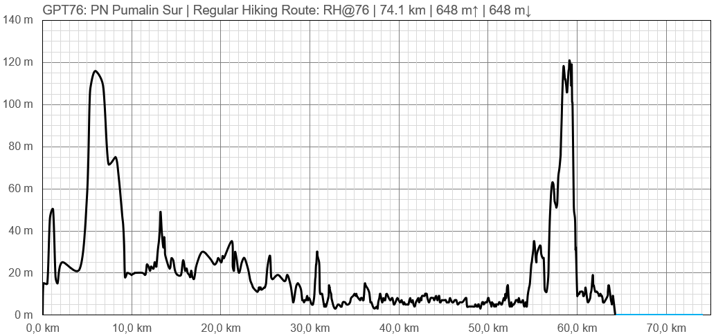
| GPT76: PN Pumalin Sur | Hiking | Packrafting | |||||
| Group | N: Fiordos Norte | Total | 64.3 km | 15 h | 77.1 km | 22 h | |
| Region | Chile: Los Lagos (X) | Trails (TL) | 18.8 km | 29.3% | - | - | |
| Start | Chaitén | Minor Roads (MR) | 35.5 km | 55.3% | - | - | |
| Finish | Caleta Gonzalo | Primary Roads (PR) | 10.0 km | 15.5% | - | - | |
| Status | Published & Verified | Cross-Country (CC) | - | - | - | - | |
| Traversable | Sep - May | Bush-Bashing (BB) | - | - | - | - | |
| Packraft | Very Useful | Ferry (FY) | (9.8 km) | (13.3%) | - | - | |
| Connects to | GPT71, GPT74P, GPT77 | Investigation (I) | (18.8 km) | (29.3%) | - | - | |
| Options | 277 km (2 Options & Variants) | Exploration (EXP) | - | - | - | - | |
| Hiking | Packrafting | Total on Water | 77.1 km | 100.0% | |||
| Attraction | 2 (of 5) | 4 (of 5) | River (RI) | - | - | ||
| Difficulty | 3 (of 5) | 4 (of 5) | Lake (LK) | - | - | ||
| Direction | Both ↓↑ | Both ↓↑ | Fjord (FJ) | 77.1 km | 100.0% | ||
| Comment | Hiking: ↑ Recommended to facilitate boat transfer | ||||||
| Character | Packrafting: ↑ Preferable due preceding section GPT74P Río Yelcho and predominant wind direction | ||||||
| Challenges | Valdivian Rain Forest, Sea Coast, Farmland, Settlers, Fjord Packrafting | ||||||


