Diferencia entre revisiones de «GPT11 (Cerro Dedos)»
(Etiquetas: Edición desde móvil, Edición vía web móvil) |
(Etiquetas: Edición desde móvil, Edición vía web móvil) |
||
| Línea 242: | Línea 242: | ||
=Resupply and Accommodation= | =Resupply and Accommodation= | ||
| + | |||
| + | Accommodation in Guallali: | ||
| + | Brown house, ask for Romira; bed, dinner and breakfast for 30k | ||
| + | |||
| + | Supplies: | ||
| + | Hitchhiked to Chenqueco, 10 km, shop with small selection, some veggies, pasta, the essentials | ||
| + | |||
| + | Bus to Ralco with more options every day at 5.30 am takes 3,5 h | ||
| + | |||
| + | Same bus to Los Angeles | ||
==Resupply and Accommodation in nearby Towns== | ==Resupply and Accommodation in nearby Towns== | ||
| Línea 251: | Línea 261: | ||
==Resupply and Accommodation along the Route== | ==Resupply and Accommodation along the Route== | ||
| − | |||
=Transport to and from Route= | =Transport to and from Route= | ||
Revisión del 21:57 5 dic 2023
Add a new log entry always on top in the appropriate season sub-chapter and use format:
* Start Date to Finish Date (use Format YYYY-MMM-DD) / Duration in Days / Hiking or Packrafting / Travel Direction (SOBO for Southbound or NOBO Northbound) / Chosen Route and/or Option Name (RR for Regular Route) / Names or Alias
Summary with remarks to route that are considered useful for other hikers and packrafters. Include alerts, suggestions and personal perception of attractiveness and difficulties.
Add a sub-chapter by placing two "=" before and after the new sub-chapter heading ('==Sub-Chapter Heading==').
Contenido
Section Log, Alerts and Suggestions
Season 2025/26
Season 2024/25
Season 2023/24
2023-Dex-02 to 2023-Dec-04 / 2 days / Hiking / NOBO / RR / Jens
We combined the two stages 12 and 11. The hot springs after about 7 kilometres gave our weary bones a little rest.
I had tried the ascent to the pass along the left-hand side. I followed a trail for a few kilometres, but at some point it ended in bush bashing. The better route is probably through and along the river.
As there was still a lot of snow at the beginning of December, crossing the pass was not easy. The last 100 metres in altitude were particularly steep. I can imagine that the melting of the snow could lead to avalanches in the coming weeks.
On the other side, I had no further problems. There was still some snow, but I could either avoid it or walk right over it.
Water: Many options
Camping: Many options from two kilometres before and after the pass.
Season 2022/23
- 2023-Mar-05 to 2023-Mar-05 / 2 days / Hiking / NOBO / RR / Iris, Alexis
Continued directly from GPT12 so we started at the end of RR-TL-V {11} [31.3+1.5] . We followed the RR for the whole section.
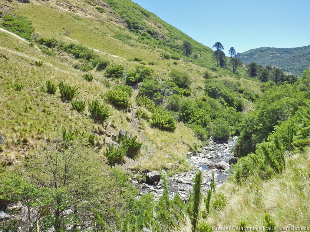
On day 1, for RR-CC-A {11} [27.6+3.3], you have to stay in the river stream for the whole duration. You will find plenty of water because you walk in it, and nice pools and little cascade if you want to take a bath. Leaving the stream for higher up is not a good choice : every time we tried it was a mistake. We camped at Camp {11} [26.1/1957]. It was not protected and the night was very windy... Not our best choice.
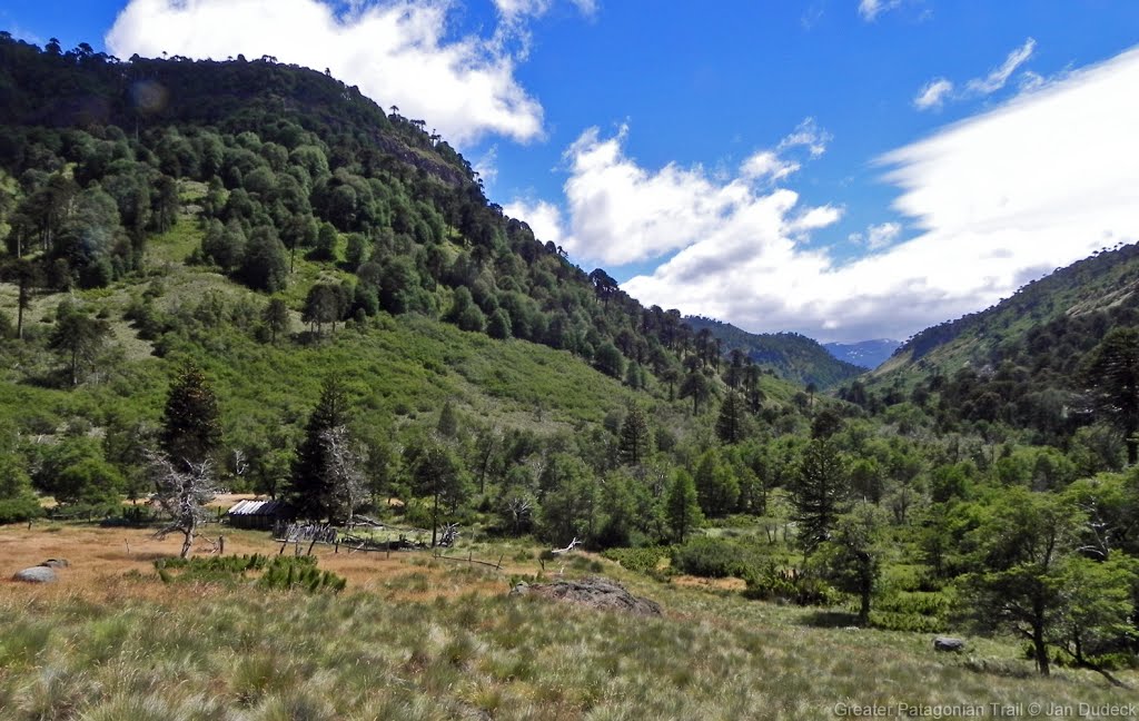
On day 2, we continued until Guallali following the RR. The trail around Km15 transforms in a MR that leads you to the village without even checking the GPS. There, we found the minishop that had limited resupply options (we bought lentils, cookies, snacks and cola). We checked in with the carabineros that were friendly and sayed we could camp wherever was wind protected. We opted for the football field which is a nice flat and grassy place.
Not much to say about this section, we found the end on the dirt road relatively dull but the beginning in the mountain is awesome
- 2023-Feb-11 to 2023-Feb-12 / 1.5 days / Hiking / SOBO / RR (option 01+ off route) / Natalie&Tomáš
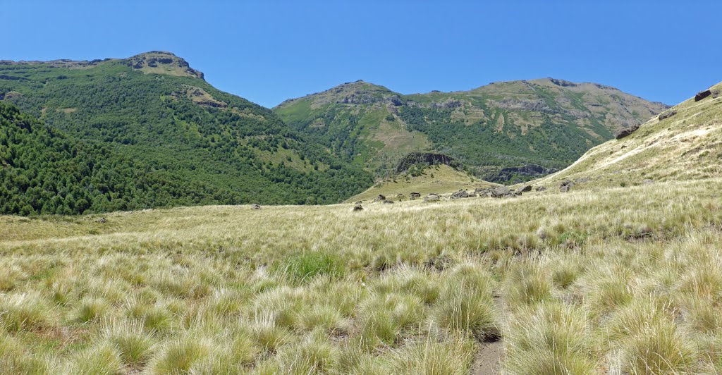
Combined GPT 10(01)+11+12 Day1 Slept in Guallalí in the growth as others have described but still asked the shop owner first for permission. Carabineros were nice and told us we did not need to check in although the sign says "obligatory check". Pedro at the mini shop is also kind and willing to help hikers although there is only a handful of items in his shop-bought some sweets. Pedro also told me that option05 to lonquimay would require you to pay 10mil from the locals. We took RR. At this time of year the road is the "dirt-dust type" but still fast until Estero Quillaylemu (14km) which makes for a nice rest. Tomáš checked out the hotsprings at 6.6. There is a table and a pool of nicely hot muddy water directly next to a river. Better camping site than in Guallali. After the Estero Quillaylemu the track gets harder to follow but becomes beautiful after the ford and bend towards the pass. Lost the trail a couple of times but found lots of wild quinoa. Camped at 25.1 behind a boulder by the river to cut the wind, camp at 26.1 looked nicer.
For the pass we followed the ridge for as long as we could (option 01) and it was fun and straightforward. Luckily, although the winds were strong that day the ridge was almost windless. Made our way down similar to Will. Got off the ridge here; -38.10270, -71.07250 (later than indicated by the GPX), headed to a small dry gully next to and below the "greyish" dirt here; -38.10359, -71.07282, you had to use your edges as the ground was hard"grit". Entered a small creek bed here;-38.10604, -71.07538 and followed it (some water) until it turned into a scramble. At that point we climbed back up to our left (East), moved south until we went down and up our final gully, just underneath 01B. This last gully was easy as Tomáš found a soft spot, somewhere around here;-38.11039, -71.07474. After this point it was easy to connect to the main route. Just the section up to here from the ridge is problematic - maybe two km. Probably fastest would be to go down the regular route and take the first option left, which is probably a trail and only means about 300 m of additional climbing. The route as mapped by the GPX files (option01; second half of the traverse) looks quite steep and exposed and does not save much elevation. It is probably possible but to us from below it does not look worth it.
Lastly there are water sources on the other side of the ridge (SW, the hard side) before the hotsprings if needed.
Continued onto Section 12 towards Banos Coyucos for the night.
- 2023-Jan-27 to 2023-Jan-28 / 2 days / Hiking / SOBO / RR / Johana & Matouš
We camped near the ford on the 18th kilometre (just about 20 metres upstream is a great place to take a bath in). The next day we made it all the way to the end; however, it was an ordeal. The view from the pass was jaw-dropping and parts of the path leading up to it were shaded by beautiful trees, but we feel like the horrible descent (we were doing the regular route) made it not worth it for us. Despite the fact that we were lucky enough to have the best conditions for the descent (only some snowpatches at the top, sunny weather), the terrain felt ankle-spraining. The wobbly stones kept sliding down and it required a lot of focus. We went down through the canyon and after the point where you need to go above it when it becomes too narrow we went down the wrong way and I fell down clutching at straws (literally) not to fall down. So it might be better to go through the river..? To be optimistic, the last part of the path was beautiful again. We hitched a ride and stayed with a really nice family that took us to Lonquimay the next day. It's a nice bigger town with a lot of possibilities to resupply. There are really buses only Mo-We-Fri from Ranquil.
- 2023-Jan-17 to 2023-Jan-18 / 2 days / Hiking / SOBO / option 1 to the Termas del Pelehue / Will
I took the bus to Guallali, which took me past the Carabineros and directly into town where I set up in the standard grove. A bit after dark two carabineros showed up at my tent. Intimidating at first, they were very friendly after I explained my plans. They just said that next time I should make sure to stop and report to them on my way by.
The section starts out with a not very interesting road walk, but suddenly became super beautiful 15ish km in. I camped at 25.1, a somewhat sheltered spot by a stream, where the wind rattling my tent made it hard to sleep. A few arrieros came by during the evening. The 26.1 campsite looked similar.
The horse flies reappeared as I got up closer to the pass. Had flashbacks of sections 7 and 8, trying to determine whether each stab was a horse fly or a burr or a paranoid hallucination. My theory is that they've migrated up to the higher altitudes, now that it's later in the season.
I took option 1 (diverging a decent amount) to join up with section 12 at the termas de pelehue. It was tough and slow going, taking around 3 hours, but I really enjoyed it. I planned my route to avoid horizontal slope traversals so I never really felt in danger of a serious fall. I did still slip a few times, cutting up my hand a bit.
I started out with the ridge walk from the pass. Would have been great walking if not for the absurd winds, I spent most of it slightly to the south below the ridge. The slope was pretty gradual there and not slippery. I then went down past the two grass patches following the route on openstreetmap. I descended to the south all the way down to around 1875m, along a stream around 50m to the east of the openstreetmap route. It was easy rock walking at first, but turned into some tricky hands on scrambling as the stream got bigger.
I wouldn't recommend it if the flow rate is high. Then I climbed back up to the final stretch of the main option route. The climb was steep at first but with enough vegetation and solid rock in the slope to get up. Everything after that was easy, more or less.
- 2023-Jan-14 to 2023-Jan-16 / 2.5 days / Hiking / SOBO / RR / Martin & Helena
From Guallalí there’s a gravel road for first few kms, easy walking. We didn’t check the hot springs in a hot day, but someone mentioned it is fine. All the fords were easy. We camped around km 21 in a little forrest. The ascent to the pass is pretty gradual and we enjoyed it really. Based on previous comments we chose to stick to the RR which turned out to be a good decision. There was still quite a lot of snow and the terrain is more technical, but it just requires focus. We walked on the right edge of the snowfield and slided down in some parts. When we reached the river we didn’t walk at all on the snow but rather on river banks or even in the river itself. Closer to the junction we once or twice followed the alternative dotted line that is marked in our maps - it just goes higher up from the canyon and back. After the junction we continued to GPT12.
Contact: @martin_hanzelka @helenneka
- 2023-Jan-13 to 2023-Jan-14 / 2 days / Hiking / SOBO / Guallalí - Termas de Pelehue (junction GPT 11, option 1 and GPT 12) / Anna & Christopher
In Guallalí we camped at the same spot as Veronica after arriving around 20:30. The first day there is a lot of walking on dirt roads and good paths, so the km went by quickly. We camped at the ford waypoint [24.3/1688], where the way passes a small creek. It has some natural pools, which are amazing to take a bath.
The next day after arriving on the plateau there is a CC part, so keep an eye on your navigation device. When we reached the pass we accidently went the wrong way and ended up taking option 1 to decrease the detour. Bad idea! Better don't take option 1. There is almost no path, its very steep, a lot of scrambling and there was one very stupidly dangerous descent across some gravel/rock part. It took us around 3,5 hours to cross option 1. We would definetly not do it again. We directly continued to section 12.
- 2022-Dec-25 to 2022-Dec-30 / 5.5 days (GPT11 + GPT12) / Hiking /SOBO / RR + OH 2 / Véronica
Route: Guallalí - Junction to Section 11, Option 2 - Ridge Las Monjas - Junction with GPT12, RR-CC-A {12} [12.9+3.5]
Ralco is a good resupply town, the smaller supermarket had camping gas. Took the bus back to Guallalí at 5 p.m. for 1,000 clp, arrived around 8:30 p.m. I camped in the same araucaria grove as the night before (via the wooden gate next to the escuela). Good and clear path in a pleasant valley, river fords easy. Found some ripe berries/brambles along the trail that were delicious.
I decided to opt for Option 2 that goes east of Cerro Dedos. I was worried about the likelihood of snow on the steep south side of the pass (2174 m) on the regular route. I didn't need to stop in Ranquil, so figured it was best to stay high on the mountain and take either Option 1 or Option 2 to connect with GTP12. After reading the comments from other hikers, I knew I didn't want to take Option 1. A scree traverse on a south-facing slope didn't sound appealing, especially if you factor in lingering snowbanks this year. So I thought Option 2 would be best. A detailed description of my experience along that route is posted under "Optional Routes" ("its directly under this post - modified by Joscha97") . The gist of it is - it was very technical, not much solid footing, lots of exposed scrambling. In a couple spots I genuinely feared for my life. Would not do it again. Please stay safe if going that route, and I would definitely not attempt it NOBO!
Took 1.5 days to meet up with GPT12 at km 12.9
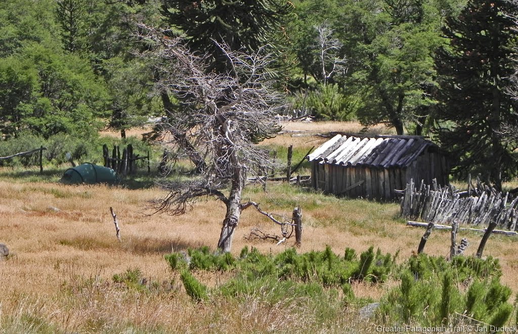
OH 2: The trail is good and easy to follow in the initial valley once it splits from the RR. There was no puesto at the second "puesto" waypoint, just remnants of old fences and corrals. Good place to camp, sheltered from the wind. The start of the CC section is an annoying but thankfully short bushwhack to the treeline. Afterwards it's straight up to the top of the ridge, grass turning to scree/rocks higher up. Steep, but quite doable. Once at the top of the ridge, this is where my troubles started. The ridge is not nice and rounded, but very narrow and jagged, with vertical, rock outcrops/spires blocking the way frequently. You have to go around most of these obstacles (impossible to climb over), and this is the most dangerous part. To go around you need to descend back onto the nearly vertical scree slope, traverse around the rockface, then climb back up to the ridge. All on the most slippery scree/gravel I've ever experienced. It was all extremely precarious. Climbing back up around the very first obstacle, the scree was so loose I was on my hands and knees scrambling upward, trying to climb faster than the rocks falling under my body. One of the most frightening situations of my life honestly, I felt like I could have gone down with the rocks like an avalanche. After miraculously getting back up on the ridge, I couldn't stop shaking and was almost in tears. Couldn't believe what I'd gotten myself into honestly. And then came more scrambling and clambering. Poles were useless, I was using my hands the whole time. I can't stress enough how loose and unreliable most of the rocks were. Very, very difficult. Would not attempt this northbound, ever. And thank goodness the weather was good and calm too. The views were spectacular, out of this world, but not worth risking my life for, and I wouldn't ever do that section again. Don't know if Option 1 would have been better. At least snow wasn't an issue with Option 2. If I had to do it again I would stick to the regular route, go down to Ranquil and climb back up GPT12 via the RR. Anyway, south of S 38° 06.903', W 071° 02.205', the ridge becomes less steep and more rounded, easy to walk on. You reach the pass {11-04} [5.4/2385], and make a sharp left to go along the Argentina border. Go across a few easy snowfields. Amazing views of snow-capped volcanoes all around. Condors swooping near my head. Felt like I was the only human on earth. Still lots of snow on Cerro Dedos. Once GPT11-02 meets with GPT12, you pick up a faint path and navigation is easier.
Season 2021/22
- 2022-Feb-25 / 3 days / Hiking / NOBO / RR / Romain
- If you cook on campfire or on wood burning stove you have better stay discrete because everything burnt some years ago and the landscapes are still marked.
- There are a lot of Araucaria trees. You can easily save food just by harvesting piñones on the floor following the path. I would recommend to not rely on it because it depends on the period, but there was plenty.
- Camp {11} [22.6/1461] : I loved this place. It was very comfortable with grass on the soil, almost flat, protected from the wind even if there is some in the valley, discrete, and I spent much time looking at the stars thanks to a good and warm (or at least not cold as it was the previous days) weather. To get water you have to walk 3 minutes following the point on the GPS which is precise
- Ford {11} [18.0/1199] : I had good time there, the weather was very good, the place is calm and good to rest, water is still cold but there is enough to wash if you want to
- From GPT-11C Start to Guallali it's now a Minor Road so it's very easy to follow and you meet a lot cars going in both directions, they just waved me.
- 2022-Feb-13 to 2022-Feb-14 / 2 days / Hiking / SOBO / RR + OH 11-01 (ABCDE) from the pass to Termas Pelehue on GPT12 / Veronika & Jo
The MR out of Guallalí continues until about km 12 on RR-TL-V (another trail that's been jeep-tracked recently) where it veers off to the north. We found out two kilometers too late, but got back to optional route 11-C by CCing through some araucaria forest. This turned out to be a happy little accident, as, this way, we saw a family collecting things from the ground, which turned out to be piñones. Here is where we learned that the ripe cones are "café", and that the piñones just fall down when the cone is hit with a stick or a rock. It's basically nature's piñata (no etymological relation though!). Before getting back to the track, we found some low-hanging ripe cones, which sprinkled more piñones than we wished to carry. Got a nice free meal out of those we did pick up :)
Camped in one of the many camp sites deeper in the mountains.
The next day, we decided to skip the descent to Ranquil after the pass, instead taking the optional route 11-01 (ABCDE). 11-01 stays above 2000m on the slopes of the peaks to get to Termas de Pelehue on GPT12. We had food for three more days and the weather was excellent.
We regretted this decision. 11-01 is CC without a clear path. Initially you're walking diagonally on a 45° incline of scree and sand, which is technical and requires constant concentration to find the scree-free spots. Later on, you're going from lower-incline slope to slope with little high-incline "gulleys" in between (as usual on a mountain flank). At some point, we did not see how to cross such a gulley at the spot suggested by the track files. We decided to descend to the point where the gulley seemed to have a passable incline, to ascend back on the next slope. This turned out to be a mistake, as the slope became more inclined before the gulley became passable. In the end, we did a lot of clambering, I got some fresh cuts from sliding down high-incline scree, and we narrowly avoided some scary looking cliff edges at the low end of our slope. This was the most dangerous situation we got in so far, and we were not really prepared to handle it well.
I'm not blaming the track files: it was clear that it was high-altitude CC, and there was a waypoint warning of "demanding clambering" (though it should not be limited to "nobo"). Maybe going up the problematic slope instead of down would have been the better decision. Just be aware of the challenges this optional route brings. Definitely not doable in bad weather (you would just slide down to your death in some spots). Note that OSM shows a trail a little to the west (a little lower on the slopes) of 11-01, which connects at the beginning and end. We think we saw this path at some points during our traverse. This may be the easier route to follow instead of sticking to the CC points (which was the superior strategy on all other CC sections so far ;) There's a water spring at S 38° 06.178', W 071° 04.579'.
Anyway, we were happy to reach the Termas de Pelehue. Sub-par hot spring, but great scenery all around. You can camp there, we went for a small spot protected on most sides by mountain slopes: S 38° 07.407', W 071° 03.775'. There are some non-sulfur water springs as well as a warm river to wash up in the surroundings.
We continued on GPT12 for one day, getting back to Ranquil via the southern optional route 12-01. This way, we could catch the bus to Lonquimay the morning after (left at 07:55, there's a second one at ~17:00 Mo-We-Fr). Camped opposite the carabineros (on their suggestion) a bit behind the bus stop, close to the river.
- 2022-Jan-17 / 2 days / Hiking / NOBO / RR / Molly and Melissa
We arrived in Ranquil with the bus at 17, and walked about two hours to the hot springs where we camped. They are not very deep, but you can probably lie in them comfortably. Nicely warm. The ascent towards the pass next to Cerro Moncol follows the riverbed, and as previously noted, it's necessary to cross it multiple times. We were able to cross without getting our feet wet every time, though. The terrain before the pass is difficult, but after it immediately gets easier and the trail is easy to find. We were in a snowstorm and found it easily. The trail to Guallalí is pretty easy, a long way before Guallalí it becomes a gravel road.
As described by others, there is a shop in Guallalí with VERY limited supply. It's next to the brown house of big planks, but you enter in front of the little red house to the right. Romina normally still offers accomodation, but when we were there she was leaving for an appointment in the evening and couldn't have us. She pointed us to the carabineros to camp, but they didn't want us there and told us to go to the camping ground "3 km" down the road. It turned out to be more like 12, and we ended up camping on a field some km from Guallalí
- 2021-Dec-03/ 1.5 days / Hiking / NOBO / RR / Marc Anthony
Took the bus from Lonquimay to Ranquil friday at 15:00 (leaves Monday, Wednesday and Friday). On arrival I met two fellow GPT-hikers. Started off in some pretty bad weather with hail and thunder, but it luckily passed after a few hours. The first challenge I encountered was walking up the small river towards the first mountain pass (NoBo). To make my way up this section I had to cross the river countless times because of the difficult terrain by the river banks. Getting wet feet was inevitable. Afterwards I encountered a snowfield that leads up to the pass. Definitely possible to avoid the snow by walking along the edge, but I found it easier to just make my way up through the snowfield. Continued on to guallalí where there is a mini-shop with very limited supplies. (There are no flags or signs that indicate there’s a shop but it’s by the brown house made of rustic wooden planks.) Went directly on to GPT10 and made camp at the camping ground by el barco lake (5000 pesos) you can ask them to charge your electronics by the house where you pay. They didn’t sell any food.
- 2021-Dec / Hiking / NOBO / OH 5 / Franck & Damien
Be aware there are only 2 water spots on the road around the volcano One at the start (tap by the conaf barrack) and a very small one at the camp before entering the scoria field (not sure if water flows after december). Make sure you load liters of water, esp. in summer (heat + exposure to sun) Plenty of water (snow melt) once you passed the volcanoe. The TL from Contracto bridge to Communidad Chenqueco is now a kind of MR, we crossed several 4WD there (? !!). There is plenty of water there.
Season 2020/21
Season 2019/20
- 2020-Jan-28 / 4 days / Hiking / SOBO / OH5 / Martin
4 days. 120 km. Because of bad weather forecast in the high parts of the cordillera, with strong winds, rain and even snow, we opted to take Alternative route 5 from Chenqueco to Lonquimay Volcanoe. A lot of road walking at the begining but the scenery and trail in the National Park were really amazing and worth it. Beware that in the traverse through the volcanoe to Corralco Ski Resort, there is no water and also difficult to camp. High winds and a lot of rain at the end. We checked many hostels in Lonquimay and the most convenient for us, was Hostal Nativo close to the main square.
- 2020-Jan-23 / 2 days / Hiking / SOBO / RR (mostly) / Frank
2 days & continued to GPT12 At Pass 2180 wind & rain came in, I diverted onto OH-CC-A@11-03-#001 as described by Linda. Snowfields were old & undercut by stream leaving tunnels 5M deep, definitely not safe to slide on. Walked on edge of snowfields or a little above them on right. Then you enter a gorge, it is best to stay close to the stream & only leave the gorge if you must. In to Ranquil, nothing there apart from Carabineros & no traffic. From Ranquil I continued on OH-TL-V@12-01-#001 to GPT12
- 2020-Jan-23 / Hiking / SOBO / RR / Ty & America
Guayali - Termas de Pelehue Short & Beautiful. 4:00 Bus Ralco - Guallali. Arrived at carabineros after 8. Luckily they let us camp outside. TONS OF FLIES, so be ready for that. The thermal pools at Pelehue are up by the fumarole. The traverse over there is gnarly, steep, slippery, all the good stuff. Quite small, but with an AMAZING view. The lower one seemed fine to get in, we didn’t as we wanted to make it to the next hot springs on section 12.
- 2020-Jan-17 / 2.5 days / Hiking / SOBO / RR / Martina & Ivo
Start: Guallalí, End: Termas de Pelehue 2.5 days. We went from Ralco to Guallalí by Fletes (see section "To section start"). It's a bit expensive but we didn't want to take the bus at 16:30, arriving late. Beautiful section. The first hot springs are worth the detour if you have time to clean them and dig a bigger pot (would take you approx. 2h), otherwise you just have a warm foot bath. After the pass we took the optional route #002 leading back to the regular route, then we switched some times between optional and regular route and finally took the optional route directly to the Termas de Pelehue. This part is quite demanding as there are some landslides where you have to find your way through somehow. The hot springs are gone due to lack of maintenance.
- 2020-Jan-15 / 3 days / Hiking / SOBO / OH 5 / Maddie & Tom
3 days, 120km walking around Volcán Lonquimay. Given section 11 was not feasible due to high levels of snow we took Optional Route 5. For us it was 5 star scenery. It is beautiful and the trail is very easy to follow with trail markings in the CONAF park. We found it to be quite a quick section as a result of the easy navigation and good trail quality. Good resupply options in Lonquimay (we stocked up on food as well as bought some new socks and more 95% alcohol for our stove).
- 2020-Jan-09 / 5 days (GPT11+12) / Hiking / SOBO / OH / Matus & Anna
We combined sections 11 and 12. It took us 5 days including one zero because of weather. Patagonia showed us bit of it's potential in these two sections. All walked trails were in good condition and CC sections pretty easy to navigate. In the sadle of section 11, because of strong wind, poor visibility and fresh snow and ice we were forced to take optional to the valley. There is a big snowfield, I don't recomend sliding on it all the way. It the lower parts there were big holes into the stream. From Ranquil we took optional #002 because we didn't want to climb back up. Uphill is more a minor road, downhill nice trail. After a laguna we took a optional to the Pass 2180 and road around the Pehuenche Extortioner. We needed to get down from elevation ASAP bacause of wind. We passed puesto early in the morning and no one was around. After rainy day everything above 2000m was white. We took trail to pass 1920m which was just with bit of fresh snow and then took minor road #001 down to valley. So I have no idea about the rest of the trail. Edit: adding a picture from the last sadle 1920m, we did after "rainy" day.
- 2019-Dec-27 to 2019-Dec-28 / 2 days / Hiking / SOBO / RR + OH 3 / Linda
Regular hiking route until the pass 2180 meters and then Option 3 Nice section ! After the pass, I decided to go down along Option 3 that goes into the canyon. Lot of snow at the beginning, but that was fun cause the slope was not very steep and I could use my bag raincover as a sledge to go down! Then, I ended up into the canyon, crossing the river at least 20 times but no problem cause the water level is low and the river is tight (compared to GPT07 for instance). The only difficulty was once the canyon becomes too tight and I had to find a way up and had to face a landslide. Just one part of 5 meters wide but quite dangerous cause very sleepy with the rocks falling down. After, back into the canyon until I could join the Regular Hiking route. No difficulties until Ranquil. Was lucky to find people with a car who dropped me in Lonquimai cause I had to resupply. Otherwise, only 3 Buses a week from Ranquil (no tiendas to resupply) to Lonquimai = Monday, Wednesday, Friday Supermercado with everything to resupply and accommodations in Lonquimai
- 2019-Dec-12 / 4.5 days / Hiking / NOBO / RR / Sophie & Hendrik
In total we were 5.5 days on the trail, of which we spend 1 in the tent due to bad weather. On Cerro Moncol there was still some snow, which made us very slow, as we either had the options to walk on steep snow or walk higher up in more difficult terrain. Rivercrossings were no problem. We liked: The amazing views, the condors we met at the northern part of the pass (they came very close to us), the mountain crystals of which there are plenty on the northern side of Cerro Moncol. We did not like so much: The higher difficulty due to the snow in some parts (Snow on top of Cerro Moncol made the regular route more difficult)
Season 2018/19
Season 2017/18
Season 2016/17
Resupply and Accommodation
Accommodation in Guallali: Brown house, ask for Romira; bed, dinner and breakfast for 30k
Supplies: Hitchhiked to Chenqueco, 10 km, shop with small selection, some veggies, pasta, the essentials
Bus to Ralco with more options every day at 5.30 am takes 3,5 h
Same bus to Los Angeles
Resupply and Accommodation in nearby Towns
- Lonquimay (from Ranquil)
- Supermercado Espinoza next to the bus terminal has most things. A little shop on the left hand shortly after the bus terminal when walking from the bus terminal towards the center has gas. The shop has different air mattresses, clothes and some outdoorsy things in the windows. There's also a ferretería that might have. Several accommodation options
Resupply and Accommodation along the Route
Transport to and from Route
- Guallali
(2020-Jan)
Bus Ralco-Guallalí 16:30 Mon-Sat, 9PM Sun. (~2.5h) The bus leaves Los Angeles terminal rural around 2PM Mon-Sat, 7:30PM Sun, continuing to Ralco & Guallali
Fletes: 4x4 Cars in front of the supermercado. They drive you everywhere. CLP 80'000 to Guallalí, but if you find one going there anyway the price is much lower ;-)
- Ranquil
(2022 Jan) Bus from Lonquimay Monday, Wednesday and Friday at 15 Other days bus to Troyo can take you most of the way, but hitching the rest might be difficult
Bus from Ranquil to Lonquimay Monday, Wednesday and Friday 7:30
Permits, Entry Fees and Right-of-Way Issues
Links to other Resources
Retired Section Article GPT11 - Cerro Moncol


