Pochoco (english)

|
Contenido
Season
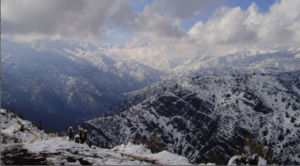
All year, but preferably avoid the driest months (January to March), when an earth?, And to privilege the winter, when the hill is green and can be the beauty of the Plomo massif and La Paloma snow. The days immediately following the winter rains, when there is some snow at the summit, are best.
Access
By car
It should go up Avenida Las Condes where it ends up in Plaza San Enrique. Once there, you must turn right by Pastor Fernandez. Continue around, cross the Mapocho bull riding pass and then turn left onto a narrow street called Camino Alto. We must continue down this street to where it ends (where there is a junction, Camino High is coming up, to the right, the left is Las Acacias), which is where the parking lot and the astronomical observatory Pochoco the same name.
Public transport and hitchhiking
Only reachable by microbus to Plaza San Enrique. From here you can take a bus to the parking lot of Pochoco for about $ 1,300 (Accurate!) One weekend, you can walk through Pastor Fernandez and hitchhike. If you are going to "face trekking" is unlikely to achieve a ride, especially from the High Road when it is obvious that the destination is the Pochoco (a weekday is much more unlikely).
Route description
The route starts in the parking lot described. From this point you should start crossing a wooden fence that is located to the northeast. From this point you will notice that not a single path, but actually a small network of intertwined forking paths and then reassembled, so there is no need to stop at each branch to assess the corercta alternative: they all come to the summit. The route is clearly marked in three sections separated by two breaks. The first tranche, part going up the hill, bordering the observatory Pochoco, heading southeast. After 5 to 10 minutes you cross a wooden portal is always open. Then the route turns to the east and up the northern slope of Pochoco. It is an area of sparse vegetation and wide, dusty trail, which in summer can be quite slippery. After reaching some trees, rocks, and meanders a bit (in this area may miss some path) before reaching the edge. We are in the western ridge of Pochoco appeared Mapocho River valley to the south and have achieved the first break. The second part is more friendly, then ascends along the ridge eastward. The route alternates between small sections on the northern slope (dry) and south (forest, inhabited by quillayes). While
will be on the edge, there's nothing like getting lost, though the route may seem confusing sections. They pass several large boulders. After reaching a kind of false summit and down a few meters alcanzael second break. This place is topographically a "saddle" with the ground rising to the summit and from where we came from, but down to our right and left. A good place to relax and watch the final rocky stretch to the summit.The route follows the ridge a few yards until it disappears and facing the final rock mass. It must overcome a small gutter rock that requires using hands to assert (it is very easy, nobody panic). Then the trail continues to turn south. The last part zigzags between the rocks and cactus (there are several branches irrelevant) before reaching the summit.
Variants
From the summit of Pochoco, you may continue to Llanos de Javier, a trek of about 6 hours total.
Expected Time
- A normal walking pace, this trek should take about an hour and half to the summit: 35 minutes sections 1 and 2, 20 minutes to stretch 3.
- If you go first, taking photos and enjoying the scenery, take about two hours
- This is a normal hill for "skyrunners. It is not uncommon to see people trotting lowering the barrier of 40 minutes from the parking lot to the summit.
Consider a half hour to 45 minutes for the descent. At the trot are not over 20.
Permits / Fees
- This route does not require permits or admission is charged.
Recommendations
- There is water all the way
- If you are a weekend or a holiday in the morning, be prepared to meet many people. It is even likely that there is no place in the parking lot after 10 am and be required to park below (no problem with that anyway).
- While this is an easy hill, there are stretches of loose material and not enough small slope, which makes frequent slips. It is common for Pochoco be elected by the people of Santiago as their first approach to the world of mountaineering and trekking or end up disillusioned and disgusted by falls and scrapes. For the same reason it is good to go with right-soled shoes, avoiding too smooth soled shoes.
Map and waypoints in Google Earth
- Waypoints of Pochoco. To download the file right-click and then select "Save file as" (IE) or "Save link as" (Firefox, Chrome). By trying to open it directly, some browsers will show the raw code with the coordinates.


