Diferencia entre revisiones de «Cerro el Roble (ruta vehicular) (english)»
| Línea 26: | Línea 26: | ||
==Route and Waypoints on Google Earth== | ==Route and Waypoints on Google Earth== | ||
| − | *[[Media:Cerro_el_Roble.kmz|Ruta del Cerro El Roble]]. {{Descargar waypoints}} | + | *[[Media:Cerro_el_Roble.kmz|Ruta del Cerro El Roble]]. {{Descargar waypoints English}} |
[[categoría:Trekking en Chile]] | [[categoría:Trekking en Chile]] | ||
[[categoría:Mountain Biking Chile]] | [[categoría:Mountain Biking Chile]] | ||
Revisión del 17:23 6 jul 2009
Hay muy pocas o ninguna página que apunten a este artículo, puedes ayudar a hacerlo más visible poniendo un link desde la página del País/Actividad correspondiente |

|

|
Contenido
Season
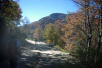
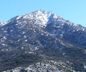
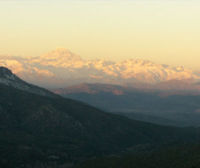
This trek can be done year round, but the ideal time is May, when the Oak trees are red, orange, and yellow. The winter months are also good when the Andes are covered in snow, and there is a beautiful view to the Aconcagua and company. For those who chose to ascend by bike, you should be careful in those days that just after a front of bad weather, snow has fallen on the peak. During those days (4 or 5 days a year) it can be necessary to carry your bike on the final stretch.
Access
Vehicle Acess
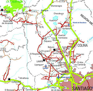
From Santiago, take Ruta 5 (Route 5) to the north. The detour to Rungue is at kilometer 54. Take that exit and enter the town. Where the street where you came from ends, turn left, and after a few meters turn right (the street ends anyways) to cross a stream. Immediately after having crossed the stream, turn left, and start bordering the stream on a dirt road which is in good state. You will then border the Runge dam. After 3,9 km from route 5, you will see a detour to the right ("A Caleu) which you must take. This road, also a dirt road in good state (any vehicle can pass), penetrates the valley and progressively ascends. Approximately 11 km from the detour (14,9 from Route 5), you will have reached Caleu and you will see a fork: take the left, which will keep ascending on the hillside. 970 meters higher, little before the pass to the valley of Olmué, is the road to El Roble to the right.
Puclic Transportation and Hitchiking
From La Paz bus terminal, located in Avenida La Paz with the street of Dávila Baeza, buses leave daily to Til Til, from 6 am and every 15 minutes. At 4 PM, a bus leaves destined to Caleu. The fare is 1.600 CLP. Many cars use this road, so the possibilities of hitching a ride are quite good.
Route Description
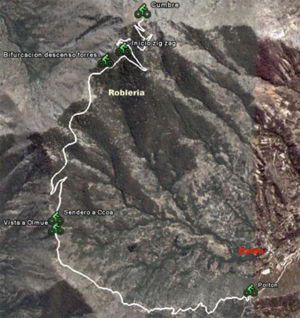
The route begins at the gate, where you must pay for the access. The path is clear to peak, since it is a vehicle road built for the construction and maintenance of the antennas at the peak. On a normal weekend (specially after a snowfall), you should find a few cars on the road. From the access gate, start west. The road ascends without stopping up to the peak. The first stretch is through the south edge of the hill. It then reaches the edge that divides the valleys of Caleu and Olmué. Towards the west you will have beautiful views of the Ocoa palm grove and La Campana. Briefly after this first view of the valley of Olmué, a pedestrian fork appears to the path that leads to Ocoa. For the peak of El Roble, continue up the main vehicle road. You will then pass by a wooden fence to the left. Then the road penetrates the Oak forrest, and then begins a hard zig-zag. Little before the peak, you will be able to see some of the transmission towers. The peak is a relatively large plain, with installations for telecommunication services that take away from the feeling of being outdoors, but the view is nevertheless beautifully impressive.Estimated Time
- Trekking: 4 hours from the gate. It is possible to continue a little more by car and reduce the walking time.
- Mountain Bike: 2,5 hours from the gate.
Permits/Fees
- 1.500 CLP per person must be paid to enter. The door is open on weekends and holidays from 9:00 am to 5:00 pm. If you want to cross the gate by vehicle on a weekday, you must call 84759457 or 87231141 (both mobile phones).
Recommendations
It is recommended to do the ascent stretch on the vehicle road when it has snowed in Santiago. It can be done in randonnée or rackets, low difficulty.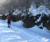
Route and Waypoints on Google Earth
- Ruta del Cerro El Roble. To download the file it is recommended to right click on "Save link as" (Firefox and Google Chrome).
- See all wikiexplora routes on Google Earth: In addition to dowloading the waypoints of a particular route, you may see on Google Earth all the Wkiexplora routes that have been published so far. It is ver easy, go to: Wikiexplora en Google Earth to see how to do it

