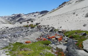
GPT06 - Volcán Descabezado
|
|
|
| |||||||||||||||||||||||||||||||||||||||||||||||||||||
Recent Alerts and Suggestions
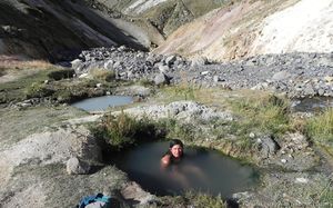
Drinking the water of the hot springs is not recommended because it can upset your stomach. Better take fresh water from the river or a cold spring nearby. When climbing the Descabezado Grande take plenty of water from the base camp in particular if you plan to spend one night higher up. You may refill your supplies with snow near the summit.
Season Section Log
Linda // Start = 6 december 2019 at Parque Ingles // 4 days Southbound // Finish = Las Termas El Medano //
GENERAL FEELING
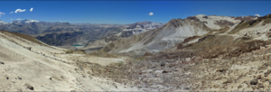
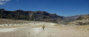
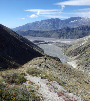
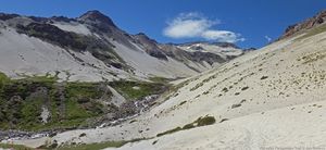
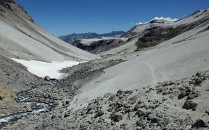
Amazing section !!!! Incredible mineral landscapes as soon as you go beyond Laguna Las Animas. It was tough because of the passes (and this was also my first hiking days and I carried too much food ... ) and the ground around the volcanoes is sand ! So it makes each step even more difficult. I loved the contrast between the areas around the volcanoes and the Laguna Caracol is just one of the most beautiful place I've ever seen !!!
LOGISTICS
- Bus from Molina to El Radal (off season and weekdays = only one bus at 5pm in Molina that stops in El Radal. Weekend : it goes directly to Parque Ingles and the schedule may also be different)
- Hitchhiked from El Radal to Parque Ingles
- First night in a camping in Parque Ingles = 5000 CLP
- The day after, I had to register to CONAF. Office opening at 8:30 am. Entrance fee = 6000 CLP Some people (5 or 6) were going to El Bolson for the day but after Laguna Las Animas, there was absolutely nobody till the end !
- Still snow when you go beyond the 2300 meters high
- Be careful for the last pass Las Hornitos, a lot of snow at the top and it makes it impossible to follow the GPS track to go down. I found my way on the left when you face the valley and then got back to the GPS track
- No problem to go out from the mine. Actually, workers I met on my way down to Los Cipreses suggestedto drop me by car to the main road. The guard was just smiling when he saw me in the car and when I told him I was hiking
- Mini market where you can find basic food (eggs, spaghetti, chocolate ...) in Las Termas El Medano
Summary Table
Satellite Image Map
Elevation Profile
Section Planning Status
Recommended Travel Period
This traverse is best be hiked between December and April. After a mild winter with less snow than usual you may already set out in November but be aware that some rivers may be impassible high during snowmelt (in particular GPT01-WP018 and GPT01-WP019). If you plan to get up to the summit of the Descabezado Grande without carrying crampons you should have better chances at the end of December or later when most of the snow is gone.
Benefits of Hiking and Packrafting
Recommended Travel Direction
The treck can be hiked in either direction but doing it from South to North requires an entrence permit from the hydropower station Cipreses (See Permits and Entrance Fees). Therefore southbound is the recommended direction.
Section Length and Travel Duration
The trail can be hiked in 6 days but plan some contingency in case of bad weather or if you suddenly fall in love with one of the amazing places on the route. If the climate does not favor you, than you should not attempt to cross the passes. In this region bad weather normally does not last long so you are probably better off siting out a bad day. If you are tempted to get up to the summit of the Descabezado Grande (GPT01-WP028) add two more days. The climb can be done in one long day or split up in two days when camping one night a bit further up.
Suitable Section Combinations
Section Attractiveness
Section Difficulty
The isolation and the high passes make this a rather difficult but rewarding trail. Good orientational skill are required because hardly any signposts are placed and some parts of the trail are cross country.
Resupply
You need to carry all the food for the entire trail. There is no food supply after Parque Ingles. If you meet arrieros at one of the Puestos you may ask for some goat or lamb meet but if you are not ready to take an entire or at least half an animal they may be reluctant to sell. Refill your water supply at the marked river crossings and the camps. In between these waypoints your will find only ocasinally some trinking water because water trickles away easily into the volcanic soil.
Resupply Town
Shopping: Food
Shopping: Fuel
Shopping: Equipment
Services: Restaurants
Services: Laundry
Services: ATM and Money Exchange
Accommodation: Hostals and Hotels
Accommodation: Cabañas
Accommodation: Camping
Transport: Ground Transport
Transport: Ferries
Transport: Shipping Services
Resupply on the Trail
Location, Names, Available Items and Services
Access to Route and Return
The last settlement on the trail is Parque Ingles about 10 km after Radal. This is also the last opportunity to spoil yourself with a good meal in a restaurant and to buy some goodies. On the trail that follows are only two occasionally used puestos; one at the Termas de Azufre (GPT01-WP020) and a second one at the Base Camp Descabezado Grande (GPT01-WP024). The first 20 km from Radal to El Bolson are a popular hiking destination for national tourists. Some go up to the Laguna las Ánimas but few continue beyond this point. The Base Camp Descabezado Grande is frequently visited by national and international tourists coming from Vilches Alto. Also horseback tours often stop and rest here. Hardly any hikers take the scenic trail from the Base Camp Descabezado Grande via the Laguna Caracol to the hydropower station Cipreses. It’s a hidden gem.
Access to Start
The trail starts in the tiny village Radal near the cascade "Siete Tazas". During the main season in January and February several buses go from Molina and Curico to Radal and some even go all the way to Parque Ingles. Outside of the main season there is only one daily bus from Molina to Radal leaving in the afternoon from the rural bus station in Molina.
Return from Finish
This trail section finished at the Route 115 to Talca.
Escape Options
Permits, Entry Fees and Right-of-Way Issues
CONAF does register all trekkers at Parque Ingles (GPT01-WP004) but does not charge an entrance fee. Camp fires are not permitted within the national park that reaches from Radal (GPT01-WP001) to the Laguna las Ánimas (GPT01-WP013).
Regular Route
Regular Hiking Route
If you want to see the cascades Siete Tazas about 7 km after the start in Radal you are charged a rather high entrance fee depending if you are a national or a foreign tourist. If you don’t want to spend the money and the time don’t worry; you will see plenty more cascades for free on the Greater Patagonian Trail.
| Stage | Days | Stage End Point | Stage End Waypoint | Distance | Ascent ↑ | Descent ↓ | Time |
|---|---|---|---|---|---|---|---|
| A | 1 | (Start to) El Boslon | Refuge (GPT01-WP011) | 20 km | 1180 m | 140 m | 06:10 |
| B | 1 | Laguna Mondaca | Camp (GPT01-WP016) | 16 km | 1000 m | 1210 m | 05:20 |
| C | 1 | Termas de Azufre | Hot Spring, Camp & Puesto (GPT01-WP020) | 8 km | 690 m | 180 m | 03:00 |
| D | 1 | Base Camp Descabezado Grande | Camp & Puesto (GPT01-WP024) | 19 km | 920 m | 1010 m | 06:00 |
| E | 1-2 | Optional: Climb to Summit Descabezado Grande | Camp & Puesto (GPT01-WP024) | 16 km | 2030 m | 2030 m | 08:00 |
| F | 1-2 | Laguna Hornitos and optional side trip to hidden lakes | Camp (GPT01-WP036) | 16 km | 1010 m | 900 m | 05:40 |
| G | 1-2 | Finish | Bus Stop (GPT01-WP043) or Bus Stop (GPT01-WP045) | 25 km | 170 m | 1430 m | 06:00 |
Stage A: Start to El Bolson
If you leave in the morning in Radal you can reach in one day the camp and refuge El Bolson. Parque Ingles is a good place for a lunch break.
Stage B: El Boslon to Laguna Mondaca
From El Bolson you get in one day to the Laguna Mondaca. If you partition this stage differently be aware that there are no inviting camp sites between the Laguna las Ánimas and the Laguna Mondaca. This stage should not be attempted in bad weather.
Stage C: Laguna Mondaca to Termas de Azufre
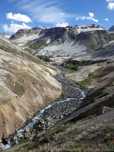
Going from the Laguna Mondaca to the Termas de Azufre makes a short relexing day and gives you pleanty of time to enjoy Laguna Mondaca in the morning before leaving and the hot springs in afternoon and evening when arriving. If the sulfor smell at the hot spring bothers you, than you can camp on one of the meadows a bit further up.
Stage D: Termas de Azufre to Base Camp Descabezado Grande
The rather long day hike from the hot springs to the base camp Descabezado Grande requires reasonable good weather as you cross a 2700 m pass.
Optional Stage E: Summit Descabezado
The climb can be done in one day or split up in two. The disavantage of doing it in two days is the leak of a reliable water supply further up towards the summit once the snow is gone. If you do the climb in one day you may desire a rest day either before or after the climb. An extra day gives you also a buffer if the weather is not optimal for an ascent.
Stage F: Base Camp Descabezado Grande to Laguna Hornitos
This stage can be hiked in one day. Alternatively you may partition this stage in two if you want to explore the hidden lakes after the Laguna Caracol or if you simply need a more relaxing day after you got up to the summit of the Descabezado Grande. There is a suitable camp site about 2 km after the Laguna Caracol in a wide open treeless valley. The pass between this camp site and the Laguna Hornitos should not be done in poor weather.
Stage G: Laguna Hornitos to Finish
From the Laguna Hornitos you can walk in one short day to the hydropower station Cipreses and the first bus stop on the Route 115. To the regular finish at the second bus stop on the Route 115 it’s a rather long day. If you do not want to arrive in Talca late in the evening you may opt to camp near the finish on the banks of the river Maule and take the a bus in morning.
Regular Packrafting Route
Not applicable.
Optional Routes
Investigations and Explorations
Links to other Resources
Alerts and Logs of Past Seasons
Older information for review
Waypoints
| Waypoint Name and Waypoint Code | Comment |
|---|---|
| Start (GPT01-WP001) | Start in Radal at final bus stop. Only in January and February some busses continue to Parque Ingles. |
| Shop (GPT01-WP002) | Small shop with basic supplies in Radal. Good to get a beer and some extra goodies for the night but not to supply you for the trip. |
| Camp $ (GPT01-WP003) | Nice, reasonable priced camp site in Radal. Recommen¬ded place for the first night if arriving in the evening. |
| Shop & Restaurant (GPT01-WP004) | Parque Inglés with kiosk and a cosy restaurant about 10 km after the starting point. Last chance to enjoy the pleasures of civilisation before heading into the wilderness. |
| Diversion, CONAF & Camp $ (GPT01-WP005) | The hiking trail starts left. You should register at the CONAF office. There is a camp site nearby. |
| River Crossing (GPT01-WP006) | Easy river crossing. |
| River Crossing (GPT01-WP007) | Easy river crossing. |
| River Crossing (GPT01-WP008) | Easy river crossing. |
| River Crossing (GPT01-WP009) | Easy river crossing. |
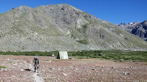
| Camp (GPT01-WP010) | There are some nice camp sites on the meadows of El Bolson. Inside the national park CONAF does not permit camp fires. |
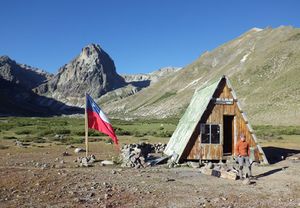
| Refuge (GPT01-WP011) | Basic refuge in El Bolson that can shelter for up to 4 persons. |
| Pass 2260 m (GPT01-WP012) | First pass with nice view back into the Valle del Indio. After this pass comes a 2 km levelled section before ascending to the second pass. |
| Lake (GPT01-WP013) | Laguna Las Ánimas. You may camp at the lake but there is little shelter from wind. |
| Water (GPT01-WP014) | Clear fresh water. |
| Pass 2560 m (GPT01-WP015) | Second pass with nice view towards Laguna Mondaca. |
| Camp (GPT01-WP016) | Probably the best camp spot near Laguna Mondaca with water, fire wood and some wind protection. |
| Lake (GPT01-WP017) | Laguna Mondaca. |
| River Crossing (GPT01-WP018) | Difficult river crossing during snowmelt and after heavy rain. The river often changes it's bed therefore look for the optimal place to cross. Yon need to cross the river to avoid rocky terrain ahead. |
| River Crossing (GPT01-WP019) | Difficult river crossing during snowmelt and after heavy rain. The river often changes it's bed therefore look for the optimal place to cross. |
| Hot Spring, Camp & Puesto (GPT01-WP020) | Termas de Azufre. Excellent hot spring with several small pools. You may need to adjust the temperature by regulating the hot water inlet flow. No fire wood but you may heat water and food at the hot steam vents (follow the noise). Good camp site if you tolerate the sulphur smell. The posteros arrive in January. |
| River Crossing (GPT01-WP021) | Moderate difficult river crossing. Yon need to cross the river to avoid steep loose pumice fields ahead. |
| River Crossing (GPT01-WP022) | Easy river crossing. |
| Pass 2700 m (GPT01-WP023) | The highest point of the entire Greater Patagonian Trail (apart from the summit of the Descabezado Grande). |
| Camp & Puesto (GPT01-WP024) | Base Camp Descabezado Grande. Probably the best camp spot in this area. You best take water from the spring on the right side of the river about 20 to 30 m from this waypoint. Frequently visited area. Base camp for climbing the Volcan Descabezado. Basic stone shelter occasionally used by local posteros and horseback guides. |
| Hot Spring (GPT01-WP025) | One lukewarm pool at the Base Camp Descabezado Grande. |
| Water ? (GPT01-WP026) | Possible access to water on the way to the summit. May be unreliable and depending on snowmelt. Please verify and report to trekking guide author. |
| Cross (GPT01-WP027) | Cross near the summit. |
| Summit 3900 m (GPT01-WP028) | Summit of the Descabezado Grande. |
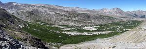
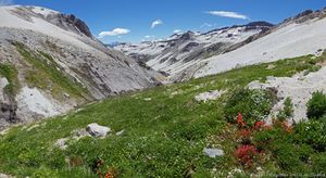
| River Crossing & Camp (GPT01-WP029) | Astonishing oasis in the middle of a volcanic desert. Good camp site with water, fire wood and wind protection. |
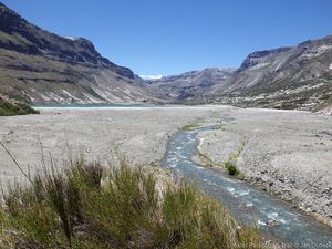
| Lake (GPT01-WP030) | Nearly 3 km long drainless lake Laguna Caracol in the middle of pumice and lava. |
| Lake (GPT01-WP031) | Hidden lake in volcanic crater that can be seen from the next pass. |
| Camp (GPT01-WP032) | Camp site without fire wood and wind protection. Water is probably best taken from the spring 300 m upstream. |
| Water (GPT01-WP033) | Clear fresh water spring. |
| Lake (GPT01-WP034) | Hidden lake that can be seen from the next pass. |
| Pass 2540 m (GPT01-WP035) | Pass with impressive view. |
| Camp (GPT01-WP036) | Probably the best camp site in this area and the only one with a meadow. Sufficient water and fire wood. The lake further down is dusty and without fire wood. |
| River Crossing (GPT01-WP037) | Easy river crossing. |
| Lake (GPT01-WP038) | Laguna Hornitos that is dammed up by the Crater Hornitos. You can easily ascent to the summit of the crater (60 m climb). |
| Trail Head (GPT01-WP039) | Trail head (or end). Turn right onto the hydropower station road. |
| Water ? (GPT01-WP040) | Possible access to water. |
| Gate (GPT01-WP041) | Unmanned gate that may be locked. Pedestrians may pass on the right side of the gate if locked. |
| Gate ? (GPT01-WP042) | Gate of hydropower station that was not used by trekking guide author. Please verify and report to author. You probably can leave anytime but you need a permit from the hydropower station for entering. |
| Bus Stop (GPT01-WP043) | Unmarked bus stop on the Route 115 to Talca. |
| Gate (GPT01-WP044) | Manned main gate of hydropower station Cipreses. You can leave anytime but you need a permit from the hydro¬power station for entering. You may ask the leaving employees for a ride to Talca. |
| Bus Stop (GPT01-WP045) | Unmarked bus stop on the Route 115 to Talca. |
Tracks
| Track Name | Comment |
|---|---|
| GPT01-TR001-2 | Take the public gravel road from Radal to Parque Ingles. Only few vehicles use this road but traffic increases in January and February. |
| GPT01-TR002-1 | The track starts left at the entrance of Parque Ingles. The national park trail from Radal to El Bolson is well main-tained and clearly visible with some signposts and marks. After El Bolson the trail occasionally splits and peters out so try to follow the GPS trek when in doubt until reaching the 2560 m high pass. At the pass do not descent the well visible trail that keeps right but follow the GPS trek that descents directly towards the Laguna Mondaca. During the descent the trail is partially only vaguely visible. |
| GPT01-TR003-0 | From the camp side (GPT01-WP016) you can cross the vast sediment field to the Laguna Mondaca. |
| GPT01-TR004-1 | Return 1.4 km on the same trail as you arrived. |
| GPT01-TR005-0 | Cross the pumice field and look for a suitable location to cross the smaller valley ahead. There is not trail clearly visible nor required. Keep going over the pumice and sediment field until reaching the first challenging river crossing (GPT01-WP018). The river seams to change frequently its bed so look yourself for a suitable location to cross the river and do not trust on the waypoint. Continue on the sediment field until the second crossing (GPT01-WP019). Look again for a suitable location to cross the river yourself. After the second river crossing you need to head up the ridge in front of you. The first few meters of the trail on this ridge were lost during a recent landslide. Therefore you need to find your way up to ridge and trail yourself. |
| GPT01-TR006-1 | Follow the generally well visible trail until reaching the hot springs (GPT01-WP020). Continue on this trail until getting to the river crossing (GPT01-WP021). Do not evade the river crossing by continuing on the trail on the same side. This trail will later disappear in a steep pumice slope. Follow the mostly well visible trail on the other side until crossing the river again (GPT01-WP022). The trail now rises to the 2700 m high pass and slowly descents after the pass. The generally well visible trail will lead you eventually to the base camp of the Descabezado Grande. If you want to make a campfire you may collect some firewood in the sediment field starts about 1 km before the camp. There is little firewood at the camp. |
| GPT01-TR007-0-X | Several trails lead up to the summit of the Descabezado Grande. During the ascent you should generally prefer the the more solid rocky parts. During the descent the loose pumice fields allow you to slide down with less effort. |
| GPT01-TR008-1 | A good trail heads into the 4 km wide lava river. You need to leave the main trail at the oasis in the middle of the lava flow after crossing the small river (GPT01-WP029). Get up the hillside towards your left. A vaguer trail continues through the remaining lava field to the Laguna Caracol. Pass the Laguna Caracol on the right side and follow the meandering river the feed the lake. After the spring of this river turn left and cross the wide open area. Here the trail peters out until the trail forms again at the ascent towards the pass (GPT01-WP035). Just before the pass leave the main trail and follow the GPS track towards the left. |
| GPT01-TR009-0 | From the pass (GPT01-WP035) several vague tracks lead down. You may either look for the regular trail or follow the GPS track. The GPS track keeps on the left until it descents in a steep pumice slope towards the river. Here the GPS track joints the regular trail. |
| GPT01-TR010-1 | The trail continues on the left side of the river until reaching the Laguna Hornitos. The trail crosses the river in a wide sediment field. Pass the lake and the crater Hornitos on the right and decent until reaching the hydropower station road in the valley far down. |
| GPT01-TR011-2 | Follow the rarely used gravel road towards the hydropower station Cipreses. Once you reach the now unpopulated settlement you have to choose between two options. |
| GPT01-TR012-2 | Option 1: You can take the 10 km dirt road to the regular trail section end where the next part of the Greater Patagonian Trail starts. This gets you to the more distant bus stop (GPT01-WP043). |
| GPT01-TR013-2-X | Option 2: Alternatively you can take the shortest way to the Route 115 if you want to return early. This gets you to the closest bus stop (GPT01-WP045). Alternatively you can wait for lift at the power station main gate (GPT01-WP044). |
| GPT01-TR014-4-X | Option 2: If you took the short way to the Route 115 and you still want to complete the entire trail than you need to walk 9 km on the paved Route 115. Not recommended! |


