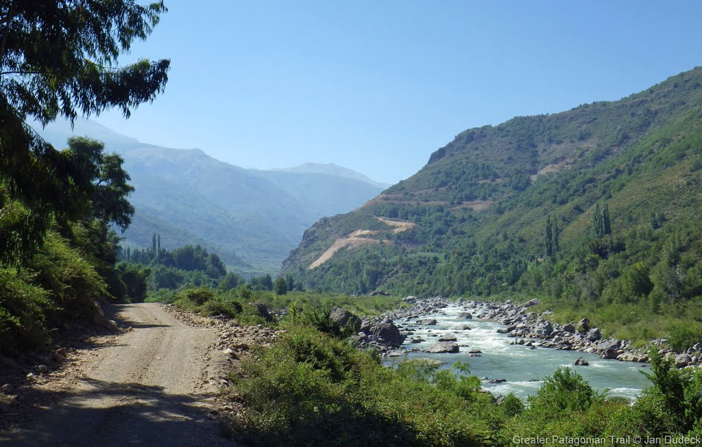
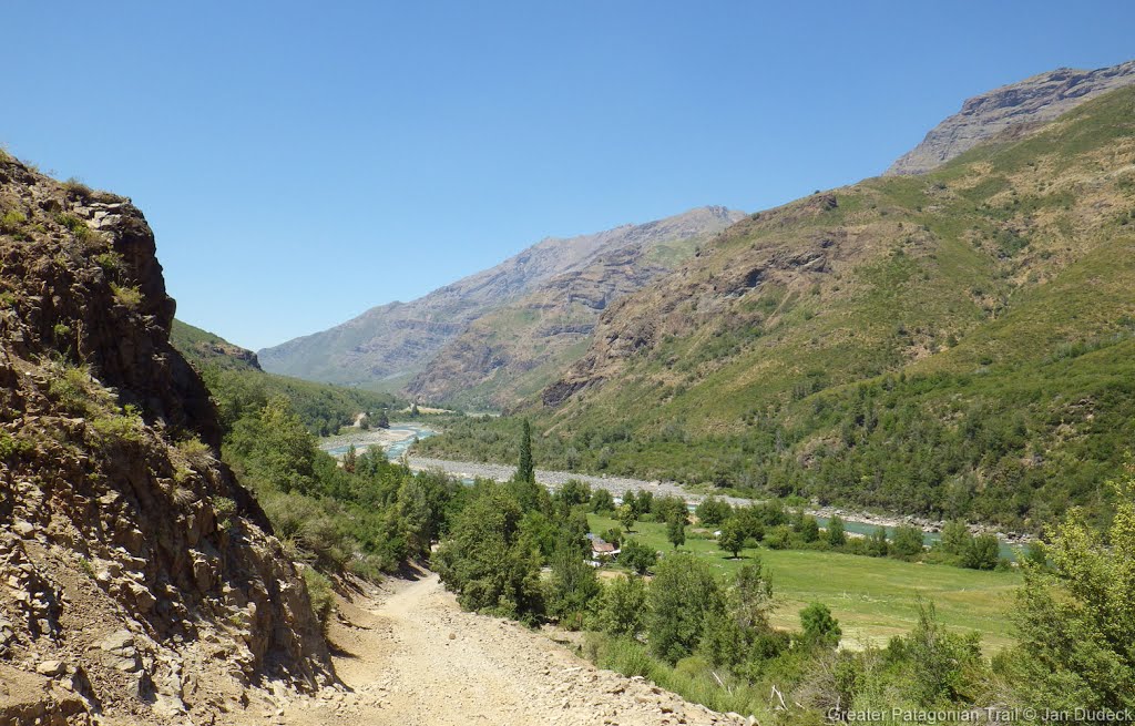
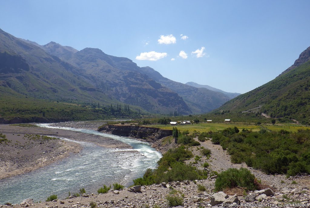
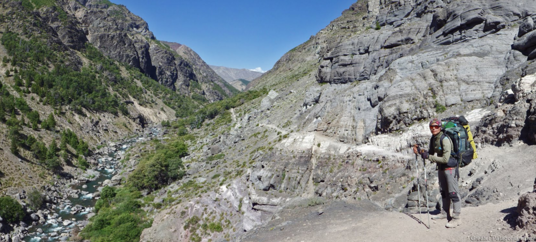
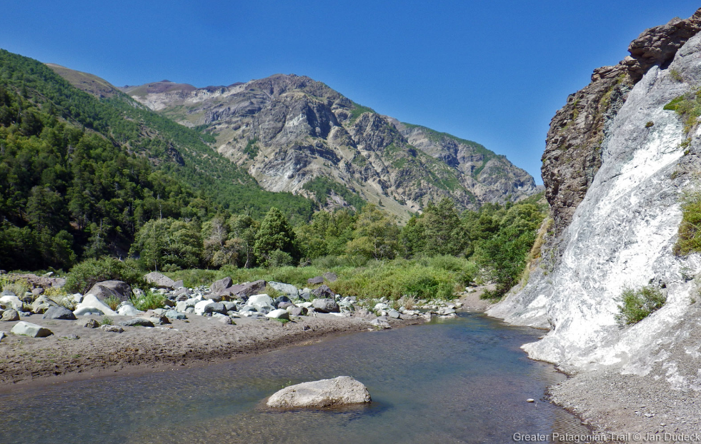
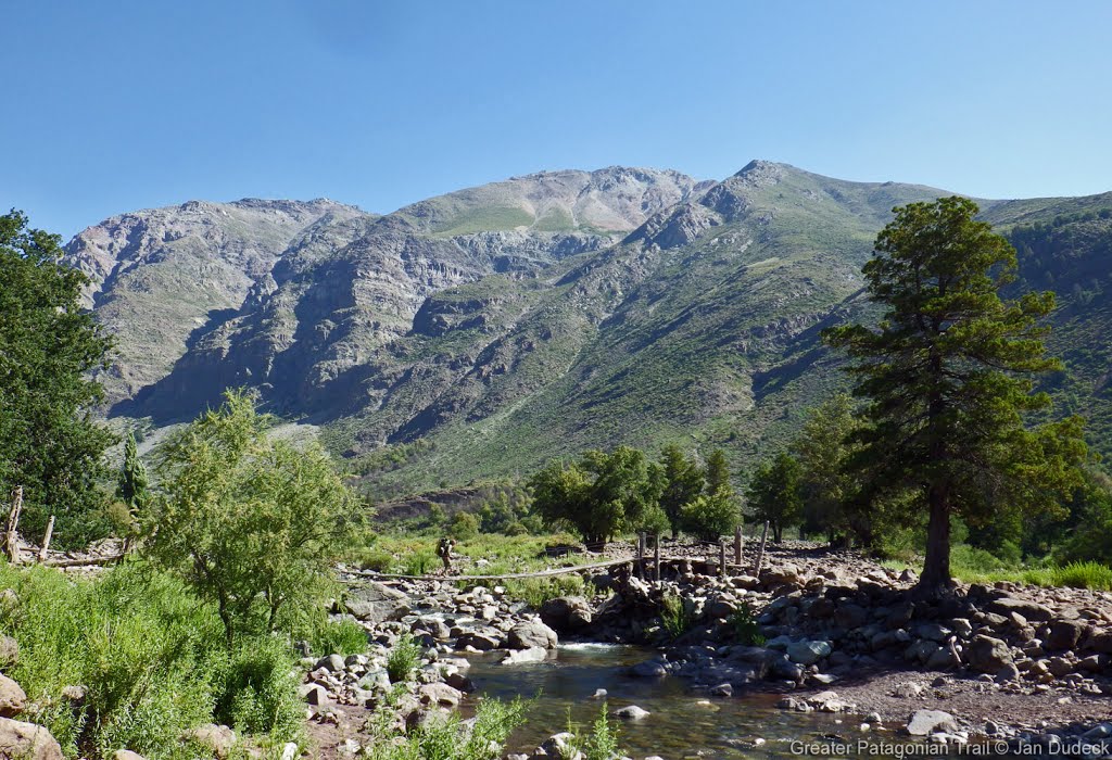
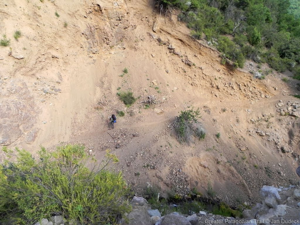
GPT07 (Laguna Dial)
Contenido
How to a add new entry
You need to be logged in to save your edits (and on mobile view, you need to be logged in to start editing).
Add a new log entry always on top in the appropriate season sub-chapter and use format:
* '''Start Date to Finish Date (use Format YYYY-MMM-DD) / Duration in Days / Hiking or Packrafting / Travel Direction (SOBO for Southbound or NOBO Northbound) / Chosen Route and/or Option Name (RR for Regular Route) / Names or Alias'''
If you are packrafting, put the above info into HTML tags like this (if you follow a hiking route for part of the way, highlight only "packrafting", as above):
* <span style="background-color:aqua;">'''YYYY-MMM-DD / X days / Packrafting / SOBO / RP / Your name'''</span>.
Include remarks about your route useful for other hikers and packrafters, alerts, suggestions and personal perception of attractiveness and difficulties. Try to be specific. Do not be shy to fix obvious mistakes.
Overview
Section Log, Alerts and Suggestions
Season 2025/26
- GPT07 | 2025-12-27 to 2026-01-01 I 5 days | hiking | SOBO I Route: option 10 - 1D - 1B - 1E - 1H - 1 - D - RR - Variant F - RR - Variant L | Michaela
• I hitchhiked to Laguna del Maule. • At the border post, the officers were unsure whether I needed to register or not. Three people discussed it and finally decided that registration was not necessary. • The selected route options at the beginning were very beautiful, both the view at Laguna del Maule and later the valley. • There are many plum trees around Carrizales with very tasty, ripe plums. • I did not meet anyone at the police post in Carrizales. • At the shop in Carrizales, I bought cola and chocolate. There is also well-functioning Wi-Fi there. • I really liked the hot springs near Carrizales. The water is very pleasant and warm, with only a few algae. I repeatedly switched between the warm hot spring and the cold river next to it. • I bought cheese and bread from Irma. • All river crossings were easy. The water level was at most knee-deep. • I arrived in Puente Inglés on January 1st (public holiday). A police officer who was delivering hay for the police horses gave me a lift to San Fabián, where I am spending two rest days at Cabañas Nativa.
1. Camp: -36.076696, -70.741539 , 2. Camp: -36.139711, -70.898629 , 3. Camp: -36.372434, -70.908755 , 4. Camp: -36.455999, -71.046771 (my best spot at this section) , 5. Camp: -36.567818, -71.210619 (water 200m away) ,
Attraction: 3/5, Difficulty 2/5
2025-12-17 / 9 days / Hiking / SOBO / RR, RH, OH, Option 4,6,7,8 / Anh
It was a beautiful section with lots of water. The weather was very good, even very warm. The heat is not as annoying as horseflies. To my surprise, there were no more snowfields, not even at 2300 Highmeters. The rivers had little water, so crossing them (Ford) was no problem. The options are rarely used, so the paths are very difficult to find. Sometimes I couldn't find the path and had to invent BB or detours. So the options are sometimes more dangerous than RR.
2025-12-17 to 2025-12-21 / 4.5 Days / Hiking / SOBO / Option 10 + Option 1D,
1B, 1E, 1H + Option 1 + RR + Variant L / Martin Ankel
Day 01
Started with hitchhiking from Los Alamos towards Laguna de Maul. A pick-up truck with water company workers drove me most of the way, I walked the last 6 kilometers on the main road, i.e., Option 10.
Passed the border control and hiked Option 1D + Option 1B + Option 1E + Option 1H + Option 1 to connect to the regular route. A good route, many views. I recommend it.
They were in the process of moving cattle up the valley so I had many encounters where I had to step aside to let the animals pass.
I camped here [36.057258, 70.820546]. Good flat piece of grass, easy to pitch the tent. No immediate nearby water, but many opportunities to fill up before the campsite.
Day 02
Continued walking to Carrizales, where I registered with the Cabinerros. They were extremely friendly, asked me if I needed anything. Overall they seemed happy to see a hiker.
I bought some bread, cheese and eggs at the resupply location — very limited resupply — before continuing hiking. Took the variant 7 detour to look at the hot spring. Good temperature, but overgrown with algae.
Found a good campsite here [36.272752, 70.925621], dry, flat, grass and nearby water.
New Puesto here [36.170581, 70.904965].
Day 03
Continued walking and passed the other police station. Also very friendly.
Camped at {07} [105.4/1607]. Nice place.
Day 04
In the last valley leading down to Los Sauce they were full swing herding cattle. Unfortunately this bit also includes several choke points where you simply have to sit and wait for all cattle to pass. At one time I had to sit down and wait for 1 hour, yes I timed it, while a thousand cows or so crossed one of the choke points.
I found a flat piece of grass/gravel to pitch my tent in here [36.567565, 71.210629], with water only about 200 meters away (Water {07} [141.9/970]).
Puesto {07} [129.0/1341] is destroyed. Can remove marker.
Bridge {07} [138.7/1041] is destroyed. New bridge built 50 meters upstream, but lies within the settlement barbed wire fence. Easy to fjord the river though.
Day 05
Low clouds cover the slopes of the regular route so decided to take Variant L into Los Sauce. To limited resupply opportunities to continue on GPT 08. Hitchhiked to San Fabian, ate like a starving dog, and booked two nights at Casa Domo San Fabian for 70 000 CLP. Nice accommodation, I recommend it. I will rest one day and embark on GPT 08 on Tuesday by hitchhiking back to Los Sauce.
All fjords are easy and all water are reliable.
GPT07/2025-12-13 to 2025-12-18/ 5 days + 1 Zero/ SOBO/RR + Variant B + OH 4/Graham
Beautiful and challenging section. Was beaten down by the heat, limited sombra for sure. Variant B to avoid sketchy Horse Trail along cliff. Stayed at Victor’s Puesto at Km 95. Very nice. Got humbled by some cows…then got a terrible stomach bug. Took a rest day. Took Variant L to avoid final climb, picked up by two friendly guys who drive me to San Fabian about 2km from Puente Inglés. A lot to learn…need more sunscreen!
GPT07/2025-12-5 to 2025-12-10/5 days/SOBO/RR/variant L Denis and Robert
We had police control while entering Carrizales. Resupply in Carrizales is fine, it is needed to ask to open. We took the variant L with the hope that we would catch the first bus at 7:30 or so , but the first bus went at 10 am even there is written 9 at e the bus. 1000 pesos per person Overall it was very easygoing section, with option to resupply. No conflicts about right of the way. Water almost everywhere, no big river fording. Many puestos and arrieros all around the trail. Difficulty 2/5 Attractiveness 3/5
- 2025-08-09: Track file update 2025 and investigation suggestions of Jan Dudeck
- The southern terminus of the regular route was updated in 2025 to minimize road walking. The regular route now suggest the trail on the eastern side of the of the valley adds a 600 m climb. Exhausted hikers might take Variant L (previous regular route) which is the gravel road to El Ingles.
- GPT07 Option 3 (Camino Valle Melado) and Option 4 (Termas Las Zorras): At the beginning or the end of the season, the options 3 and 4 offer a lower and shorter route with presumably more feasible river crossing. It's a lot more road walking but certainly faster.
- GPT07 Option 6 (Las Truchas) and Option 7 (Cordillera la Mortandad): Southbound hikers that have enough food left might take these options. Option 7 was updated in 2025.
Season 2024/25
- 2025-02-14 to 2025-02-23 / 9 days / Hiking / SOBO / Option 3 (Atajo Camino Melado), RR / Eric and Jakob
Route: We chose to start with the Option 3 (Atajo Camino Melado) because we wanted to have more options to resupply so we can reduce the weight in our backpacks. We hitchhiked from the shop in Los Alamos to the start of the option, which saved us some kilometres on a pretty big and busy street. The option is not very pretty since it simply is a very long gravel road. Many people stopped and asked us if they could give us a lift. Would probably save around two days when taking a lift instead of walking the whole street. In Carrizales we went back to the main route.
Permissions: No Permissions needed.
Resupply: Resupplying on this section is easier than on GPT06. On the Option we had a couple of small shops which allowed us to stretch our food supplies for another couple of days. The shop in Carrisales owned by Dagoberto also sold pasta. We also came across another Irma which is on the optional route (S 35 59.577 W 070 57.394). She owns a shop and was really nice. She allowed us to camp in her garden, cooked dinner as well as breakfast for us and provided us with a bathroom. At the marked point at km 86.4 “Irma” we bought six pieces of bread for 2000 Pesos. She also sold cheese which we didn’t buy. After the second Irma there is no other possibility to resupply. When finishing GPT07 we went to the Shop at Puente el Ingles but it didn’t provide enough food for us to resupply for the next Section. So we asked the owner of the shop (Rigo) if he could drive us to a supermarket in San Fabian which he did for 60 euros. Normally one could also take a bus to San Fabian but since we arrived on a Sunday no buses were travelling to San Fabian.
Attractiveness: 2-3/5 Difficulty: 2/5
- GPT07 / 2025-02-27 to 2025-03-03/ 4.5 days / NOBO / RR until Carrizales / Mara & Tobias*
We did the 100 km stretch from Puente Inglés to Carrizales. In Carrizales we got a lift to Talca after 2 hours of waiting. At Irma’s Puesto we bought goat cheese and meat. It has been a beautiful section without difficulty’s or right of way conflicts.
- 2025-FEB-19 to 2025-FEB-22 / 4 days / Hiking / SOBO / 01K + RR / Martin
I went exploring Cascada Invertida in the morning and then started from there around noon. At first I wanted to hitchhike to Maule and start from there, but there were very few cars and nobody stopped. So I started from 01K. There is a gate and a guard as it’s some kind of construction site. It was difficult to explain to the guard what I want from him (I don’t speak Spanish), but eventually he got it and let me enter. This option is actually quite nice, gradually going up to a pass. And then down to a valley that was full of cows.
The rest was mostly straightforward, but as usual, you always need to focus on what is the right path. First day I camped a 100 m before Camp [44.6/1604].
Second day I got to Carizales. The shop was empty, but I went to the nice holiday house next to it and the lady was there, sweeping. So she went to sell me stuff. I had enough food, so just bought Coke and a chocolate bar. I camped around km 81, right after the ford, next to the “road”. Good spot.
Third day, I arrived at Irma’s in an hour. There were quite a lot of people. I bought cheese and bread. The section along Laguna del Dial was exhausting with constant up and downs. I camped a but up from the lake, at Camp [114.9/1727].
On the final day, I was hoping the trail would get better and better. And it did. Apparently people walk here, many foot steps. But only met a few people despite it being weekend.
I got to El Ingles at 18:30, so decided to stay there and take the 7:30 bus all the way to San Carlos. The camp was 5000. The guy running the place was friendly and showed me a nice quite place in the camp.
- 2025-JAN-24 to 2025-JAN-28 / 4.5 days / Hiking / SOBO / RR / Elijah & Michael
The section went quickly with lots of 4x4 roads & moderate grades. The police in Carrizales guided us to a shop with limited but sufficient resupply, and heavily fruited plum trees lined the road into & out of the village. Irma sold us magnificent goat's cheese. Camping at Laguna Dial was a highlight. The bus was not running from Puente Ingles on a Tuesday morning; however, we were able to hitch into San Fabian and return to Puente Ingles on the bus the following day at 2 pm (1,000 CLP). The shop at Puente Ingles sells a limited resupply as well as snacks and drinks.
- January 9 to January 15, 2025 / 7 days / Hiking / SOBO / from Border Control: 01C, 01B, 01, 02, RR, 06C, RR, 06H, 07 / Peggy
Interesting stage, sometimes monotonous, but with pleasant surprises as well. A few encounters with arrieros and lots of animals, but fairly isolated due to the chosen options. Challenge: the heat.
River crossings went well, except for the Río Guaquivilo on option 02 (42.1/1284). I arrived there around 5 PM, found it too strong for me, and decided to wait until the next day. That evening, there was a storm, so the next day the river was even higher, more turbulent, and less clear. I tried to find a better crossing point and regretted not taking the trail on the other side, which avoids crossing the river (I assumed it wasn’t listed as an alternative—perhaps because sections of the bank had collapsed into the river?).
In the morning, I spotted an arriero with his horse and dogs on the opposite bank, regretted my decision even more, and initially planned to either find a crossing point upstream or backtrack all the way to the ford (35.2/1382) to take the trail on the other side. After some wandering and observing, I noticed fresh horse and dog tracks that showed they had crossed upstream of the ford (42.1/1284). Following these tracks (thank you, rain, for making the tracks fresh and visible), I found a perfect crossing spot.
I’m sharing this because it was a valuable learning experience for me. Unfortunately, in my excitement at successfully crossing, I forgot to note the GPS point—but I estimate it was about 200 meters upstream.
I wonder if the trail on the opposite bank near the ford (35.2/1382) is passable?
Laguna del Dial: No one was there (probably due to the previous night’s storm). Lovely campsite (104.5/1607). Great swimming spot.
Option 06C: Stunning view at the pass and the valley on the other side. For me, this option is absolutely worth it. Start the climb before the pass (118.2/2013), unlike the GPS track, which descends, then climbs back up. Still, it’s doable either way!
At the start of the season, the campsite (6.0/1714) was flooded. I arrived late and didn’t go further but found a spot across the river where I cleared rocks and plants to pitch my tent.
Pleasant trail along the Río González on the RR.
Option 06 and 06H: Campsite (3.9/1282) with plenty of bivouac options. A beautiful and enjoyable spot amidst trees. Lovely waterfalls. I followed the path that stays on the right side of the river, avoiding the ford, and descended after an hour to see the marmitas.
Up to km 33 (intersection with the trail to the lakes), the path is easy to follow. After that, it gets a bit tricky but is still manageable. At this intersection, there was a cairn, which I assumed (from the map) led to the lakes. I turned left, following the GPS track. There was no trail or even a hint of one. Later, I crossed a trail with cairns, then lost it again, and so on.
I wondered if the cairned trail at the intersection with the riverside path might be the one to follow for 06H. Does it perhaps branch off left a bit further? It seems that on one side of the pass, there’s the GPS track for 06H, and on the other, a trail with cairns. For me, using a combination of the GPS track, the cairned trail, and my own reading of the terrain worked well. It was even fun, and the area is stunningly mineral.
However, the descent on the other side was an entirely different story.
At first, I followed a marked trail with cairns and animal tracks. After a while, I realized I was far off the GPS track, which was now higher up and behind a ridge. The trail I was on wasn’t on any map, the cairns became sparse, and I wasn’t confident in the animal tracks. So, I cut across the mountain to rejoin the GPS track without climbing back up.
This off-trail section was initially relatively easy: downhill on sandy, rocky terrain with shrubs and bamboo, which was manageable. But after that, it became much harder. The easiest route (or not?) was through the riverbed—first dry, steep, rocky, and slippery. Then the final section had water, tall plants, and thorny bushes. It was challenging and exhausting. I must have fallen about twenty times! I ended up experimenting with different ways of falling!
I was so relieved to reach the bottom—and absolutely exhausted!
It was a good first off-trail (CC) experience on the GPT for me, but I wonder if the trail I initially followed up high might be a better option. Worth trying?
- 25-01-19 - 25-01-20 / 2 days / SOBO / 01C-01D-01E-RR / Volker
Laguna Maule to Corrizales
Day 1: I combined gpt06 and gpt07 and hitchhiked from La Mina to Laguna Maule. First car - chilean hikers, heading for a waterfall on Rio Campanario, interesting area for further exploration around gpt06 OH2; second: carabineros; they took me to the CL Border Control, their colleagues noted my passport data. Then I went to the Laguna, took a bath and walked these options: 01C-01D-01E. Great views on the Laguna Maule and Cerro Confluencia, then amazing mixture of volcanic landscape and pastures. Chatted a while with an arriero at his Puesto, later the trail crosses 3 times Rio Saso (water only to ankles). Camped 1km before X Camp, 44,6 on a green spot some 100m after a non-indicated puesto, where I took water. After some very scenic, but dusty camp spots on gpt06 a luxury camp.
Day 2: RR to Corrizales. On the MR one of my shoes suffered a sudden death. MR walking was still possible, but any remote mountain trail too high a risk. Close to the settler at 54.2 I met a group of three Chilean day-hikers, who tried to get down to the huge waterfall on Rio de la Puente. I decided to join them and instead of at least 2 days of MR walking (with uncertain perspectives for hitchhiking) to accept the offer for a ride to Talca. It turned out to be impossible to get down to the waterfall. The attempt on two very steep slopes (and in even steeper and densely overgrown creeks) ended at vertical walls. Result of the exploration: there is a path starting (on the orographically right side) at the bridge at 07-03, 38,4. It brings you at least very close to the bottom of the waterfall, the last 100m seemed easy (as far as it was possible to see from the slope on the opposite side of the river - fording perhaps an alternative). After the failed attempt, we walked to the carabineros and were offered coca-cola and sandwiches. Very nice guys (and not the same, that other gpt-hikers met earlier this year, as they rotate every four weeks). Then 40km on a dirt road, more than 2 hours by car on OH 03 to Ruta Pehuenche (Talca-Laguna Maule-Argentina). This is definitively not an option you would like to walk - and one with few chances for hitchhiking (probably better on saturdays or sundays).
- 2024-12-09 to 2024-12-14 / 5,5 day / Hiking / SOBO / OH 01B+OH 01+RR+OH 03A+OH 03+RR+OH 04+RR / Dorota Szparaga
I started from Laguna de Maule using variant 01B and then 01. Nice views from the passes on Laguna de Maule. I have joined RR at km 29.8. And followed to Carisales. Between km 42.2 and 44.6 grass with water and plants which made me allergic on my legs. In Carisales I spent about 1.5 hours with carabineros. I have registered and they prepared me lunch and gave me some food. There was un arriero who recommended me to cross the river passing bridge Melado (OH 03 km 38.4) through Rio Melado. In that way I did not have to cross the river Guaiquivilo. It was a really good decision. This option uses good MR. It was Friday so a lot of cars went for fishing or Laguna de Maule. With one of them I have crossed the river near hot springs ( km 58.8 of OH03 ). At km 80.9 RR I have joined the regular route. I have also registered at carabineros El Dial. Because I am walking alone all carabineros told me that for my safety it is better to register. Here I have spent a nice time talking with them. They offered me dinner also. When I have spent a night at the pass at km 102 it was a storm. The last days temperature is above 30 degrees. Near Laguna Dial I have met only arrieros. From the km 118.9 RR where I spent the night I took variant 04E - a nice place for camp with water from the lake before the pass Cordillera González (OH 04E 2.5/2029). Then I took OH04 from Termas La Zorra (38.6/1306). I passed the river Zorra four times - water above the knee (height 164 cm). From km 38.6 to 48.5 there is a good path but very often it is not accurate with the track. After crossing the river Zorra last time at km 48.6 it should be MR. But in fact it is km 52.5 which is a combination of CC+V with some BB. From km 52.5 starts good MR. I have met arrieros. And visited one man who invited me for a café near the carabineros. We had a good talk. I have reached El Inglés at 14. Finally I have put my tent near the shop. And the next day went to Chillán. I sent a deposit there with Starken.
- 2024-DEC-23 to 2024-DEC-30 / 7.5 days / Hiking / SOBO / RR, OH option 5/ Tamar & Nimrod
1st day- heading from El Medano (after a rest day when finishing section 6). Started walking and after 10 minutes took a ride to X[11.3/1241]. There was a gate and a house, but we didn't see anybody, we passed through the hole in the fence to the right of the gate. Towards the pass got our feet wet in the grass. Saw 8 condors together flying very close to us - incredible!! Camped in camp [32.4/2030]
2nd- There were a lot of cows and arrieros on the way, our feet got very wet and muddy from walking in the grass. Ford at Rio Las yeguas at 3pm was ok. Camped in a place with a view to a big waterfall (-36.044667,-70.531381) with water 2 minute walk away from a small stream. We wanted to camp before but there were a lot of fences saying it's private property around the route.
3rd- in Carizales we hoped to buy fresh bread and cheese but it was Christmas eve, and no one at home in the the shop waypoint in the morning. Camped in waypoint water [56.8/1117].
4th- crossed Rio Guaiquevilo at 12pm. The current was pretty strong and got up to our waist (our height is 1.70 meter), but when walking together and up stream and to the side we made it. At Irma's puesto we bought coke, cheese and 3 pieces of bread (she didn't have more). She did have a lot of dogs ("they areonly dogs, not lions" in her words). They bark but are friendly after calming down. We slept next to the carabineros. They gave us juice, password to the wifi, and let us use their cold shower.
5th- climbed to Laguna del dial, took a dip in the water (highly recommended! The water is great) slept in the southern side of Laguna dial after descending (-70.99933,-36.45309). There was a group of chillian tourists that came fishing, and their guide gave us some remaining of fried fish and fries bread (which was awesome because it was Hanukka and us Jews love eating fried food in this holiday =))
6th- Climbed the pass, camped near the river (-36.319514, -071.064414).
7th- There were a lot of river crossing even in places where it wasn't marked ford. crossed Rio Gonzales in the morning- last ford before the bridge- The current wasn't strong but the water was deep up to our chests. Maybe if crossing a few meters near by it would have been less deep. Bridge [137.6/1041] - is currently broken but we crossed the river with no problem. There was a place with a lot of cherry trees and plum trees an hour walk from the broken bridge. After the bridge [143.1/909] the trail is an MR and there were some vehicles, so hitchhiking is possible. Camped in (-36.354990/ -71154314) no water.
8th- started walking towards Puente Ingles, and got a ride to San Fabian after half an hour. The driver told us that there's a bus to San Fabian once a day at 10am. And from San Fabian to Puente Ingles at 2 pm.
San Fabian accommodation - Cabañas Nativa San Fabian - looks like a really good place with pool, jacuzzy, kitchen, privet bath, garden, a path to near by river, coffee shop (the only one we found which serves real coffee) near by, for a price of 42,000 clp for a night for 2 people. We already booked a place with laundry on Airbnb so didn't get to stay there ourselfs.
- 2024-DEC-13 > 17 / 5 jours / Randonnée / SOBO / lac coté ouest > frontiere argentine > RR > frontiere argentine / Pierre-Marie
Etape : GPT07+GPT08 | Meteo : soleil | Eau : facile | Neige : non | Intérêt : 3/5 | Difficulté : 2/5 | Danger : attaque d'oiseaux, plantes urticantes
Bus de 15h (le seul) Talca>El Medano, puis stop vers laguna del maule. Route peu frequentée le soir car douane fermée de 19h à 9h. La rando est tres facile. Il y a des taons et des attaques d'oiseaux les 10 premiers km apres le col de 2560m. L'option est est en hors piste sauf la derniere descente. A la fin de la vallée, il faut escalader plusieurs fois la falaise. Plantes urticantes que je n'avais pas encore vu jusque là. Elle sont entre 1500 et 2200, dans les zones semi ombragées type ravins et sous bois. Il y a 2 clotures facile a passer a Termas los Moscos. Malgré son immense bassin versant, le rio Salitre etait tres facile a franchir. Depuis le col, j'ai marché sur la crete jusqu'au sommet principala a 1,5km au sud. Puis j'ai rejoins la trace gps. Le sentier est difficile a suivre avant le col que j'ai monté en hors piste, mais c'est bien pire apres le col ou une epaisse vegetation complique la progression. J'ai pris mon temps et ai bien suivi les traces d'animaux. Le bush-bashing est impossible car il y a du bambous. Ensuite le chemin est vraiment facile (malgré quelques portes et clotures), avec meme des ponts pour franchir deux rivieres.
- 2024 - DEC-10 to 2024-DEC-17 / 7 days / hiking / NOBO / RR / Michal a Anna
We hitchhiked from San Fabian to El Ingles and started the hike around 2pm - at that time the shop at El Ingles was closed with no one around to ask. The shop at Carizalles [58,2/1117] was also closed as the owners left that day (we walked around around 5pm).
The trail was very pleasant, no steep up&downs. We found the section very charming, it was interesting to meet all the locals and arrieros, most of them were up for a little small talk.
All fords were fordable, the highest at Río Gonzalez [133,3/1226] was to Anna’s hips (she is 1,65 m). We forded in the morning and Eduardo living nearby warned us that in the evening it wouldn’t be crossable on foot.
No problems with agressive dogs (even at Irma’s puesto [86,4/1212]. We met a lot of cows (couple of times the herds had bulls). A lot of wetlands and plenty of water everywhere.
Carabinieros [92,7/1322] were very kind and hospitable. Very pleasant stop at their puesto.
- 2024-DEC-07 to 2024-DEC-12 / 5 days / Hiking / SOBO / RR + OH (var. A) / Ivan, Jakub, Daniel
The main road section on the beginning we did with head-torches in the night. After leaving the main road, it seems that part of the minor road was washed away by water. This short section must be bypassed by walking on stones along the riverbed to avoid the fenced-off area. At the end of the valley, we choose variant A. At CC [33.3+1.8], the ground was extremely waterlogged. From the ford [47.7-60.5], the trail transitions into a minor road. After 2 days we resuplied in a little store in Carrizales [58.2/1117]. Nice lady prepared some lunch for us too. We recommend to ask the locals, it's easy to miss it, but the position in track files fits perfectly. The water level in the Río Guaiquivilo was elevated, so we had to traverse some sections along the rocky slopes above. Camp 103.2 is completely waterlogged due to melting snow. The ford at km 120.4 we crossed without getting wet. However, at km 137.6, there is no bridge, so wading is necessary. At the intersection of RR and OH [143.4/942], a really good minor road begins, which is marked as a trail in the track files.
Season 2023/24
- 2024-03-29 to 2024-04-02 // 4,5 days // Hiking // NOBO // RR + Variant A // Quentin Clavel
Best section so far in terms of meeting people. Only nice souls are in this area, a lot of great talks with arrieros, carabineros, or just people passing threw.
But in terms of landscapes and hiking, it's pretty much always passing threw looooong valley, that could be a bit annoying because not so diverse.
I had great time anyway, passing these valleys, the Laguna dial is very nice and I was happy it was Easter,
I have been invited for an overnight party with locals, drinking mate, eating cordero, cazuella, had an amazing desajuno before leaving for the rest of the section
I met Dona Irma, after dealing with her crazy aggressive dogs, and spent some time with her, she's definitely a local legend ! Bought cheese and bread for feeding me the rest of the section (10K CLP/kg)
I arrived in the carabineros of carrizales who are the best carabineros of Chile no doubt ! Giving me sopaipillas and cola, then we discuss a lot, took dinner together, turning into an overnight stay here, they make some space for me to sleep inside, we took some Pisco then going to bed. Best experience with carabineros so far !
No trouble in the junction with the road, a local living in a puesto 1kl earlier invite me to have mate, then the guard at the end of the gravel roads gently opened me the gate and I continued on the long and boring 11klm of road until El Medano.
There's few options to sleep in El medano, but as I was out of the season everything was closed, I have been invited for stay with a local and quite happy about that because it was a very bad weather night !
- 2024-03-09 to 2024-03-15 / 7 days / SOBO / Started at border control close to Lagula Del Maule —> 1C, 1B, 1, 2, RR, 6C, 6D, RR, 6F, 6E, 6, 6H, 6I, 7B, 7 - Puente El Ingles / Marilyne
I planned this route to avoid the aggressive dogs that have been mentioned a couple times now as it is my main fear along the GPT! I also wanted to explore some alternative routes as some people mentioned that the road walking was not very interesting. That meant that I didn’t get to visit Irma’s place or Carrizales.
Day 1 ~22km The timing of my errands in Talca meant that I was ready to start on a Saturday, which is unfortunate as the buses to Termas El Medano don’t run on weekends. After evaluating my options, I decided to just take Uber to right before the border control (75K + big tip). I made sure the driver was ok with it and he seemed quite happy, we chatted the whole way.
Went into the border control building just to make sure that no check was needed since I was not crossing the border and went on my way to Laguna Del Maule where a lot of people were fishing. Later that day on option 2 slipped twice in wet muddy grassy fields. Fun times :-) Camped close to a gate at -36.15739, -70.61193, before the puestos down the valley on option 2.
Day 2 Long day in a valley with a couple puestos. Dogs around puestos were not aggressive but barked at me as can be expected. Chatted with a couple different arrieros. I feel like Rio Guaiquivilo would make a nice class 3/4 packraft option early in the season, but there would be some required portages.
Day 3 Ended option 2 and rejoined the RR to climb up to Laguna del Dial. Enjoyed the view and the surroundings. Meet a lovely Chilean couple that were camped by the Laguna and invited me to stay with them. They ended up being clients of Don Hector, Irma’s husband. They shared their dinner with me. I got to taste Irma’s cheese that I hadn’t been able to purchase and they gave me a lot of food to take with me. Don Hector told me that the 3 agressive dogs people have been mentioning on the RR and that I was afraid of don’t usually bite… More people on horses showed up at the camp later.
Day 4 Finished the walk along Laguna del Dial and took the 6C/6D option. The trail on that pass is hard to follow at times but sticking to the gps line really helped as in some spots you need to be exactly where it is. After that pass I rejoined the main trail which is at a lower elevation and has trees and shrubbery. Camped close to some puestos, however I did not make my presence known and crossed the river to hide to camp - I’m a woman traveling alone. (-36.52496, -71.10122).
Day 5 Decided to take the 6F route despite few comments on this page about the route and the extra elevation gain and loss. 6E starts at a puesto and I had to duck under a couple fences to make it to the gps line. No one was there when I crossed, I’m unsure if it would have been a problem. The cross country section was somewhat hard and steep. Camped close to the end of 6E
Day 6 I initially intended to take option 6 the rest of the way but somehow missed the warnings about the right of way issue until I got there. Since I’m traveling alone and uninterested in arguing with anyone, I went for option 6 but northbound from the end of 6E to continue on option 6H. 6H was hard to follow but a beautiful valley, not much water up there so plan accordingly. The rest of 6H going down on the other side seemed treacherous to me so I opted for 6I instead. Felt really exhausted at the end of the day. Camped at the 7B/7 junction. I was very dirty and dusty by the end of that day and the lack of water at camp did not help.
Day 7 Did the short 6km walk to Puente El Ingles in the morning. Nothing was opened. Started walking the road towards San Fabian de Alico and got picked up about an hour later by three guys who had gone on a fishing trip to Argentina. They gave me a ride all the way to a village outside of Chillán and from there I quickly caught a bus to Chillán (I had a Starken box to pickup there). Realized when I got to my Airbnb that I had a bunch of dirt on my face :-D.
Once again the little solar panel on my pack kept everything fully charged. This section is not as beautiful as section 6 but I still quite liked it.
- 2024-Feb-29 to 2024-Mar-06 / 7 days / Hiking / NOBO / Puente El Inglés - Control Fronterizo Laguna del Maule/ RR + Option 06C + Option H (half) + Option F + Option B +Option 01A, B and C / Alex & Christophe
This section is nice but not our favorite. There is some long dirt road walking in some big valley. But sometimes you can find some fresh fruits in the trees (especially near Carrizales) and the road walk feels a bit less boring. Our favorite part was Pass {07-06C} [1.7/2187] where the view is incredible. Maybe not the most used or maintained path but nothing dangerous and it totally worth the extra hiking hour. The trail and the camps near Laguna Dial were also really nice. And finally, as everybody, we found the Hot Spring {07-F} [0.7/1357] really pleasant after a long, dusty and hot day in the valley.
Here are our points needed to be mentioned :
We started this section after a resupply in San Fabián De Alico. Since there is no more bus to Puente El Inglés, we hitchhiked and got a lift after maybe 30min to 3 km before El Puente Inglés.
When we passed Puesto {07} [86.4/1212] (Irma), we tried to buy some cheese but nobody was here (maybe because it was Sunday). We only found some aggressive dogs on the property. We also encountered 2 or 3 other dogs who where barking and coming to us in this valley. I think they where the most agressives dogs we saw during nearly 3 month on the GPT. Hopefully, we weren't bitten.
The carabineros in Carizales are the nicest we met. They gave us water with harina tostada and even 2 packs of jam when we left.
The fords were all really easy to cross but it is not possible to cross the river at Ford {07} [80.6/1149]. The river bank is too high and you can't go near the water at this place. We just wen't a little bit further and found a place where 4x4 cross the river and it was really easy (maybe at the half of option H).
We finished this section at Control Fronterizo Laguna del Maule at 2pm. We hitchhiked for 45min before being taken. The car drove us directly to Talca to resupply before section 6.
- 2024-feb-13 to 2024-feb-19/ 7 days / hiking / NOBO / RR + 0H 1C, part of 1B, 1D, 1E, G / Juliet and Martin
Day 1: We set off from Thermas del Medano after taking the bus from Talca (no bus at weekends, bus from Monday to Friday). We walked for about 1 hour along route 115 before being picked up and given a lift to the border post. We opted for option 1C, which runs along the laguna del Maule, and to take option 1D we used part of option 1B to reach the RR the next day. We camped near Hector's puesto after his agreement. We encountered several puestos along the way. Several watering holes
Day 2. We rejoined the RR to go to carrizales. The little store was open. We were able to get something to eat and drink, in addition to a warm welcome. We went a little further to sleep. We met Danilo, who helped Jan along the way. It was great. Great bivouac spot with water and above all shade! Camp {7} [62,5-1322]. Recommended.
Day 3. On Danilo's advice, we took variant 9 for a few km. We passed many puestos and were even invited to taste a harissa tostada. We went to buy cheese at Irma's puesto and bivouacked not far away (with her agreement). Regular water spots. No difficulty in crossing the various rivers.
Day 4. In the morning, we passed through a carabinieros station. They were very kind and gave us internet access as we were worried about the weather based on information given by locals. After being reassured, we climbed up to the laguna del dial. No particular difficulty. We bivouacked a little later at the first camp.
Day 5. A short day along the laguna. It goes up and down, but it's really beautiful. We pass a lot of herds. Less water on this day, but enough not to carry too much.
Day 6. Another short day as we were early and seduced by the Ford camp some 23km before the end of GPT07. Several water spots. Lots of easy downhill.
Day 7. Last day's walk to puente Inglès. Arriving at puente Inglès, we ask at the small store. Apparently, there is no longer a bus running between puente Inglès and san fabian. We were picked up hitchhiking all the way to san fabian.
- 2024-Feb-16 to 2024-Feb-24 / 8.5 days / SOBO / / Matthias de Austria
Bus from Talca to El Medano 12:30. Hitchhike up to Laguna del Maule with 3 cars, reach lake at 16:00. Water: plenty, lots of unmarked sources, never carried more then 1 or 2 liters. Low amount of Tabanos. No snowfields, all fordings very easy. Weather warm and sunny, except 1 day of rain and cold temperature.
Quite a few closed gates, all easy to open. Camp at 44.6 is bad, small stream nearby along a cowshitmeadow. Rabbit holes in camp and all full of rabbit poo. Don't follow the RR at -36.063395, -70.834222 but instead the road. RR leads to a new massive fence with no gate and hard to climb at around Gpt07-01h End. Shop in Carrizales, 58.2, was open at early sunday afternoon. Tiny room with a few mostly empty shelfs. Got some sugary stuff and a beer. They have WiFi. Local police guy was there too, very friendly, name is Matias, greet him from me when your there or at the local police station you will walk by earlier on RR. Ford 60.3 has a small log bridge. Warm spring F was totally worth it for me and I spent a few hours there, however if you come from the south you might be disappointed - the hot spring in Gpt 8 is way better. Camp 62.5 was good beside the usuall cow/horseshit. Mid February Rio Guaiquivilo had nice swimming options around -36.20990,-70.90613 and a bit further south. The fording for cars and horses is at -36.271860,-70.923030. Water levels where mostly low and current tame, lots of options to cross.
1kg goat cheese at Irmas for 13500 peso, very delicious, no bred. 3 big white aggressive barking shepperd dogs few hundred meters before Irmas surrounding me and come very close, keep them at distance with my hiking poles. Around -36.30252,-70.91928 it was very swampy. Friendly police at 92.7, water to refill and got a soda. Laguna Dial was nice for swimming, but very windy from noon to nightfall. Water at 116.3 was dry, but shortly after theres enough water. Rio Cisternas was partly dry, but at camps 116,5 and 114.9 had plenty of water - just not inbetween. No pools though. Warm spring 124.6 isn't worth it, way too tiny. Bridge 137.6 is gone, but dry feet crossing was possible by jumping ovee the rocks under the destroyed Bridge. Little shop in Puente El Inglés was open in the evening and had eggs, noodles, beer, icecream, lots of sugarystuff (don't buy that white packaged and the black packaged chocolate stuff in the backwall of the shop, big package but almost empty inside. Total scam. They had no bred in the evening nor in the next morning, but said in the afternoon bred would be available. Nice section, best for me was the warm spring and laguna Dial. Spent a lot of time bathing and swimming and just enjoy the view. No difficulties. Work in progress.
- Feb-1-2024 to Feb-6-2024 / 5 days / SOBO / Oh3, RR, Var H, RR / Matthieu
Long section with a lot of nice meetings on the way, espacially at the beginning in the pueblitos. Laguna Dial is magnificient and the water of good temperature. First part of MR a little bit boring though, but plenty of cars to hitch. No particular difficulties except the sun in the part from Rio Guaiquivilo to the pass after the laguna, no trees for shadow. The way may be slippery in this part to, on steep slopes, sometimes have to really take your time.
River crossing : I crossed Rio Guaiquivilo where begin variant H. Lots of division that you can see from the pass before, this way easy to adapt the strategy. Thigh deep with weak current, knee deep with stronger current but nothing hard. No other strong rivers.
Water : plenty on the way, no need to carry liters in the pack, with minor streams not marked on the GPT waypoints.
Camps : everywhere. Special regards to camp 62.5 with the thermas nearby where you can enjoy a good hot bath before sleeping, and camp 104.5 where you can hide from the wind with the big wall of lava.
Variant H : at the beginning, you have the choice to follow GPT tracks (steep slope) or go up the hill on a well marked trail. I recommend to go up the hill, following the steep slope is dangerous at times. The rest of the variant is easy.
Hitched to san fabian before puento Ingles on the minor road.
- 2024-Jan-31 to 2024-Feb-03 / 4 Days / Hiking / SOBO / RR + OH 01 / Joscha
Day 1:0H07-01C + OH07-01B [5,6-8,4] + 0H07-01D + 0H07-01E + RR [44,6-49,3]
I hitched from El Medano to the Laguna del Maule. The guards at the border control north of Laguna de Maule let me pass without controlling me. At km 6,4 of OH07-01B is a locked gate, but its possible to climb around. You have to ford Rio Saso multiple times, but water is max. ankle high.
Day 2: RR [49,3-62,4] + OH07-F to Hotspring and back + RR [62,4-77,9]
OH07-F is a short detour to a Hotspring. It's big enough for 1 person to lie in. There is a cold stream next to it and a tree offers some shade. Nice break spot. Ford 76,9 was below Knee high in the evening.
Day 3: RR [77,9-107,5]
I forded Rio Guaiquivilo at 9 am at the gpx tracks (km 80,6), but came out a little further downstream. Water went around knee high (I am 191 cm tall).The police at the station km 92,7 took a picture from my passport and wanted my phone number. They were friendly. I forded Rio Paralelo at 2 pm at the gpx tracks (km 95,3). Water went around knee high.
Day 4: RR [107,5-145]
Rio Gonzales is an easy ford. RR [143,2 to 155,3] is a dirtroad. I got a hitch for the last 10 km to puente ingles on a saturday evening.
GPT07 is mostly walking along rivers in different valleys. I really liked Laguna Dial and Laguna de Maule, otherwise its nice but not very spectacular. You will meet a lot of Arrieros on this section.
- 2024-Jan-10 to Jan-23 / 14 days / SOBO (mostly) / Opt 1B, 3, 4, 4C, 4D, 8 / Kasia and Michael
Day 0 From Molina we took the bus to Talca. The bus from Talca to El Medano still only leaves early in the morning, at 3:00 in the afternoon, and sometime in the evening. We took a bus to San Clemente hoping to catch different transportation, but no luck. The town itself is not particularly charming, however the square is nice and has places to sit and you can find some shade. There is also a coffee shop half a block off the plaza that has decent espresso at a good price. The bus from Talca passes through San Clemente at the bus stop in front of the Unimarc on the main road. We caught the bus to El Medano and arrived there around 5:30. From there we began to walk the road towards Laguna Maule hoping to catch a hitch. After about an hour of walking a couple picked us up and we rode in the back of the truck as far as Cascada Invertida. It is an interesting spot with a waterfall that has a constant wind blowing some of the water back up the waterfall. Worth a stop if you have time. From there we road-walked another two kilometers to a camp site that is popular with local rock climbers. There are plenty of campsites and a pozo for water and washing.
Day 1 From the campsite we walked back to the road and quickly caught a hitch as far as the border control point. No issues getting through border control; there is a separate line for people just going to the lake. We didn't talk to anyone, no one took our documents and we just walked right through one door and out the other. The road up to the lake is a road-walk but not that long. At the lake we started up Option 1B. We hiked up a ways, but there was a tongue of snow that was on a steep angle, extremely slick, and large pieces easily broke off. It seemed dangerous to try to pass, so we opted to hike back down and onto the road. Option 1K is a path that avoids going back through border control and ends on the highway. (If going SOBO and wanting to avoid BCP, look for a broken gate a little less than a half km before BCP and follow the road up.) From there we caught a hitch fairly quickly all the way to the beginning of Opt 3. We walked Opt 3 up for about six kilometers to a campsite marked Puente Enemigo on Gaia. Free public camping with river access. About a half km further on is a similar site.
Day 2 We started walking up the road early. The road is very dusty and the tabanos were pretty unbearable. We caught a hitch with a group of hunters and fishers going out for the weekend. They ended up taking us all the way to the end of Opt 3 and to where Opt 4 begins. We walked to the beginning of Opt 4B, but the water was too high and the current to strong, so we camped near Rio Guaiquivilo for the night.
Day 3 We took Opt 4A up and over the hill, an easy walk. The ford in the river was about crotch height with fairly strong current, however we passed where the cars drive through to get to the other side. We continued on Opt 4 which goes through farmland, a lot of which is swampy. If going through, choose footing carefully. We noticed that where the little white flowers grow is usually more stable ground than where the yellow flowers or just grass are. We went down to the river and camped under a tree just where the path drops to the river level, a little before the marked camping site.
Day 4 We continued on Opt 4 hiking along the river bed. It was slow going and we had to ford many times throughout the day as the river braids back and forth across the valley. All fords were easy, knee height at most but generally lower. It was actually easier crossing rivers than walking along the river bed since there are so many large rocks. We followed the path where it goes up the hill for about a kilometer and a half and then ran into an area where the trail had collapsed. It may have been passable but we felt that it seemed too dangerous so we turned back. When we returned to the river bed we started hiking further up the river bed to see if it was possible to go on a lower route. We camped in the river bed for the night.
Day 5 We got a late start that morning. We walked up the Rio Gonzales spending the entire day in our water shoes. We probably crossed the river two dozen times, excellent training in river fording. Some fords at crotch height, most at knee or lower. The water was a beautiful color, an excellent temperature, and there were plenty of places to go swimming. By 17:00 we had only made it half way to the marked ford point below the pass, so we turned around. We were not able to determine if it would be possible to go all the way to the final river ford before the pass. However, even if it is not possible to get to the pass, if one has time this is worth a day trip. Every bend in the river had interesting things to look at, it was exceptionally beautiful, and just very pleasant to spend a hot day half submerged in the water. Obviously this is only feasible when the water level has dropped for the season. We camped in the same spot as the night before.
Day 6 We decided to try Opt 8. We walked down the river taking Opt 4C until Opt 4D, then crossing the river there and reconnecting with Opt 4. The path up the hill on Opt 4D was a little tricky to find, but it was there; head to the left. We followed Opt 4 NOBO for a bit, then cut across the valley toward a puesto we had noticed on the way up. This is easily visible in the valley as it is marked by several very tall trees (poplars I think) that stand out against the landscape. We passed by there and chatted with the arrieros for a short while who confirmed that the pass to Achibueno was passable and that we could continue on the south side of the river. It was getting late at that point so we camped near the river.
Day 7 We continued parallel to Opt 8 on the south side of the river. First the land is swampy, then dry. Look for an OSM track that is about 2.3 km long. Stay below the canal that the arrieros built until the OSM track begins, then cross over the canal and follow it. When it drops back down to the river, there was a small section of very mucky swamp. We had to build a rock bridge to cross it. After that, cross the river and reconnect with the GPT track. We went up and over the pass, it is a bit difficult but easy to follow. I will heavily caveat this by saying many groups of arrieros had been through this season. I think doing it in a season prior to the arrieros passing through would be challenging. The view at the top of the pass over Laguna Achibueno was absolutely stunning; it looked like something out of a movie. We dropped down to the first camp site marked. It was a grassy plain with relatively little wind, some mosquitoes, and lots of little black bugs that did not seem to bite. Camped there for the night.
Day 8 We got a late start again, being tired since we had not taken a rest day. We went down the other side of the pass. Same as the day before, tricky but absolutely passable, but probably much more challenging prior to arrieros passing through. The valley below was beautiful and green, a lot of Andean oak. We found a camp site a little past the first marked camping. At the bottom past the sign for the Laguna and the sendero, there is a small hill with several large oak trees. Nice views on three sides of mountains and the waterfall, a stream close by.
Day 9-11 We stayed camped in the same spot for a rest day. We got invited to join the festival of San Sebastian that a large group of arrieros and local farmers were holding. We met a lot of really nice people and ate a ton of really amazing asado. Everyone was so incredibly welcoming, kind, and generous. This will absolutely be one of our most enduring memories of the GPT.
Day 12 Refreshed from the rest and all the meat, we continued on Opt 8. The trail out was really enjoyable, lots of Andean oak, very fantasy-like landscape. The bridge over Rio Achibueno was destroyed. We found a ford point about 50 m upstream from the mark on the track. Waist deep and a little tricky, but we managed. Camped at La Gloria down near where the estero meets the river.
Day 13 Continued on Opt 8. Wood plank “bridges” on the esteros from La Gloria on. This is a popular hiking trail, we started seeing lots of day hikers and casual hikers. We took Opt 8 instead of switching to Opt 8A, which we regretted. Opt 8 up is through a very green, but very dry and dusty forest. From the last crossing of the estero there was no water until after the pass. We also hiked it during a heat wave which made it extra challenging. It would be possible to camp on the pass which is low and has a lot of trees and flat space. There is a waterfall a ways down the far side for water. The road down to Estero Los Guayes was not difficult, but half way down you are just waking through a commercial pine plantation. The road is dusty and is mostly fenced in both sides with very infrequent access to the estero. There is also no camping officially allowed according to a resident; they said the Carabineros will come and tell you to leave. We found a spot to stealth camp in front of a small abandoned corral that was not visible from the road. Didn't have any issues. Opt 8A has camping marks on Gaia and is the main access for people driving in to hike, so this seems a better option for either hiking or hitching.
Day 14 Continued to walk out on Opt 8. Hot, dusty, tons of tábanos. After about 3 hours we caught a hitch all the way to Linares.
- 2024-Jan-12 / 6 days / Hiking / SOBO / RR / Tanja
Easy hitch from El Medano to the RR trailhead in the morning. No right of way issues. There’s a big gate that was closed but 15 meters to the right the fence is broken. No one there at a Friday morning at 8h30. Even the local guy that gave me a ride knew that there was a trail. Further up where the trail turns at the first river crossing there’s a big landslide of rocks covering the road. Doesn’t look like any/many cars would come through here these days.
Crossed Rio Guaiquivilo on midday further upstream of where the gpx track suggests (-36.27219, -70.92341 is where I came out). River has two arms there and is pretty wide. I’m 1,65m, water up to mid thighs at deepest spot.
I had a first attempt where I felt water was flowing slowly and river had just one arm but way too deep for me. Choose your spot wisely, stay focused and be patient.
Did not meet any other hikers but had several really nice encounters including an asado in one of the puestos.
Heaps of water. Never carried more than a liter. Campsites everywhere.
Lagoon doesn’t have trees but on that little beach in the middle there is an old wooden structure. You could tie a groundsheet or tent fly on top of it to create some shade.
Crossed bridge at km145 over Rio Los Sauces as I wanted to get a ride into San Fabian which worked after a bit of roadwalking. Stayed at Cabanas Nativas. Paid 30.000 CLP for a two person cabin after asking for a discount as I was solo. Was last cabin available. Laundry service is 8.000CLP.
- 2023-Dec-22 to 2023-Dec-27 / 5.5days / Hiking / SOBO / {07-03}-{07-04A}-{07-04}-{07-04C}-{07-04}- RR / Lilian
Avoid of right of way dipute and crossing Rio Guaiquivilo, so i go for {07-03}.
{07-03} Km6.1 - km7.2 : Lot of campong spot beside the road.
Pass[11.8/1175] : not a camping place
Shop,camp[16.3/801] : the shop is not at GPS marked, it is at km16.1. When you come down from pass when get close, you can see your left side have a red roof house, with some ice cream+drinks sign at front gate. When i get to there, shop is open but nobody, only a black dog watching me, take me about 10min to figure out the shop owner is working in farm behind the house. I called him loudly and he noticed me. He is a nice and very friendly guy. I ate canned fish, bread, ice cream and coke in the shop for lunch, yummy yummy! The shop mostly for alcohol, but you still can buy some small items for chill.
Km17.4 : start from here, lot of possible camping spots beside the dirt road in this valley
Km17.4 - km40 : good cell service.
Bridge[33.1/763]: dont cross it, it is impossible to cross Río Melado come back to this side by {07-08G}
Police[20.5/775] : they'll mark down your basic information, destination and the reason why go in this area. Friendly, they give me some ice cold water to drink!
Shop,camp[25.7/813] : look like is closed, sign for private area
Km29.5 : look like a small shop for drinks and ice cream here, with a sign"BEBDIAS HELADAS CIGARROS" at the front gate. But no luck, nobody home when i was there.
Bridge[38.4/936] : i love this bridge.
Ford[41.9/1031] : look like up tp thighs at road crossing, log bridge for dry feet crossing upstream 50m.
I forget to mark the location, 1 more stream flowing up to knee, also a log bridge upstream 20m for crossing.
Settlter[51.6/1138] : a small stream crossing, bridge downstream 15m.
Water[56.8/1117] : two dirt road crossing the river here, downstream one is deeper like up to waist and much stronger. Upstream one is easier, it break to 2 part by an island, first part go downstream 5m, rock bar underwater, flowing strong and just above knee at late afternoon. After arrive the island, go upstream back to road crossing point, easy crossing there for second part.
OH-MR-V{07-03}[56.8+1.5] : the middle part is washed away by huge flood, you can walk, but no more dirt road.
{07-03} Km59.0 : just like Lukas en Tess said, the river is impossible to cross at this moment. So i turn to {07-04A} then {07-04} to keep going south. Also {07-04B} is impossible to hike too, because it need to cross 2 times of that river.
{07-04} km6.8 : river breaks into 2 parts by an island. There are 2 bridges for crossing, cross the first one, then walk downstream 200m on the island to cross the second bridge.
First bridge : -36.24670, -70.95043
Second bridge: -36.24481, -70.94877
Mostly you can follow a trail on {07-04C} easily until {07-04C} km7.0, then the trail become hard to find and follow, so i walk on the riverbed by my own way. If you want, you can cross the river to join {07-04}, but just remian a little part of trail (others maybe wash away by flood).
Walk to the end of riverbed at {07-04} km18.8, the trail shows you need to cross the river and climb up to the west. Dont cross the river at RR, it is flowing fast and strong, and look like up to waist at afternoon. At downstream 60m, river breaks into 2 parts, just before the breaking, the river becomes wider, cross at the wide point, it is fast too, but just above knee. When you arrive the west side and meet RR, you'll walk on a trail again.
{07-04} Km21.1 : Pass, some flat spots at this area.
Follow the trail in a beautiful valley until km28.7.
Pass[28.7/1959] : excellent view point of Nevado de Chillán! Still lot of snow of the north side! Beautiful!
Hot spring[38.6/1306] : i hope you don't have any expectations on it and the one beside it. It is just a warm spring at the GPS point, maybe 30°C, a little hotter small pool at upstream, but it is surrounded by tons of cow poops. You wouldn't smell sulfur, because the smell all covered by ....... And i saw one of them is floating inside.
Hot spring[38.7/1312] : it is much hotter, like boiled water, but very spread, flowing very weak and no pool.
Puesto[38.8/1304] : after here, you need to cross Rio La Zorra 4 times immediately. Up to knee at morning.
Ford[41.1/1236] : after this river crossing, from here to Puesto[48.5/1102], is overgrown with thorny plants, more up and down and distance than GPX said. Leave more time for it.
Ford[48.6/1109] : RR crossing is impossible for this moment, flowing strong and look like need to swim to cross because too deep my feet can't touch the riverbed.
But there are better crossing point, when you stand at RR crossing, look at upstream, river breaks into 2 parts, go to there. Get to upstream even 50m more than the break. You'll see a huge white rock, cross before it, it is the widest point of the first part, just half of calf, easy.
After you get on the island, continue going upstream a little about 30m, it is the widest point of the second part, also half of calf, easy. You can walk on the rock bar of second part, back to RR, a camping spot with fire ring and log seats there.
OH-MR-V {07-04} [48.7+13.4] : please don't have any expectations on it, it is an overgrown with thorny plants, loose rocks, old and damaged dirt road, you wouldn't enjoy it. Look like no cars running on it for some years.
{07-04} km53.3 : finally!! The road go under tree line, road conditions become nice, easy walking start!
No luck, there was no bus on Wednesday 10am to San Fabián. So i walk a little further to see hitch hike possibilities.
FYI : bridge{07} [155.3+1.7/703](cable car crossing) is chain locked. Look like can't use in some moments. But i find another cable car is at 600m before it.
OH-TL-V {08-A} [1.2], -36.66468, -71.27290
- 2023-dec-17 / 6 days / hiking / NOBO / O7 + O4 + O8 + O8C / Jens
It was all pretty straightforward. The only hard part was on option 8C between the lagoon and where it joins option 3. Rough terrain. No trails. All cross country.
I really enjoyed Option 8. Many huge waterfalls and lush forests.
Done the supply in Talca. At that time buses only ran once a day from La Mina.
Very limited supply in La Mina and El Medano.
7.30 from La Mina to Talca 15.00 from Talca to La Mina
Buses to and from Armadillo are more frequent.
- 2023-dec-9/ 7 days / hiking / SOBO /7-1B, RR, 7-3, 7-4 / Lukas en Tess
We stayed a night at el Medano coming from Talca to resupply. Next day we hichhiked to Laguna del Maule to start hiking 7 option 1 B to join RR at K30. We did this to avoid the right of way dipute and the steep climb in the snow. A guy called Arturo gave us a lift and he was in charge of the clearing of the road to Argentina. He told us that what they are doing now they usually do in August!!! Following 7 option1B was no problem exept for a strange snowlake we had to cross we tried to stay at the edge as much as possible. Breaking through the top layer of snow just gave you really wetand icy cold feet but you didnt fall in completely. From there we had no issues folowing RR until Rio Las Yeguas. The river was the toughest ford we did but we managed, Tess clamping on to my backpack and moving together. The best place was just where RR crosses, we tried moving up and down the river a couple 100 meters to no avail. We continued al the way down to the termas, the minishop on the way was not open. Termas are great! We met a lot of Awesome caballeros at the camp and we shared food and drink and they gave us a lot of advice. Some offered to help us cross Rio Guaiquivillo but others argued that is was not possible. One guy crossed with his horse and the water came over the back of the horse!! So turning back and following 7 option 3 seamed the best option. That soon turned into 7 option 4 as we were unable to cross the River at 7-3, K59. We where able to cross with a small bridge at a puesto where we met some great people, they told us a guy passed 3 days before and we were able to track his footprints al the way to the end of section 7. The route option 4 is great at times, horrible at others but the perfect alternative. We didn't get to see Laguna Del Dial but the amazing mountain forests we passed made up for it.
- 2023-Dec-17 to 2023-Dec- 22 / 6 days / Hiking / NOBO / RR + option 4 + option 3 + option 1 / Yannick & Nolwenn
- Water : all markers are good and even more water present
- Snow : a little bit of snow left on the pass and around Laguna del Maule but nothing important.
- Camping spot : easy to find
- River crossing : (1) option 4 at km 7,8 - the water was really high in the afternoon and the current really strong, Nolwenn thankfully got helped by some caballeros to cross it | (2) on RR at km 47,7 Rio Las Yeguas was crossable in the morning, take your time to find a good spot to cross | the other river crossings were easy
- Weather : Sunny
- Resupply : (1) in Carizales at km 58,2, you can ask for Dagoberto he has a little ' negocio where he sells some beverages and he will try to have some food as well to sell | (2) the mini market at El Medano is not enough, (3) we went to Talca because we had to buy new shoes (lot of good hiking shop)
Season 2022/23
- 2023-Jan-03 to 2023-Jan-09 / 5 days / Hiking / SOBO / David and Erika
We shortened this route by 25 km with a resupply at the restaurant in Los Alamos (past the ghost town of Los Ciprese) Great peeps there, who served us breakfast, recharged batteries, sold us enough ramen and soup to keep us going. For another 5 days. Also gave us a lift to a road above the border crossing at Laguna del Maule, avoiding an unnecessary conversation with boarder guards. It intersects OH-CC-A{07-01C} and starts at where the lake begins, also know as GPT section 2 alts Laguna Dial. This is a great at and plenty of water in Jan. Eliminated also the 500 meter climb and avoids some locked gaits and right of passage issues. Pretty straight forward from there till the end. One Pyrenes puppy trailed us after passing a Puesto. Owners said the puppy didn’t come back. If that happens again, they suggest to deter the puppy from following by using a stick. We found that the settlers at the first water source after the English bridge (marked Water, Settlement {07} [150.6/834]-36.61455, -71.2763) is a delightful family who offered us refuge, a lift in the morning to San Carlos, and lively entertainment.
- 2023-Mar-23 to 2023-Mar-30 / 8 days / Hiking / SOBO / RR / Hannes, Luisa and Noemi
Hitchhiked from San Clemente to Laguna del Maule (there are some buses to El Colorado). First night up the valley, second night we slept in Carizales. Little before we were welcomed at the puesto de Carabineros who gave us harina tostada, warm bread, marmelade and juice and showed us the way to the mini shop; Friendly owner there who let us sleep close to the shop. Next day we slept in the middle of this amazing huge and warm valley where Irma and Co. make their cheese...the following day we stood at her puesto and had a great evening with some local arrieros. The day after we went up to the Laguna and camped at the first lake fed by the Laguna, was a great option, nearly no wind and warm water to swim in....Next days (2,5 more) all along to get out at Los Sauces. A section which impressed by the people we met, not so much because of the trail, which has been rather annoying sometimes because of entire valleys to be walked through....Laguna Dial was a highlight but the rest just walking to get in and out with no super special highlights. This is a section where you get loads of contact with arrieros and this makes this section so unique. Value is more on the people than on the panorama.
- 2023-Jan-24 to 2023-Jan-29 / 6 days / Hiking / SOBO / RR + Option 7/ Ondrej
El Medano - Puente Inglés Overall, GPT07 has many different faces which I really enjoyed - alpine-like pastures, mighty rivers, an impressive laguna, and even forests for the last 25km. Most of the trail goes through long valleys. There is minimum of steep descents and ascents. However, the length and the afternoon heat still make this section challenging. Occassional fruit trees, mini-shops, arrieros, and friendly carabineros make this trail even nicer.
Details:
On the 1st day, I started hitchhiking from El Medano at 8am Tuesday, no luck after 20 min so I decided walking, hitched a car in the middle (after 6km). As I got to the fence at the trailhead, there were two cars but no one outside, so I just walked around it and all was ok. Path up the first valey was nice, there is a beautiful green plateau afterwards (what a pleasant change after gpt06!). Cows sometimes camp at the “camp” waypoints. Better not to 100% rely on the marked spots and look for other places. In general there are many good spots for camping.
The 2nd day marked a slow descent to Carrizales, easy trail and nice views, water pastures can be avoided by following the cliffs alongside the valey. Just be careful, some rocks are unstable - I fell once and scratched myself. On a sidenote, I was quite impressed by the birds that start screaming like an old alarm clock as soon as they spot you, so every being in the valey knows you’re there. Carabineros in Carizales are the best guys ever. They served me a chilled cola and taught me how to prepare harina tostada (i also got some from them). I showed them how the satellite comm device works in return. I camped at the amazing hotsprings after Carozzales. I met two arrieros there who were just leaving. No one else showed up, so I rolled out my mat just next to the hotsprings (there is not enough space for a full tent, but a mat fits quite nicely) and spent a night there.
3rd to 5th days are again slow descents/ascents through valleys. Fords are very easy at this time, not above knees. Cheese from Irma is great (10k CLP per kilo) but pack it at least in two ziplock bags otherwise you’ll have the excess liquid all in your backpack like I had. Irma also had beer, cookies, chips and tuna. Laguna Dial is beautiful but indeed no shade. I camped in the middle at one of the camping spots on the shore.
On the 6th day I was walking along Rio Gonzáles. From km 130 the section is full of forests and extremely beautiful. The fords are fun. Once the route reached the bridge (km 143.1), I decided to follow the advice of other folks and took the alterative option 7 (i.e. staying at the left bank of the river). The climb is significant for the first 6km of the optional route (about 500m in altitude) and without a proper shade. Fortunately there are multiple streams around during the climb. Once you get to about 1200m in altitude, an oak forest starts, another face of gpt07, very beautiful. At about there the trail forks into two paths. I took the option 07-B (the southeastern path of the fork) and it was a bad choice. The trail was hard to find and there were overgrown parts. After some trying I decided to turn back to the fork and continue with the north-west route. The trail there was very well marked and easy to follow. So my advice is once you reach the fork, take the path to your right.
Buses from Puente Inglés to San Fabian go at 7am and 10am. San Fabian has cabanas that tend to be overbooked. Here is my advice: try to book Cabanas Nativas in advance (they are on whatsapp). If not possible, visit them and check on the day. The owner called about 4 other cabana sites for me and tried to find me a spot. He then offered me to stay with them in the last free cabana (for 12 people) for 35,000 CLP (i.e. a price of a small cabana) which was amazing. There are also two camping sites which have always a spot for a tent. The first one is located at (-36.5650377, -71.5525476) and is just next to a river. It is called Camping Jahuel. Price is 6,000 CLP per person. The second one is at (-36.5541935, -71.5406932) and is called Camping Luciernagas. The price is 15,000 per a tent slot. I liked the first camping more. In terms of resupply, La Montana supermarket has gas canisters. There is also a good supermarket on the main road (approximately -36.5579937, -71.5514614). San Fabian is overall a lovely city worth spending some time in.
- 2022-Dec-31 to 2023-Jan-05 / 6 days / Hiking / SOBO / Option 07 / Tomáš
This has so far going SOBO been the easiest but also the worst part. Apart from the last 45 km and a few spots, there is a lot of road walking and the long flat valleys are not very spectacular. I wonder how the alternatives compare. Laguna del Dial is not that attractive, there are no trees around it. What is good are fruit trees, from the shop in Carizales there are plume-like trees that probably ripen in late January, at the Laguna there are probably-edible bushes of wild currant (probably ripe in January) and at the end at the penultimate bridge (137.6/1041), there are lots of cherries at a puesto and then 1 km further in a former puesto - these ripen in December.
By this time of the year, all the fords were easy, not above my knees.
I ressuplied in Talca, where I got using two cars, it took me about five drivers and about 4 hours to go to the place where GPT branches off the main road. I missed the hot springs in El Medano. The trackfiles want to you to keep walking far to the West of the hut in the fenced compound, but there is a trail close to the fence that can be followed to the minor road behind. There is no cell phone coverage on the major road after the hot springs.
The first pass is nice, soon after there are lot of puestos and this was the first section where I actually met people-arrieros every day. The descent to the valley is uneventful, once you reach Rio Saso, there is a minor road with very little cars. Carabinieros at Carizales took my details, asked where I went, I said Laguna del Dial and that was that. There was nobody at the shop (and they have very little supply from what I could see from the window) around 1830. They seemed to have wifi in case somebody badly needs it, it is password protected, but you could ask. A few km before the Hot Spring {07-F} [0.7/1357], a trail branches off the main road - then it is about 10 km of trail before you reach the road again. This stretch and a few km around the shop are quite nice despite the road.
The hot springs are nice, perfect temperature. Right next to them, there is place for a single person for sleeping (no tent) otherwise you need to camp further downstream or at the camp waypoint. They can easily be reached in two days, the trail is easy. I managed to miss the second carabinieros befora the Laguna sw Si without really wanting to. The road only ends less then 10 km from the Laguna.
The first waypoint "hot springs?" is in the middle of the river, not sure what it is supposed to mean.
The section from the second pass (the one after the laguna) is really nice, first with some trees, at the end with lots of trees.
The second "hot spring? (Hot Spring ? {07} [124.6/1404])" waypoint is real, you need to ford through the canyon a bit (which is fun on its own, there are places where you can leave the canyon about 200 m downstream from the hot spring) to reach it. The water is too hot, it springs not much above the level of the river. I tried to make a pool where the water could cool down but have not finished it. I encourage you to build upon it.
Then there is a stretch with a lot of fording (there it is gorgeous), one last ford is missing from the waypoints - you need to ford about 20 m along a steep rock face that falls directly to the river. Do not try to go around it.
Once you reach the last bridge where the minor road to the end of section begins (in the files it is mislabeled as trail), I encourage you to stay on the left bank and climb a bit on option 07. It goes through really nice oak (I think) forrest and it is a trail almost to the end of the section. I think this part is almost the nicest of all GPT 07 and I think RR should be routed through this option. The trail is in good condition. From Los Sauces, there are not many cars (congratulations to other people having been lucky). Luckily there are buses at 7 and 10 in the morning to San Fabian. The second bus goes back at two. I think on Sundays it is all shifted by one hour (so it leaves an hour later) but I am not sure. There is signal from the last bridge but there is no cell signal in Los Sauces.
- 2022-Dec-25 to 2022-Dec-31 / 6 days / Hiking / SOBO / RR + Option 3 / Martin & Helena
After some good time spent at El Medano (there was a small shop and kiosk with basic food and drinks) we followed the road for first few kms. At the end at km 11.3 going right to join the trail to the mountains, we went around the security house, greeting the guard from distance and further following the gps. But after joining the minor road we got into a little right of way conflict - there were 2 cars going down the road from the mountains and they stopped to tell us its a private property and its not possible to get through without permission. We tried to explain everything, showing maps and garmin device, no intention to set up fire, ziplock for trash etc, but we got the same answer all over again - its private, not possible to pass and that the way is dangerous anyway. For some time it looked like we would be able to obtain the permission from the guard, so we agreed to go with them back to the security house, but at the time it was getting dark already, the guard didnt seem to worry about us, but we understood they will not let us go through - we were told that the permission is not possible to get now and that there is another way around which turned out to be the option 3 going through the next valley. The family offered us to take us to their house and to the other road (start of 07-03) the next day which we accepted, eventhough it would be probably possible to refuse and somehow sneak into there, we decided to respect their will and it turned out to be really nice evening with this family, we learned a lot about the place. Option 3 was not that intersting, basically a dirt road all the time. Shop at km 16.3 is actually on the opposite side than what shows the gps, just a few meters back, you cant miss that. There is a wide selection of drinks, beer and wine (probably locals favorites) and some basic things like canned fish, biscuits etc. Possibly even some food that we have seen on the sign, but didn’t ask. A lot of annoying tabanos everywhere in this part. Shop in Carrisales is really small but still something to look forward, it has even beer and ice cream. It is run by a friendly man who’s looking after the property.
We really liked the whole stretch in the valley and around all the puestos. We forded the river in its wider part after marked hot spring and walked on the other side. Some parts were a little more exposed on the trail we took but otherwise easy to follow. We have seen even some people camping and fishing there. The way to Irma’s puesto is well described below. Stopping there is a must, they invited us to sit with them for a while in the evening and let us camp on their yard (honestly not the best place with all the animals 😄). But we bought some drinks, beer (!) and even pan + goat cheese in the morning. 1 kg of cheese was for 16k CLP i believe. At police station we had no problem.
The next few kms were quite exhausting for us in the hot weather, but we made it to Laguna Dial in the afternoon. Good place to have some rest in the beginning where is a rock on the other side. On that day we made it aprox. half way around the lake where we met some Argentinian fishermen still celebrating their World Cup win, what a nice encounter. We didn’t have any problem on the rest of the trail and it took us 2 more days to El Ingles. Last ~20km on the road are fast, but its still up and down quite a lot. We finished this section on 31st Dec in the afternoon. With no hope of any bus going to the town we bought some snacks and beer in a small shop in some construction site by the main road and continued in the direction to the south. After less than 15m waiting in a bus station by the cable car a car arrived and took us all the way to San Fabian.
Contact: @martin_hanzelka @helenneka
- 2022-Dec-26 to 2022-Dec-31 / 6 days / Hiking / SOBO / RR / Will
El Médano - Puente Inglés I had a tougher time than expected on this section, but overall still a good experience. My pace ended up similar to section 6, at times slower but with the occasional fast road to make up for it. I spent a lot of time trying to keep my feet dry but they always just ended up getting wet anyway, I had a bunch of blisters by the end of day two. My main advice just be to accept it and just trudge straight through the waterlogged pastures.
Meeting the arrieros/settlers along the way was one of the highlights. No one seemed to mind me passing through their country. Most of the time we'd just wave, and sometimes they'd call out and chat for a bit. They had some amazing yells. There was no one at the shop in Carrizales when I passed through at 4:30, but I did manage to get a fanta and some great goat cheese later from Irma. The cheese lasted well through a day and a half of hiking in the heat. 500g was the least she'd sell, so I just ate a bunch of it with chips for my last few meals.
Everyone I passed told me about another pair of hikers doing the same route, but a day ahead of me. I never caught up with them, but I know their footprints well.
The horseflies were really swarming on some stretches, they made a few nights and lunch breaks pretty uncomfortable. But I found that if I just kept walking I'd normally find a bug free spot within an hour or so. I never figured out how to predict where I'd find them. There were generally more at lower altitude and sheltered places, with lots of exceptions.
The fords were all easy for me, the highest came up to my thighs (I'm 5'11/180cm).
I spent the first night at El Médano. They didn't have a midday bus from Talca, the earliest I could go was at 3pm. The vapores were great, but a little hard to find. Pretty much empty at 6pm. The next morning I hitched easily to the start. I decided to start hiking on the other side of the river where I got dropped off, and then ford further down after the building.
I luckily caught a ride from some carabineros pretty early along the road walk at the end, who took me straight to San Fabián.
Overall a great hike. Doing it in five walking days was reasonable, but felt a bit rushed for me. The second half was definitely more enjoyable for me. If I could go back in time I'd probably hitch a bit further to the Laguna del Maule and do one of the options starting from there.
- 2022-Dec-17 to 2022-Dec-23 / 7 days / Hiking / SOBO / RR / Anna & Christopher
El Médano - Puente Inglés We started by hitchhiking to the beginning of the dirtroad (11 km from El Médano). At about 7:30 am on a saturday we got a ride within a minute :) As Veronica wrote there is a closed gate, but you can walk around it. We met a local living there and he greeted us niceley, so it seems to be no problem. The next day we arrived in Carrizales around 4 pm. We resupplied there (the shop has a modest selection). The almacén is basically at the owners house, so one can propably buy sth there pretty late or early in the day. Plus the owner is super nice. She even offered us some fruits and vegetables for free and allowed us to camp opposite her house.
The first river crossing was the hardest for us. Anna is 1,63 m and the water reached above her hips. The other two rivers were pretty easy to cross.
From Puente Inglés we hitchhiked to San Fabián. There is also a bus once a day which leaves at 10 am.
Section 7 is really nice with beautiful views and a very diverse landscape. It gets really hot in the afternoon though.
- 2022-Dec-07 to 2022-Dec-12 / 5.5 days / Hiking / SOBO / RR / Véronica
Route: El Médano - Carrizales - Río Guaiquivillo - Laguna Dial - Río González - Puente Inglés
A wonderful stretch of the GPT, I especially enjoyed the second half of it. Decent trails, except when they go into cow pastures or traverse some sandy/scree cliffs where erosion has taken place. Lots of great swimming opportunities, which is good because the midday/afternoon heat gets quite oppresive.
Some demanding river fords this time of year. The ones that stand out as being particularly difficult are 1: the one after the first pass after Carrizales, 2: Río Guaiquivillo (downright scary), 3: Río Paralelo before Laguna Dial (although not so bad after experiencing Guaiquivillo)
Took the bus from Talca back to El Médano at 3 pm. The "vapores" at El Médano are awesome, and free if you stay at the nearby campground. When I went three next morning at 9 a.m. there was nobody there and I got to try out and enjoy the three different saunas.
Hitching the 11km along the paved road is pretty easy, but few cars go by. There was no one at the gate/fence when I arrived, easy to go around by following the river a few hundred meters.
At the last cross-country section before Carrizales, I recommend taking the northern Option D route, as the RR takes you straight into a muddy, flooded cow pasture, and the drier mountainside is covered in pesky, sharp/thorny yellow flowers which will tear through your legs. The northern route has to be better than that!
The fences before Carrizales start near the junction where Option H ends, but I found lots of accessible water sources and decent campsites even along the fenced section. The best one was less than a km after the last "settler" waypoint before Carrizales, with lots of shade, grass, and mature trees to the right of the trail.
The hot springs after Carrizales are definitely worth the detour! They are properly hot, and right next to a beautiful, cool creek.
I'm 165 cm and Río Guaiquivillo was one of, if not the most, demanding ford I've ever done. I went upstream a couple hundred meters from where the RR crosses it, where the river braids into two channels and is wider. The current was fast in the first channel, making little rapids over the rocks, but the water only went midway up my thighs. The second channel the water went up to my hips and nearly swept me downstream. Maybe look for a better place downstream to cross the second channel once you reach the island after the first channel.
After the river crossing, follow the 4×4 path, not necessarily the GPS RR track. The GPS will try to lead you into knee-deep boggy pastures, but if you follow the 4×4 trail it should (mostly) stay dry.
The carabineros at the police puesto took down my passport info and asked when I'd be returning from Laguna Dial. I explained I was continuing onward to Puente Inglés and wouldn't be coming back.
Between the police puesto and Río Los Sauces, I only saw 2 people (arrieros), and not a soul at Laguna Dial. Must be a quieter time of year. Laguna Dial is amazing - clear, cold, deep waters perfect for swimming. The trail from the west end of Laguna Dial all the way to the last bridge before Puente Inglés is awesome - clear and easy to follow. The stretch along Río González was probably my favorite part, as you are in frequent forests going along a steep-walled canyon. Plus the fords along that river were not difficult :)
I got offered a ride once I was midway through the hot, dusty road walk to Puente Inglés, and they took me straight through to San Fabian. So I can't comment on the bus schedule.
Season 2021/22
- 2022-Feb-28 to 2022-Mar-06 / 7 days / Hiking / NOBO / RR / Carlos
There is now a locked gate to acces the dirt road from/to Road 115 CH at the power station building. I was told it wasn't allowed to enter and was asked how I had got in (going Northbound it was the end of my hike). I explained I was coming from Carrizales on a trail and they opened the gate for me.
It was a Sunday and oddly enough the guards just happened to be crossing the gate in a pick up just at the very moment I arrived, so couldn't find out if the station is manned during the week.
As It was quite obvious they were not happy at all me being there I couldn't scout the place to find a way around but it looked quite possible to walk around the fence, either towards the slope or next to the river. Although if you want to enter (hiking Southbound) and there is a guard at the gate you might be turn around.
- 2022-Feb-06 / 8 days / Hiking / NOBO / RR / Molly and Melissa
Generally an easy trail, but tough due to the heat and the heavy pack. Plenty of water despite the dry landscape. Not many panoramic views - instead the attraction consists of meeting the many arrieros and walking through the land where they live. We arrived by bus at El Inglés at 3:30 pm and started walking down the very hot, dry gravel road. Lots of places along the river seems great for camping/swimming. After walking a little, a car offered us a ride and dropped us off right before the first bridge. We wanted to camp at the first "hot spring?" waypoint, but there seemed to be no hot springs. From there, a nice path all the way to Laguna Dial. We ended up camping at the second camp waypoint, very nice place for a swim - which was very needed after a very hot day. The first camp waypoint has a puesto as well. We passed the police, they were very excited to have visitors and served us soda and biscuits. We camped at the next ford near a big willow. There is a campsite that seems to be used by the arrieros, but not while we were there. Irma's daughter sold us some of their cheese. They had goat and cow cheese, 1.5 L colas, beer, wine and sopaipillas. Irma wasn't home. Initially we were chased off by a pretty scary dog, but we were able to approach once some horseback riders appeared and people in the puesto came out and could shout at the dogs. After her puesto, we had some trouble finding the right path - the route kept leading off the gravel road with no path in sight. In the end, we just followed the gravel road, returning to the regular route just before the climb at the second "hot springs?" waypoint. This required a river crossing that was a little difficult even in this dry year. Pretty easy walk the rest of the way to Carrizales on a gravel road. We found many delicious brambles along the road.
The shop in Carrizales had pasta, canned tuna, cakes, many different biscuits, popsicles, chips, bread, sodas, marmelade, harina tostada, batteries, caramels. The town itself consisted of a few houses and an avanzada de carabineros. As mentioned, some fences after the town. We camped at the next "ford" waypoint, on a nice meadow next to the river.
On the next cross country section, better stick to the route along the mountain side - the whole valley is very wet, and there's often a path to follow along the route. Many animals and puestos all the way up the mountain. We camped at the camp/ford waypoint after reaching the last gravel road. A lot of garbage, but we found a nice little place and even caught a trout. The main road is pretty big, probably easy to hitch, but goes through some pretty mountains as well.
Termas el Medano is a nice place as well, there is a big hot pool (with some cold currents in-between) and some smaller lukewarm ones, and you can swim in the river. The entrance is 1000 pesos, but if you camp at the nearby campground (3000 pesos per person), acces is free. There is also a minishop with sodas, chocolate, chips, sunscreen and a few other things, and a restaurant with typical Chilean food. The bus leaves for Talca at 7:10 in front of the parking lot, but you have to call in advance as it only goes that far if they know someone is going - +56994741961.
- 2022-Jan-17 to 2022-Jan-24 / 8 days / Hiking / SOBO / RR / Veronika & Jo
Termas El Médano -> Carrizales (2 days) -> Rio Maule -> Laguna del Dial -> El Inglés (3 days)
Greatly enjoyed this section, which took us seven proper hiking days to complete.
We started at 19:00 at Termas El Médano because the only bus at Talca left at 15:00. Hiked the 11 km of tarmac and camped on the river bank next to 115, about 1 km beyond section 1 (S 35° 52.736', W 070° 40.119', courtesy of iOverlander).
At the end of the third section (around S 35° 57.665', W 070° 38.836') we could not find the path on the northern scree and rock slopes. Instead, we switched to the southern valley flank about a hundred meters before the actual switch, fording the small stream easily and following cow trails until we were back on the path. Found a decent camp site (S 35° 52.736', W 070° 40.119') after the first puesto on the mountain plains.
From about 10 km before Carrizales, all water and accompanying meadows are fenced in. If you plan to camp before Carrizales, turn back the moment you see fences appear on the side of the road. At the end of a long day, we asked the shop owner in Carrizales if she knew a good spot, and she let us camp on one of their fields (with accompanying barking dogs ;). Still, muchas gracias!
The hot springs after Carrizales were the best so far and definitely worth the detour. Señora Irma sold us fresh cheese, tomatoes, bread and coke, even though we happened upon her puesto in the middle of celebrating January 20th - either in the honor of San Sebastian or a victory in the war between Chile and Peru-Bolivia - with friends and family. Thanks again!
Laguna del Dial was gorgeous and great to swim in. We camped right at the start of the lake (S 36° 25.533', W 070° 55.101') where the water had sufficiently retreated to leave room for one tent. After the lake, we had the impression of taking an arriero highway, encountering plenty of horseback riders, most of them arrieros. For us, it was often hard to understand their dialect, given that we're very novice Spanish speakers. Still, got to see a glimpse of the way these modern day cowboys live.
The first bridge you encounter (sobo, around S 36° 33.547', W 071° 10.798') is rickety and unusable. Hence the second smaller bridge a bit further upstream, which I only found out about after fording the river :D
The bus at El Inglés to San Fabián left at 7:00 and 10:00 in the morning. At the bridge, the river bank opposite to the shop has some smaller streams pouring into the river, making this the relatively nicer side to camp (though there's plenty of garbage on both sides, despite the signs requesting not to litter). Some Chilean campers showed us the streams, thanks once again!
In San Fabián, stayed at Cabañas Anfer Domos for 35.000 CLP per night for two. Cabañas Nativas and Hostal El Molino were both full.
- 2021-Dec-26 to 2022-Jan-04 / 5 days / Hiking / SOBO / Option to Reserva Achibueno /
From Parque Inglés to the entrance of Reserva Achibueno Buy your ticket online for “El Bolsón” on the CONAF website and get to the trailhead before 3pm 4hrs hike to El Bolsón, a great place with waterfall, great views, nice camping spots, hikers TO CHECK: Bus from Molina to Parque Ingles leaves at 9 am (not positive) on week-ends and holidays Easy hitch from Radal to Parque Ingles coz lots of campers going there on week-ends Be careful a ranger told me the park closes on Mondays It took me around 4 days from Parque Siete Tazas Park entrance to the road Q115 (Central Cipreses) From Road 115 I hitched to a village by Colbún lake where I resupplied : good supermarkets (a little on the expensive side), food truck , pastry shop I didn't like Altos de Lircay NP : after El Bolson (4 hrs in) no fucking shade for 3 days and an half except that of a shelter a little off trail, blazing sun all day, sand sand sand, I found the place so inhospitable, monotonous sights : sand dunes for ever, quite some struggling pedalling in the soft sand, plus I had no gaiters (stupid me) and low heels shoes so that was a bummer. However the place is super special, feels like on the moon (beautiful pictures) and I can understand why many love it Some “hot springs” are actually just luke and others just a hole or boiling hot (I added these informations to the track and waypoints I sent to Jan Dudek) so don't be like me fantasizing all day on that fantastic bath you will get or wait for Jan's update (thanks so so much for all you do mate). After resupplying I hitched on option 7 XXX all the way the Mellado cañon (really nice, by the river all the time), communities. After hiking South from Carizales (which has a very limited “store”) I was short on time and food and realized bare landscapes over the tree line were not my cup of tea (I prefer hiking below 1700 m in this part of Patagonia) so I left RR and took another option all the way to the West to Reserva Achibueno which I really enjoyed : great landscapes, lakes, rivers and met some cool hikers and fishermen
Season 2020/21
Season 2019/20
- 2019-Dec-30 / 6 days / Hiking / SOBO / Ian Hikes + Tobias
Overview: Just want to say quick that the termas vapaors in Mèdano are worth checking out, I highly recommend them. Please consider checking them out, they are only ½ km off the trail and absolutely worth it. They are sauna boxes built around a few hot rocks emitting hot steam. The result is a steam room/ sauna experience. I personally spend over 4 hours chilling out in the steam rooms. After a 2-hour road walk on the side of the highway you make your way back on trial. This section takes you thru many areas used for grazing livestock with puestos in sight almost all the time. Carizales a small settlement right on trail has a small store and the family also sells bread. There was also a puesto that sold us fresh goat cheese and Coca Cola. It is marked as a waypoint on the GPX file about 20km south of Carizales. Much of the trail is very dry and exposed and the landscape is void of trees and vegetation. There are many great places to jump into the river and cool off. The section up and around the lake offers great views of the mountains, volcanoes nearby and Laguna Dial. The trail itself is well established and never had any real trouble navigation. There were also quite a few hot springs on trail or close by.
Difficulties: Hot and Exposed (especially in summertime). Resupply Distance.
Highlights: Hot springs. Great sweeping views. Pools of cool water to jump into in the middle of the day.
Please feel free to reach out and ask me any questions at Ultratrailca@gmail.com
- 2020-Jan-17 / 7.5 days / Hiking / SOBO / RR / Bruno and Martin
7.5 days for this great section. We resupplied in el Médano and continued with the section. Just enough variety. Highly recomend eating harina tostada, a vital meal for the arrieros, nutritious and practical. Be minded tha in our camping ground in El Médano there were only three hours of electricity a day, may be hard to recharge. Regular trail was easy to follow, except on mountain pastures where is also likely to get your feet wet. Bought some food in Carrizales. Passed through the welcoming puesto of señora Irma for some eggs, bread and cheese. Irma te manda saludos Jan! Laguna Dial is amazing and we stayed one day fishing, resting and swiming in Lake Camp -2. We were invited for some mate and tortas by a local arriero.The Rio Gonzalez valley is a complete change of scenery, with forests which we enjoyed very much. Resupplying in San Fabián.
After talking with the carabineros in San Fabián, we were told that we would not be allowed to pass through the RR near Volcán Chillán, in the last comisaria in El Roble, due to current volcanic risk. Trying instead an optional start further south, in Termas de Chillán. Maybe for next hikers it would be ok, but better to ask anyway.
- 2020-Jan-3 / 5 days / Hiking / SOBO / RR / Maddie & Tom
Starting at El Medano, hiking the regular route southbound towards El Ingles. 11km in we encountered a gate to get onto the trail with private property signs. However no one was there so we walked in without difficulty by walking around the fence (it was late Christmas Day however so it could have been quiter than normal). In general a nice route however when the track descends into cow pastures it gets very boggy and the track sometimes disappears. We did not think there were any dangerous spots. To resupply at the end of the section we took a bus in the morning from Los Sauces (10am) to San Fabian. We caught the same bus back at 1pm. Great selection of cheap food in the local ‘mountain’ supermarket and overall a good town for resupply options. It had methylated spirits for cooking but the bottle did not state the concentration. I suspect around 70%.
- 2019-Dec-29/ 8 days / Hiking / SOBO / RR with optional start at Cruze de Melano / Tyler & America
We took our sweet time through this section. The optional start helped...as we were able to hitch all the way up to the RR at Carizales. (Bus from Talca @3, 2000 CP each) Hot springs near Carizales were warm & awesome. Two nice little tubs. We took our time and had a great time with all the arrieros along the way. Irma sells beer, wine, and delicious cheese. Other arrieros will welcome you in and treat you like family as well...so be sure to leave them with whatever you feel fit in return. All river crossings good, be diligent on filtering throughout this entire section. Dog at El Ingles shop bit me, so be careful with that. We camped down by the river for free. Bus leaves at 7:00 and 10:00 to San Fabian, and amazingly friendly town. We got a 1 bed Cabin at Cabanas Nativa for 30,000/N total. Pool, private bath & kitchen, ok WiFi, welcoming people. Fine town for re supply.
- 2019-Dec-18 / 4 days / Hiking / Optional/Exploration Route around Laguna del Maule / Lea Geibel & Kevin Moe
After finishing section 5 we only had 4 days left before the end of our hiking time, so we decided to do some exploring in the area instead of following the regular route of section 7. We followed the main road to the Laguna del Maule where we roughly went in a loop around the Laguna (~60km) starting at the Chilean Border Control. We checked in with the border control and informed them about our plans (that involved to not cross into Argentina but stay in Chile, just behind the Border Control). It was no problem for them, we just had to go through the Border Control again on our way back to have our backpacks checked for food. The water level of the laguna is very low and walking along the shore is mostly easy travel on sand/pumice, however, sometimes can be rather rocky and tedious. We climbed up some of the 3000 meter peaks around the Laguna (that mark the border with Argentina), each of them offering beautiful views on the area. There are several beautiful hidden lagunas higher up in glaciers that are well worth exploring. We never followed any particular route but just headed cross country to whichever place we fancied, which is very easy in the open, sandy terrain. The Southern end of the Laguna has many flamingos living in it, the East shore is mostly untouched by humans and the east side has some puestos and fishermen (mostly on weekends and close to the roads) but we didn't see anyone around. Around the Laguna there is a very strong thermal wind that picks up during the day but dies down/weakens a lot during the nights. Highlights: all the views, swimming in laguna, lava fields flowing into the laguna, flamingos, numerous obsidian fields, empanadas de queso at the bistro right next to the border control (only open on weekends)
- 2019-Dec-24 / 7 days / Hiking / SOBO / RR / Martina & Ivo
7 days for this awesome section. Absolutely agree with all of Matus & Anna's remarks :-) We went to San Fabian (excellent resupply place) for some days off.
- 2019-Dec-24 / 5 days / Hiking / SOBO / RR / Matus & Anna
Trail was in good conditon. River crossings were not a problem but plenty of water everywhere. In tienda in Carizales you can buy pasta, tuna, cola, beer some cookies. We bought huge chunk of cheese and some bread from Irma. It was amazing. Tienda in El Ingles is not best for resupply. We saw some tunas and pasta, but it was not enough for us to buy for next section. There is one more tienda down the road in Los Sauces but it was closed with no one around. We took bus to San Carlos which is leaving at 7am. We didn't find accomodation in El Ingles but it's possible to camp just before the bridge on the right side of the road.
- 2020-Feb-07 / 6 days / Hiking / SOBO / Arnaud
Great section, easy to walk, nice people met on the way. After 11km, we leave the road with a minor road in a private property (zona geotermica). After discussion with the guard, he let us pass by the rio, and not by the porton (to join the road 400m further) because the access on the road is prohibited... ;-) Then the uphill is easy until the top. Possible resupply in Carizales with elia, whose welcome with half a sandia was perfect (pasta, atun, frutas y verduras, harina tostada but no gas). Laguna del Dial is great to have some rest. Don't hesitate to plan to spend some time there. It seems to be a good spot to fish. With the state of the volcan chillan, we decided to skip the section 8 and have some rest in San Fabian. From los Sauces to San Fabian, the micro leaves at 11pm only. We stayed by the Anfer Domos of Edgardo Lopez (+56 9 630 91 627), which is a great place to have some rest (a little far from the centre (1km), but he lends bikes if necessary), cabañas Nativa were full.
- 2020-Jan-12 / 5 days / Hiking / SOBO / RR / Frank
No access problem as you leave main road @ KM11, just go left around the fenced area & you will find a small track that leads up to the dirt road. Termas El Medano is last stop for bus but you can hitch first 11K. Don't expect much from shop in Carizales, contents listed by Matus are all she has. Irma, about a 1 day walk beyond Carizales has cheese, drinks in 2L bottles & sometimes bread. At Puesto 9 before Puesto Irma, fresh cold water comes up from the ground into a small pool, safe to drink without filtering. There is an arreiro living there so talk to him first. Very hot in Guaiquivilo Valley & as you go round Laguna Dial. Little shade in the valley & virtually none @ Laguna Dial. Spectacular trail down canyon on last day. You cross the river 8 times. Dogs @ Puente Ingles shop attacked me & if I didn't have a stick would have been bitten also. Camped down by Puente Ingles bridge but it's noisy on weekends & lots of horseflies. 2 buses out from Puente Ingles around 7 & 7:50AM
Resupply and Accommodation
- El Médano
Termas el Medano is a nice place as well, there is a big hot pool (with some cold currents in-between) and some smaller lukewarm ones, and you can swim in the river. The entrance is 1000 pesos, but if you camp at the nearby campground (3000 pesos per person), acces is free. There is also a minishop with sodas, chocolate, chips, sunscreen and a few other things - maybe some bread and flour, but nothing else for resupplying. There's also a restaurant with typical Chilean food, it was very busy when we were there but they do take away as well. The bus leaves for Talca at 7:10 in front of the parking lot, but you have to call in advance as it only goes that far if they know someone is going - +56994741961 - many others went when we were there, though.
Resupply and Accommodation in nearby Towns
Resupply and Accommodation along the Route
Transport to and from Route
- Bus Talca - Termas El Medano
07:00, 12:30,15:00, 18:45
from Terminal Talca
- Bus Termas el Médano - Talca
The bus leaves for Talca at 7:10 am at the bus shed in front of the parking lot, but you have to call in advance as it only goes that far if they know someone is going - +56994741961. Otherwise it leaves from La Mina at 7 am
Annotation (Jan-24): A handwriten scedule at the Minishop in El Medano indicated that there is another bus at 3:30 pm from El Medano a Talca.
- Bus from Puente Ingles around 7 & 10AM. Confirm times @ the shop. Bus back from San Fabián at 2 and 6 pm
Permits, Entry Fees and Right-of-Way Issues
- Tanja: No right of way issue RR trailhead for me on January 12, 2024. There’s a big gate that was closed but 15 meters to the right the fence is broken. No one at gate on Friday morning. Further up where the trail turns at the first river crossing there’s a big landslide of rocks covering the road. Doesn’t look like any/many cars would come through here these days.
- Martin & Helena: We got into a right of way conflict on 25th of Dec 2022 - for detailed description see our section log from that time. Short version is that we met 2 cars going down the minor road to the security house at km 11. They refused to let us pass, but we believe it was just their good intention and fear of a possible accident. We tried to convince them in every possible way, but with no success, maybe someone with better Spanish could talk his way through. The guard saw us before and didn't care, so it was just a bad luck for us to meet these cars.
Links to other Resources
Retired Section Article GPT07 - Laguna Dial


