GPT12 - Río Rahue
|
|
|
| |||||||||||||||||||||||||||||||||||||||||||||||||||||
Section Statistics
Basic statistics
| Traversable | Dec - Mar (Conditionally: Nov, Apr) | |
| Packraft | Deployable (1.1 km | 1.1 % on Water) | |
| Hiking | Packrafting | |
| Attraction | 5 / 5 | No Rating |
| Difficulty | 4 / 5 | No Rating |
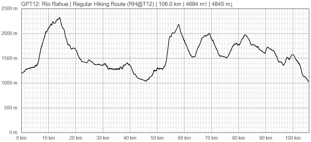
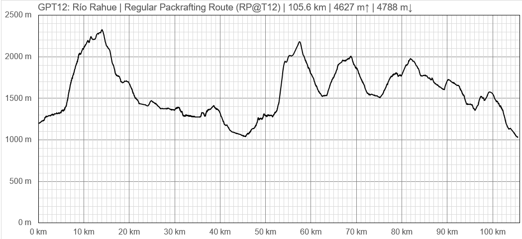
| Distance | 106.0 km | 37 h | 105.6 km | 37 h |
| Direction | Both ↓↑ | Both ↓↑ |
| Comment | - | |
| Status | Published and Verified | |
| Zone | C: Zona Pehuenche | |
| Region | Chile: Araucanía (IX) | |
| Start | Ranquil, Carabineros, (Termas de Pelehue) | |
| Finish | Liucura | |
| Previous Section | Next Section | Alternative Section |
| GPT11 | GPT13 | No |
Section Planning Status
Recommended Travel Period
Benefits of Hiking and Packrafting
Recommended Travel Direction
Section Length and Travel Duration
Section Attractiveness
Section Difficulty
The isolation and the high passes make this a rather difficult but rewarding trail. Good orientational skill are required because hardly any signposts are placed and some parts of the trail are cross country.
The electronic map Topo Chile Deluxe from Garmin shows the contours precisely but some lakes and smaller river are incorrect displayed. Only few trail sections are integrated. Some of the “Alleys” of this electronic map are far off the true position or inexistent. You should use the Greater Patagonian Trail data files for navigation.
Resupply
Resupply Towns at Start, Finish and off Route
Ranquil - no shop but there are families who sold us sopaipillas
Resupply en Route
Access to Route
Bus from Temuco to Liucura every day (on weekdays at 12, sundays at 7.30am and 4pm_ status may 2019), 5 hours of travel
Bus from Ranquil to Lonquimay (on Mon, Wed and Fri at 6.45am from the village, at 6.20am on the road out of the trail approx 15 min of walk from the Carabiñeros)


