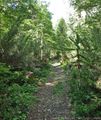
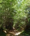
GPT16 - Volcán Quetrupillan

|
|
| |||||||||||||||||||||||||||||||||||||||||||||||||||||
Recent Alerts and Suggestions
All hikers are requested to publish in this chapter obstacle that turned them around or that complicated their hike significant. This shall be done as soon as possible to alert other hikers.
1. Log In on Wikiexplora
2. Click on the [Edit] button after "Recent Alerts and Suggestions"
3. Start with * followed by your name or alias and the event date
4. Describe what route you attempted to travel (regular hiking route, regular packrafting route, a particular option), the travel direction and the obstacle your encountered. If possible provide also a suggestion for other hikers.
- Your name or alias YYYY-MM-DD
Brief description of your attempt, the obstacle and suggestion for other hikers
Section Statistics
| Traversable | Dec - Mar (Conditionally: Nov, Apr) | |
| Packraft | Deployable | |
| Hiking | Packrafting | |
| Attraction | 4 / 5 | No Rating |
| Difficulty | 4 / 5 | No Rating |
| Distance | 67.5 km | 21 h | 66.9 km | 20 h |
| Direction | Both ↓↑ | Both ↓↑ |
| Comment | - | |
| Status | Published and Verified | |
| Zone | C: Zona Pehuenche | |
| Region | Chile: Araucanía (IX) & Los Ríos (XIV) | |
| Start | Currarehue | |
| Finish | Reyehueico | |
| Previous Section | Next Section | Alternative Section |
| GPT15 | GPT17H or GPT17P | No |
Section Planning Status
Recommended Travel Period
Benefits of Hiking and Packrafting
Recommended Travel Direction
Section Length and Travel Duration
Section Attractiveness
Section Difficulty
Resupply
Resupply Towns at Start, Finish and off Route
Resupply en Route
Access to Route
Permits, Entry Fees, Right-of-Way Issues
Regular Route
Regular Hiking Route
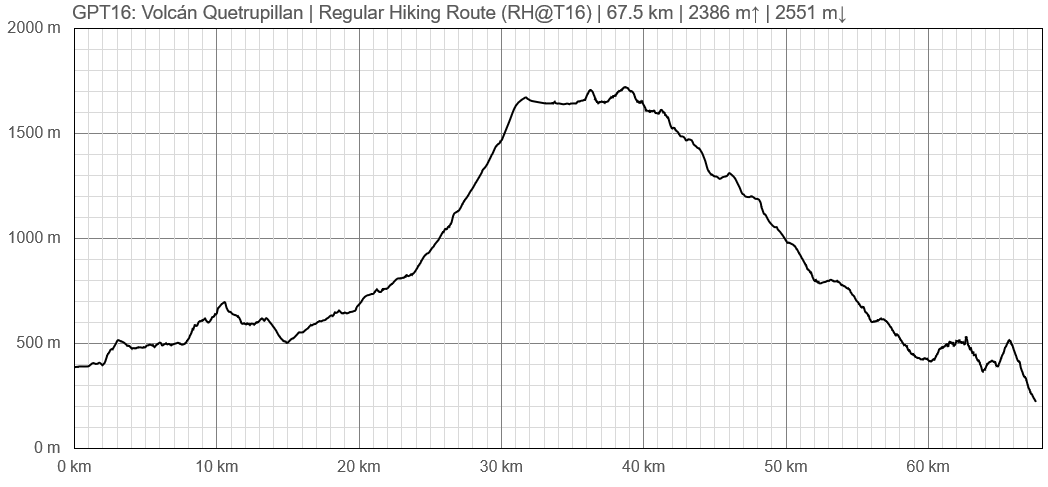
Elevation Profile of Regular Hiking Route
Comments to Regular Hiking Route
Regular Packrafting Route
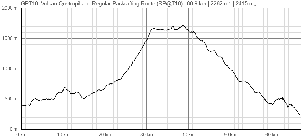
Elevation Profile of Regular Packrafting Route
Comments to Regular Packrafting Route
Optional Routes
Investigation and Exploration Tasks
Images
Related Routes on Wikiexplora
Section Feedback's, Personal Travel Tales and Links to Blogs and Online Publications
All hikers are welcome to add their personal travel story or to place a link to their personal travel blog in this chapter.
Logbook
All hikers are welcome to add themselves to the section Logbook. To add a line in the table:
1. Log In on Wikiexplora
2. Click on the [Edit] button after "Logbook" and scroll down to the end of the window
3. Replace the "|}" at the very end of the table by the following 7 lines and enter your information
|-
| Enter your name or alias
| Enter your start date
| Enter duration in days
| Enter hiking direction
| Comment the chosen route and options
|}
| Name or Alias | Start Date | Duration | Direction | Comments |
|---|---|---|---|---|
| Season 2018/19 | ||||
| Enter your name or alias | Enter your start date | Enter duration in days | Enter hiking direction | Comment the chosen route and options |


