GPT04 - Alto Huemul
De Wikiexplora
This article is just a draft. You can help by expanding and improving its content
| All GPT sections (click to show) |
|---|
|
GPT Section Articles
|
Recent Alerts and Suggestions
Season Section Log
- Start Date: December 20, 2019
- Section: GPT 04 Southbound
- Duration: 3 Days
- Name/Alias: Ian Hikes
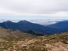
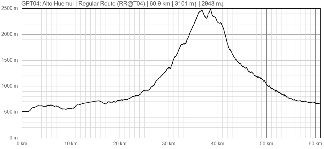
- Overview: If hiking southbound this is the first section where it really starts to get green and the pine trees start to appear more frequently. The first section is dominated by dirt roads with paying campsites, cabins, puestos and other developments. Later you go over a large mountain pass with sweeping views in all direction completely above the tree line. Finally, you follow the valley into Los Quenes which in a nice little town to resupply in. The town has a small supermarket with many food options along with a few restaurants. These include pizza, sandwiches and empanadas. The plaza in the center of town also has free access to WIFI which I used while I was there.
- Difficulties: Exposed mountain pass. Route finding
- Highlights: Sweeping views. High mountain passes and lakes.
- Please feel free to reach out and ask me any questions at Ultratrailca@gmail.com
- 2019-Nov-30 / Martina & Ivo / Regular route southbound
4 days, low water levels, no snow, trails in excellent condition. ...and food and accommodation in Los Queñes :-)
- 2019-Dec-09 / Matus & Anna / Regular route
We started in Las Peñas (we took Uber there from San Fernando). It took us 2 days. Trail is in good condition. Some parts on the descend are slightly overgrown, but still easy to follow. There is enough water on both sides. Accomodation, food and tiendas in Los Quenes.
Summary Table
| GPT04: Alto Huemul | Hiking | Packrafting | |||||
| Group | A: Precordillera | Total | 60.9 km | 21 h | - | - | |
| Region | Chile: O'Higgins (VI) & Maule (VII) | Trails (TL) | 31.0 km | 50.9% | - | - | |
| Start | Aguas Buenas | Minor Roads (MR) | 26.5 km | 43.5% | - | - | |
| Finish | Los Queñes | Primary Roads (PR) | - | - | - | - | |
| Status | Published & Verified | Cross-Country (CC) | 3.4 km | 5.6% | - | - | |
| Traversable | Nov - Mar (Maybe: Oct, Apr, May) | Bush-Bashing (BB) | - | - | - | - | |
| Packraft | Only Burden | Ferry (FY) | - | - | - | - | |
| Connects to | GPT03, GPT05 | Investigation (I) | - | - | - | - | |
| Options | 98 km (2 Options & Variants) | Exploration (EXP) | - | - | - | - | |
| Hiking | Packrafting | Total on Water | - | - | |||
| Attraction | 2 (of 5) | - | River (RI) | - | - | ||
| Difficulty | 3 (of 5) | - | Lake (LK) | - | - | ||
| Direction | Both ↓↑ | - | Fjord (FJ) | - | - | ||
| Comment | - | ||||||
| Character | Semi-Desert, Forest, Alpine Terrain, Mountain Pastures, Farmland, Arrieros | ||||||
| Challenges | Exposure to Elements, Clambering | ||||||


