Diferencia entre revisiones de «GPT25H - Aldea Escolar»
De Wikiexplora
| Línea 17: | Línea 17: | ||
|AltitudMedia= | |AltitudMedia= | ||
|Primer Autor=[[user:Jandudeck|Jan Dudeck]] | |Primer Autor=[[user:Jandudeck|Jan Dudeck]] | ||
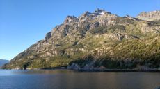
| − | |Imágen Principal= | + | |Imágen Principal=Cerro Situación.Chubut .jpg |
|ComentariosImagen=Cerro Situación, por Jorge Elgueta Chiguay | |ComentariosImagen=Cerro Situación, por Jorge Elgueta Chiguay | ||
|KMLZ=GPT25H - Aldea Escolar.kmz | |KMLZ=GPT25H - Aldea Escolar.kmz | ||
Revisión del 14:17 28 mar 2019
This article is just a draft. You can help by expanding and improving its content
|
| ||||||||||||||||||||||||||||||||||||||||||||||||||||
Section Statistics
Basic statistics
| Traversable | Nov - Apr (Conditionally: Sep, Oct, May) | |
| Packraft | Only Burden | |
| Hiking | Packrafting | |
| Attraction | 1 / 5 | No Rating |
| Difficulty | 3 / 5 | No Rating |
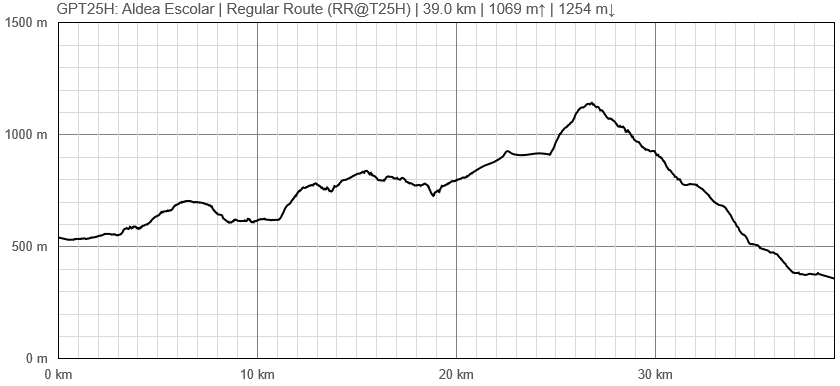
| Distance | 39.0 km | 11 h | 39.0 km | 11 h |
| Direction | Both ↓↑ | Both ↓↑ |
| Comment | - | |
| Status | Published and Verified | |
| Zone | E: Zona Rios y Lagos Argentinos | |
| Region | Argentina: Chubut | |
| Start | Villa Futalaufquen | |
| Finish | Aldea Escolar | |
| Previous Section | Next Section | Alternative Section |
| GPT24H, GPT24P | GPT26 | GPT25P |


