![]()
Greater Patagonian Trail

General Description

To be issued.
.
Images
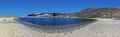
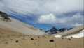
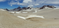
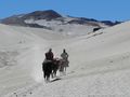
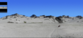
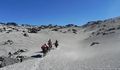
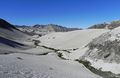
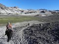
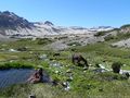
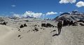
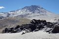
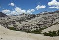
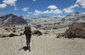
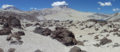
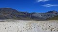
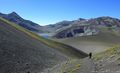
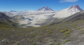
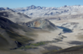
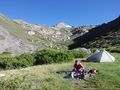
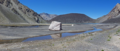
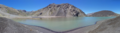
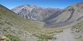
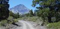
Here you find a selection of images from all 16 sections of the Greater Patagonian Trail.
Trail Sections
The entire trail consists of 16 sections that require between 2 to 10 days each. Every section connects seamless with the following section and starts and ends near a road with public transportation. Therefore each section can be hiked as an individual trail or several sections can be combined to a longer trip.
The sections 2 and 3 can be combined with an lovely optional trial through a pristine area that bypasses the small village and the road at the finish of section 2 and start of section 3. This double section makes a true long distance endurance challange.
| Section Name | Number | Distance | Ascent | Descent | Days | Time |
|---|---|---|---|---|---|---|
| Volcán Descabezado | GPT01 | 103 km | 4970 m ↑ | 4870 m ↓ | 6 - 10 d | 34 h |
| Laguna Dial | GPT02 | 144 km | 5390 m ↑ | 5430 m ↓ | 7 - 10 d | 43 h |
| Volcán Chillan | GPT03 | 129 km | 6420 m ↑ | 5820 m ↓ | 7 - 10 d | 42 h |
| Alternative Long Distance Challange via Las Truchas | GPT02-03 | 279 km | 12710 m ↑ | 12100 m ↓ | 14 - 21 d | 89 h |
| Volcán Antuco | GPT04 | 57 km | 1380 m ↑ | 1770 m ↓ | 3 - 5 d | 15 h |
| Laguna El Barco | GPT05 | 43 km | 1490 m ↑ | 1500 m ↓ | 2 - 4 d | 13 h |
| Guallali | GPT06 | 50 km | 2530 m ↑ | 2270 m ↓ | 3 - 4 d | 17 h |
| Laguna Marinanqui | GPT07 | 82 km | 2870 m ↑ | 3030 m ↓ | 5 - 7 d | 24 h |
| Laguna Icalma and Volcán Sollpulli | GPT08 | 96 km | 2600 m ↑ | 2800 m ↓ | 5 - 7 d | 27 h |
| Curarrehue | GPT09 | 70 km | 1860 m ↑ | 1680 m ↓ | 3 - 5 d | 19 h |
| Volcán Quetrupillan | GPT10 | 59 km | 2080 m ↑ | 2870 m ↓ | 3 - 5 d | 18 h |
| Neltume | GPT11 | 57 km | 950 m ↑ | 570 m ↓ | 3 - 4 d | 14 h |
| Lago Pirihueico | GPT12 | 86 km | 2210 m ↑ | 2720 m ↓ | 4 - 6 d | 24 h |
| Volcán Puyehue | GPT13 | 70 km | 2980 m ↑ | 2700 m ↓ | 4 - 6 d | 22 h |
| Volcán Antillanca | GPT14 | 39 km | 1800 m ↑ | 2040 m ↓ | 3 - 4 d | 13 h |
| Lago Todos Los Santos | GPT15 | 83 km | 2100 m ↑ | 2190 m ↓ | 4 - 6 d | 22 h |
| Cochamo | GPT16 | 145 km | 4850 m ↑ | 4690 m ↓ | 7 - 10 d | 42 h |
| Total | GPT | 1311 km | 46480 m ↑ | 46950 m ↓ | 69 - 103 d | 389 h |
Trail Types
When planning the trip my first choise were hiking or horse trails. Where possible I avoided roads, in particular roads with some traffic. Paved roads were the last choise.
Cross country routes go only through open terrain. In this parts no technical climbing is reuqired and you do not need to cut your way with a manchete though a dense forest.
| Trail Type | Distance | Percentage | Comment |
|---|---|---|---|
| Minor Dirt Road | 532 km | 40.6% | No or light traffic only. Can also be an abandoned road or a private road that is not open for public use. |
| Hiking or Horse Trail | 486 km | 37.1% | Mostly visible trail on any terrain. |
| Lake (Packraft) | 95 km | 7.3% | Alternative options available if not carrying a packraft. |
| Mayor Dirt Road | 83 km | 6.3% | Public dirt roads with moderate traffic. |
| Cross Country | 73 km | 5.6% | Track that pases through open landscape without a visisble trail. |
| To be verfied | 15 km | 1.2% | Remains to be hiked and recorded by GPS to update the trail file. Alternative option available if not in explorers mood. |
| River (Packraft) | 15 km | 1.1% | Alternative options available if not carrying a packraft. |
| Paved Road | 11 km | 0.8% | Only few shorter segments at the start or finish of a sections. |
| Total | 1311 km | 100.0% |
Expected Duration
Hiking the complete trail requires approx. 90 to 120 days. This inculdes some rest days, resupply bus trips to nearby towns and an occasional day lost to bad weather.
Recommended Season
If you plan to hike the entire trail starting with section 1 you should leave within December.
On the first sections several rivers and high passes need to be crossed. In particular high river-water-levels during snowmelt may make the river crossings difficult and dangerous until early December. Therefore leaving before December may put you in risk when crossing rivers and passes. If you leave after December you may be surprised by the heralds of the winter before reaching the finish.
If you do not insist in hiking all trail sections in the correct sequence you have more options when and where to start. If you have a packraft you may in example set out already in late October or November at the start of section 11 in Coñaripe (first packraft section). This also give you the advantage of floating down the river Caucuá with a comfortable high river-water-level during snow melt. Once you reached the finish of section 16 your can travel by bus to the start of section 1 an hike to the point where you started the trip.
Trekking Direction
The generally recommended trekking direction is southbound even if most sections can be hiked in either direction.
Some sections require an entrance permit if you hike northbound. This limitation applies to section 1, 2-3 and 12. Without an entrance permit you may be “kicked out” but if you walk southbound you may be asked to leave the property in the direction that you are hiking anyway.
Also for section 11 the southbound limitation applies but for a different reason. Only in this direction you can float down the river Caucuá with your packraft. If you want to hike section 11 northbound you need to take a rather boring dirt road with moderate traffic.
For section 15 the recommended trekking direction is also southbound. If you go south you can ask shortly before reaching the Lago Todos Los Santos a local settler for a private boat transfer. In the other direction this may not work as easy. So if you do not have a packraft or if you are unsure that you really want to cross such a rather large lake with a tiny boat than hike the section 15 southbound.
Logistical Considerations
Food Supply
There are no proper shops along the first seven sections of the trail. The first regular food store on the trail comes after 600 km at the finish of section 7. But there is a road with public transportation at the end of each section that gives you the opportunity to take a bus and to travel to the next village or town to resupply. A true through-hike would require the setup of food depots on strategic points along the route.
On this trail, in particular on the first seven sections you will meet shepherds on the summer pastures with their annimals (cattle, sheep, goats and horses). Depending on the altutude and the snow melt they migrate up between October and January and return home in April or May. These shepherds, locally called "Postero", live in imporvised permanent shelters, called "Puesto". They bring large quantities of food with their horses and mules up in the mountains. You may ask them for food, in particular for flour and bread or whatever they are willing to sell. If you are desperate for meet they may sell you a goat or a sheep but be aware, the smallest quantity for sale is typically half an annimal. To communicate with the locals you need to be speak Spanish.
On section 5 to 10 you will cross the Araucania region with plenty of impressive Araucaria trees. What we liked on this trees were not just the imposing figure of these living fossiles, but the nutritious fruits rich in carbohydrates. The indigious Pehuenche people teached us how to harvest and prepare this food. You can gather these Araucaria "piñoes" between February and April.
The product range in smaller villages and towns is limited. In particular dehydrated trekking food may not be offered at all. If you prefer to have some special stuff that you find only in Santiago or that you bring with you from overseas you have the following option: You pack a box with food and other gear in Santiago and send the box with one of the mayor bus companies to a town where you plan a resupply stop. To send the box you do not need any address in this town; all you need to do is making yourself the recipient of your own package. The bus company will ship your box to this town in 1 or 2 days and store it until you pick it up (storage of up to 30 days is free of charge). There you can take out of your box whatever you need and resend the box to the next resupply town.
Visa
As a non-Chilean tourist with a regular tourist visa you can stay up to 90 days in Chile. The easiest way to renew your visa is travelling to Argentina before you complete your 90 days and return a few days later to Chile. On re-entry you will normally be granted another 90 days.
Recommended Equipment
GPS and Electronic Map
To be issued.
Solar Charger
To be issued.
Packraft
A packraft is a light-weight inflatable boat designed to be carried in the backpack when not needed but to carry the backpacker and his backpack over lakes and rivers when he needs it. A packraft is recommended for sections 10, 11, 12, 13, 15 and 16.
Here you find some images of our packraft.
The packraft made our trip much more diverse. It was so great to walk to the shore of a lake or river, take the backpack down, inflate the boat, store the gear, take a seat and row off.
At the two larger lakes you can alternatively take a daily ferry (Lago Pirihueco) or a private boat transfer (Lago Todos Los Santos). For all other lakes and rivers alternative trails, that circumvent the water are included in the GPS File for Trekking below. So you can bypass on food all water sections if you do not have a packraft or if wind and weather does not permit the crossing of a lake with a rather tiny boat.
Dangers and Annoyances
To be issued.
GPS File for Trekking
The KMZ file displayed on the satellite map above is optimized to provide a good overview but does not include waypoints and detailed information for hiking. Therefore the file below should be downloaded and used if you actually plan to hike a section or the entire Greater Patagonian Trail.
The file is organized in folders and subfolders for a better overview in particular when viewing and organizing the trail on a computer. There is one folder for each section and each section contains a subfolder for waypoints and a subfolder for tracks.
Waypoints
The waypoints are named with the item of interest at the waypoint. A running number is added in brackets to be able to refer in the trail description to specific waypoints. The GPS normally displays the entire waypoint name.
| Item | Comment |
|---|---|
| Border | Point where the trail crosses the actual border between Chile and Argentina. The border control is typically in a different location. |
| Border Control | Location where the police performs the exit and entry control. If you plan to cross the border you need to actively seek the police at the border control. You will not be given an entry step without getting the exit stamp first. |
| Bridge | Pedestrian or vehicle bridge. May be in poor state. |
| Bus Stop | Marked or unmarked bus stop. In most places buses will stop at any location if you clearly signal the driver that want to take a ride. Ask locals for the bus frequency and times. |
| Cable Car River Crossing | At larger rivers that cannot be crossed by food cable cars may be installed. Ask the locals how to operate the cable car to cross the river. |
| Camp | Location suitable for camping. If not stated otherwise water and fire wood is available nearby. |
| Carabineros | Chilean local police. To control the border small partly improvised police posts are setup and manned during the summer in remote areas. Whenever you reach such a police post report to them and explain your plans. We were always treated very nicely. |
| CONAF | Corporación Nacional Forestal. Conaf is the governing body of all National parks of Chile, including those without forest or major vegetation. |
| Diversion | Location where the trails splits or where attention is needed to no miss the correct trail. |
| Ferry | Public ferry. |
| Food | Location where you may get food or a meal. |
| Gate | Gate that may be locked. We several times climbed over such gates. |
| Hot Spring | Natural geothermal hot spring. |
| Hotel | There are not many hotels along the trail so if you get there is rare opportunity to pamper yourself. |
| Lake | Fresh water lake. |
| Lodging | Accommodation of any type that is not a hotel. May be a simple room in a private house with a family (hospedaje familiar) or a bungalow (cabaña). |
| Mini Shop | Small shop or kiosk with a limited product range. If closed ask at the houses nearby for attention. |
| Pass | Mountain pass. The pass elevation is normally added. |
| Puesto | Improvised shelter or house in a remote area that is temporary used during the summer. If locked do not enter except in emergencies. If open you may use the shelter if needed with the appropriate respect. |
| Refuge | Shelter that is open for public use. |
| Restaurant | Restaurant but not expect a sophisticated cuisine but a meal that fills. |
| River Crossing | River crossing without a bridge or a cable car. Water levels may change significant with snow melt, rain and daytime. If the river is feed by snowmelt water levels are normally lowest in the morning. Since rivers can change their bed look for the optimal spot where to cross and do not rely on the waypoint but your own judgment. |
| Sea | Access to the sea. |
| Settlement | Group of permanently inhabited houses. |
| Settler | Single permanently inhabited house. |
| Shop | Shop with a wider product range. If closed ask at the houses nearby for attention. |
| Start | Starting point of a section. |
| Summit | Summit of a volcano along the trial that can be climbed on an optional side trip. |
| Trail Head | Location where a trail starts on a road. Attention is needed to no miss this trail. |
| w/o Water | Camp or Puesto without drinking water near by. If you plan to camp at such a location you should carry sufficient water for one night. |
| w/o Wood | Camp or Puesto without drinking fire wood. If you plan to camp at such a location you should either carry a camping stove or sufficient fire wood for one night. |
| Water | Location where you can get drinking water. The water may need to be filtered, boiled or chemically treated to be fit for drinking. |
| $ | Camp or Hot Spring where you need to pay. |
| ? | Not verified waypoint. The unconfirmed waypoints are based on satellite images, maps or tales from locals. Whenever you can confirm or correct such a waypoint, you are welcome to send the waypoint with a comment to the author of this trail for update of the GPS File. |
Example waypoint name: “Start (GPT01-WP001)”
- Start: Item of interest, in this case the start of section 1
- GPT: Greater Patagonian Trail
- 01: Section 1
- WP: Waypoint
- 001: Running number
Tracks
The track of each section is broken into smaller segments to differentiate between different trail types. Each section consists of up to 20 such trail segments.
Used trail types are:
| Trail Type | Number/Letter | Comment |
|---|---|---|
| Cross Country | 0 | Track that pases through open landscape without a visisble trail. |
| Hiking or Horse Trail | 1 | Mostly visible trail on any terrain. |
| Minor Dirt Road | 2 | No or light traffic only. Can also be an abandoned road or a private road that is not open for public use. |
| Mayor Dirt Road | 3 | Public dirt roads with moderate traffic. |
| Paved Road | 4 | Only few shorter segments at the start or finish of a sections. |
| Lake (Packraft) | L | Alternative options available if not carrying a packraft. |
| River (Packraft) | R | Alternative options available if not carrying a packraft. |
| Sea (Packraft) | S | Alternative options available if not carrying a packraft. |
| Ferry | F | Alternative ferry over lakes if not carrying a packraft. |
| To be verfied | ? | Remains to be hiked and recorded by GPS to update the trail file. Alternative option available if not in explorers mood. |
| Options and Alternatives | X | A "-X" is added to the track name for optional side trips or alternatives i.e. trails around lakes. |
Example track name: "GPT01-TR006-1"
- GPT: Greater Patagonian Trail
- 01: Section 1
- TR: Track
- 006: Running number
- 1: Trail type, in this exmaple its a hiking trail or horse trail
A "X" is added to the track name for optional side trips or alternative trails.
Example track name: "GPT01-TR007-0-X"
The "X" at the end means that this is an optional side trip. In this example its the optional climb to the summit of the volcano Descabezado Grande.
Distances, Ascent, Descent and Walking Time
This trail description contains plenty of numbers for distances, altitudes, ascents, descents and even walking times. All these numbers are based on the "cleaned" GPS track without our occasional seek and search detours. Also all altitudes, ascents and descents are based on a digital map with a quite precise altitude profile.
These numbers are therefore also free of accumulated "GPS noise" and "barometric altimeter noise" that increase the measured distances, ascents and descents when recording the track by GPS while hiking. So, don't be surprised if your GPS will always indicate longer distances, more ascents and decents even if you stay on the trail. A deviation of 10% is typical.
The walking times provided here are estimated moving times without any breaks and rests. When evalutating our GPS records I was surprised that we did not move nearly one third of the time between leaving the camp in the morning and stopping again in the evening. It did not appear to us that we make such long breaks but the GPS record does not lie. So a walking time of 6 hours means more or less a 9 hour hiking day adding normal breaks to to eat, take pictures, verify navigation, chating with the locals on the trail or harvesting some piñoes.
The estimated walking time is calculated purely based on distances, ascents and descents. I opted to use such a calculation because it removes the unnecessary seek and search detours and the factor of having a good day or a bad day. I developed and verified this calculation method based on all our GPS records and was surprised myself that such a simplified calculation provides quite reliable estimates. The calculated times correspond closely with our actual walking time. If applied to our actual GPS records the average deviation per day is 15 minutes and never more than 50 minutes.
The used calculation factors are:
- 12:23 minutes per km (corresponds with 4.8 km/h on a level trail)
- 11:26 minutes per 100 m ascent
- 3:44 minutes per 100 m descent
These factors resulted in the smallest average deviation to our actual moving time.
Verifications, Additional Options and Extensions
Verifications
The GPS File for Trekking above contains a few not verified track and waypoints because we did not hike all the options and alternatives. This unconfirmed tracks and waypoints are based on satellite images, maps or tales from locals and have a question mark “?” in the name. So you know on what items you can rely on and where your explorer’s skills are needed. Tracks that need to be explored can also be recognized on unnatural straight lines.
Whenever you walk such a not verified trial, you are welcome to record the trail by GPS and send the file with a comment to the author of this trail for update of the GPS File.
Additional Options
If you know a better or simply an interesting alternative trail, that fits well into this Greater Patagonian Trail you are invited to be become co-author by sending your proposal with a GPS File to me. I will review it and incorporate it in the master file. This applies also to helpful new waypoints.
Extensions
This trail is not finished yet. There is plenty of terrain left till this trail finally reaches the southern tip of Patagonia and ends either on the shores of the Magellan street or even on Tierra del Fuego. So, if you hiked a section that extends this trail further south or that simply covers an area that is not included yet you are more than welcome to become a co-author by contributing your trail.
The trail should get you further south on a route that is worthwhile hiking. It should consist mainly of horse trails or minor dirt road with no or insignificant traffic. Walking i.e. long distances on the Careterra Austral seams not tempting to me. If I take the Careterra Austral, than I rather do it by bicycle.
The route should be passable without a manchete, technical climbing or superman skills. Cross country through of an open landscape is great but I do not want to fight me tree by tree through dense tampered rainforest.
It does not matter at all if the trail is on the Argentine side or the Chilean side as long as it does not depend on clandestine border crossings. If you get catched in particular by the Chilean carabiñieros without a valid stamp you may get expelled and this makes not a nice finish of such a trip.
Creation of the Greater Patagonian Trail
To be issued.
Section 1: Volcán Descabezado
- Duration: 6 to 8 days
- Distance: 103 km
- Ascent: 4970 meters ↑
- Descent: 4870 meters ↓
- Option 1: Climb to the summit of the volcano Descabezado Grande
- Duration: 1 to 2 days
- Distance: 16 km
- Ascent: 2030 meters ↑
- Descent: 2030 meters ↓
- Option 2: Explore to hidden lakes
- Duration: ½ to 1 day
Summary
The first stage of the Greater Patagonian Trail gets you right into a mind-blowing volcanic theatre. The landscape is transformed by numerous powerful eruptions of the volcano Descabezado Grande and it’s equally potent smaller brothers in the surrounding. During the last major outbreak in 1932 the Quizapu; a parasitic crater 6 km south of the main crater; vomited an estimated 25 cubic kilometer of lava and volcanic ash.
After leaving the forest you will step through endless fields of pumice, climb three passes and cross a 4 km wide lava river. The struggle is rewarded with amazing outlooks, deep blue lakes and lagoons that suddenly pop in a surreal scenery and two thermal springs. Here you can soak up heat during a freezing night while admiring a sky full of stars. You can even cook your meal on one of the hot steam vents.
As an option your may climb to the 3900 m high summit of the “Great Decapitated”; this is what Descabezado Grande means. It’s a demanding long but technically uncomplicated ascent.
You can also explore two hidden lagoons; one that fills an ancient crater and a second one that was dammed up by another smaller volcano. Both lakes are not far of the trail near a scenic camp site.
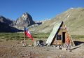
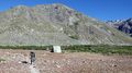
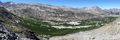
Images
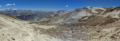
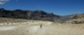
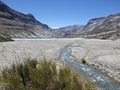
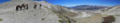
Here you find a selection of images of section 1 of the Greater Patagonian Trail.
Expected Duration
The trail can be hiked in 6 days but plan some contingency in case of bad weather or if you suddenly fall in love with one of the amazing places on the route. If the climate does not favor you, than you should not attempt to cross the passes. In this region bad weather normally does not last long so you are probably better off siting out a bad day.
If you are tempted to get up to the summit of the Descabezado Grande (GPT01-WP028) add two more days. The climb can be done in one long day or split up in two days when camping one night a bit further up.
Recommended Season
This traverse is best be hiked between December and April. After a mild winter with less snow than usual you may already set out in November but be aware that some rivers may be impassible high during snowmelt (in particular GPT01-WP018 and GPT01-WP019). If you plan to get up to the summit of the Descabezado Grande without carrying crampons you should have better chances at the end of December or later when most of the snow is gone.
Trekking Direction
The treck can be hiked in either direction but doing it from South to North requires an entrence permit from the hydropower station Cipreses (See Permits and Entrance Fees). Therefore southbound is the recommended direction.
Permits and Entrance Fees
CONAF does register all trekkers at Parque Ingles (GPT01-WP004) but does not charge an entrance fee. Camp fires are not permitted within the national park that reaches from Radal (GPT01-WP001) to the Laguna las Ánimas (GPT01-WP013).
If you want to see the cascades Siete Tazas about 7 km after the start in Radal you are charged a rather high entrance fee depending if you are a national or a foreign tourist. If you don’t want to spend the money and the time don’t worry; you will see plenty more cascades for free on the Greater Patagonian Trail.
If you wish to hike this trail in reverse from South to North you need to request a entrence permit in advance from the hydropower station Cipreses. If you hike the trail as described from North to South you will enter the property “from behind” without noticing it. Once you reach one of the permanentely manned gates they can’t send you back over the mountains but need to let you leave the compound. In contrast, if you try to enter without a permit you are probably turned back.
Inhabitation and Tourism
The last settlement on the trail is Parque Ingles about 10 km after Radal. This is also the last opportunity to spoil yourself with a good meal in a restaurant and to buy some goodies. On the trail that follows are only two occasionally used puestos; one at the Termas de Azufre (GPT01-WP020) and a second one at the Base Camp Descabezado Grande (GPT01-WP024). The first 20 km from Radal to El Bolson are a popular hiking destination for national tourists. Some go up to the Laguna las Ánimas but few continue beyond this point.
The Base Camp Descabezado Grande is frequently visited by national and international tourists coming from Vilches Alto. Also horseback tours often stop and rest here.
Hardly any hikers take the scenic trail from the Base Camp Descabezado Grande via the Laguna Caracol to the hydropower station Cipreses. It’s a hidden gem.
Food Supply
You need to carry all the food for the entire trail. There is no food supply after Parque Ingles. If you meet arrieros at one of the Puestos you may ask for some goat or lamb meet but if you are not ready to take an entire or at least half an animal they may be reluctant to sell.
Water Supply
Refill your water supply at the marked river crossings and the camps. In between these waypoints your will find only ocasinally some trinking water because water trickles away easily into the volcanic soil. Drinking the water of the hot springs is not recommended because it can upset your stomach. Better take fresh water from the river or a cold spring nearby.
When climbing the Descabezado Grande take plenty of water from the base camp in particular if you plan to spend one night higher up. You may refill your supplies with snow near the summit.
Maps
The electronic map Topo Chile Deluxe from Garmin shows the contours precisely but some lakes and smaller river are incorrect displayed. Only few trail sections are integrated. Some of the “Alleys” of this electronic map are far off the true position or inexistent. You should use the Greater Patagonian Trail data files for navigation.
The paper trekking map “Condor Circuit” with a scale of 1:50’000 shows the trail from Parque Ingles to the Base Camp Descabezado Grande. This map is a useful supplement to the electronic map in particular if you need to abort the trip. In this case this map can guide on the shortest possible trail out of this isolated volcanic area i.e. to Vilces Alto.
Difficulty
The isolation and the high passes make this a rather difficult but rewarding trail. Good orientational skill are required because hardly any signposts are placed and some parts of the trail are cross country.
Access to Start
The trail starts in the tiny village Radal near the cascade "Siete Tazas".
During the main season in January and February several buses go from Molina and Curico to Radal and some even go all the way to Parque Ingles. Outside of the main season there is only one daily bus from Molina to Radal leaving in the afternoon from the rural bus station in Molina.
Return from Finish
This trail section finished at the Route 115 to Talca.
All spring and summer run four buses per day on the route 115 between La Mina and Talca. La Mina is about 4 km up the road from the hydropower station Cipreses. In La Mina is the Chilean border control post and a thermal spring. Simply wait at the main road at one of the unmarked bus stops for the bus to Talca and call the attention of the bus driver when he approaches (GPT01-WP043 or GPT01-WP045). You may also try to hitchhike.
From where to return best depends if you want to connect with the next section of the Greater Patagonian Trail without leaving any gap. If you insist on hiking every step of the trail you should take the bus stop at the El Melado junction (GPT01-WP043). At this junction starts the section 2 of this long distance trail.
If you don’t mind to skip the less atractive 10 km streach along the Maule River then you can go straight to the Route 115 and take the closest bus stop (GPT01-WP045). You may also try to get a lift with one of the hydropower station workers from main gate to Talca or to San Clemente (GPT01-W044). From San Clemente leave frequent minibuses to Talca.
Suggested Stages
| Stage | Days | Stage End Point | Stage End Waypoint | Distance | Ascent ↑ | Descent ↓ | Time |
|---|---|---|---|---|---|---|---|
| A | 1 | (Start to) El Boslon | Refuge (GPT01-WP011) | 20 km | 1180 m | 140 m | 06:10 |
| B | 1 | Laguna Mondaca | Camp (GPT01-WP016) | 16 km | 1000 m | 1210 m | 05:20 |
| C | 1 | Termas de Azufre | Hot Spring, Camp & Puesto (GPT01-WP020) | 8 km | 690 m | 180 m | 03:00 |
| D | 1 | Base Camp Descabezado Grande | Camp & Puesto (GPT01-WP024) | 19 km | 920 m | 1010 m | 06:00 |
| E | 1-2 | Optional: Climb to Summit Descabezado Grande | Camp & Puesto (GPT01-WP024) | 16 km | 2030 m | 2030 m | 08:00 |
| F | 1-2 | Laguna Hornitos and optional side trip to hidden lakes | Camp (GPT01-WP036) | 16 km | 1010 m | 900 m | 05:40 |
| G | 1-2 | Finish | Bus Stop (GPT01-WP043) or Bus Stop (GPT01-WP045) | 25 km | 170 m | 1430 m | 06:00 |
Stage A: Start to El Bolson
If you leave in the morning in Radal you can reach in one day the camp and refuge El Bolson. Parque Ingles is a good place for a lunch break.
Stage B: El Boslon to Laguna Mondaca
From El Bolson you get in one day to the Laguna Mondaca. If you partition this stage differently be aware that there are no inviting camp sites between the Laguna las Ánimas and the Laguna Mondaca. This stage should not be attempted in bad weather.
Stage C: Laguna Mondaca to Termas de Azufre
Going from the Laguna Mondaca to the Termas de Azufre makes a short relexing day and gives you pleanty of time to enjoy Laguna Mondaca in the morning before leaving and the hot springs in afternoon and evening when arriving. If the sulfor smell at the hot spring bothers you, than you can camp on one of the meadows a bit further up.
Stage D: Termas de Azufre to Base Camp Descabezado Grande
The rather long day hike from the hot springs to the base camp Descabezado Grande requires reasonable good weather as you cross a 2700 m pass.
Optional Stage E: Summit Descabezado
The climb can be done in one day or split up in two. The disavantage of doing it in two days is the leak of a reliable water supply further up towards the summit once the snow is gone. If you do the climb in one day you may desire a rest day either before or after the climb. An extra day gives you also a buffer if the weather is not optimal for an ascent.
Stage F: Base Camp Descabezado Grande to Laguna Hornitos
This stage can be hiked in one day. Alternatively you may partition this stage in two if you want to explore the hidden lakes after the Laguna Caracol or if you simply need a more relaxing day after you got up to the summit of the Descabezado Grande. There is a suitable camp site about 2 km after the Laguna Caracol in a wide open treeless valley. The pass between this camp site and the Laguna Hornitos should not be done in poor weather.
Stage G: Laguna Hornitos to Finish
From the Laguna Hornitos you can walk in one short day to the hydropower station Cipreses and the first bus stop on the Route 115. To the regular finish at the second bus stop on the Route 115 it’s a rather long day. If you do not want to arrive in Talca late in the evening you may opt to camp near the finish on the banks of the river Maule and take the a bus in morning.
Waypoints
| Waypoint Name and Waypoint Code | Comment |
|---|---|
| Start (GPT01-WP001) | Start in Radal at final bus stop. Only in January and February some busses continue to Parque Ingles. |
| Shop (GPT01-WP002) | Small shop with basic supplies in Radal. Good to get a beer and some extra goodies for the night but not to supply you for the trip. |
| Camp $ (GPT01-WP003) | Nice, reasonable priced camp site in Radal. Recommen¬ded place for the first night if arriving in the evening. |
| Shop & Restaurant (GPT01-WP004) | Parque Inglés with kiosk and a cosy restaurant about 10 km after the starting point. Last chance to enjoy the pleasures of civilisation before heading into the wilderness. |
| Diversion, CONAF & Camp $ (GPT01-WP005) | The hiking trail starts left. You should register at the CONAF office. There is a camp site nearby. |
| River Crossing (GPT01-WP006) | Easy river crossing. |
| River Crossing (GPT01-WP007) | Easy river crossing. |
| River Crossing (GPT01-WP008) | Easy river crossing. |
| River Crossing (GPT01-WP009) | Easy river crossing. |
| Camp (GPT01-WP010) | There are some nice camp sites on the meadows of El Bolson. Inside the national park CONAF does not permit camp fires. |
| Refuge (GPT01-WP011) | Basic refuge in El Bolson that can shelter for up to 4 persons. |
| Pass 2260 m (GPT01-WP012) | First pass with nice view back into the Valle del Indio. After this pass comes a 2 km levelled section before ascending to the second pass. |
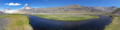
| Lake (GPT01-WP013) | Laguna Las Ánimas. You may camp at the lake but there is little shelter from wind. |
| Water (GPT01-WP014) | Clear fresh water. |
| Pass 2560 m (GPT01-WP015) | Second pass with nice view towards Laguna Mondaca. |
| Camp (GPT01-WP016) | Probably the best camp spot near Laguna Mondaca with water, fire wood and some wind protection. |
| Lake (GPT01-WP017) | Laguna Mondaca. |
| River Crossing (GPT01-WP018) | Difficult river crossing during snowmelt and after heavy rain. The river often changes it's bed therefore look for the optimal place to cross. Yon need to cross the river to avoid rocky terrain ahead. |
| River Crossing (GPT01-WP019) | Difficult river crossing during snowmelt and after heavy rain. The river often changes it's bed therefore look for the optimal place to cross. |
| Hot Spring, Camp & Puesto (GPT01-WP020) | Termas de Azufre. Excellent hot spring with several small pools. You may need to adjust the temperature by regulating the hot water inlet flow. No fire wood but you may heat water and food at the hot steam vents (follow the noise). Good camp site if you tolerate the sulphur smell. The posteros arrive in January. |
| River Crossing (GPT01-WP021) | Moderate difficult river crossing. Yon need to cross the river to avoid steep loose pumice fields ahead. |
| River Crossing (GPT01-WP022) | Easy river crossing. |
| Pass 2700 m (GPT01-WP023) | The highest point of the entire Greater Patagonian Trail (apart from the summit of the Descabezado Grande). |
| Camp & Puesto (GPT01-WP024) | Base Camp Descabezado Grande. Probably the best camp spot in this area. You best take water from the spring on the right side of the river about 20 to 30 m from this waypoint. Frequently visited area. Base camp for climbing the Volcan Descabezado. Basic stone shelter occasionally used by local posteros and horseback guides. |
| Hot Spring (GPT01-WP025) | One lukewarm pool at the Base Camp Descabezado Grande. |
| Water ? (GPT01-WP026) | Possible access to water on the way to the summit. May be unreliable and depending on snowmelt. Please verify and report to trekking guide author. |
| Cross (GPT01-WP027) | Cross near the summit. |
| Summit 3900 m (GPT01-WP028) | Summit of the Descabezado Grande. |
| River Crossing & Camp (GPT01-WP029) | Astonishing oasis in the middle of a volcanic desert. Good camp site with water, fire wood and wind protection. |
| Lake (GPT01-WP030) | Nearly 3 km long drainless lake Laguna Caracol in the middle of pumice and lava. |
| Lake (GPT01-WP031) | Hidden lake in volcanic crater that can be seen from the next pass. |
| Camp (GPT01-WP032) | Camp site without fire wood and wind protection. Water is probably best taken from the spring 300 m upstream. |
| Water (GPT01-WP033) | Clear fresh water spring. |
| Lake (GPT01-WP034) | Hidden lake that can be seen from the next pass. |
| Pass 2540 m (GPT01-WP035) | Pass with impressive view. |
| Camp (GPT01-WP036) | Probably the best camp site in this area and the only one with a meadow. Sufficient water and fire wood. The lake further down is dusty and without fire wood. |
| River Crossing (GPT01-WP037) | Easy river crossing. |
| Lake (GPT01-WP038) | Laguna Hornitos that is dammed up by the Crater Hornitos. You can easily ascent to the summit of the crater (60 m climb). |
| Trail Head (GPT01-WP039) | Trail head (or end). Turn right onto the hydropower station road. |
| Water ? (GPT01-WP040) | Possible access to water. |
| Gate (GPT01-WP041) | Unmanned gate that may be locked. Pedestrians may pass on the right side of the gate if locked. |
| Gate ? (GPT01-WP042) | Gate of hydropower station that was not used by trekking guide author. Please verify and report to author. You probably can leave anytime but you need a permit from the hydropower station for entering. |
| Bus Stop (GPT01-WP043) | Unmarked bus stop on the Route 115 to Talca. |
| Gate (GPT01-WP044) | Manned main gate of hydropower station Cipreses. You can leave anytime but you need a permit from the hydro¬power station for entering. You may ask the leaving employees for a ride to Talca. |
| Bus Stop (GPT01-WP045) | Unmarked bus stop on the Route 115 to Talca. |
Start (GPT01-WP001): Start in Radal at final bus stop. Only in January and February some busses continue to Parque Ingles.
Shop (GPT01-WP002): Small shop with basic supplies in Radal. Good to get a beer and some extra goodies for the night but not to supply you for the trip.
Camp $ (GPT01-WP003): Nice, reasonable priced camp site in Radal. Recommen¬ded place for the first night if arriving in the evening.
Shop & Restaurant (GPT01-WP004): Parque Inglés with kiosk and a cosy restaurant about 10 km after the starting point. Last chance to enjoy the pleasures of civilisation before heading into the wilderness.
Diversion, CONAF & Camp $ (GPT01-WP005): The hiking trail starts left. You should register at the CONAF office. There is a camp site nearby.
River Crossing (GPT01-WP006): Easy river crossing.
River Crossing (GPT01-WP007): Easy river crossing.
River Crossing (GPT01-WP008): Easy river crossing.
River Crossing (GPT01-WP009): Easy river crossing.
Camp (GPT01-WP010): There are some nice camp sites on the meadows of El Bolson. Inside the national park CONAF does not permit camp fires.
Refuge (GPT01-WP011): Basic refuge in El Bolson that can shelter for up to 4 persons.
Pass 2260 m (GPT01-WP012): First pass with nice view back into the Valle del Indio. After this pass comes a 2 km levelled section before ascending to the second pass.
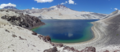
Lake (GPT01-WP013): Laguna Las Ánimas. You may camp at the lake but there is little shelter from wind.
Water (GPT01-WP014): Clear fresh water.
Pass 2560 m (GPT01-WP015): Second pass with nice view towards Laguna Mondaca.
Camp (GPT01-WP016): Probably the best camp spot near Laguna Mondaca with water, fire wood and some wind protection.
Lake (GPT01-WP017): Laguna Mondaca.
River Crossing (GPT01-WP018): Difficult river crossing during snowmelt and after heavy rain. The river often changes it's bed therefore look for the optimal place to cross. Yon need to cross the river to avoid rocky terrain ahead.
River Crossing (GPT01-WP019): Difficult river crossing during snowmelt and after heavy rain. The river often changes it's bed therefore look for the optimal place to cross.
Hot Spring, Camp & Puesto (GPT01-WP020): Termas de Azufre. Excellent hot spring with several small pools. You may need to adjust the temperature by regulating the hot water inlet flow. No fire wood but you may heat water and food at the hot steam vents (follow the noise). Good camp site if you tolerate the sulphur smell. The posteros arrive in January.
River Crossing (GPT01-WP021): Moderate difficult river crossing. Yon need to cross the river to avoid steep loose pumice fields ahead.
River Crossing (GPT01-WP022): Easy river crossing.
Pass 2700 m (GPT01-WP023): The highest point of the entire Greater Patagonian Trail (apart from the summit of the Descabezado Grande).
Camp & Puesto (GPT01-WP024): Base Camp Descabezado Grande. Probably the best camp spot in this area. You best take water from the spring on the right side of the river about 20 to 30 m from this waypoint. Frequently visited area. Base camp for climbing the Volcan Descabezado. Basic stone shelter occasionally used by local posteros and horseback guides.
Hot Spring (GPT01-WP025): One lukewarm pool at the Base Camp Descabezado Grande.
Water ? (GPT01-WP026): Possible access to water on the way to the summit. May be unreliable and depending on snowmelt. Please verify and report to trekking guide author.
Cross (GPT01-WP027): Cross near the summit.
Summit 3900 m (GPT01-WP028): Summit of the Descabezado Grande.
River Crossing & Camp (GPT01-WP029): Astonishing oasis in the middle of a volcanic desert. Good camp site with water, fire wood and wind protection.
Lake (GPT01-WP030): Nearly 3 km long drainless lake Laguna Caracol in the middle of pumice and lava.
Lake (GPT01-WP031): Hidden lake in volcanic crater that can be seen from the next pass.
Camp (GPT01-WP032): Camp site without fire wood and wind protection. Water is probably best taken from the spring 300 m upstream.
Water (GPT01-WP033): Clear fresh water spring.
Lake (GPT01-WP034): Hidden lake that can be seen from the next pass.
Pass 2540 m (GPT01-WP035) : Pass with impressive view.
Camp (GPT01-WP036): Probably the best camp site in this area and the only one with a meadow. Sufficient water and fire wood. The lake further down is dusty and without fire wood.
River Crossing (GPT01-WP037): Easy river crossing.
Lake (GPT01-WP038): Laguna Hornitos that is dammed up by the Crater Hornitos. You can easily ascent to the summit of the crater (60 m climb).
Trail Head (GPT01-WP039): Trail head (or end). Turn right onto the hydropower station road.
Water ? (GPT01-WP040): Possible access to water.
Gate (GPT01-WP041): Unmanned gate that may be locked. Pedestrians may pass on the right side of the gate if locked.
Gate ? (GPT01-WP042): Gate of hydropower station that was not used by trekking guide author. Please verify and report to author. You probably can leave anytime but you need a permit from the hydropower station for entering.
Bus Stop (GPT01-WP043): Unmarked bus stop on the Route 115 to Talca.
Gate (GPT01-WP044): Manned main gate of hydropower station Cipreses. You can leave anytime but you need a permit from the hydro¬power station for entering. You may ask the leaving employees for a ride to Talca.
Bus Stop (GPT01-WP045): Unmarked bus stop on the Route 115 to Talca.
Tracks
GPT01-TR001-2: Take the public gravel road from Radal to Parque Ingles. Only few vehicles use this road but traffic increases in January and February.
GPT01-TR002-1: The track starts left at the entrance of Parque Ingles. The national park trail from Radal to El Bolson is well main¬tained and clearly visible with some signposts and marks. After El Bolson the trail occasionally splits and peters out so try to follow the GPS trek when in doubt until reaching the 2560 m high pass. At the pass do not descent the well visible trail that keeps right but follow the GPS trek that descents directly towards the Laguna Mondaca. During the descent the trail is partially only vaguely visible.
GPT01-TR003-0: From the camp side (GPT01-WP016) you can cross the vast sediment field to the Laguna Mondaca.
GPT01-TR004-1: Return 1.4 km on the same trail as you arrived.
GPT01-TR005-0: Cross the pumice field and look for a suitable location to cross the smaller valley ahead. There is not trail clearly visible nor required. Keep going over the pumice and sediment field until reaching the first challenging river crossing (GPT01-WP018). The river seams to change frequently its bed so look yourself for a suitable location to cross the river and do not trust on the waypoint. Continue on the sediment field until the second crossing (GPT01-WP019). Look again for a suitable location to cross the river yourself. After the second river crossing you need to head up the ridge in front of you. The first few meters of the trail on this ridge were lost during a recent landslide. Therefore you need to find your way up to ridge and trail yourself.
GPT01-TR006-1: Follow the generally well visible trail until reaching the hot springs (GPT01-WP020). Continue on this trail until getting to the river crossing (GPT01-WP021). Do not evade the river crossing by continuing on the trail on the same side. This trail will later disappear in a steep pumice slope. Follow the mostly well visible trail on the other side until crossing the river again (GPT01-WP022). The trail now rises to the 2700 m high pass and slowly descents after the pass. The generally well visible trail will lead you eventually to the base camp of the Descabezado Grande. If you want to make a campfire you may collect some firewood in the sediment field starts about 1 km before the camp. There is little firewood at the camp.
GPT01-TR007-0-X: Several trails lead up to the summit of the Descabezado Grande. During the ascent you should generally prefer the the more solid rocky parts. During the descent the loose pumice fields allow you to slide down with less effort.
GPT01-TR008-1: A good trail heads into the 4 km wide lava river. You need to leave the main trail at the oasis in the middle of the lava flow after crossing the small river (GPT01-WP029). Get up the hillside towards your left. A vaguer trail continues through the remaining lava field to the Laguna Caracol. Pass the Laguna Caracol on the right side and follow the meandering river the feed the lake. After the spring of this river turn left and cross the wide open area. Here the trail peters out until the trail forms again at the ascent towards the pass (GPT01-WP035). Just before the pass leave the main trail and follow the GPS track towards the left.
GPT01-TR009-0: From the pass (GPT01-WP035) several vague tracks lead down. You may either look for the regular trail or follow the GPS track. The GPS track keeps on the left until it descents in a steep pumice slope towards the river. Here the GPS track joints the regular trail.
GPT01-TR010-1: The trail continues on the left side of the river until reaching the Laguna Hornitos. The trail crosses the river in a wide sediment field. Pass the lake and the crater Hornitos on the right and decent until reaching the hydropower station road in the valley far down.
GPT01-TR011-2: Follow the rarely used gravel road towards the hydropower station Cipreses. Once you reach the now unpopulated settlement you have to choose between two options.
GPT01-TR012-2: Option 1: You can take the 10 km dirt road to the regular trail section end where the next part of the Greater Patagonian Trail starts. This gets you to the more distant bus stop (GPT01-WP043).
GPT01-TR013-2-X: Option 2: Alternatively you can take the shortest way to the Route 115 if you want to return early. This gets you to the closest bus stop (GPT01-WP045). Alternatively you can wait for lift at the power station main gate (GPT01-WP044).
GPT01-TR014-4-X: Option 2: If you took the short way to the Route 115 and you still want to complete the entire trail than you need to walk 9 km on the paved Route 115. Not recommended!
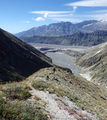
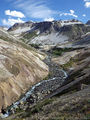
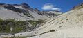
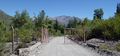
Image Gallery
El Bolsón
Leaving El Bolsón
Laguna Las Ánimas
Pass 2560 m
Approaching Laguna Mondaca
Laguna Mondaca
Bypasses Laguna Mondaca
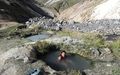
Termas de Azufre
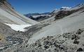
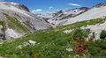
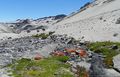
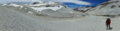
Leaving the Base Camp Descabezado Grande
Hot springs at Base Camp Descabezado Grande

Camp near Laguna Los Hornitos
Laguna Los Hornitos
Laguna Los Hornitos


