Diferencia entre revisiones de «ENG:Los Glaciares del lago O'Higgins»
m (Texto reemplazado: «|type=satellite» por «|TipoDeMap=HYBRID») |
m (Texto reemplazado: «|300px|» por «|») |
||
| Línea 32: | Línea 32: | ||
==Season== | ==Season== | ||
| − | [[Archivo:Glaciar-OHiggins-g2.jpg|thumb | + | [[Archivo:Glaciar-OHiggins-g2.jpg|thumb|right]] |
| − | [[Archivo:Glaciar-OHiggins-d6b.jpg|thumb | + | [[Archivo:Glaciar-OHiggins-d6b.jpg|thumb|right]] |
From November to April. | From November to April. | ||
| Línea 156: | Línea 156: | ||
<span style="color:red">Panoramic Views: O’Higgins Lake, Fitz Roy Mountain and Torre Hill. Observation Lenga adult forest. | <span style="color:red">Panoramic Views: O’Higgins Lake, Fitz Roy Mountain and Torre Hill. Observation Lenga adult forest. | ||
| − | [[Archivo:Glaciar-OHiggins-d1a.jpg|thumb | + | [[Archivo:Glaciar-OHiggins-d1a.jpg|thumb|right]] |
| − | [[Archivo:Glaciar-OHiggins-d1b.jpg|thumb | + | [[Archivo:Glaciar-OHiggins-d1b.jpg|thumb|right]] |
The entire segment is a public road, | The entire segment is a public road, | ||
| Línea 244: | Línea 244: | ||
<span style="color:red">Colorado Hill Cord Crossing Observation O’Higgins Hill Cord Panoramic Views: Chico Lake and Glacier. | <span style="color:red">Colorado Hill Cord Crossing Observation O’Higgins Hill Cord Panoramic Views: Chico Lake and Glacier. | ||
| − | [[Archivo:Glaciar-OHiggins-d2a.jpg|thumb | + | [[Archivo:Glaciar-OHiggins-d2a.jpg|thumb|right]] |
| − | [[Archivo:Glaciar-OHiggins-d2b.jpg|thumb | + | [[Archivo:Glaciar-OHiggins-d2b.jpg|thumb|right]] |
Follow the track from [[Hitos Los Glaciares del lago O´Higgins#Hitos/Guidepost 1,2,3|Guidepost 3]] | Follow the track from [[Hitos Los Glaciares del lago O´Higgins#Hitos/Guidepost 1,2,3|Guidepost 3]] | ||
| Línea 415: | Línea 415: | ||
<span style="color:red">Observation Lenga adult forest and bird species. La Carmela Farm Cord Crossing north sector. Panoramic Views: O’Higgins Glacier and O’Higgins Hill Cord. | <span style="color:red">Observation Lenga adult forest and bird species. La Carmela Farm Cord Crossing north sector. Panoramic Views: O’Higgins Glacier and O’Higgins Hill Cord. | ||
| − | [[Archivo:Glaciar-OHiggins-d3a.jpg|thumb | + | [[Archivo:Glaciar-OHiggins-d3a.jpg|thumb|right]] |
| − | [[Archivo:Glaciar-OHiggins-d3b.jpg|thumb | + | [[Archivo:Glaciar-OHiggins-d3b.jpg|thumb|right]] |
Keep walking from [[Hitos Los Glaciares del lago O´Higgins#Hitos/Guidepost 4,5,6,7|Guidepost 7]] approx. | Keep walking from [[Hitos Los Glaciares del lago O´Higgins#Hitos/Guidepost 4,5,6,7|Guidepost 7]] approx. | ||
| Línea 558: | Línea 558: | ||
environments and glacial geoforms. La Carmela Farm Cord Crossing north sector. | environments and glacial geoforms. La Carmela Farm Cord Crossing north sector. | ||
| − | [[Archivo:Glaciar-OHiggins-d4a.jpg|thumb | + | [[Archivo:Glaciar-OHiggins-d4a.jpg|thumb|right]] |
| − | [[Archivo:Glaciar-OHiggins-d4b.jpg|thumb | + | [[Archivo:Glaciar-OHiggins-d4b.jpg|thumb|right]] |
From [[Hitos Los Glaciares del lago O´Higgins#Hitos/Guidepost 8,9,10|Guidepost 10]], move forward | From [[Hitos Los Glaciares del lago O´Higgins#Hitos/Guidepost 8,9,10|Guidepost 10]], move forward | ||
| Línea 751: | Línea 751: | ||
<span style="color:red">Observation of Lenga adult forest and bird species. Panoramic View Chico Lake and Gorra Blanca Hill. | <span style="color:red">Observation of Lenga adult forest and bird species. Panoramic View Chico Lake and Gorra Blanca Hill. | ||
| − | [[Archivo:Glaciar-OHiggins-d5a.jpg|thumb | + | [[Archivo:Glaciar-OHiggins-d5a.jpg|thumb|right]] |
| − | [[Archivo:Glaciar-OHiggins-d5b.jpg|thumb | + | [[Archivo:Glaciar-OHiggins-d5b.jpg|thumb|right]] |
| − | [[Archivo:Glaciar-OHiggins-d5c.jpg|thumb | + | [[Archivo:Glaciar-OHiggins-d5c.jpg|thumb|right]] |
From [[Hitos Los Glaciares del lago O´Higgins#Hitos/Guidepost 15,16,17|Guidepost 17]] continue for | From [[Hitos Los Glaciares del lago O´Higgins#Hitos/Guidepost 15,16,17|Guidepost 17]] continue for | ||
| Línea 852: | Línea 852: | ||
<span style="color:red">Colorado Hill Cord Crossing Observation O’Higgins Hill Cord. Panoramic View Chico Lake, Chico Glacier, Fitz Roy Mountain and Torre Hill. | <span style="color:red">Colorado Hill Cord Crossing Observation O’Higgins Hill Cord. Panoramic View Chico Lake, Chico Glacier, Fitz Roy Mountain and Torre Hill. | ||
| − | [[Archivo:Glaciar-OHiggins-d6a.jpg|thumb | + | [[Archivo:Glaciar-OHiggins-d6a.jpg|thumb|right]] |
Revisión del 15:11 4 oct 2016
|
|
|
| |||||||||||||||||||||||||||||||||||||||||||||
Season
From November to April.
Access
By car
From Chile:
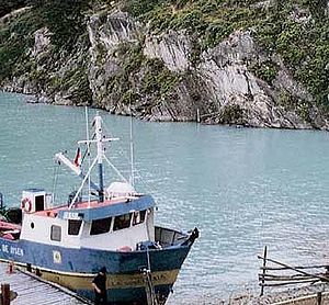
from Bahamondes bay, located 7 kilometers south Villa OHiggins, there is a boat bound to Candelario Mansilla, 3 hours by the lake, depending on weather conditions. (For information on the time schedule, contact the Municipality).
From Argentina:
from Chaltén to Laguna del Desierto. A boat is necessary from there to cross, or the lagoon may be bordered by a path located in the eastern bank, to its north end, 9 kilometer path will drive you to Dos Lagunas crossing point, open from November to April, located 13 kilometers away from Candelario Mansilla.
Public transport
General description
Southern Ice Field Patrimonial
Road, The Glaciers, is a 79.1 kilometer
circuit. It starts and ends at Candelario
Mansilla quay, on the banks of
O’Higgins lake, at the south end of
Region XI of General Carlos Ibáñez
del Campo.
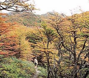
The journey comprises huge
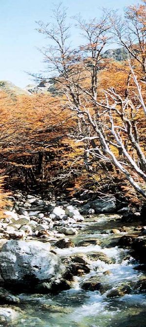
natural wonders, centennial Lenga
forests (Nothofagus pumilio) and
shrubby forest formations between 700
and 1000 meters above the sea level.
High Andean steppe habitat and its
vegetation floors may be observed in
crossings of mountain ranges.
The Road provides a special
opportunity to recognize native bird
fauna. Between forests and steppes,
you may be surprised by Black
Woodpecker ( Campephilus
magellanicus ) ; “ Viudita ”
(Colorhamphus parvirostris), a little
kind of parrot, or “Dormilona Rufa”
(Musciasaxicola capitrata).
Most of the Southern Ice Field is
made up by majestic glaciers which,
along with their related habitat,
transform this Road into a source of
inspiration for naturalists interested
in ecosystems and geomorphologic or
glaciological phenomena, which are
a real outdoors natural museum under
austral skies.
Small glacier, GAEA glacier,
and O’Higgins glaciers are some of
the glaciers that can be seen from
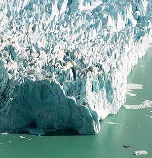
the Road. The latter measures 810
square kilometers and is the fourth
biggest of the Southern Ice Field,
after Pío XI, Viedma, Upsala.
O`Higgins glacier shows a unique
panoramic view of a more than 60
meter high and over 4 km long glacial
front. You will be able to admire these
grandiose tracks of the past, with
O’Higgins mountain range as your
witness.
The Road has been structured
into seven segments, divided in
accordance with their territorial and
transitability characteristics. The
first 6.7 kilometers correspond to the
public road, therefore, it is fit for four-
wheel drive motor vehicles, bicycle,
horse, or walking. The next 65.9
kilometers are only fit for walking
and horse-riding. Do not try to travel
the road in motorcycle.
If you will walk, you must at
least consider 5 days to complete the
circuit from “Candelario Mansilla”.
If you prefer horse-riding, you will
take 4 days. However, a couple of
days extra is suggested for further
safety.
For those who are not used to long walks, note that difficulties of this Road are only restricted to its extension, unstable weather conditions, and strong winds that may sometimes delay the walk. We suggest you to thoroughly follow indications provided in this Topoguide to avoid missing the path.
Route description
Segment 1
CANDELARIO MANSILLA DOCK - BEGINNING OF THE TRAIL
- Distance: 6,7 km.
- Walking time: 2 hours 40 min.
- Season: September to may
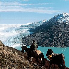
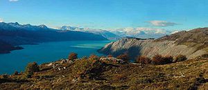
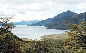
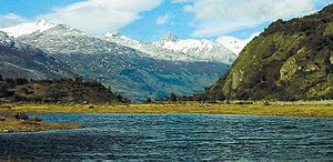
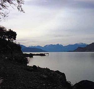
Panoramic Views: O’Higgins Lake, Fitz Roy Mountain and Torre Hill. Observation Lenga adult forest.
The entire segment is a public road,
and starts at the quay (Guidepost 1) of the old group of houses of
“Candelario Mansilla”, the most
austral location of the region, located
at the banks of O’Higgins lake. Here
you will find the information sign of
the road.
If you want to visit old settlers'
houses, you will have to follow a small
path that starts at the quay sector,
that will take you about 300 meters
east. There, you can meet one of the
few families that still live in
O’Higgins lake and share their kind
hospitality.
From Guidepost 1, you walk
in the middle of Obstáculo river
valley, always by the public road.
Approximately one kilometer later,
you will reach “Hernán Merino
Correa” police station, next to the
old aerodrome. Here, you may
request further information on the
Road and obtain the first panoramic
views of O’Higgins lake. If weather
is good and you have time, cross the
aerodrome until getting to the edge:
a small and beautiful beach will be
waiting for you.
From the police station, follow
the road heading south, starting a
slope where you will have amazing
panoramic views of O’Higgins lake,
as well as observing contrast of
visible landscapes when projecting
the sight to the Argentinean side,
where the lake is called San Martín.
Following by the slope, you will
see Obstáculo river, to your right, with
its deep canyon that prevents any
attempt to cross. You will now see the
first Lenga (Nothofagus pumilio) virgin
forests, until getting to top of the slope,
where you will find a natural mirador
(Guidepost 2) of Fitz Roy hill's range,
a privileged site from which you can
observe unique panoramic views of
the Chilean side. If weather conditions
are good, you will be in the presence
of these mythical mountains that have
constituted a milestone in Patagonian
geography for almost one century,
highlighting Fitz Roy hill (3441 a.t.s.l.
a.t.s.l. = above the sea level) and
Torres hill (3102 a.t.s.l.), considered
by many one of the most beautiful and
difficult mountains in the world:
conquering it is a real challenge. We
recommend you to approach a small
rocky promontory, just at the other
side of the road, from which you can
enjoy the spectacular view and take a
rest before starting to climb Colorado
hill range (1799 a.t.s.l.).
Following the road, you will
find Guidepost 3, few meters
away, that indicates a bifurcation
that will take you away from the
road to start walking by a path
which climbs Obstáculo river
valley in its south spring.
Segment 2
BEGINNING OF THE TRAIL - LAGO CHICO PENINSULA
- Distance: 18,1 km.
- Walking time: 6 hours.
- Season: November to april
Colorado Hill Cord Crossing Observation O’Higgins Hill Cord Panoramic Views: Chico Lake and Glacier.
Follow the track from Guidepost 3
and you will get to a beautiful forest
formation until crossing a little stream.
Walk ahead about 100 meters and you
will arrive to the east bank of the main
stream of the valley.
Carefully, cross the stream bound
to 280º, and you will see a gully where
you will have to climb approximately
100 meters, and then take the right until
getting out of the woods. We recommend
you to be careful in such places where
the track is not well defined; keep the
track between Obstáulo river cliff and
the forest limit, from which you can
see a wide panoramic view of the river
in its upper section.
After leaving the cliff, you will
have to climb a new slope, having a
sector of dry logs as reference. While
going up, Obstáculo river will be at
your right and a small stream at your
left. Keep going until ending the
inclined hillside, which also
corresponds to the progressive end
of the adult forest, until facing a large
sector of swamps. Follow general
course of 310º for a little more than
600 meters until crossing the first of
6 brooks, always in the presence of
a shrubby forest up to the division
fence of the property.
Walk forward for over 1
kilometer, and you will arrive to the
top of the narrow pass, that divides
local waters. Keep a small lagoon,
located at approximately 1,200 meters
of altitude, as reference, which must
be boarded by the left.
Leaving the lagoon behind,
continue by a flat sector until getting
to Guidepost 4, which indicates the
start of descent. It is a high Andean
swampy terrain with an over 5
kilometer extension lacking of forest
formation. This sector is covered by
snow most of the year.
After Guidepost 4, in the next
2 kilometers, you will have to cross
2 small streams coming from Vicente
hillsides (1918 a.t.s.l.), after which
you will have to cross the main
stream of little flow.
If visibility conditions are good,
you can see while you walk one of
the main mountain ranges of the
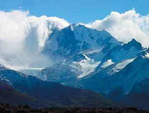
Southern Ice Field associated to
O’Higgins hill, one of the most
unknown and beautiful geographic
accidents in the Patagonia, highly
recognized and admired by old
explorers. There are countless
summits that rise, highlighting
O’Higgins hill (2860 a.t.s.l.) and
Cóndor hill (1810 a.t.s.l.), as well
as hanging glaciers that cover them.
Don't forget to take pictures. If you
are not lucky, don't worry, you will
have a better chance in coming
segments.
Remember that only one
kilometer and a half is left to get to
Guidepost 5 from crossing of the
already cited main stream. Once you
enter the shrubby forest, be careful
to take the left side and start the
steepest descent before getting to
Guidepost 5 and finishing crossing
of the narrow pass.
Guidepost 5, is an interesting
natural mirador of O’Higgins hill
range, located before starting
descent to Chico lake peninsula.
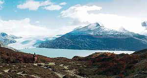
From here, you will have wide
panoramic views of O'Higgins lake
south west sector and of all Chico
lake.
Note that Chico lake peninsula
is an interesting remainder of Chico
glacier advance, one of the many ice
bodies that make up the Southern
Ice Field, which is characteristic for
the large amount of rocky and ashy
material deposited in its ices, a
phenomenon that demonstrates
proximity to Lautaro volcano (3600
a.t.s.l.), the highest volcano in the
Southern Ice Fields. At this point,
landscape is unique. Take some time
to watch and save in your memory
these images that have only been
seen by adventurer explorers and
old settlers who arrived to these
remote lands.
Follow around 700 meters by
a well defined track. Keep Chico
glacier as reference until getting to
a rustic gate, where a small stream
has to be crossed. The track is well
define throughout the descent,
therefore, it should be easy to
properly follow the Road.
An approximately 1 kilometer
descent starts after the stream,
passing by a small lagoon and
crossing a stream by a well defined
track. This area is mostly planted
with new Lenga shoots. You will have
to cross forests and small prairies
until finally arrive to Guidepost 6.
To continue by the road, take your
right and go down until getting to
the flat sector. We recommend you
to visit the small settlement that you
will see when arriving to the valley.
There, you will find local services
and hospitality of its people.
Remember to obtain information on
Chico lake drainage crossing.
At this flat sector of the
peninsula, head west for slightly
more than 1 kilometer by firm terrain
and abundant short thickets until
getting to Chico lake drainage.
Pay attention to Guidepost 7
that is marked in a small thicket on
the opposite bank of the drainage.
You will need any kind of boat
to cross at this point. Do not try to
cross by your own means due to
depth, flow and temperature
conditions of the water. In such sense,
you will have to contact the
neighbors and try to obtain a boat
to cross it.
Segment 3
LAGO CHICO PENINSULA – CAMP I
- Distance: 7,3 km.
- Walking time: 4 hours.
- Season: November to may
Observation Lenga adult forest and bird species. La Carmela Farm Cord Crossing north sector. Panoramic Views: O’Higgins Glacier and O’Higgins Hill Cord.
Keep walking from Guidepost 7 approx.
200 meters in north-west bound by a
small slope, until getting to a settler's
house that may help you cross. There,
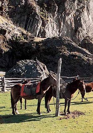
you can rent horses to continue the ride.
Here, you will find Patagonian
hospitality and some local service. You
may also take the opportunity to
reorganize your gear to start climbing
to arrive directly to O’Higgins glacier.
Approximately 300 meters from
the settler's house, you will find a
bifurcation of the track. Go to the
right, following the slope by a well
defined track until getting to a brook
next to a rustic gate. Keep on climbing
this hilly ground that looks like an
old lateral moraine connected to
Chico glacier.
Following this direction, you will
the brook at your right until arriving
to a small clearing in woods and
natural mirador. It is interesting to
watch O’Higgins lake from here,
Chico lake and its peninsula, which
formation is associated to a classic
example of an ice deposit of terminal
character with old channels connected
to the different lacustrian levels. It is
a place to admire geographic
formations and native flora of the
surroundings. It is protected from
winds, allowing to rest before getting
to the next narrow pass.
Once you leave Guidepost 8
behind, keep on climbing until reaching
a mark made in an adult Coigüe. From
here, take general course 240º, in the
middle of a dense forest, although shorter
and shrubbier, indicating that you are
getting closer to upper vegetation limit.
The track continues by a slight slope
with general course 220º, progressively
leading to your right until crossing a
gully and then taking the right and
continue climbing. In this point, you must
change general course, bound to the west,
always by the most marked track among
abundant Lenga woods. Approximately
one kilometer and a half from previous
gully, you will arrive to the narrow pass
of Fundo “La Carmela”, corresponding
to Guidepost 9.
This is a surprising stop for the
majestic panoramic view of O’Higgins
Glacier plateau and the mountain range
that makes up the landscape.
Do not be surprised if strong winds
show up. It is a normal situation due to
proximity to the Southern Ice Field,
usually generating extremely unstable
atmospheric conditions. In such sense,
it is important to take forecasts made by
locals into consideration, since they
are highly reliable upon making
decisions concerning continuity of
the Road.
From Guidepost 9, start going
down taking right bank of a lagoon
that you will find in a few meters,
always by swampy terrain and Lenga
shrubby woods. Walk down
progressively to the west until
reaching the crossing of a small
stream. From there, you will have to
go ahead approximately 100 meters
to start the walk by a beautiful forest
of thin Lenga trees, between the
hillside and an old side moraine, that
you will soon have to climb by its
top, boarding the scarp. This is an
interesting run that blends majestic
panoramic views of the surroundings
and reconnaissance of the particular
habitat.
Follow the track. Just before
arriving to the next stream, remember
to climb to the left by a moist
esplanade where you will see some
dry trees. Cross this esplanade
having a rustic fence that divides the
property as reference. Go through it
(remember to leave it closed), keep
going by the small and beautiful
valley that is squeezed in between
the hillside and the moraine system,
where you can watch centennial
Lenga trees. For bird watching lovers,
the nature will bring you in these
latitudes a never-ending bird singing.
Approximately 400 meters away
from the above described rustic fence,
pay attention to a mark indicating
that you will have to climb again to
the top of the moraine that is at your
right. Do not continue by the bottom
of the small valley, since stream
water will prevent you from
advancing.
After a few minutes of walk by
the above cited moraine, the track
will lead you to Guidepost 10,
which will indicate you that you are
few meters away from an ideal sector
to rest or camp. Travel from this
Snupie has to start before noon, in
view of characteristics of the next
segment and the possibility to have
time enough to watch the landscape
in coming points of interest.
Segment 4
CAMP I - CAMP II
- Distance: 13,8 km.
- Walking time: 6 hours.
- Season: November to april
Observation of O’Higgins Glacier and GAEA Glacier. Panoramic View of GAEA Cord. Identification of periglacial environments and glacial geoforms. La Carmela Farm Cord Crossing north sector.
From Guidepost 10, move forward
a few meters and divert to the left,
leaving the lateral moraine and
beginning a ascent through the
opposed hillside. From there, you
should face an ascent to the west
just until the upper limit of the adult
forest. Take the track at the right
which, at a few meters, will lead you
out of the forest to directly have
access to an exposed rocky
promontory which locates at a few
meters at the right of the marked
track corresponding to Guidepost 11. There you will enjoy interesting
panoramic views of O’Higgins
glaciers and its surroundings.
Once you take the track again,
enter the forest again, avoiding
getting out of it, or going round the
edge of it further on its upper limit,
until reaching a slight ascent with
well-marked track which will lead
you to Guidepost 12, located in a
small exposed rocky edge. This is an
ideal place to observe the O’Higgins
glacier, mountains that cast powerful
spells on its visitors; we recommend
to ensure a closeness picture of this
beautiful glacial body and to take
your time. Here, it is absolutely
necessary to watch the glacial
retrocession experienced during the
last century.
Continuing the tour from
Guidepost 12, we observe that the
landscape gradually becomes a high
Andean steppe, leaving forest behind
and breaking serenity with constant,
strong and gelid winds coming
directly from the highest sectors of
Campo de Hielo Sur. We recommend
to specially consider in this sector
to wear a windbreak jacket with
thermal interior for your better
comfort and safety.
Taking general south-east
direction and always following the
main track, you should direct your
run to a small crossing beside a large
rocky wall which is visible at a
distance higher than 500 meters.
After passing this accident, consider
the crossing of small lagoons and
the beginning of a slight descent. In
this sector, you should be careful,
since at about 300 meters after
crossing said lagoons, it will be
necessary to divert from the main
track to the right, in order to have
access to the most west lagoon, next
to a scarp, where you could identify
Guidepost 13 in its shore, on a large
rock.
Guidepost 13 is a unique
natural mirador for the perspectives
of the O’Higgins Glacier front. Face
to face with the glacier and in one of
the most sublime sights of nature, the
calm of the landscape is interrupted
by the unknown clatter of the glacier
pieces falling to the lake. The ice
voice is heard, shaking us even with
smallest loosening.
After beginning with the tour
again and leaving the O’Higgins
Glacier front behind, take general
direction 210º going round the edge
of scarp without visible track. After
running more than 1.5 kilometers
from Guidepost 13 you will find a
plain sector, with pasturelands and
abundant deep pools, just before
crossing a small stream, reason why
you should be extremely careful for
not getting wet.
Consider no more than 10
minutes after this stream to reach
Guidepost 14 on a large rock
located next to a small pool, it is an
excellent mirador of the glacier and
the GAEA cord. In this sector, the
terrace edge is exposed, it is advisable
to keep a prudent distance.
It is also important to consider
that the following 7 kilometers from
Guidepost 14, correspond to an
access ascent to “Alto de los Líquenes”
mountain pass, which name is due to
the abundance of this vegetation. It
is mostly rocky lands of periglacial
environment, where there is no track,
demanding us to double safety
measures and the attention to
indications. You should note that the
next camp is between 3 and 4 next
hours.
If weather conditions are not
particularly good, consider the
convenience to continue with the tour.
Remember to periodically check your
barometer and to consider an
appropriate break in camp I.
From Guidepost 14 take general
direction 75º, at about 800 meters you
will cross a small mountain pass, where
you could observe a rock dry-stone wall,
from where you should directly climb
the hillside for about 150 meters until
crossing a stream. Then, take your right
and continue, because at a few meters
you will cross the stream again. From
here, remount about 500 meters with
direction to the south to take as reference
the mountain pass that will show you
the cord crossing. It is a complex land
to be followed due to the existence of
abundant rocks, for this reason a map
and ideally a GPS support are required.
At the end of the ascent, you will
face Guidepost 15, that will show you
the arrival to “Alto de Los Líquenes”
mountain pass, from where you could
begin the descent to the other side of
the mountain. Said descent is made
through a rocky sector, being
approximately 300 meters with 40º of
slope until arriving to the background
of an old glacial cirque, formation
proper of high-Andean erosion. For
those who are horse riding, we
recommend to go down unhorsed.
During the next two kilometers you
will be close to a lagoon seen at the
distance. Go around the edge through
its north-east riverside until arriving to
its sewage. From there, only 400 meters
are left to arrive to Guidepost 16
located on a rocky doorsill, showing the
beginning of a new descent, and soon
allowing the path to the forests of Chico
Lake.
Upon entering the forest,
downstream the valley, you should take
your left through a marked track,
considering that in less than 20 minutes
of run from Guidepost 16, it will be
necessary to cross a stream at your right.
From there continue next to the riversides.
Be careful when leaving the stream,
the track is lost in this sector reason
why you should try to not get too far
away from it. Follow its south riverside
in plain lands and with abundant forests
until reaching Guidepost 17,
corresponding to Camp II. It is a perfect
place for a longer break, at the stream
shore and well protected from winds in
a beautiful wood of Lengas.
Segment 5
CAMP II- LAGO CHICO PENINSULA
- Distance: 8,6 km.
- Walking time: 3 hours 30 min.
- Season: September to may
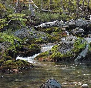
Observation of Lenga adult forest and bird species. Panoramic View Chico Lake and Gorra Blanca Hill.
From Guidepost 17 continue for
about 40 meters downstream, cross it
and then take a small wooded ascent
through a track that will lead you to a
plain sector which you should cross.
Run about 350 meters for these soft
and wet land until crossing a small
stream. From there consider a few
meters until facing an open and more
rocky land, where you should take your
left with direction to the north.
At a few meters, you will cross a
stunted Lenga forest and gradually
going to the right and always in
ascent considering the east rocky end
of the hillside as destination. Do not
confuse to arrive to a close mountain
pass that you could see to the north.
After finishing the ascent you
will arrive to Guidepost 18 , which
is an interesting mirador of “Gorra
Blanca” hill and the mountains of
the upper sector of Chico glacier. If
you want a better panoramic view,
including the sights to the O´Higgins
lake and Chico lake, we recommend
to continue the tour to Guidepost 19 .
This SNUPIE is located in a
rocky promontory sculpted by ice
being a natural mirador at a few
meters to the east and visually
identified from the previous SNUPIE.
Be careful of not exposing too long
to the strong winds.
From Guidepost 19 , take the
track again and continue down
always through the hillside (north-
east direction), going partially round
the edge of the stream and listening
to water at your left. If you lose the
track, try to take referential direction
to the O’Higgins lake, without getting
far away the previous stream through
lands where you will clearly observe
that the forest is each time higher, a
clear sign of our descent and
closeness to the background of the
main valley.
After continuing for not more
than one hour, you will arrive to
Guidepost 20, an ideal place to
camp or to make a brief break before
reaching the peninsula of Chico lake.
In this place you could observe the
native flora associated to virgin
woods or birds, such as a
Woodpecker with its red panache or
– if you are lucky– a puma or fox
unexpectedly.
From Guidepost 20, you
leave the stream so that in a few
meters, you begin the descent to the
north. Please note that the track is
well-marked until the peninsula of
Chico lake, reason why you should not
be confused. Anyway, at about 700
meters from the last SNUPIE, you will
cross a small lagoon at the right, so
later you continue with the descent
through the wood until arriving to the
division palisade of the site.
From this point, you will only
have to run about 1 kilometer to end
this segment, going through a marked
track on an open hilly ground, which
will directly lead you to the colonist’s
house located in the sector and with
whom you should agree the sewage
crossing. We recommend you a longer
break so that you have a pleasant rest,
share and prepare the return.
Segment 6
LAGO CHICO PENINSULA – CANDELARIO MANSILLA DOCK
- Distancia: 24,8 km.
- Walking time: 8 hours.
- Season: November to april
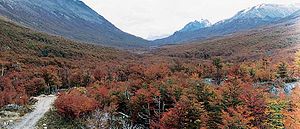
Colorado Hill Cord Crossing Observation O’Higgins Hill Cord. Panoramic View Chico Lake, Chico Glacier, Fitz Roy Mountain and Torre Hill.
In this segment we begin the return to
Candelario Mansilla. First of all, you
should agree with the neighbors of the
sector the crossing from Guidepost 7,
located at the sewage edge of Chico
lake. Upon planning the return, consider
an appropriate time because of the
extension and duration of the travel. The
idea is to arrive to Candelario Mansilla
with day light, and also have the
opportunity to stop to enjoy the last
panoramic sights of the O’Higgins cord
and part of Campo de Hielo Sur, as well
as the views of Fitz Roy Mountain and
Torres hill in Guidepost 2.
If weather conditions are good to
cross the mountain cord of Colorado
Hill, we recommend to patiently wait in
the Chico lake peninsula. Likewise, we
recommend you to be advised by local
inhabitants and not forget to notify your
return to Carabineros de Chile.
Recommendations
- This trekking is described in full detail in the following topoguide of the Ministery of Public Patrimony. The printed guide can be obtained for free in the Ministery:56-2-3512100 -> 2325. It is hihgly recommended to take it to the walk, as it enriches the experience with descrptions of flora, fauna, geography and geology.


