P.N. La Campana, Ocoa (english)

|

|
Contenido
Season
Year round, although the ideal time to go would be during the beginning of Spring or end of the Winter.
Vehicle Acess and State of the Road
Public Transportation and Hitchhiking
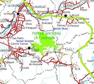
Take Route 5 to the town of Rabuco. Once you've exited Route 5, continue south for 500 m, then turn right on Rabuco street (west), after 1,4 km the street turns south, continue on it until reaching rout f304 where you must turn left. Continue on this road for 7 km until you see a dirt road. Here turn right and in 30 m turn left (south). After 2 km, this road will take you to the entrance of the park.
Route Description
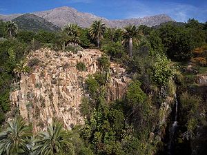
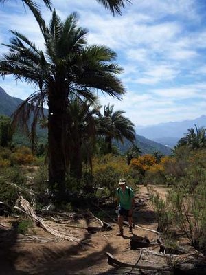
From the ranger booth, walk south on an old vehicle track. After 1,9 km passing through areas with plenty Chilean Palms (Jubaea chilensis) and some lookout points, you will reach the Casino sector, where you will see a track to the right (west), if you follow it, it will take you to Granizo sector at the south side of the park, trek that is described starting from the opposite side on Travesía P.N. La Campana. Continue on the main path, the vegetation will decrease little y little and the path will increase its slope. 4 km after the Casino sector, you will reach a fork. The main road continues south to an old quartz mine, but take the path the left (east). It ascends significantly, but not for long, after 10 minutes you will reach a lookout with a spectacular view of a rocky waterfall, surrounded by cacti and plenty of Chilean Palms. Even though it is possible to return on the east side of the valley going behind the waterfall and following a diffuse path, we recommend returning on the same path to avoid getting lost.
Estimated Time
At a normal pace, this trek should take about 3,5 hours. If you mountain bike, 2 hours should be enough, but there are many paths that you can explore.
Permits/Fees
An entrance fee of 1.500 CLP is charged.
Recommendations
Waypoints in Google Earth and Map Source
To download the file right-click and then select "Save file as" (IE) or "Save link as" (Firefox, Chrome). By trying to open it directly, some browsers will show the raw code with the coordinates.
Hiring Guides
Hiring guides is possible for this trek:
Montaña Nativa: Tailored tours, 2 day treks, hot springs, Glaciers, ascents and road trips. Experienced guide with a degree from Escuela Nacional de Andinismo Chileno and ornithology. Ethical and ecological vision. TripAdvisor certificate of excellence 2015.- Contact: guia@montananativa.com
- Phone: +569 6477 8461
- Social Media: Facebook Montaña Nativa
- Ecotrekking Santiago de Chile Ecotourism and "High Mountain" activities in Cajón del Maipo and Farellones. Logistics, guides, and passenger transport.
- Contact: ecotrekkingchile@gmail.com
- Facebook: Ecotrekking Santiago de Chile
- TripAdvisor: Ecotrekking Chile
- Phone: +56966028918 (WhatsApp)
- Ecochile Travel: Regular and private trekking trips in the Andes.
- Contact: info@ecochile.travel, (56- 02) 25708826
- Flecha Extrema: Private Hiking Tours / "High Mountain" Expeditions around Santiago - Experience the Andes
- Contact: contacto@flechaextrema.com, +56 9 65 61 72 77
- Facebook Turismo Flecha Extrema
- Phone: +56965617277 (Whatsapp)
- AndesBrown: Hikes and excursions in Chile's central mountains. Guided tours, certified guides
- Phone +56988382014.
- Cajonoutdoor: Treking, horse back, and excursions in all of Cajón del Maipo. Passenger transport to and from the hotel/airport/chosen destiny. Bilingual local guides.
- Contact: contacto@cajonoutdoor.cl
- Phone: +56991940429 - +56975275503.
External Links
Weather
- Meteochile Región de Valparaíso
- Accuweather Valparaíso
- Accuweather Viña del Mar
- Meteochile Región Metropolitana
- Accuweather Santiago
- Accuweather Puente Alto
Lodging
Revisa la lista completa de 621 rutas de trekking y las 345 rutas de montaña en Chile
|

