Diferencia entre revisiones de «ENG:Cerro Plata»
(→Photo Gallery) |
|||
| (No se muestran 4 ediciones intermedias del mismo usuario) | |||
| Línea 41: | Línea 41: | ||
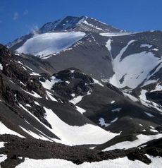
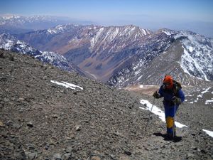
[[Archivo:Cerro Plata (57).JPG|thumb|Final meters. 11/2011]] | [[Archivo:Cerro Plata (57).JPG|thumb|Final meters. 11/2011]] | ||
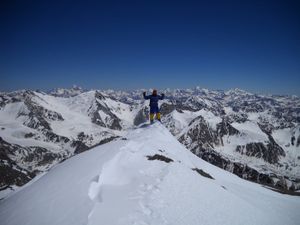
[[Archivo:Cerro Plata (67).JPG|thumb|Summit of the Cerro Plata. November 2011]] | [[Archivo:Cerro Plata (67).JPG|thumb|Summit of the Cerro Plata. November 2011]] | ||
| − | El Plata is the main summit of the mountain range that bears his name. It is a four-day ascent, which allows a panoramic view of the Mendoza mountain range. It is a mountain frequented by local climbers, both by the school guides and by those who acclimatize for the ascent of [[ | + | El Plata is the main summit of the mountain range that bears his name. It is a four-day ascent, which allows a panoramic view of the Mendoza mountain range. It is a mountain frequented by local climbers, both by the school guides and by those who acclimatize for the ascent of [[Monte Aconcagua]]. |
| + | |||
== Appropriate time == | == Appropriate time == | ||
October to May, although between March and May it is already very cold. Unlike the western slope of the Andes, summer storms are less infrequent in this area, so it is necessary to review the weather forecast before leaving. | October to May, although between March and May it is already very cold. Unlike the western slope of the Andes, summer storms are less infrequent in this area, so it is necessary to review the weather forecast before leaving. | ||
| Línea 55: | Línea 56: | ||
From Las Vegas, you can only do autosop, but only on weekends you can be lucky. | From Las Vegas, you can only do autosop, but only on weekends you can be lucky. | ||
== Description of the route == | == Description of the route == | ||
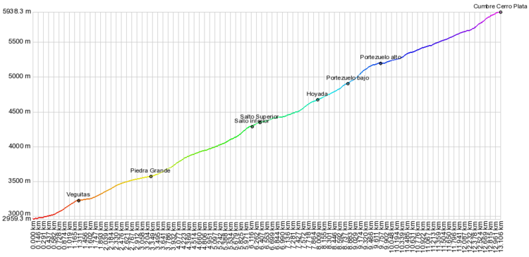
| − | [[ | + | [[Archivo:Perfil_Cerro_Plata.PNG| thumb | center | 750px | Profile of climb to Cerro Plata]] |
=== Day 1: Mendoza - Piedra Grande === | === Day 1: Mendoza - Piedra Grande === | ||
From the Vallecitos station (km 0 - 2959m), walk towards the southwest, until you cross a stream. Take the track that ascends along the main estuary of the stream. After 30 minutes you will reach an area of herbs called "Las Veguitas" (km 1.3 - 3230m). | From the Vallecitos station (km 0 - 2959m), walk towards the southwest, until you cross a stream. Take the track that ascends along the main estuary of the stream. After 30 minutes you will reach an area of herbs called "Las Veguitas" (km 1.3 - 3230m). | ||
| Línea 72: | Línea 73: | ||
=== Day 3: La Hoyada - Summit - La Hoyada === | === Day 3: La Hoyada - Summit - La Hoyada === | ||
| − | An extensive journey is undertaken, which ascends towards the "Lomas Amarillas-Plata" ridge (km 8.8 - 4910) marked at the "Portezuelo bajo" waypoint. Then we ascend with more slope towards the great amphitheater that ends in the pass that separates the Silver hill from Vallecitos hill (km 9.7 - 5210m). Already observed [[ | + | An extensive journey is undertaken, which ascends towards the "Lomas Amarillas-Plata" ridge (km 8.8 - 4910) marked at the "Portezuelo bajo" waypoint. Then we ascend with more slope towards the great amphitheater that ends in the pass that separates the Silver hill from Vallecitos hill (km 9.7 - 5210m). Already observed [[Monte Aconcagua]]. Attention, although visually one already feels close to the summit at this point, there are still 3 or 4 hours of promotion. |
There is a long and exhausting section that climbs in a zigzag along a slope that passes behind the so-called "false Silver". From that point, it continues to the somital edge. A few meters from the summit are the remains of a helicopter of the Mountain Rescue Brigade of the Argentine Air Force. | There is a long and exhausting section that climbs in a zigzag along a slope that passes behind the so-called "false Silver". From that point, it continues to the somital edge. A few meters from the summit are the remains of a helicopter of the Mountain Rescue Brigade of the Argentine Air Force. | ||
| − | Once at the summit (km 13.1 - 5930m), there are numerous memories of the mountaineers who preceded us. From the summit, they dominate the aforementioned Aconcagua to the North and the [[Tupungato | + | Once at the summit (km 13.1 - 5930m), there are numerous memories of the mountaineers who preceded us. From the summit, they dominate the aforementioned Aconcagua to the North and the [[Volcán Tupungato]] to the West. |
| + | |||
===La Hoyada - Mendoza=== | ===La Hoyada - Mendoza=== | ||
Same route back. | Same route back. | ||
| Línea 100: | Línea 102: | ||
Cerro_Vallecitos.JPG | Cerro Vallecitos. November 2011 | Cerro_Vallecitos.JPG | Cerro Vallecitos. November 2011 | ||
Cerro_Plata_ (92).JPG | [[Monte Aconcagua]] from the Cerro Plata | Cerro_Plata_ (92).JPG | [[Monte Aconcagua]] from the Cerro Plata | ||
| − | + | Volcan Tupungato cara Noreste.JPG| Northeast face of the [[Volcán Tupungato]] from the summit of the Silver. November 2011 | |
</gallery> | </gallery> | ||
Revisión actual del 18:56 5 jun 2019
|
|
|
| |||||||||||||||||||||||||||||||||||||||||||||||||
General Description
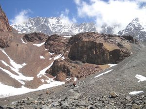
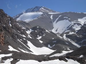
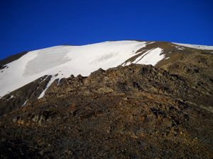
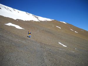
El Plata is the main summit of the mountain range that bears his name. It is a four-day ascent, which allows a panoramic view of the Mendoza mountain range. It is a mountain frequented by local climbers, both by the school guides and by those who acclimatize for the ascent of Monte Aconcagua.
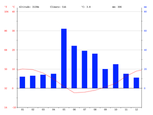
Appropriate time
October to May, although between March and May it is already very cold. Unlike the western slope of the Andes, summer storms are less infrequent in this area, so it is necessary to review the weather forecast before leaving.
Access
In own vehicle
From the center of Mendoza, it is 95 kilometers to the Vallecitos ski center. You must take international route 7 to Uspallata and Chile. After 67.8 kilometers you reach the town of Potrerillos, next to the homonymous reservoir. Here you must leave the international highway and take the road to Tupungato (paved), taking a wide detour to the left that goes through the town.
After 10.7 kilometers there is a detour to the right towards the Vallecitos Ski Center. There are 16.5 kilometers of gravel in good condition to Vallecitos.
In public transport and hitchhiking
Express Uspallata arrives to Las Vegas.
- Address: Omnibus Terminal, Av. Bandera de los Andes, Mendoza, Argentina
- Telephone: +54 261 431-3309
From Las Vegas, you can only do autosop, but only on weekends you can be lucky.
Description of the route
Day 1: Mendoza - Piedra Grande
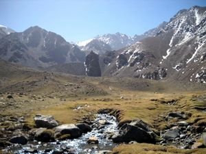
From the Vallecitos station (km 0 - 2959m), walk towards the southwest, until you cross a stream. Take the track that ascends along the main estuary of the stream. After 30 minutes you will reach an area of herbs called "Las Veguitas" (km 1.3 - 3230m).
Continue on the right side of the ravine, going up the moraine. It will reach an open area where the slope rises sharply and the last vegetation formations disappear. Continue on the left of the small upper valley (the path is always very clear) until you reach "Piedra Grande" (km 3.3 - 3575m). Although it is only two hours from the beginning, it is a good place to set up the first camp, in order to make a gradual acclimatization.
Piedra Grande is also a base camp for Lomas Amarillas (5000m), Adolfo Calle (4300m), Franke Peak (4900m), Stepanek (4100m) and Rincón (5363m), so it would not be unusual to find more people there.
Day 2: Piedra Grande - Hoyada
The day begins by crossing the "cap or infiernillo". It is continued by an edge that ends in a corridor of some degree of difficulty. After this point, you reach the "Waterfall" (km 6.1 - 4290) marked with the waypoint "Lower jump". It is a pleasant place with abundant water. Many people camp here, but this implies a very long day on the summit day.
220 meters in the horizontal direction further on, at an altitude of 4350m, the Upper Jump is located, although it is less known and less noticeable than the previous one.
The trail is always very clear until "La Hoyada" (km 7.9 - 4680m), about 3 hours walk from the lower jump. It is a wide sector that normally has snow, and there is also a stream of running water a few meters away.
Day 3: La Hoyada - Summit - La Hoyada
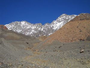
An extensive journey is undertaken, which ascends towards the "Lomas Amarillas-Plata" ridge (km 8.8 - 4910) marked at the "Portezuelo bajo" waypoint. Then we ascend with more slope towards the great amphitheater that ends in the pass that separates the Silver hill from Vallecitos hill (km 9.7 - 5210m). Already observed Monte Aconcagua. Attention, although visually one already feels close to the summit at this point, there are still 3 or 4 hours of promotion.
There is a long and exhausting section that climbs in a zigzag along a slope that passes behind the so-called "false Silver". From that point, it continues to the somital edge. A few meters from the summit are the remains of a helicopter of the Mountain Rescue Brigade of the Argentine Air Force.
Once at the summit (km 13.1 - 5930m), there are numerous memories of the mountaineers who preceded us. From the summit, they dominate the aforementioned Aconcagua to the North and the Volcán Tupungato to the West.
La Hoyada - Mendoza
Same route back.
Expected Time
Four days of promotion, although the first day it is possible to leave at noon (three and a half days, strictly speaking).
Permisos / Tarifas
Hire Guides
- Andemara offers an eight-day promotion, which includes acclimatization and an additional day to unforeseen
- info@andemara.com
- + 542614251983 - Outside of Argentina | 02614251983 - From Argentina | Hours: from 9:00 a.m. to 5:00 p.m.
- Alquimia Turismo offers promotions in six days
- O'higgins 603 - Junín de los Andes - Neuquén - Argentina
- Phone: + 5402972491355
- Whatsaap: + 540294154611568
Recommendations
- There is water throughout the ascent. It is not necessary to load more than one liter, except for the summit day.
Photo Gallery
Monte Aconcagua from the Cerro Plata
Northeast face of the Volcán Tupungato from the summit of the Silver. November 2011


