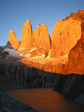
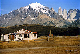
ENG:Trekking Torres del Paine
|
|
|
| |||||||||||||||||||||||||||||||||||||||||||||
Introduction
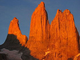
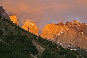
' 'Trekking Torres del Paine' is one of the most spectacular treks in the world. In fact, according to a review of 9 specialized books that make their own selections of the best routes in the world, Torres del Paine is the most frequently named (you can see the study in Best Treks / Hikes of the World, top 100). For this reason, it is extremely popular, and it is very advisable route in November to early December to avoid the massive January and February.
Before starting, please read the Suggested itineraries, to decide what is the best way to make your days there. You can also train you a general idea of [[Torres del Paine] National Park].
Note that although this route is located in Patagonia, famous mythical so remote and so hard on your climate, this is a low altitude trekking and with very good infrastructure, so it is a business that anyone with good fitness can perform, with or without experience.
That said, if you have no experience in trekking, it is especially important to pay attention to the advice on equipment and food: it is very common for inexperienced people who rush to finish this hike suffering to carry food or equipment too heavy, or poor quality. While it is a challenge that anyone can take, you can not just bring the family pot half kilo of your home, a solid stove designed for camping car or those zapatones more oriented to industrial work than walk 7 hours day.
And now, enjoy!
Epoca adecuada
La época adecuada para esta ruta es entre los meses de noviembre y marzo. Ideal es noviembre y diciembre, cuando el clima ya ha mejorado, los días son largos y no hay tanta gente haciendo el circuito como en enero y febrero. Invierno es una bella época, pero el circuito completo es demasiado solitario para estos meses, y resulta más recomendable intentar la "W" o, ya bastante menos ambicioso, contentarse con la Base de las Torres del Paine.
Access
From Chile (Punta Arenas)
To get to Punta Arenas there are three options:
- Airway: There are daily flights from Santiago to Punta Arenas. The trip takes about 4 hours and if it's clear you can see from the air the Patagonian fjords, ice fields and the Torres del Paine themselves.
- Sea: There is a 4 day trip highly recommended, either from Puerto Montt to Puerto Natales or vice versa. It takes you through the wonderful maze of canals and the Gulf of Penas. It passes by Puerto Eden, a small village inhabited by fishermen and refuge of the last alacalufes, and also a starting point to the impressive glacier Pio XII.
- By Land: The journey takes 36 hours between Puerto Montt and Punta Arenas, but it is the cheapest option. It lets you know the pampa and its estancias, where the huge distances have shaped the character of this region.
Depending on the amount of time availabe and on your resources it is advisable to combine different means of transport to get in and out of Patagonia, thus to get a fuller view of the region.
By car
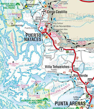
From Punta Arenas there are 254 kilometers by paved way to Puerto Natales. From there, there are two options:
- Old road through Cerro Castillo: Continue to Cerro Castillo, 60 km of paved road. Once in the village, turn left (west) and continue along a gravel road. 44 kms later there is a bifurcation: two roads lead to the park. Take right. After an additional 9 kilometers (113 and 367 from Puerto Natales from Punta Arenas) the CONAF (ranger) post of Laguna Amarga is reached.
- New road to Villa Serrano: From Puerto Natales, advance 16 kms along the old route (towards Cerro Castillo) to the turnoff to the left that leads to the Milodon Cave. The cave is reached after 7 kilometers of road gravel. Since the cave, there is a stretch of 65 kilometers of gravel until the administrative center of the park, at Villa Serrano. From there, continue along the gorgeous main road of the National Park, which 39 kilometers later reaches the CONAF (ranger) post of Laguna Amarga
Public transport and hitchhiking
All phones with codes 56-61
It may seem unbelievable, but there are no direct buses from Punta Arenas to the park, so you have to stop in Puerto Natales. As the second and final trip to the park from Puerto Natales is at 14:30, from Punta Arenas to Puerto Natales you can take the buses that leave at 8:30 and 10 to arrive before 14:30 and get to the park on the same day (it takes about 3 hours between the two cities).
Buses from Puerto Natales to Torres del Paine National Park will leave you at Laguna Amarga. From that point, it's about an hour of additional hike along the road to Hosteria Las Torres, the usual start of the trekking. This last stretch can also be done in minibuses that wait for the arrival of the buses from Puerto Natales.
Punta Arenas - Puerto Natales
- Buses Pacheco ($ 4,000, $ 7,000 roundtrip)
- Frequencies: daily from Punta Arenas: 8:30 - 10 - 14 - 18 - 19:30 hrs.-
- Heads back at 7.30 - 10 - 13:30 - 16 - 19:30 hrs.-
- To corroborate schedules: here.
- Punta Arenas: 900 Avenida Colon T: 242174 and 241162
- Puerto Natales: Ramirez 224 T: 414800, 415123, 414800
- Buses Fernández ($ 5,000)
- Frequencies: daily from Punta Arenas: 8-9 - 13 - 14:30 - 17 - 18:30 - 20
- To corroborate schedules: here
- Armando Sanhueza 745
- T: 221429
- Bus Sur
- Frequencies: daily from Punta Arenas: 9 - 15 - 17 to 19 hrs
- José Menéndez 552
- T: 614224-614225
Puerto Natales - Torres del Paine National Park From Puerto Natales, between December and February there are two buses a day to the park, at 7 am and 2:30 p.m.. In November, March and April the are only buses that depart at 7am.
- Bus Sur: Baquedano 668 T: 614220-614221
- Tourismo JBA Patagonia: Prat 258, 412 824
- Buses Gomez Prat 234-A. T: 415700 ($ 12,000 round trip in January 2009)
- Bus transfer: Bulnes 518 T: 412 616
- Buses María José: Esmeralda 869 T: 410951
Torres del Paine National Park from El Calafate, Argentina
By car
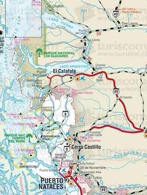
From El Calafate, it is 284 kms to the border in Río Don Guillermo, close to Cerro Castillo. From there, it's another 58 km. of gravel road to the CONAF post at Laguna Amarga, in Torres del Paine National Park.
El Calafate, in turn, is located 215 kms south of El Chalten, the other trekking hot spot of the region.
Public transport and hitchhiking
Tourism Zaahj drives the route El Calafate - Cerro Castillo - Puerto Natales. Get off the bus at Cerro Castillo and wait for the buses described in the previous section coming from Puerto Natales.
Schedules
- Tuesday - Thursday - Saturday: 8:00
- Monday - Friday: 16:30
The trip takes 5 hours to Puerto Natales, but it depends on the immigration control in both Argentina and Chile.
Office El Calafate:
- Bus Terminal, Office 07, El Calafate, Argentina.
- Phone / Fax: 54-2902-491631.
Torres del Paine National Park opening times
Office hours in Sarmiento and Laguna Amarga: 8.30 to 20.30, all year round.
Transporte desde Guardería CONAF de Laguna Amarga a Hostería Las Torres (inicio del trekking)
Para llegar a la hostería hay dos opciones: caminar 7 Km por un camino vehicular (1,5 horas) o tomar un transfer por $2.500 c/u. También hay buenas opciones con el autostop si se viaja en un grupo reducido.
Descripción de la ruta
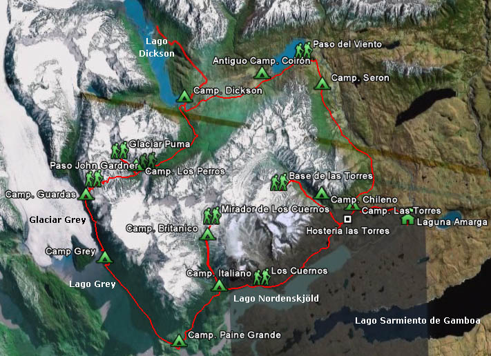
El circuito del Paine es una caminata de 8 días de caminata efectiva (que suben a 9 si se realiza además el trekking al Glaciar Dickson). Lo normal es realizar el circuito en el sentido contrario a las manecillas del reloj, y tomar dos ramales de un día completo importantes (Valle del Francés y Base de las Torres) y un ramal de un par de horas (Glaciar Punta Puma).
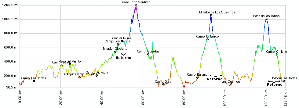
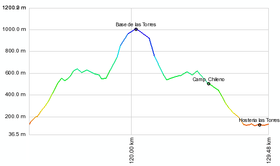
La siguiente imagen muestra el perfil altitudinal de la ruta. Se observa que se trata de un trekking en general de baja altura, lo que no obsta para que, dado el duro clima del lugar, se puedan presentar condiciones de montaña, incluso en los meses de verano.
Día 1: Hostería Las Torres - Serón
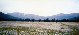
Nota: en esta reseña este tramo ha sido señalado como día 1, pero puede ser también el día 2 si se decide partir el primer día a la Base de las Torres, marcado acá como día 8.
Detrás del albergue “Las Torres”, sale el sendero que inicia el circuito de las Torres del Paine. A poco más de 100 metros aparece el primer letrero que muestra el sendero en dirección al campamento Serón. Se debe subir una pequeña loma y luego cruzar una barrera de madera (se ruega cerrarlas una vez atravesadas, al igual que todas las demás). El sendero atraviesa una zona abierta y despejada, con árboles dispersos (sobretodo lengas y notros). Desde este punto, se dejará de apreciar el monte Almirante Nieto (2.640 m), que domina la zona del hotel Las Torres.
Tras una canaleta de roca aparecerá laguna Amarga, la entrada al Parque Nacional y el camino vehicular hacia el área de llanuras de baja altura, con un clima más estable y seco que la parte más occidental parque, cuya mayor altura atrapa la humedad proveniente del Paífico. A nuestra espalda se podrá observar, a la lejanía, el monte Balmaceda (2.036 m), en caso que no esté cubierto de nubes. Tras cerca de media hora se cruzará una segunda tranca para comenzar a caminar por una zona boscosa, donde pronto aparece otra señalización y una alambrada que discurre en forma paralela al sendero que venimos siguiendo. Quince minutos después se cruz una pequeña vertiente, provista de un puente de madera. Continuando por el sendero, se entrará y saldrá del bosque en forma cíclica un par de veces más.
Tras aproximadamente hora de caminata, aparece una nueva señalización. Desde este punto, es posible observar laguna Azul a lo lejos, y el río Paine en la parte baja del valle. Ahora se podrá apreciar con mayor claridad, en toda el área de la ribera nororiente del Paine (la ribera opuesta de nuestra huella), los efectos del incendio que estalló el 17 de febrero de 2005.
Cumplida la hora y media de caminata, se pasa por sobre un segundo riachuelo, frente al cual está laguna Azul y buena vista al valle del Paine, el río que le da nombre al parque. El sendero luego circunda el cerro Paine (1.508 m., no confundir con el Paine Grande de 3.050 m y el "tres mil" más austral de América), cuyas laderas contienen gran cantidad de troncos quemados debido a los frecuentes incendios del siglo XX. Hacia adelante se verá una quebrada importante, hacia la cual el sendero baja con suavidad, y que trae una cantidad importante de agua. Sigue una nueva barrera de madera, y a continuación la huella desciende a un sector abierto, con algunos ñirres a los lados.
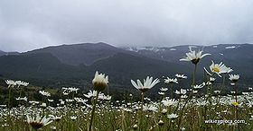
Con posterioridad se bajará a una confluencia de dos caminos: el que hemos venido siguiendo y el que viene desde la portería de Laguna Amarga. Hay una nuevo cartel y otra tranca. Luego se atravesará un terreno ancho y plano, junto al río Paine, bellamente cubierto de margaritas y uno que otro ñirre aislado o en bosquetes. Tras 20 minutos se llega a una pasarela de rústicos troncos provista de un pasamanos de cuerda. Al acercarse más al río, habrá un bosque de ñirres.
Poco antes de Serón se debe sobrepasar una alambrada. La huella pasa por una ladera donde el cerro alcanza el río, último punto antes de llegar al camping. Existe un estero con agua limpia, varias mesas de picnic junto al puesto de una estancia y un pequeño almacén.
El camping Serón es pagado: $4.000 p/p.
- Tiempo total de tramo: 3h 20'
Día 2: Serón - Dickson
Desde Serón hay que avanzar 200 metros paralelos a una alambrada, para luego cruzarla. Aún se camina por la pradera de margaritas y ñirres ocasionales. Se continuará junto a un área pantanosa ubicada a la derecha del sendero. Tras aproximadamente 25 minutos, se pasará por un estero que desemboca en una entrada del río Paine. Luego el sendero asciende junto al río y se torna más pedregoso, al tiempo que surgen los primeros neneos, un curioso vegetal arbustivo con forma redondeada, así como también algunos calafates (posiblemente sin sus famosos frutos, debido al paso frecuente de caminantes). A los 250 metros de altitud, será posible observar una laguna con característica forma de riñón, en cuyo punto existe un cartel indicando la ruta. Se debe entonces iniciar un ascenso en zigzag por un sector de acarreos hasta los 400 metros de altitud, en el llamado "Paso del Viento", y cuyo nombre lo tiene bien ganado. En dicho punto, la huella tuerce hacia al oeste, permitiendo observar el lago Paine en toda su extensión. Desde este punto, se ingresa al área más salvaje y montañosa del parque, y se aprecia la ruta hacia adelante: el camino a Coirón, camping Dickson, glaciar Los Perros hacia la izquierda y el valle que conduce hasta el Paso John Garner. Hacia la derecha, lejos de la ruta, se aprecia el monte Ohnet, de 1.929 m. Al bajar, el sendero bordea el lago Paine. En la mitad del descenso hay una pequeña vertiente. Tras la segunda mitad del lago, el avance es retardado por subidas y bajadas fluctuantes.
Transcurrido una hora y media desde el Paso del Viento, se llega a un antiguo campamento en el sector de Coirón. El lugar está abandonado, carece de atractivos naturales y está muy próximo a Serón, lo que lo hace una mala alternativa para acampar. Hay un pequeño estero. Diez minutos después, se llega al riachuelo que viene de cascada visible ladera arriba. Se sigue luego bordeando la ladera, pasando junto a un sector pantanoso a la derecha. Ahora es posible contemplar con más claridad el glaciar Los Perros, y a la derecha el glaciar Dickson, uno de los tantos desagües orientales del gigantesco Campo de Hielo Sur, bajo los montes Cubo y Daudet. Lo que sigue es un tramo plano, con algunas lomas menores. En las proximidades del lago Dickson se puede ver hacia izquierda las Torres del Paine -la poco usual vista desde el norte- y, a la izquierda del Oggioni (1.697 m.), la Torre Central.
Este sector está poblado por estacas demarcatorias, a cuyos lados se encuentran numerosos rastros de los incendios del siglo XX realizados para despejar praderas para el ganado. Unas dos horas después de Coirón se arriba a los pies de una colina donde hay una construcción abandonada, en una zona pantanosa. Sólo media hora después se llega a Dickson.
El camping Dickson es pagado: $4.000 p/p.
- Tiempo total de tramo: 5h 40'
Día opcional: Glaciar Dickson
En primer lugar, es preciso cruzar el río en un zodiac, disponible en los meses de verano, y que se debe conseguir en el refugio, y para lo cual se debe pagar (¿CUÁNTO?). Una bandera en el lugar da aviso de la salida de trekkeros. Una vez en la otra orilla, se debe remontar un poco la ladera para montarse en el sendero que conduce al lago Paine. A la izquierda hay una loma y a la derecha el río Paine. La huella sigue hacia el norte, rodeando una meseta de roca ubicada a la izquierda hasta salir a un terreno abierto. Se pueden observar la inusual cara norte de las Torres del Paine así como el cordón que conduce al Paso John Garner (y que enfrentaremos en dos días más).
Tras 30-35 minutos hay estacas perpendiculares a la izquierda del camino, rastros de una antigua alambrada. Un letrero en el suelo indica hacia "Carabineros". En ese punto se debe girar a la izquierda y continuar enforma paralela a las estacas, hacia el glaciar Dickson. El sendero es difuso en este tramo, por lo que es importante seguir, por camino con poca pendiente, la antigua cerca o las estacas naranjas. A la izquierda hay una meseta de roca. Luego se entrará a una zona boscosa y se cruzará al poco rato un estero. Tras 10 minutos el sendero gira a la izquierda, en dirección a un desfiladero, donde hay un portezuelo. Pero nuestra ruta asciende una loma y luego pasa por el lado de un acarreo.
Tras hora y media se llega al lago Quemado (300 msnm), al este del lago Dickson, en un entorno marcado por antiguos incendios que de a poco se recupera. El sendero sube y baja varias veces. Tras una media hora desde que se alcanzó el lago Quemado, se retorna a un área de bosques maduros, no arrasados por los incendios. La huella acá está marcada con color naranjo. Hay puentes de madera y pasarelas construidas por Carabineros. En cuanto se deja el bosque aparece el glaciar. Se pasa por un área pantanosa y luego se llega a una pequeña loma, a la izquierda, la que se recomienda ascender para aprovechar su magnífica vista.
Unos 15 minutos más adelante, tras superar otro bosque con esteros y pasarelas, el sendero sube a un lugar despejado, donde se ubica el retén de avanzada de Carabineros, que cubre el área de la frontera contigua a Campo de Hielo Sur. A pocos minutos del retén está el espléndido mirador Dickson, donde además del glaciar se observarán los montes Daudet y Cubo.
- Tiempo total de tramo: 2h 55' de ida, 2h 30' de vuelta, más el tiempo del cruce del río.
Día 3: Dickson - Los Perros
Se comienza por el sendero marcado por una bandera, el cual conduce hacia un tupido bosque principalmente compuesto de lengas, pero también de coigües de Magallanes y notros. Tras 15 minutos se verá hacia le espalda el lago Dickson, y el glaciar del mismo nombre al fondo. A 350 metros de altitud se debe cruzar una antigua alambrada. Luego, se debe seguir por bosque más maduro, cruzando al rato una pasarela de madera.
Antes de internarse hacia el interior, llegará a un lugar abierto con excelente vista junto a un mallín (zona inundada). Hay una pequeña loma con buena visibilidad. El sendero gira hacia la izquierda junto al mallín y luego desciende hacia el río Cabeza del Indio, donde hay una pasarela de maderos. La huella luego asciende por una zona barrosa y se interna hacia el suroeste por el valle del río Los Perros. Tras cerca de media hora desde el Cabeza de Indio se verá una cascada. El sendero continúa próximo al río, con poca pendiente, a la sombra de las fagáceas del lugar, interrumpido por ocasionales árboles caídos y frecuentes esteros de agua fresca.
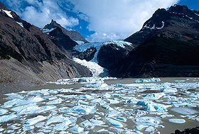
Dos horas y media después de la cascada se arriba a un puente colgante que cruza el río Los Perros. En este punto se vuelve visible el glaciar Los Perros. El sendero remonta la morrena en un tramo donde el sendero se pierde un poco. Tras 15 minutos se alcanza el extremo superior de la morrena, desde donde hay una linda panorámica del glaciar y su laguna, normalmente poblada de hielos flotantes. Se ve también la ruta hacia “El Paso”. Se debe seguir luego por la morrena. El camping Los Perros se ubica al interior de un bosque de lengas, a 540 msnm. Existe un almacén, baños y fogón, y se debe pagar $4.000 p/p.
- Tiempo total de tramo: 4h 20'
Ramal alternativo a Glaciar Punta Puma
Desde el camping Los Perros, se debe salir por la huella que conduce al paso, incluso cruzando el río por la pasarela, pero después de ésta, se debe continuar derecho junto al río O’Brien en lugar doblar a la izquierda en dirección al Paso. Se camina al lado del río por un espacio desprovisto de vegetación. Cuando ya no se puede seguir por este claro, hay que entrar al bosque. La huella es poco nítida y no hay señalizaciones, pero basta con avanzar en forma paralela al río bajo la sombra de un denso bosque de lengas y coigües de magallanes. Luego se ascenderá por una ladera y el río será visible hacia abajo, en un sector más encajonado. Tras aproximadamente 25 minutos, se llega a un sector de vegetación achaparrada que crece sobre la morrena, punto desde el cual el glaciar Punta Puma ya es visible. Luego hay que atravesar una pequeña barrera de piedras sueltas antes de montarse sobre un terreno rocoso desprovisto de vegetación. Llama la atención un bosquete aislado de lengas jóvenes. El trayecto restante hasta el glaciar es por un camino de poco pendiente. Tras una hora de caminata y a 750 metros de altitud se alcanza el hielo del glaciar. El extremo inferior está recubierto con piedras y cae con una suave pendiente al valle, pero es posible caminar un poco sobre él hasta un área de hielo blanco. Este ramal es recomendable de recorrer si se ha llegado temprano al camping Los Perros (antes de las 16) pero en ningún caso se recomienda destinar un día completo a él.
- Tiempo total de tramo: 1h de ida hasta montarse al glaciar, 45' de vuelta
Día 4: Los Perros - Paso John Garner - Guardas
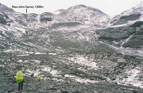
Es el día más duro del trekkig. Desde el camping Los Perros, se debe continuar por el sendero cruzando el río por la pasarela. Luego se debe girar a la izquierda, en dirección hacia el Paso. La huella ha sido señalada en los árboles por un buen trecho. Luego se debe superar un sector pantanoso (es la única parte del trekking que en verdad justifica polainas) que se prolongará durante la próxima hora de caminata. Hay algunos sectores abiertos con buenas panorámicas. Tras hora y media, a 760 m la huella se aproxima al río Paso, que hay que cruzar guiándose por las marcas naranjas, en un tramo más angosto. Es importante acertar al lugar, porque no es fácil de cruzar en otros puntos. La huella persiste su ascenso en la otra ribera, dejando atrás el barro. Ahora es terreno pedregoso y usualmente ventoso, propio de la media montaña. Ahora las marcas naranjas están en las rocas. A partir de varios cientos de metros por debajo del paso, se vuelve probable encontrar nieve, incluso en los meses de verano. Y si hay pronóstico de lluvia, en esta zona posiblemente caiga nieve.
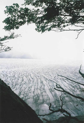
El paso John Garner está a 1200 msnm., 1 hora y media más adelante que el cruce del río, y permite cruzar el macizo de la cordillera del Paine hacia el sector occidental del parque. La vista a Campos de Hielo Sur y su glaciar Grey es espectacular, por lo que, sumado a la descrita posibilidad de nevadas, resulta muy recomendable realizarlo con buen tiempo. Hay varillas naranjas que sirven para guiar el camino cuando el clima empeora la visibilidad. El descenso se realiza por una morrena, y con siempre con bellísima vista. Es posible apreciar el retroceso del glaciar Grey: el antiguo nunatak ahora es una península, y recientemente ha aparecido un segundo nunatak. Tras 15 minutos de descenso, a 950 m., se vuelve a los primeros atisbos de vegetación, con algunas lengas empequeñecidas y dobladas por el viento. A medida que se camina por el bosque, el glaciar es visible entre las ramas. El descenso es abrupto y difícil, con bastante pendiente.
A los 550 m. y tras algo menos de 2 horas de descenso se llega a un antiguo sector de campamento, bastante estrecho, ubicado entre los árboles, señalado por letrero como "Campamento EL Paso". Se debe continuar en dirección sur, en forma paralela al glaciar. Hay algunas vertientes junto a grandes lengas. Tras 40 minutos desde el punto anterior, se llega al campamento El Paso, ubicado en un estrecho sector junto al sendero y un riachuelo. Hay un pequeño baño y un container abierto que sirve de cobijo y lugar natural de reunión de los campistas. Es un lugar sin servicios ni baños, pero es gratis.
- Tiempo total de tramo (hasta El Paso): 5h 45'
Nota
A partir de este punto (lo que en esta reseña figuran como días 5 y 6) la forma de distribuir los días no es tan clara como en los días 1 a 4. El día 7 claramente será hasta la Hostería Las Torres pero puede variar el punto de partida. El día 8 (que también puede ser el 1) es casi fijo también (salvo para quienes quieran seguir al Valle del Silencio, quienes podrían tomar dos días) por lo que sólo los días 6 y 7 muestran mayor dispersión de opciones entre los trekkeros.
- Opción 1: La que se recomienda en esta reseña. Acampar en Guardas (camping gratuito pero sin servicios). Al día siguiente caminar hasta Paine Grande, y al día siguiente seguir al Campamento Italiano, dejar el equipo de camping, continuar al Valle del Francés y volver al Italiano.
- Opción 2: Acampar en El Paso. Al día siguiente caminar hasta Paine Grande (día largo), y al día siguiente seguir al Campamento Italiano, dejar el equipo de camping, continuar al Valle del Francés y volver al Italiano.
- Opción 3: Acampar en Guardas, al día siguiente caminar hasta Paine Grande, y al día siguiente seguir al Campamento Británico. Luego seguir desde el Británico hasta Las Torres en un sólo tramo.
- Opción 4: Seguir caminando hasta el camping Grey, en otras 4 - 4 1/2 horas (día bastante duro). Al día siguiente llegar hasta el camping Italiano y al siguiente subir y bajar el Valle del Francés.
- Otras opciones que combinen las anteriores.
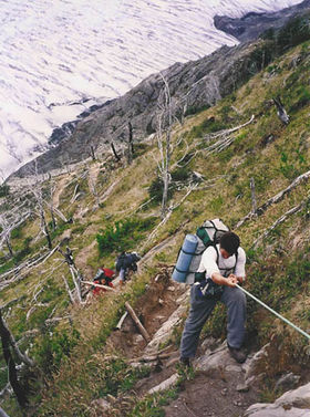
Desde El Paso se remontará una gran subida que conduce a un mirador del Grey. El sendero continúa bien señalizado con numerosas subidas y bajadas, y frecuentes raíces que se deben superar. Luego se cruzan varias quebradas pequeñas con agua y un segundo mirador. Hay luego que seguir por una zona de precipicios y viejos incendios, visibles en rastros de árboles quemados. Tras una hora de caminata se alcanza una quebrada de mayor tamaño, donde una rústica escalera facilita el ascenso. Se sigue por un abrupto precipicio, a orillas del Glaciar Grey. Veinte minutos más adelante hay otra quebrada provista de una escalera de madera. Superada la zona de acantilados se reingresa al bosque de lengas y coigües. Luego sigue otra quebrada más, con enormes farellones que caen hasta el glaciar.
- Tiempo total de tramo (hasta Guardas): 8h 45'
Día 5: Guardas - Paine Grande
Desde Los Guardas la ruta continúa por el bosque y tras 35 minutos se llega a un mirador del Grey. Luego el sendero se aleja del glaciar y se interna por un bosque hasta. A una hora y media desde Los Guardas hay un cruce señalizado que lleva al refugio Grey, así como la huella que conduce hacia el mirador.
The refugio is beside the lake of the same name, in the middle of a lenga forest, adjacent to a sandy beach. From there also comes another trail that leads to the viewpoint of the glacier. There is camping, storage, shelter and guided walks over the glacier.
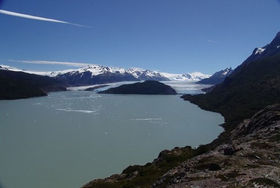
The trail to Lake Pehoe advances through flat land, in a southeasterly direction. The terrain is smooth, and after 15 minutes there is a short climb and then it continues at the same altitude, to reach the bridge over the river Olguin, located on a narrow stretch of the river. After half an hour from the refugio the trail climbs quite a bit through rough terrain. It is a muddy area, with abundant vegetation. After the highest point is reached, the path continues with the Grey Lake to our right. Later, there is another climb, an area where is not uncommon to find some water dripping. In this new ascent, there is a viewpoint towards the glacier, lake and its icebergs. Then follows a rocky path, that ascends to 450 m.
After just under 2 hours of walking, having left behind a flat stretch with small lengas, the trail begins to descend gently to the "Quebrada de los Vientos" area, right after a section of rounded boulders where the south beach of Lake Grey is visible, normally populated by ice (and tourists, given its access by road). Walk around the side of a small lagoon and continue to descend, with the incredible emerald Lake Pehoe as backdrop.
Refugio Paine Grande (ex Pehoé) is situated adjacent to Lake Pehoe and has a wide but windy paid camping ($ 4000 p / p). It is commonly fully booked, so get there early if you plan to sleep. There are toilets and well-stocked store (even T-shirts and souvenirs are sold). There is also a hotel. From this point you can either:
- Continue the trek to Valle del Francés (thes route this article describes)
- Walk to the park entrance along a flat (and somewhat boring) trail, flanking the Grey River (5 hours),
- Take the catamaran to Pudeto .
- Tiempo total del tramo: 5h 35'
Día 6: Paine Grande - Valle del Francés
From Refugio Paine Grande, continue towards Valle del Francés (or "French Valley") along a clear path that runs along the northern shore of Pehoe Lake. Within a few minutes there is a slight rise that hides the lake behind us. Appreciate the Cuernos del Paine ahead (2,600 m the highest). Then the trail becomes winding, and enters a flat area, with little vegetation due to the persistent wind. Then a stream is crosseb with a wooden plank.
The trail passes at the foot of Punta Bariloche (2,600 m). After 30 minutes Skottsberg Lake appears, known for occasional wind eddies that form in its waters. The trail continues along the western bank of the lake, overlooking the Paine Grande (3,050 m.), the southernmost "threethousand" of America. A small waterfall and some glaciarettes are visible on the left. Several springs come from the hillsides and cross the path. In one of them, there is an orange arrow that shows the way to a more comfortable path.
After walking 40 minutes along Skottsberg Lake, the end of it is reached. At that point there was a dense forest of lenga and coigüe de magalllanes, which unfortunately burned in the fire 2011-12 (although there are still burned trees). The trail ascends slightly, and there are some wooden steps. Fifteen minutes later, you will pass a small pond on the right. There are several wooden walkways. After another half hour of hiking, you will appreciate the full scale of the Paine Grande Massif, with its majestic ice. In this area the trees form larger and denser forest of notros. After crossing the Francés river by two suspension bridges you reach the camp Italiano, located at 220 meters above sea level amidst a beautiful forest of lengas. The setting of this camp is beautiful, facing Paine Grande and the Francés Glacier. It's free and there are toilets. From here you can continue into the valley, one of the most beautiful corners of the park. The ideal place to fully enjoy the area is to camp.
The route into the Valle del Francés (the intermediate vertical stroke of the "W") begins at camp Italiano, where the path moves northwards along the eastern bank of the Francés river. Once out of the forest, it climbs up trough a rocky terrain. There are many stones painted with orange marks. After 25 minutes, the Nordenskjold Lake appears on the horizon, at a point where there is a deep ravine with water at the bottom. The track then climbs a rocky area with both Francés glacier and Paine Grande visible on the left. About 10 to 15 minutes later you come to a sharp rise, well equipped with fixed ropes. It then continues along a ridge through a forest of lengas. To the right there is a little depression, behind which the walls of the Cuernos del Paine (2,600 m) rise. Marching for another hour, a stream is reached. The orange marks persist on the right. The trail goes up sharply, along a stream. From there, it follows by a lenga forest.
After 1 hour and twenty minutes from the camp Italiano, you get to an open and windy place, called "Mirador" (680m), from where the valley is dominated. To the east, Hoja (or "sheet", 2,200 m), Espada ( or "sword" 2,500 m) and Fortaleza ( "fortress", 2,681 m) are visible. Heading south, Nordenskjold, Pehoe and Toro lakes are also visible. Soon, the trail returns to the forest shade. Hopefully, you will hear the fall of some serac falling from Paine Grande. The trail continues under the shade of the trees keeping the altitude, parallel to the river. The notorious Aleta de Tiburón ("Shark's Fin", 1,717 m), so named for its shape, can be appreciated. There are marks on the trees now, and the path climbs gently. The trail then leaves the forest to an open, marshy area, which constitutes a second viewpoint. Oranges marks become the guide to reentry the forest.
After more than an hour from the viewpoint, the Británico camp is reached. It lacks services, but it's free, and an excellent place to camp. Only five minutes after that, you pass through an area of white stones. Then the trail climbs a steep and rocky sector.
Fifteen minutes later the Británico, we reach the lookout La Piedra ("The Stone" 1,100 m), a great place to admire the Espada (2,500 m), Hoja (2200), Máscara ("mask" 2,300 m), Cuerno Norte (2,400 m), Aleta de Tiburón(1,717 m), Cabeza de Indio ( "Indian Head" 2,230 m), Fortaleza (2,681 m), Escudo ("Shield" 2,440 m), Trono Blanco ( "White Throne" 2,197 m), Catedral ("Cathedral", 2,168 m), Punta Catalina (2,100 m), Aguja ("Needle" 1,703 m) and Cota 2000 (2.000 m).
- Total expected time: 2h 25 ' from Paine Grande to Camp Italiano. 2h 55 from the Italiano to Mirador La Piedra and 2h back to Italiano. Total: 7h 20 '
Día 7: Valle del Francés - Hostería Las Torres (Los Cuernos del Paine)
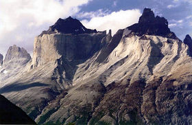
From Italiano Camp, the trail goes down toward the southwest and continues along the northern shore of Lake Nordenskjold, at the foot of the massif of the Cuernos del Paine, whose impressive granite walls are visible most of the way. First you must cross a wooded area. After 10 minutes, an area of peat and vegetation stunted by the wind is reached. This entire section usually has a lot of mud, although there are wooden bridges in the worst areas. The path is gets closer to the lake, until it reaches the shore. Then it follows the beach, and it goes back to the forest after that. We return to the forest to reach the camping / shelter Cuernos, right at the foot of the Cuerno Este (2,200 m), as well as the stream that descends from the Bader Valley. That's about two hours from camp Italiano. It is also a beautiful viewpoint. There is a camp fee.
Just after that, a creek is crossed by a wooden walkway. Then it ascends to continue parallel to the lake. The Bader Valley, a beautiful but rarely visited area of the park, is visible to the left, between the Cuerno. You come to an area of numerous streams, that requires several ups and downs before it stabilizes. There is a beautiful view of Nordenskjold lake to the right.
The trail then continues farther from the lake, at the foot of Almirante Nieto (2,640 m) until it reaches a small lake on the right, next to a wetland. From this point begins the descent to the lodge.
Shortly before the Hosteria Las Torres is visible, you will se to the left the path that goes up to the base of the Torres del Paine. A suspension bridge crosses over the Ascencio river and then finally heads to Hosteria Las Torres, where there is also camping and a hostel sector. There is a forest of ñirres and several creeks. The place is very busy between December and February.
- Total expected time: 5h 45'
Día 8: Base de Las Torres (2 días si se visita además el Valle del Silencio)
This is by far the most popular walk of Torres del Paine National Park. It can be crowded from late december to the end of february. The trail is, therefore, very clear. From Hosteria Las Torres, the path penetrates into the valley. After 10 minutes, an old suspension bridge crosses the Ascensio river. About 150 meters further you will find a bifurcation: to the left it leads to the our destination, and on the right it heads towards Los Cuernos and Valle del Francés. Then, it follows a zig zag in a slope sparsely vegetated and very well marked. The lack of vegetation and high traffic has badly eroded the area and formed several parallel tracks, so take care to keep in the main track and avoid further erosion. The there is another trail at left that leads to Los Cuernos. You gain near 375 meters in this section (from 135 meters to about 500 m.). Then there is a drop of 50 meters, after which the path becomes far less steep. Consider about an hour to this spot. You will then cross a spring. After 45 minutes from the end of the zig zag, Chileno Camp is reached, on the opposite bank of the Ascensio river, in the shade of a lenga forest. There is a bridge to get there. The camping costs $ 4,000 per person and there is a cafe, but no store.
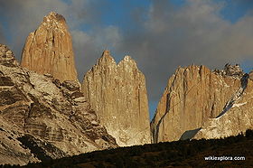
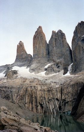
No need to cross the river because the trail always continues along the southwest bank. In the following section, the trail gets into the forest of lenga, with a fairly moderate slope. It crosses several small streams that drain the north face of Almirante Nieto. After about 70 minutes from Chileno, at 700 m., the foot of the moraine that gives access to the lookout is reached. There is a sign indicating the trail to the lookout and fork to Las Torres camp (with toilet). The last leg of the hike is far steeper. Continue next to a stream, under the shade of small trees located on the edge of the moraine. Further up, the trail dissapears and you will have to walk over the bare rocks, some of which are marked to show the route. After 45 minutes from the sign "700 meters", you will be at the east end of the lagoon. The landscape is wonderful, with the three towers (Central, Monzino, De Agostini) in full view, and the mountains Peineta and Nido de Cóndores.
- Tiempo total de tramo: Tres horas y media de ida y dos horas y media de vuelta, más el merecido tiempo de descanso y fotos en el mirador.
Tiempo total esperado del Trekking Torres del Paine, circuito completo
La reseña anterior muestra 8 días, o 9 si se incluye el poco frecuentado ramal a Glaciar Dickson. Dado que el clima en la zona es inestable y lo más probable es que hayan días de mal tiempo, es deseable considerar al menos 11 días de caminata.
Torres del Paine National Park fees
All campsites must be paid in advance, and you will not be able to start the hike on day 1 if you can't show the rangers that you have a booking for each campsite on consecutive nights.
(Chilean pesos (1 $US equals aprox $600))
| High season (01 oct-30 apr) |
Low season (01 may-30 sep) | |
| Chileans | $5.000 | $3.000 |
| Foreigners | $18.000 | $10.000 |
| Children | $500 | $400 |
Updates in park fees can be checked here
Campsites
- Torres: $6.000
- Chileno: $6.000
- Base Torres: gratuito
- Cuernos: $8.000
- Italiano: gratuito
- Británico: gratuito
- Paine Grande: $4.800
- Grey: $4.000
- Serón: $4.000
- Dickson: $4.000
- Los Perros: $4.000
- Paso: gratuito
- Los Guardas: gratuito
Shelters
- Torre Central: bed with sheets, pillow and blanket: $38.000
- Cuernos: bed: $24.500 / bed with sleeping bag: $28.500 (there are no sheets here)
- Paine Grande: bed: $26.500 / bed with sheets: $40.000
- Grey: bed:$17.300 / bed with sheets: $40.000
Recomendaciones
Tiempo
- Considerar al menos 3 días de mal tiempo para tener holgura y no "sufrir" caminando bajo la lluvia, sobre todo el día del paso John Garner.
- Muy recomendable bajar el este mapa del parque, con todos los senderos y sus tiempos, o el también completísimo Mapa de CONAF.
Equipo recomendado
- Zapatos: deben ser de cuero, en lo posible sin inserciones de tela, impermeables o con membrana de Gore Tex, ya que podrá encontrar nieve e intensas lluvias durante el recorrido. La suela debe ser profunda y en lo posible con taco, ya que el terreno es resbaladizo. Se recomienda usar dos pares de calcetines, un primer par delgado y de un material no absorbente. El segundo par debe ser grueso para abrigar y proteger del roce.
- Ropa: el clima en la zona es muy variable, desde una mañana asoleada y tibia a una tarde con nieve y bajísimas temperaturas. Se deben usar prendas interiores sintéticas de fibra hueca que no absorben agua y conservan la temperatura, jamás usar algodón o jeans. Una chaqueta y pantalones probadamente impermeables son absolutamente necesarios, ojala sean respirables (Gore Tex o similar). Se deben llevar sombreros para el sol y el frío.
- Anteojos: deben tener una efectiva protección contra los rayos UV, ya que en esta región la capa de ozono que filtra éstos se encuentra muy debilitada. Se recomiendan rangos de 95% a 97% de eficiencia.
- Bastones: un par de bastones de esquí o caminata suelen ser muy útiles, cuando se camina cargado por senderos difíciles.
- Mochila: deber ser cómoda y suficientemente amplia para acarrear todo el equipo adentro. Se debe considerar un cubre mochila para las lluvias o bien llevar todo envuelto en bolsas plásticas.
- Carpa: los vientos son muy fuertes y es frecuente encontrar lluvias y nevazones en Patagonia: La carpa debe tener un cubretecho impermeable, debe ser robusta, ojala mástiles de aluminio y tener a lo menos cuatro vientos para poder afirmarla bien en caso de tormenta.
- Botiquín: debe contener los siguientes elementos: bloqueador solar, sales de rehidratación, carbón, sulfaguanidina, aspirina o similar, calmantes de dolor, parche curita, puntos autoadhesivos, tijeras, pinzas, alfileres de gancho, desinfectante líquido o crema, vendajes, cinta adhesiva, termómetros, gasa para limpiar heridas.
- GPS o, en su defecto, brújula: Totalmente prescindible, pero deseable. La combinación de GPS y la ruta KMZ que se puede descargar desde esta página vuelve aún más sencilla la orientación en un circuito que en general no presenta dificultad alguna de orientación. Un lápiz para los registros es también deseable.
- Llevar cocinilla a gas o bencina blanca, ollas livianas para cocinar, una linterna frontal y un buen saco de dormir.
- Condiciones climáticas: En Patagonia el tiempo cambia muy rápidamente, se recomienda observar diariamente los barómetros y estar atento al cielo.
Supplies within the trails of Torres del Paine National Park
Some limited supplies are sold within the trails, at prices 3 to 4 times those of Punta Arenas. So you have the choice if you want a lighter backpack. The selling points are located at Hostería Las Torres, Serón (not always), Dickson, Los Perros, Grey and Paine Grande (former Pehoé). Bread is not always available, but groceries normally are.
Prices in february 2013 (CLP):
- 400 grams of pasta: $2.000
- Tomato sauce: $1.000
- Rice: $1.500
- Soup: $1.500
- Propane: $5.000
- Egg: $250
- Oat: $3.000 1kg
- Biscuits ("Triton"): $1.000
- Sliced bread: $2.000-$5.000 (it varies from camping to camping)
- Soda can: $1.500-$2.000
- Beer can: $2.500-$3.000
There are also sweets and chocolates, and batteries.
Electricity on the campsites works only for a couple of hours, so bring your batteries fully charged
You can also buy cooked meals at Base Torres, El Chileno, Cuernos, Paine Grande and Grey:
- Breakfast: $6.500
- Meal: $11.000
- Box lunch for the walk: $8.500
Record de velocidad
El récord de velocidad para este circuito (O+W) fue impuesto por el estadounidense Andy Tubbs el 28 de febrero de 2007: 18 horas y 30 minutos. Noticia
Photo gallery of Torres del Paine National Park
Photos of the whole park are included
Revisa la lista completa de 623 rutas de trekking y las 345 rutas de montaña en Chile
|


