ENG:Horcón de Piedra
|
|
|
| |||||||||||||||||||||||||||||||||||||||||||||||||||||||
Suitable Time
All year. In autumn the oaks offer their reddish tones and in winter the view to the Andes mountain range is excellent. If you go for more than 1 day, avoid late summer, when small water courses can be dry.
Access
From Santiago take route 5 southbound. They are 50km until the exit to Champa, shortly after the city of Paine. Continue on the road that goes to the Aculeo lagoon (west), passing through Pintué and then Rangue, where the pavement ends. The route continues along a dirt road to where a hill that zigzags up to the provincial limit begins. Just where the path begins to descend, the ascension path begins. They are 23km from route 5 through a beautiful rural route up to this point, located 600m.
- 'Attention' : The access and ascent described here correspond to the classic route used for several generations by hikers to ascend the Horcón de Piedra. However, this route runs through private lands, whose owners currently prohibit the entry referring to their intention to preserve the place.
Ascension
Next to the vehicular road (south) there is a fence with a door to cross. The trail is visible from the beginning and starts with the southwest direction. About 50m from the road there are erosion cracks to the left of the path. The route ascends by them (this is VERY important because the cracks erased the path and as the footprint by which one goes walking continues very clear towards the Horcón de Piedra, everything makes it think that continuing for it is the right thing). After a few meters you pass by a large stone monolith, which confirms the correct path, and a few meters further on you cross a small watercourse.
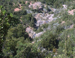
Continuing along the path, a slope ascends that leads to the north ridge of the hill. The footprint, well marked, continues along the edge next to a leafy forest. After ½h of walking you have a fairly complete perspective of the route. You must continue along this edge approx. 1h more until the route heads west, crossing the hill in width. A gentle descent, which passes along a couple of animitas and a sign that tells the limit of the Los Hornos farm (1240m), allows you to reach a beautiful estuary, with appropriate pools for bathing and surrounded by a forest of large peumos and other species . The place is ideal for a camp in case of going for more than 1 day (CB1, 1240m, 2h30-3h from the vehicular road). Here the routes to Horcón de Piedra and to Alto de la Cantillana diverge: the first crosses the estuary and continues towards the west, while the second ascends parallel to the estuary, without crossing it.
Just 10 minutes from this point is a beautiful forest of mature oaks, located on a slope of slight south orientation, at the foot of a rocky promontory. The path crosses the forest in a northwesterly direction and in ½h it reaches the pass between the rocky promontory and the ridge that leads to the summit (1680m). From here, a gently sloping path in the southwest leads directly to the summit at approx. 1 hour. In the last section the path is diluted and the slope increases, however it is not important as the vegetation becomes scarce and there are no obstacles. When it has reached what seemed like the summit, other cliffs to the east appear as candidates. The true summit is the easternmost, crowned by a rocky tower. The climbing of the top tower, which may seem somewhat complex, is easily done on its eastern flank.
The view from the summit is simply spectacular. Consider 5h-6h of ascent and 3h-4h of descent.
Recommendations
- Checklist: Aunque sepas perfectamente lo que debes llevar, es preferible chequearlo al empacar. Esta ruta ha sido clasificada como Type 1 equipment checklist: low altitude route, without camping, snow or cold.
- After the summit, it is recommended to continue on the edge towards the east, in an aesthetic walk. After 2h-3h a large plateau is reached, crowned by tall trees. You can then descend by a well marked path that, parallel to the rising estuary, continues until it joins the CB1. It's a lot longer than going down the same route, but it's worth it.
- In summer, bring a swimsuit.
Permits / Rates
You must pay $ 4,000 pesos to enter the reserve for the day. If you also want to camp inside, the figure goes up to $ 6,000 'Since 2016 you have to reserve to be able to enter, and the maximum number of people admitted per day is 30. Now they only open weekends and holidays.'
To communicate with the Corporation that manages the property, Joaquín Solo de Zaldivar should be written to the following address: Armando Jaramillo 1111, Vitacura, santiago. E-mail: solozal@entelchile.net. Telephones 09.3255549 - 7455067 - 4157216.
Galería de fotos
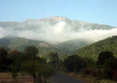
Vista desde el Oeste. The plateau of Alto de Cantillana corresponds to the third edge backwards. In its extreme right you can see the hill Horcón de Piedra. Image: Juan Francisco Bustos
External links
Weather forecast
- Meteochile Región de Valparaíso
- Accuweather Valparaíso
- Accuweather Viña del Mar
- Meteochile Región Metropolitana
- Accuweather Santiago
- Accuweather Puente Alto
Revisa la lista completa de 623 rutas de trekking y las 345 rutas de montaña en Chile
|


