ENG:Punta Guanaco
|
|
|
| |||||||||||||||||||||||||||||||||||||||||||||||
Appropriate time
- 'Trekking' : October to May. Better in November and December, when there are still some slabs of hard snow.
- 'Randonnée' : The appropriate time for the promotion in randonnée is only in the months of June and July of a normal year. Snow is scarce in the area. After the end of operations in Chacaltaya (Bolivia), El Arpa Ski Center is the most equatorial in the world.
Car access and road condition
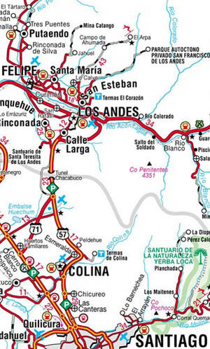
From Santiago, they are 73km to the city of the Andes in a northerly direction. From Valparaiso, it is 140km to the same city. From Los Andes it is 35km more to El Arpa ski center. To do this, continue to San Esteban and, from there, to Lo Calvo. Just before reaching Lo Calvo, turn right, towards El Cobre, and continue towards Campos de Ahumada, where there are usually goats. The last 16km to the El Arpa Ski Center are not paved and the last 5km are a zigzag in quite bad state. At the end of the road there is a small cafe where you can leave the car.
Access by public transport and hitchhiking
There are only buses to San Esteban, and the chances of success in hitchhiking are rather low (even more so with skis) because the road is very little traveled. It only leads to the ski center, which is not visited by more than 10 to 20 cars a winter day.
Description of the route
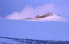
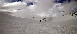
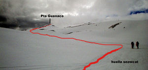
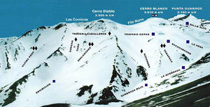
From the cafeteria sector (2973 meters above sea level), you must ascend through the great ravine that rises towards the northeast (in the image of the tracks, the ravine appears first as "low ravine" and then as "ravine"). This is the route used by snowcat (caterpillars) to take skiers to Valle Alto and Cerro Blanco (3610m), so if you go up in winter you can follow the tracks left by them. It is a very well marked valley, with moderate slope. After 1h of march the gulch begins to turn towards the north and, after a pronounced slope, the Punta Guanaco hill (3740m) appears in the horizon. The High Valley is reached after passing a last stretch of little slope. The snowcat route turns to the left, but fate is to the front, to the northeast. Then you must cross Valle Alto, a section that takes about 1 / 3h, until reaching the base of the ridge cone. The terrain is quite regular and very open, so the cone can be overcome from almost anywhere, although in winter it is easier on the west side, where there is a little marked ridge, without snow. Once at the top of Cerro Punta Guanaco (3740m), the view of Aconcagua (6959m) is impressive. The massif of the Cordillera de la Costa, with the Oak (2204m) and La Campana (1980m), is also visible. The clarity of the route explains the brevity of the description.
Expected time
At a normal pace, this climb should take about five hours between the parking lot and the summit.
Permits / Rates
- To access the valley, you must pay a permit of $ 9,000 per person, which is only charged while operating the ski center.
Recommendations
- Especially in winter, call to ask about the state of the route: 9 579 0877
- Visit the Ski Arpa website
- Bear in mind that the ski center closes after intense snowfall due to the risk of avalanches.
- It is also possible to rent randonee, for a value of $ 3,500 p / p (US $ 6) in the year 2005 (update!).
- In winter, when the Ski El Arpa center is open, you can pay the $ 10,000 p / p (US $ 22-18) that costs the snowcat ascent to the Valle Alto, in which case the crossing to the summit would take approx. only 1h.


