Plantilla:Base de Las Torres en
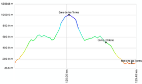
This is by far the most popular section of the [[Torres del Paine] National Park], and most likely in the summer period is that they have many other hikers along the way; The route is, therefore, very clear. From the Hosteria Las Torres, is a path into the valley. After 10 minutes of walking, an old suspension bridge that crosses the Ascensio river crossing. About 150 meters further, a bifurcation occurs: on the left leads to the base of the towers and on the right the path leads to Los Cuernos. Then follows a zig zag sparsely vegetated slope and marked. This zig zag product of the few trees and high foot traffic, is badly eroded and formed several parallel tracks, so care must be taken not to further erode the ground. It will go along with a new bifurcation to Los Cuernos, towards izuierda. This section allows you to earn near about 375 meters of altitude, from 135 meters. to about 500 m. before entering the valley itself and stabilize the slope, but not before drop 50 feet to the first side. About an hour out here. Then rises again and walks past other side. After 45 minutes from the end of the zig zag Chilean camping is reached on the opposite bank of the Ascensio river, in the shade of a beech forest. The camping costs $ 4,000 per person and there is a cafe, but no store.
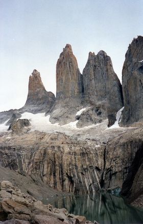
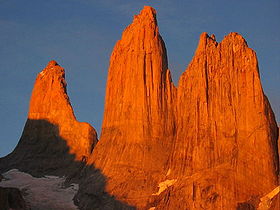
No need to cross the river by the bridge and stop, because the trail continues along the southwest always bank. In the following section, the trail into the forest lenga with moderate slope, crossing several aspects that fall from the Almirante Nieto. After about an hour ten since the Chilean site, 700 m., The foot of the moraine that gives access to the lookout is reached. There is a sign indicating the trail to the lookout and fork to camping Las Torres (at this point one can replenish water and use the bathroom). From this point the trail goes far steeper. First is next to a shed and under the shade of small trees located on the edge of the moraine, but above the trail is lost as such and must continue climbing the rocks, some of which are marked to show the route. After 45 minutes, from the sign 700 meters, the east end of the lake, where you have a wonderful view of the three towers (Central, Monzino, Dagostini) hills and is reached Peineta y Nido de Cóndores.


