Diferencia entre revisiones de «GPT20 - Volcán Antillanca»
De Wikiexplora
(Página creada con «{{Draft}} {{RutaForme |Actividad=Trekking |País=Chile |CiudadesChile=Osorno |BellezaEscenica= |Atractivos=Vistas panorámicas |Duracion=días |RequiereHabilidadTrek=No req...») |
|||
| Línea 19: | Línea 19: | ||
|Imágen Principal=ejemplo.jpg | |Imágen Principal=ejemplo.jpg | ||
|ComentariosImagen=Caption | |ComentariosImagen=Caption | ||
| − | |KMLZ= | + | |KMLZ=GPT20 - Volcán Antillanca.kmz |
|TipoDeMap=HYBRID | |TipoDeMap=HYBRID | ||
|ComentariosMapa= | |ComentariosMapa= | ||
Revisión del 11:02 27 mar 2019
This article is just a draft. You can help by expanding and improving its content
|
| ||||||||||||||||||||||||||||||||||||||||||||||||||||
Section Statistics
Basic statistics
| Traversable | Dec - Mar (Conditionally: Nov, Apr) | |
| Packraft | Useful | |
| Hiking | Packrafting | |
| Attraction | 3 / 5 | 3 / 5 |
| Difficulty | 4 / 5 | 4 / 5 |
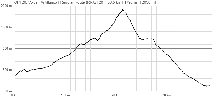
| Distance | 38.5 km | 13 h | 38.5 km | 13 h |
| Direction | Both ↓↑ | Both ↓↑ |
| Comment | - | |
| Status | Published and Verified | |
| Zone | D: Zona Rios y Lagos Chilenos | |
| Region | Chile: Los Lagos (X) | |
| Start | Anticura, CONAF | |
| Finish | Las Gaviotas | |
| Previous Section | Next Section | Alternative Section |
| GPT19 | GPT21 | No |


