Diferencia entre revisiones de «ENG:Cerro el Roble»
(Página creada con «{{GT}} EN:ENG:Cerro el Roble category:KMZconTrack Category:Parche Cordillera de la Costa {{Indexada}} Archivo:El Roble.JPG|frame|center|Cerro El Roble desde l...») |
(Sin diferencias)
|
Revisión del 18:30 5 jun 2019
|
|
|
| |||||||||||||||||||||||||||||||||||||||||||||||||
Appropriate time
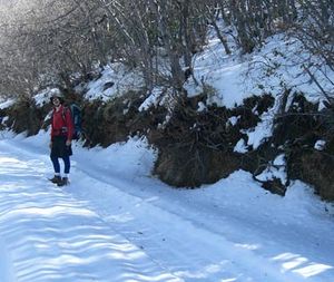
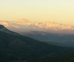
It can be done all year. The ideal time is May, when the oaks are red. The second best time is in the winter months, when the Andean mountain range is snowy and superb, and you have a great view of Monte Aconcagua and company.
Access
By car
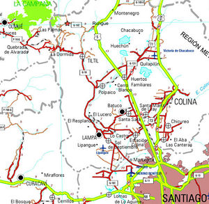
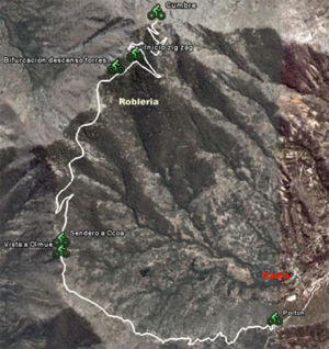
From Santiago, you must take the Pan-American highway (route 5) in the north direction. The detour to Rungue is at kilometer 54. You must take that exit and enter the town. Where the street ends, we must turn left and, a few meters further on, turn right (the street ends anyway) to cross an estuary. Immediately after crossing the estuary, you should turn left, and begin to skirt the estuary along a gravel road in good condition. The Rungue reservoir will then be bordered. After 3.9 kilometers from the Pan-American highway, there is a detour to the right ("A Caleu") which must be taken. This road, also gravel in good condition, goes through the valley and ascends progressively. Approximately on the 11th kilometer from the turnoff (14.9 from the Pan-American Highway) Caleu has been reached and a fork arises: you must take the left, which continues up the hill. 970 meters above, just before the passage to the valley of Olmué, the path to the oak tree appears on the right.
In public transport and hitchhiking
From the La Paz bus terminal, located on Avenida La Paz and Dávila Baeza street, daily buses depart for Til Til, from 6 AM and every 15 minutes. At 16.00, a bus leaves for Caleu. Passage value $ 1,600. It is quite a busy road, so the possibilities of hitchhiking are rather high.
Description of the rout
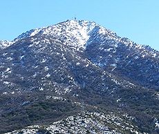
Later, in the oak forest, and then a hard zig-zag begins. Shortly before the summit you can see some towers of the transmission line. The summit (2,222 meters above sea level) is a flat for large, with telecommunications services that detract from the feeling of nature, but in all ways the view is impressive.
Expected time
- Trekking: 4 hours from the gate. The entry of motorized vehicles is prohibited. Cars are parked 500 meters from the port indicating the entrance.
Recommendation
- Checklist: Aunque sepas perfectamente lo que debes llevar, es preferible chequearlo al empacar. Esta ruta ha sido clasificada como Type 1 equipment checklist: low altitude route, without camping, snow or cold.
- The ascent on a bicycle and any motorized vehicle is not allowed.
- Camping is prohibited.
- The entry of pets is prohibited.
- It is forbidden to carry out a fire or to intervene in the spaces of the sanctuary.
- Do not extract flora.
The entrance schedule is from 08:30 am to 12:00 hrs. Sometimes many people arrive and cut the income before, so it is advisable to arrive early. At 2:00 a park ranger indicates to the visitors the moment of descent. The request of the park rangers must be respected. The doors close at 17:30 hrs.
Weather forecast
- Meteochile Region of Valparaíso
- Accuweather Valparaíso
- Accuweather Viña del Mar
- Meteochile Metropolitan Region
- Accuweather Santiago
- Accuweather Puente Alto
Contact
- THERE IS NO OFFICIAL WEB PAGE OF CERRO EL ROBLE, The administration has only a Facebook page, through which it is possible to communicate directly with people who work in the sanctuary. This is the link: https://www.facebook.com/SantuariodelaNaturalezaCerroelRoble/
- The sanctuary is administered by the administrative commission of the Sanctuary (CAS), three of its members are currently: Carmen Villalón (982461332), José Luis Rojas (973859834) and Nelson Villanueva (976455256).
Photo Gallery
- Aconcagua from the oak.JPG
Mount Aconcagua from the Cerro El Roble. May 2012
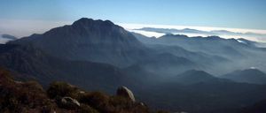
Cerro La Campana from Cerro El Roble. May 2012
- == Hire Guides and Tourism Agencies ==
- ** '''Contact''': ecotrekkingchile@gmail.com
- ** '''Phone' '': +56948469813 (WhatsApp)


