Travesía P.N. La Campana (english)
Season
All year round, but the ideal time is Spring or towards the end of Winter.
Access
Vehicle Access
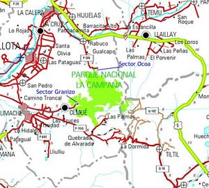
Take Ruta 5 (Route 5), to the exit to Til Til (Ruta G.132). Take this exit west, where after 9 km you will reach a steely bridge, turn right until you get to the town of Til Til (10 km from the bridge); here take the route that will take you to Limache/Olmué by taking the Cuesta de la Dormida. Go up and the descend Cuesta de la Dormida until reaching a fork to Olmue; here take Avenida Granizo on a northeast direction until you reach a dirt road where it is 2,4 km until the entrance of the park. Park your car here.
By public transport
Buses seem liable to change on a regular basis and even the most up to date guidebooks can be incorrect. At the time of writing (October 2009) Pullman bus do a regular service to Olmue from terminal Almeda with one leaving at 8:05 (6000 peso return), it takes roughly 2hrs. Get off the bus in the main square (a small grass square with a sign showing the way to the parks, but don't be tempted to walk from here it's still a long way). From here take a local Agrada bus (with plenty of character) on Av. Granizo (400 pesos) that show in the window that they are going to the park, it's only about 15-20 minutes. The bus will terminate at a turn around point. Here head further up the road and turn left up a dirt track that leads into the park.
Pullman buses return from a shop on Av. Granizo near the square. The return times are in the shop (nobody else will know them) and run until around 8:00pm. Check in at the shop on the way back to reserve a seat on the bus for the way home.
Route Description
The route can be done by starting in sector Granizo and ending in sector Ocoa, or vice versa. The first alternative is described below.
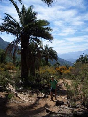
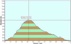
From the ranger booth, walk about 600 m on the vehicle road, upon reaching the camping area, take the Sendero del Andinista (Path of the Mountaineer) for about 5 minutes where you will see Sendero Los Peumos (Path Los Peumos). This is the path you will take. It goes through a leafy and humid native forest (see photo). The path ascends moderately. After 35 minutes of having taken Path Los Peumos, again cross the vehicle road. From here on the vegetation is not as exuberant.
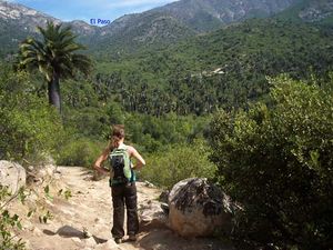
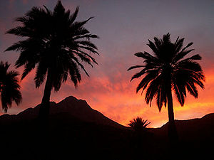
Follow the route on two curves, where another fork will be reached. The secondary path, after some 500m will take you to abandoned installations of an old mine. Take the main path. To avoid walking on the vehicle road, after the fork, take a path that goes parallel to the route but slightly more to the east (east). After 300 m these separate. The path begins to gain height following the edge of a hill in direction to the west, after ascending for 45 minutes, in some areas with a significant slope, you reach the pass (see photo). Here you will have a spectacular view of the valley of Ocoa, with plenty of Chilean Palms (Jubaea chilensis), and somewhat arid. The contrast with the valleys Cajón Grande and Granizo to the south is quite strong. These have a very different vegetation and significantly more exuberant.
After enjoying the beautiful panoramic view the descent begins. The path is clear, with almost no possibilities for getting lost. It abruptly descends for 30 minutes until it reaches the valley where the slope decreases considerably making the trek more pleasant and expedite. The descent begins with a path that goes between palms on the west side of the east hills of the valley. When reaching the last hill, the direction switches Northeast, after 10 more minutes you will find the min road to the Ocea sector. From the pass to the Casino sector it is 1,5 hours of walking (5 km). Take the road in a north direction to go to the ranger booth, the end of this trek. If you still have the energy to keep walking, if you take the path to the south you may visit a beautiful waterfall and a quartz mine (for more information on this trek: P.N. La Campana, Ocoa). After 25 minutes on the path you will reach the camping area of Ocoa. It will take about 10 more minutes to reach the entrance of the park and end of this trek.
Estimated Time
At a normal pace, this trek should take about 6 hours.
Permits/Fees
An entrance fee of 1.500 CLP is charged
Waypoints on Google Earth and Map Source
Weather
- Meteochile Región de Valparaíso
- Accuweather Valparaíso
- Accuweather Viña del Mar
- Meteochile Región Metropolitana
- Accuweather Santiago
- Accuweather Puente Alto
Lodging
Revisa la lista completa de 623 rutas de trekking y las 345 rutas de montaña en Chile
|


