Lagunas de Huerquehue (english)

This route has been translated automatically using Google Translate.png. Help us to improve it!
Trek_chile.png

Season

The right time for trekking is between October and April, when it is not too wet

Access

By car

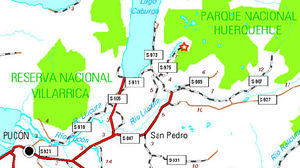
Huerquehue National Park Access Map

From Temuco to Pucon, are 112 kilometers of paved roads. From Pucón, is 7 miles down the paved road CH-199 international step towards Mamuil Malal, up bifuración where you should take the left towards the lake Caburgua, on Route S-947. 7 kilometers later, there is a new branch.

  • If you take the left, are 6 miles of paved and then gravel road 14 in good to fair condition. It must move toward the lake Caburgua to a gravel road that goes to the right, sign "The PN Huerquehue." After 8 miles of winding road and several hills, one reaches Paillaco, which must be taken to the left (north) toward the lake Tinquilco. About 4 miles later you reach the CONAF nursery, where you must pay the entry Then you can move 4 miles down the road vehicle to a parking (charged $ 500 for parking), where the trek begins.
  • If you take the right, is 12 miles paved road and then 10 miles of gravel (6 of them shared with the previous route) in regular state. It must move in the direction of the Baths of Huife until 12 miles later, you come to a gravel road which rises to the left (west). It's 4 miles of narrow and winding up caminoo Paillaco, where it joins with the previous route.

Public Transport

In January and February, JAC bus operates two daily services from Pucón to the park entrance, leaving Pucon at 8:30 and 4 pm, and returning from the nursery at 10 am and 5pm. Additionally, in summer, buses leave every 40 minutes Caburgua. For about $ 1200 (TBC) allow these buses to reach the diversion that comes to Paillaco (by the first alternative described in access by car). Since there are 14 kilometers of gravel road to the park, along a path that would be quite tiring to walk. The chances for a ride are rather high in the months of January and February, minor in December and March, and fairly low the rest of the year, except for long weekends.

Description of the route

Mapa del trekking de las lagunas de Huerquehue. El trazado de este trekking se muestra en amarillo-ocre
The walk portion of a zigzag climb sharply in the shade of a beautiful forest of tepa, coigües and peanuts. The path is perfectly clear, as the entire stretch from the parking lot to the lagoons is popular in summer months. After about twenty minutes of climb we reach the CONAF booth, where you must register and verify that it has paid for a ticket. The road is continuously rising. After about 40 munutos is reached the fork to the Eagle's Nest Falls. Then they should continue to rise, passing through the small lookout Lake Tinquilco
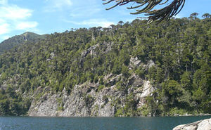
Lake Tinquilco from the trail. Descend toward CONAF. 02/09
. Then they must pass the turnoff to the waterfall Trafulco (must get to observe). After the second viewpoint, to 1094 meters, the trail increases the slope always zigzag. After about an hour from the Cascade Eagles Nest is reached beautiful Lake Chico. It has reached the plateau of Huerquehue, and thereafter the route becomes rather flat, with gentle ups and downs in the middle of a forest and Araucaria coigües. He must cross a narrow stretch of the Lake boy by a wooden bridge and then around the lake for a nice stretch along the east coast of the lagoon. Just after crossing a tributary of the lake (the stream that drains the lake El Toro) a fork. It should be right. Do not take the path that goes to the left, pointing to "Laguna Verde".
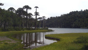
Laguna Toro. First lace. 02/09
Then you come to a pleasant and scenic peninsula on the southwestern tip of Lake El Toro (on the map marked as "first peninsula"). Good place for lunch and take a bath. Then she must undo a few yards and re-take the main path towards the right, to skirt the Bull. After about 20 minutes from the first lace, you reach the north end of the lake, marked on the map as "fourth lace, a quiet area of reeds and bower. We must continue to
Far north of the lagoon Toro (Fourth Puntilla). 02/09
the main path, ignoring a path CONAF closed today leading to the Laguna Seca and Escondida. You must climb a gentle slope area, continuing northward. Gaps have been finished by now, and the footprint is still surrounded by Araucaria. After about 25 minutes from the fourth lace, you reach an open area. Here there is a wooden sign with a map and a fork. If you follow the right and carry on towards the Crossing of the Huerquehue Park, if you take the path to the left, begins the road back to finish the circuit Huerquehue Lagoons

Tiempo esperado

About 4 to 5 hours.


Permits / Fees

To access into the park, each adult must pay CLP $2.500. Aditionally, CLP $10.000 per tent are charged at the entrance to stay in camping Renahue.


Waypoints in Google Earth

  • Waypoints Huerquehue Crossing . (For this hike, only until "Cartel") To download the file right-click and then select "Save file as" (IE) or "Save link as" (Firefox, Chrome). By trying to open it directly, some browsers will show the raw code with the coordinates.


External Links

Weather

Lodging


Revisa la lista completa de 622 rutas de trekking y las 345 rutas de montaña en Chile