Pampa Frutilla (english)
Season
November to mid April. The rest of the year is too rainy and the road becomes a mud.
Access
Road and arrival at the Puyehue National Park

The route from Pampa Strawberry is inside the Puyehue National Park, in the Tenth Region. To reach the park, after leave of Route 5 South to the East, at the height of Osorno, and take Route 215 (Osorno - Bariloche). This road, good pavement, is characterized by typical landscapes of southern Chile, with beautiful green pastures, hills, livestock and streams that fail to cause eye strain. After 47 kms from Osorno to reach the town of Interlaken, named for being in the middle of lakes Puyehue and Rupanco. The remaining 25 kms before entering the National Park, go south along the coast of Lake Puyehue, clear, calm water. Then start taking the road slope, and in this section, the state of the road gets really bad. At one point a bifurcation occurs, but do not turn right, but follow the main road to reach the office of Anticura CONAF The road passes through the middle of the park, and about 25 minutes after having left behind the lake, are signs indicating the proximity of the Office of CONAF, the south side of the road. Here are a safe place to leave cars or motorcycles for a couple of days, while making the trek.
Route description
Preparing for Departure
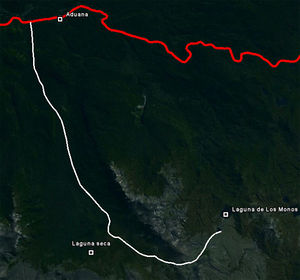
The ranger greets visitors and explains how the route, with a didactic model to scale. After leaving the vehicles having left the office and any excess charge is undertaken heading towards East. It is important to have at least 2 liters of water per person, for in this way with a total of 22 km upstream, there is a stretch of 19 kms without a single drop of water.
The route
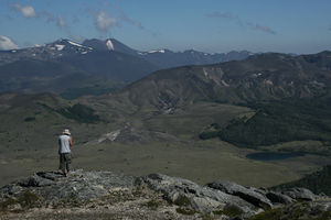
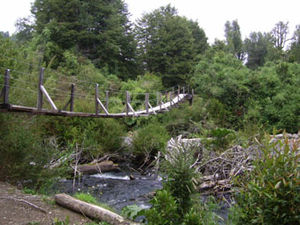
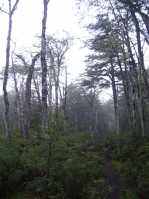
It starts from the office Anticura for a fully signposted path, and walk the first 2 to 3 miles between hills and forests coigües. You do not have much visibility beyond the trail, the density of forests. In an hour's walk leads to a clear wide, where a suspension bridge crossing a tributary of the Rio Golgol. Then, there is signage to go towards the road (remember that it crosses the park towards the East, towards Argentina) or Strawberry Pampa (right). Then begins a path with a mile coigües, which later give way to a long and monotonous forest coalitions. The forest of inferred not to see beyond about 15 meters on either side of the path. A short walk up a gentle slope begins and after an hour of walking, a new course with a green meadow, where you can observe the chain of hills that lie to the left of the road (northeast). We hear many birds, but is extremely rare to observe. What comes next is a road about 12 miles between Coligan, coigües and beech, always in a moderate rise, with large trees fallen across the path. Unfortunately, forest density, the slope of the road, lack of visibility and fauna, and the monotony of the small landscape, make this a laborious and not very motivating way for walkers. After several hours, the forest becomes less dense and exclusively of large beech, allowing to appreciate the beauty of the forest floor with a material that gradually becomes more volcanic. After a couple hours of walking, the forest is definitely back, overlooking a volcanic millet, dark gray, with bushes and low vegetation.

Expected Time
You can make this trek in relatively demanding than 7 hours vary greatly depending on weather condition. The ranger said 6 hours of walking, but that time can easily be extended to 8 hours if it is raining or physical condition of the hikers were not optimal.
Recommendations
- Bring AT LEAST 2 liters of water per person, as there is a stretch of almost KMS 20 with NO ONE DROP OF WATER.
- It is very useful to have trekking poles, with 90% of the route has a moderate slope.
- Recommended carry waterproof leggings.
- Take a load less than 12kgs per person.


