GPT30H - Coyhaique
De Wikiexplora
Revisión del 13:44 25 dic 2021 de Tobias (Discusión | contribuciones) (→Recent Alerts and Suggestions)
This article is just a draft. You can help by expanding and improving its content
| All GPT sections (click to show) |
|---|
|
GPT Section Articles
|
Recent Alerts and Suggestions
- GPT30H
Duration: 5 Days, Direction: NoBo Participant: Tobías Schorcht
Difficulties: heat, Tábanos, entering Rerserva National Coyhaique
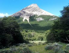
Highlights: Mountain??, friendly settlers, minimarked in El Gato
This stretch was surprisingly beatiful. Especially the people up there are very friendly and alwas up for a chat. Could not enter Reserva Coyhaique, because it was closed that day. The alternative Route leeds over private land of Alexandra Andreea Calfa (+56984608184) who wasn‘t there and could not let me in. So I had to do some roadwalking instead. I was very surprised to find a well equiped minimarked in El Gato!
Season Section Log
Summary Table
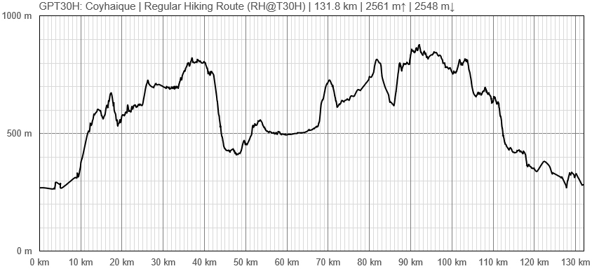
| GPT30H: Coyhaique | Hiking | Packrafting | |||||
| Group | G: Aysen Norte | Total | 129.1 km | 41 h | - | - | |
| Region | Chile: Aysén (XI) | Trails (TL) | 21.5 km | 16.6% | - | - | |
| Start | Carretera Austral (Camino Picaflor) | Minor Roads (MR) | 38.9 km | 30.1% | - | - | |
| Finish | Coyhaique | Primary Roads (PR) | 49.3 km | 38.2% | - | - | |
| Status | Published & Verified | Cross-Country (CC) | 17.5 km | 13.6% | - | - | |
| Traversable | Jan - Apr (Maybe: Nov, Dec, May) | Bush-Bashing (BB) | 2.0 km | 1.5% | - | - | |
| Packraft | Only Burden | Ferry (FY) | - | - | - | - | |
| Connects to | GPT29H, GPT31H | Investigation (I) | (3.6 km) | (2.8%) | - | - | |
| Options | 109 km (1 Options & Variants) | Exploration (EXP) | - | - | - | - | |
| Hiking | Packrafting | Total on Water | - | - | |||
| Attraction | 2 (of 5) | - | River (RI) | - | - | ||
| Difficulty | 3 (of 5) | - | Lake (LK) | - | - | ||
| Direction | Both ↓↑ | - | Fjord (FJ) | - | - | ||
| Comment | - | ||||||
| Character | Forest, Farmland, Settlers, Road Walking | ||||||
| Challenges | Demanding River Fords, Resupply Distance | ||||||


