Diferencia entre revisiones de «Plantilla:Acceso a Caleu English»
(Sin diferencias)
|
Revisión del 17:16 6 jul 2009
Access
Vehicle Acess

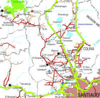
From Santiago, take Ruta 5 (Route 5) to the north. The detour to Rungue is at kilometer 54. Take that exit and enter the town. Where the street where you came from ends, turn left, and after a few meters turn right (the street ends anyways) to cross a stream. Immediately after having crossed the stream, turn left, and start bordering the stream on a dirt road which is in good state. You will then border the Runge dam. After 3,9 km from route 5, you will see a detour to the right ("A Caleu) which you must take. This road, also a dirt road in good state (any vehicle can pass), penetrates the valley and progressively ascends. Approximately 11 km from the detour (14,9 from Route 5), you will have reached Caleu and you will see a fork: take the left, which will keep ascending on the hillside. 970 meters higher, little before the pass to the valley of Olmué, is the road to El Roble to the right.
Puclic Transportation and Hitchiking
From La Paz bus terminal, located in Avenida La Paz with the street of Dávila Baeza, buses leave daily to Til Til, from 6 am and every 15 minutes. At 4 PM, a bus leaves destined to Caleu. The fare is 1.600 CLP. Many cars use this road, so the possibilities of hitching a ride are quite good.
